Filters: Tags: Duluth (X)
37 results (45ms)|
Filters
Date Range
Extensions Types Contacts
Categories Tag Types Tag Schemes |
This dataset is comprised of three files containing northing, easting, and elevation ("XYZ") information for light detection and ranging (LiDAR) data representing beach topography and sonar data representing near-shore bathymetry of Lake Superior at Minnesota Point, Duluth, Minnesota. The point data is the same as that in LAS (industry-standard binary format for storing large point clouds) files that were used to create a digital elevation model (DEM) of the approximately 5.9 square kilometer (2.3 square mile) surveyed area. LiDAR data were collected August 10, 2019 using a boat-mounted Optech ILRIS scanner and methodology similar to that described by Huizinga and Wagner (2019). Multi-beam sonar data were collected...
Types: Map Service,
OGC WFS Layer,
OGC WMS Layer,
OGC WMS Service;
Tags: Bathymetry and Elevation,
DEM,
Duluth,
Great Lakes,
Hydroacoustic,
This dataset is a digital elevation model (DEM) of the beach topography of Lake Superior at Minnesota Point, Duluth, Minnesota. The DEM has a 1-meter (m; 3.28084 foot [ft]) cell size and was created from a LAS (industry-standard binary format for storing large point clouds) dataset of terrestrial light detection and ranging (LiDAR) data with an average point spacing of 0.137 m (0.45 ft). LiDAR data were collected August 10, 2019 using a boat-mounted Optech ILRIS scanner and methodology similar to that described by Huizinga and Wagner (2019). References: Huizinga, R.J. and Wagner, D.M., 2019, Erosion monitoring along selected bank locations of the Coosa River in Alabama using terrestrial light detection and ranging...
Types: Map Service,
OGC WFS Layer,
OGC WMS Layer,
OGC WMS Service;
Tags: Bathymetry and Elevation,
DEM,
Duluth,
Great Lakes,
LAS,
The table contains oxide and cation compositions of olivine grains from drill core of the Duluth Complex, Minnesota. The oxides were determined by electron probe microanalysis (EPMA) and are reported in weight percent (wt%). The cations were calculated based on the oxide compositions and are reported in mole percent (mol%). Olivine is a magnesium iron orthosilicate mineral with the formula (Mg2+, Fe2+)2SiO4. Olivine forms a solid solution series with magnesium (Mg) at one end and iron (Fe) at the other. Forsterite (Mg2SiO4) is the magnesium endmember and fayalite (Fe2SiO4) is the iron endmember. Minor elements can substitute into the crystal structure, such as manganese (Mn) and nickel (Ni). To better understand...
Categories: Data;
Types: Citation;
Tags: Cook County,
Duluth,
Environmental Health,
Geochemistry,
Lake County,
This dataset is a digital elevation model (DEM) of the beach topography and near-shore bathymetry of Lake Superior at Minnesota Point, Duluth, Minnesota. The DEM has a 10-meter (m; 32.8084 feet) cell size and was created from a LAS (industry-standard binary format for storing large point clouds) dataset of terrestrial light detection and ranging (LiDAR) data representing the beach topography and sonar data representing the bathymetry to approximately 1.3 kilometers (0.8 miles) offshore. Average point spacing of the LAS files in the dataset are as follows: LiDAR, 0.137 m; multi-beam sonar, 1.029 m; single-beam sonar, 0.999 m. LiDAR data were collected August 10, 2019 using a boat-mounted Optech ILRIS scanner and...
Types: Map Service,
OGC WFS Layer,
OGC WMS Layer,
OGC WMS Service;
Tags: Bathymetry and Elevation,
DEM,
Duluth,
Geomorphology,
Great Lakes,
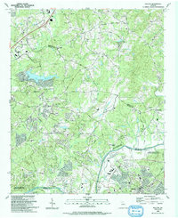
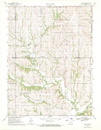
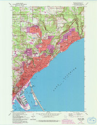
USGS Historical Quadrangle in GeoPDF.
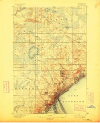
USGS Historical Quadrangle in GeoPDF.
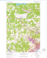
USGS Historical Quadrangle in GeoPDF.
This dataset is a LAS (industry-standard binary format for storing large point clouds) dataset containing light detection and ranging (LiDAR) data and sonar data representing the beach and near-shore topography of Lake Superior at Minnesota Point, Duluth, Minnesota. Average point spacing of the LAS files in the dataset are as follows: LiDAR, 0.137 meters (m); multi-beam sonar, 1.029 m; single-beam sonar, 0.999 m. The LAS dataset was used to create a 10-m (32.8084 feet) digital elevation model (DEM) of the approximately 5.9 square kilometer (2.3 square mile) surveyed area using the "LAS dataset to raster" tool in Esri ArcGIS, version 10.7. LiDAR data were collected August 10, 2019 using a boat-mounted Optech ILRIS...
Types: Map Service,
OGC WFS Layer,
OGC WMS Layer,
OGC WMS Service;
Tags: Bathymetry and Elevation,
DEM,
Duluth,
Great Lakes,
Hydroacoustic,

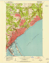
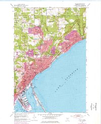
USGS Historical Quadrangle in GeoPDF.

USGS Historical Quadrangle in GeoPDF.

USGS Historical Quadrangle in GeoPDF.
USGS Historical Quadrangle in GeoPDF.
USGS Historical Quadrangle in GeoPDF.
USGS Historical Quadrangle in GeoPDF.

USGS Historical Quadrangle in GeoPDF.
This dataset is a LAS (industry-standard binary format for storing large point clouds) dataset containing light detection and ranging (LiDAR) data representing beach topography of Lake Superior at Minnesota Point, Duluth, Minnesota. Average point spacing of the LiDAR points in the dataset is 0.137 meters (m; 0.45 feet [ft]). The LAS dataset was used to create a 1-m (3.28084 ft) digital elevation model (DEM) of the approximately 4 kilometer (2.5 mile) surveyed reach of the beach. LiDAR data were collected August 10, 2019 using a boat-mounted Optech ILRIS scanner and methodology similar to that described by Huizinga and Wagner (2019). References: Huizinga, R.J. and Wagner, D.M., 2019, Erosion monitoring along selected...
Types: Map Service,
OGC WFS Layer,
OGC WMS Layer,
OGC WMS Service;
Tags: Bathymetry and Elevation,
DEM,
Duluth,
Great Lakes,
LAS,
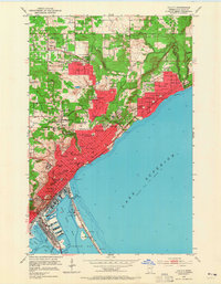
USGS Historical Quadrangle in GeoPDF.
USGS Historical Quadrangle in GeoPDF.
USGS Historical Quadrangle in GeoPDF.

USGS Historical Quadrangle in GeoPDF.
|

|
