|
|
A generalized least squares (GLS) technique was used with at-site n-day low-flow time series and frequencies, from SWToolbox (Kiang and others, 2018), and 14 basin characteristics (basin perimeter, drainage area, maximum basin elevation, mean total annual reference evapotranspiration, groundwater head, length of longest flow path, minimum basin elevation, runoff-curve number, relief, ruggedness, slope ratio, percentage of hydrologic soil type B, available water capacity, and total length of streams in a basin) for 28 selected streamflow gaging stations in Puerto Rico to calculate regional n-day low-flow frequency regression equations for ungaged stream locations. The GLS approach assigns weights based on uncertainty...
|

This child page contains eight csv files, site_flow, which contain daily streamflow values for each site. Each file includes a station identifier, date of observation, measured value of streamflow and qualifier code for the measured value. The format of the csv file (date format and column headings) is designed to meet the specific requirements of file format for R-QWTREND. If csv files are opened directly in excel, the format of the data can change. To ensure the data are in the proper format for R-QWTREND, files should be opened in a text editor. The "site" in site_flow can be cross-referenced to the main report by downloading the zipped folder HRtrend folder from child page, "Scripts to run R-QWTREND models and...
|
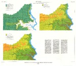
These data were released prior to the October 1, 2016 effective date for the USGS’s policy dictating the review, approval, and release of scientific data as referenced in USGS Survey Manual Chapter 502.8 Fundamental Science Practices: Review and Approval of Scientific Data for Release. This coverage contains information about the probability of obtaining a water supply within the Standing Rock Indian Reservation, Sioux County, North Dakota, and Corson County, South Dakota. The digital data were produced by the U.S. Geological Survey (USGS) in cooperation with the U.S. Environmental Protection Agency. The possibility of obtaining adequate supplies of good quality water from surficial deposits generally is limited...
Tags: Corson County,
NSDI,
North Dakota,
Sioux County,
South Dakota, All tags...
Standing Rock Indian Reservation,
USGS Science Data Catalog (SDC),
environment,
geoscientificInformation,
inlandWaters,
inlandWaters,
shallow ground-water resources, Fewer tags
|

These data were released prior to the October 1, 2016 effective date for the USGS’s policy dictating the review, approval, and release of scientific data as referenced in USGS Survey Manual Chapter 502.8 Fundamental Science Practices: Review and Approval of Scientific Data for Release. Real-time kinematic global navigation satellite systems equipment was used to map features of wetlands at six locations of interest to the Lower Brule Sioux Tribe. Items mapped include general cross-sections (primarily to show elevation differences); man-made features such as access roads, outlet control structures, and water-supply pipes; vegetation features such as edge of cattails or food plots, trees or tree clusters; and hydrologic...
Tags: Lower Brule Indian Reservation,
NSDI,
Potter Slough,
Potter Slough near the Lower Brule Indian Reservation in central South Dakota,
Sioux Tribe, All tags...
South Dakota,
USGS Science Data Catalog (SDC),
Wetlands,
biota,
elevation,
environment,
inlandWaters,
inlandWaters,
location, Fewer tags
|

These data were released prior to the October 1, 2016 effective date for the USGS’s policy dictating the review, approval, and release of scientific data as referenced in USGS Survey Manual Chapter 502.8 Fundamental Science Practices: Review and Approval of Scientific Data for Release. Real-time kinematic global navigation satellite systems equipment was used to map features of wetlands at six locations of interest to the Lower Brule Sioux Tribe. Items mapped include general cross-sections (primarily to show elevation differences); man-made features such as access roads, outlet control structures, and water-supply pipes; vegetation features such as edge of cattails or food plots, trees or tree clusters; and hydrologic...
Tags: Lower Brule Indian Reservation,
NSDI,
Sioux Tribe,
South Dakota,
USGS Science Data Catalog (SDC), All tags...
Unnamed Slough,
Unnamed Slough on the Lower Brule Indian Reservation in central South Dakota,
Wetlands,
biota,
elevation,
environment,
inlandWaters,
inlandWaters,
location, Fewer tags
|
View more...
|