|
|

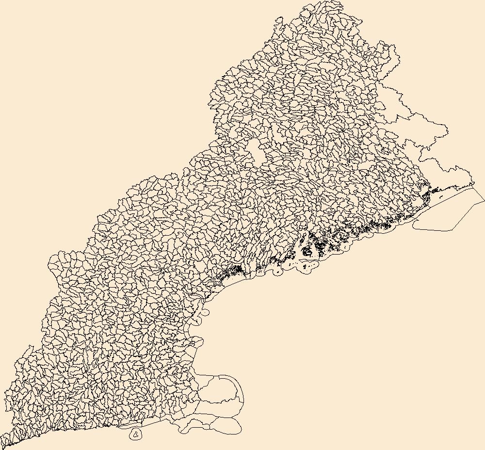
The Watershed Boundary Dataset (WBD) is a comprehensive aggregated collection of hydrologic unit data consistent with the national criteria for delineation and resolution. It defines the areal extent of surface water drainage to a point except in coastal or lake front areas where there could be multiple outlets as stated by the "Federal Standards and Procedures for the National Watershed Boundary Dataset (WBD)" "Standard" (https://pubs.usgs.gov/tm/11/a3/). Watershed boundaries are determined solely upon science-based hydrologic principles, not favoring any administrative boundaries or special projects, nor particular program or agency. This dataset represents the hydrologic unit boundaries to the 12-digit (6th level)...
Tags: 10-digit,
12-digit,
14-digit,
16-digit,
2-digit, All tags...
4-digit,
6-digit,
8-digit,
AL,
Abbeville,
Aiken,
Alabama,
Alachua,
Alamance,
Alexander,
Alleghany,
Allendale,
Anderson,
Anson,
Appling,
Appomattox,
Ashe,
Atkinson,
Attala,
Autauga,
Avery,
Bacon,
Baker,
Baldwin,
Bamberg,
Banks,
Barbour,
Barnwell,
Barrow,
Bartow,
Basin,
Bay,
Beaufort,
Bedford,
Ben Hill,
Berkeley,
Berrien,
Bertie,
Bibb,
Bladen,
Bleckley,
Blount,
Botetourt,
Bradford,
Bradley,
Brantley,
Brevard,
Brooks,
Broward,
Brunswick,
Bryan,
Bulloch,
Bullock,
Buncombe,
Burke,
Butler,
Butts,
Cabarrus,
Caldwell,
Calhoun,
Camden,
Campbell,
Candler,
Carroll,
Carteret,
Caswell,
Catawba,
Chambers,
Charleston,
Charlotte,
Charlton,
Chatham,
Chattahoochee,
Chattooga,
Cherokee,
Chesapeake,
Chester,
Chesterfield,
Chickasaw,
Chilton,
Choctaw,
Chowan,
Citrus,
Clarendon,
Clarke,
Clay,
Clayton,
Cleburne,
Cleveland,
Clinch,
Cobb,
Coffee,
Colleton,
Collier,
Colquitt,
Columbia,
Columbus,
Conecuh,
Cook,
Coosa,
Copiah,
Covington,
Coweta,
Craig,
Craven,
Crawford,
Crenshaw,
Crisp,
Cullman,
Cumberland,
Currituck,
Dade,
Dale,
Dallas,
Danville,
Dare,
Darlington,
Davidson,
Davie,
Dawson,
DeKalb,
DeSoto,
Decatur,
Dillon,
Dinwiddie,
Dixie,
Dodge,
Dooly,
Dorchester,
Dougherty,
Douglas,
Downloadable Data,
Duplin,
Durham,
Duval,
Early,
Echols,
Edgecombe,
Edgefield,
Effingham,
Elbert,
Elmore,
Emanuel,
Emporia,
Escambia,
Esri File GeoDatabase 10,
Etowah,
Evans,
FL,
Fairfield,
Fannin,
Fayette,
FileGDB,
Flagler,
Florence,
Florida,
Floyd,
Forrest,
Forsyth,
Franklin,
Fulton,
GA,
Gadsden,
Gaston,
Gates,
Geneva,
George,
Georgetown,
Georgia,
Gilchrist,
Gilmer,
Glades,
Glascock,
Glynn,
Gordon,
Grady,
Granville,
Grayson,
Greene,
Greensville,
Greenville,
Greenwood,
Guilford,
Gulf,
Gwinnett,
HU-2,
HU-2 Region,
HU2_03,
HUC,
Habersham,
Hale,
Halifax,
Hall,
Hamilton,
Hampton,
Hancock,
Haralson,
Hardee,
Harnett,
Harris,
Harrison,
Hart,
Heard,
Henderson,
Hendry,
Henry,
Hernando,
Hertford,
Highlands,
Hillsborough,
Hinds,
Hoke,
Holmes,
Horry,
Houston,
Hyde,
Hydrography,
Hydrologic Unit Code,
Hydrologic Units,
Indian River,
Iredell,
Irwin,
Isle of Wight,
Itawamba,
Jackson,
Jasper,
Jeff Davis,
Jefferson,
Jefferson Davis,
Jenkins,
Johnson,
Johnston,
Jones,
Kemper,
Kershaw,
LA,
Lafayette,
Lake,
Lamar,
Lancaster,
Lanier,
Lauderdale,
Laurens,
Lawrence,
Leake,
Lee,
Lenoir,
Leon,
Levy,
Lexington,
Liberty,
Lincoln,
Long,
Louisiana,
Lowndes,
Lumpkin,
Lunenburg,
MS,
Macon,
Madison,
Manatee,
Marengo,
Marion,
Marlboro,
Marshall,
Martin,
Martinsville,
McCormick,
McDowell,
McDuffie,
McIntosh,
Mecklenburg,
Meriwether,
Miami-Dade,
Miller,
Mississippi,
Mitchell,
Mobile,
Monroe,
Montgomery,
Moore,
Morgan,
Murray,
Muscogee,
NC,
Nash,
Nassau,
National Watershed Boundary Dataset (WBD),
National Watershed Boundary Dataset (WBD),
Neshoba,
New Hanover,
Newberry,
Newton,
North Carolina,
Northampton,
Nottoway,
Noxubee,
Oconee,
Oglethorpe,
Okaloosa,
Okeechobee,
Oktibbeha,
Onslow,
Orange,
Orangeburg,
Osceola,
Palm Beach,
Pamlico,
Pasco,
Pasquotank,
Patrick,
Paulding,
Peach,
Pearl River,
Pender,
Perquimans,
Perry,
Person,
Petersburg,
Pickens,
Pierce,
Pike,
Pinellas,
Pitt,
Pittsylvania,
Polk,
Pontotoc,
Prentiss,
Prince Edward,
Prince George,
Pulaski,
Putnam,
Quitman,
Rabun,
Randolph,
Rankin,
Region,
Richland,
Richmond,
Roanoke,
Robeson,
Rockdale,
Rockingham,
Rowan,
Russell,
Rutherford,
SC,
Salem,
Saluda,
Sampson,
Santa Rosa,
Sarasota,
Schley,
Scotland,
Scott,
Screven,
Seminole,
Shelby,
Simpson,
Smith,
South Carolina,
Southampton,
Spalding,
Spartanburg,
St. Bernard,
St. Clair,
St. Johns,
St. Lucie,
St. Tammany,
Stanly,
Stephens,
Stewart,
Stokes,
Stone,
Sub-basin,
Sub-region,
Subwatershed,
Suffolk,
Sumter,
Surry,
Sussex,
Suwannee,
TN,
Talbot,
Taliaferro,
Talladega,
Tallapoosa,
Tangipahoa,
Tattnall,
Taylor,
Telfair,
Tennessee,
Terrell,
Thomas,
Tift,
Tippah,
Tishomingo,
Toombs,
Towns,
Transylvania,
Treutlen,
Troup,
Turner,
Tuscaloosa,
Twiggs,
Tyrrell,
US,
Union,
United States,
Upson,
VA,
Vance,
Virginia,
Virginia Beach,
Volusia,
WBD,
Wake,
Wakulla,
Walker,
Walthall,
Walton,
Ware,
Warren,
Washington,
Watauga,
Watershed,
Watershed Boundary Dataset,
Wayne,
Webster,
Wheeler,
White,
Whitfield,
Wilcox,
Wilkes,
Wilkinson,
Williamsburg,
Wilson,
Winston,
Worth,
Yadkin,
Yancey,
York,
inlandWaters, Fewer tags
|

The Watershed Boundary Dataset (WBD) is a comprehensive aggregated collection of hydrologic unit data consistent with the national criteria for delineation and resolution. It defines the areal extent of surface water drainage to a point except in coastal or lake front areas where there could be multiple outlets as stated by the "Federal Standards and Procedures for the National Watershed Boundary Dataset (WBD)" "Standard" (https://pubs.usgs.gov/tm/11/a3/). Watershed boundaries are determined solely upon science-based hydrologic principles, not favoring any administrative boundaries or special projects, nor particular program or agency. This dataset represents the hydrologic unit boundaries to the 12-digit (6th level)...
Tags: 10-digit,
12-digit,
14-digit,
16-digit,
2-digit, All tags...
4-digit,
6-digit,
8-digit,
Adair,
Adams,
Albany,
Allen,
Anderson,
Andrew,
Antelope,
Appanoose,
Arapahoe,
Arthur,
Atchison,
Audrain,
Audubon,
Aurora,
Banner,
Barnes,
Barton,
Basin,
Bates,
Beadle,
Beaverhead,
Bennett,
Benton,
Big Horn,
Billings,
Blaine,
Bon Homme,
Boone,
Boulder,
Bourbon,
Bowman,
Box Butte,
Boyd,
Broadwater,
Brookings,
Broomfield,
Brown,
Brule,
Buchanan,
Buena Vista,
Buffalo,
Burke,
Burleigh,
Burt,
Butler,
Butte,
CO,
Caldwell,
Callaway,
Camden,
Campbell,
Carbon,
Carroll,
Carter,
Cascade,
Cass,
Cedar,
Chaffee,
Chariton,
Charles Mix,
Chase,
Cherokee,
Cherry,
Cheyenne,
Chouteau,
Christian,
Clark,
Clarke,
Clay,
Clear Creek,
Clinton,
Cloud,
Codington,
Coffey,
Cole,
Colfax,
Colorado,
Converse,
Cooper,
Corson,
Crawford,
Crook,
Cuming,
Custer,
Dade,
Dakota,
Dallas,
Daniels,
Daviess,
Davis,
Davison,
Dawes,
Dawson,
Day,
DeKalb,
Decatur,
Deer Lodge,
Dent,
Denver,
Deuel,
Dewey,
Dickey,
Dickinson,
Divide,
Dixon,
Dodge,
Doniphan,
Douglas,
Downloadable Data,
Dundy,
Dunn,
Eddy,
Edmunds,
El Paso,
Elbert,
Ellis,
Ellsworth,
Emmet,
Emmons,
Fall River,
Fallon,
Faulk,
Fergus,
Fillmore,
Flathead,
Foster,
Franklin,
Fremont,
Frontier,
Furnas,
Gage,
Gallatin,
Garden,
Garfield,
Gasconade,
Geary,
Gentry,
GeoPackage,
Gilpin,
Glacier,
Golden Valley,
Goshen,
Gosper,
Gove,
Graham,
Grand,
Granite,
Grant,
Greeley,
Greene,
Gregory,
Grundy,
Guthrie,
HU-2,
HU-2 Region,
HU2_10,
HUC,
Haakon,
Hall,
Hamilton,
Hamlin,
Hand,
Hanson,
Harding,
Harlan,
Harrison,
Hayes,
Henry,
Hettinger,
Hickory,
Hill,
Hitchcock,
Holt,
Hooker,
Hot Springs,
Howard,
Howell,
Hughes,
Hutchinson,
Hyde,
Hydrography,
Hydrologic Unit Code,
Hydrologic Units,
IA,
ID,
Ida,
Idaho,
Iowa,
Jackson,
Jefferson,
Jerauld,
Jewell,
Johnson,
Jones,
Judith Basin,
KS,
Kansas,
Kearney,
Keith,
Keya Paha,
Kidder,
Kimball,
Kingsbury,
Kit Carson,
Knox,
LaMoure,
Laclede,
Lafayette,
Lake,
Lancaster,
Lane,
Laramie,
Larimer,
Lawrence,
Leavenworth,
Lemhi,
Lewis and Clark,
Liberty,
Lincoln,
Linn,
Livingston,
Logan,
Loup,
Lucas,
Lyman,
Lyon,
MN,
MO,
MT,
Macon,
Madison,
Maries,
Marion,
Marshall,
McCone,
McCook,
McHenry,
McIntosh,
McKenzie,
McLean,
McPherson,
Meade,
Meagher,
Mellette,
Mercer,
Merrick,
Miami,
Miller,
Mills,
Miner,
Minnehaha,
Minnesota,
Missouri,
Mitchell,
Moniteau,
Monona,
Monroe,
Montana,
Montgomery,
Moody,
Morgan,
Morrill,
Morris,
Morton,
Mountrail,
Murray,
Musselshell,
ND,
NE,
Nance,
National Watershed Boundary Dataset (WBD),
National Watershed Boundary Dataset (WBD),
Natrona,
Nebraska,
Nemaha,
Ness,
Niobrara,
Nobles,
Nodaway,
North Dakota,
Norton,
Nuckolls,
O'Brien,
Oglala Lakota,
Oliver,
Open Geospatial Consortium GeoPackage 1.2,
Osage,
Osborne,
Osceola,
Otoe,
Ottawa,
Page,
Palo Alto,
Park,
Pawnee,
Pennington,
Perkins,
Petroleum,
Pettis,
Phelps,
Phillips,
Pierce,
Pipestone,
Platte,
Plymouth,
Polk,
Pondera,
Pottawatomie,
Pottawattamie,
Potter,
Powder River,
Powell,
Prairie,
Pulaski,
Putnam,
Randolph,
Ransom,
Ravalli,
Rawlins,
Ray,
Red Willow,
Region,
Republic,
Rice,
Richardson,
Richland,
Riley,
Ringgold,
Roberts,
Rock,
Rooks,
Roosevelt,
Rosebud,
Routt,
Rush,
Russell,
SD,
Sac,
Saline,
Sanborn,
Sargent,
Sarpy,
Saunders,
Schuyler,
Scott,
Scotts Bluff,
Sedgwick,
Seward,
Shawnee,
Shelby,
Sheridan,
Sherman,
Silver Bow,
Sioux,
Slope,
Smith,
South Dakota,
Spink,
St. Charles,
St. Clair,
St. Louis,
Stanley,
Stanton,
Stark,
Stillwater,
Stutsman,
Sub-basin,
Sub-region,
Sublette,
Subwatershed,
Sullivan,
Sully,
Summit,
Sweet Grass,
Sweetwater,
Taylor,
Teller,
Teton,
Texas,
Thayer,
Thomas,
Thurston,
Todd,
Toole,
Treasure,
Trego,
Tripp,
Turner,
US,
Union,
United States,
Valley,
Vernon,
WBD,
WY,
Wabaunsee,
Wallace,
Walworth,
Ward,
Warren,
Washakie,
Washington,
Watershed,
Watershed Boundary Dataset,
Wayne,
Webster,
Weld,
Wells,
Weston,
Wheatland,
Wheeler,
Wibaux,
Wichita,
Williams,
Woodbury,
Worth,
Wright,
Wyandotte,
Wyoming,
Yankton,
Yellowstone,
York,
Yuma,
Ziebach,
inlandWaters, Fewer tags
|

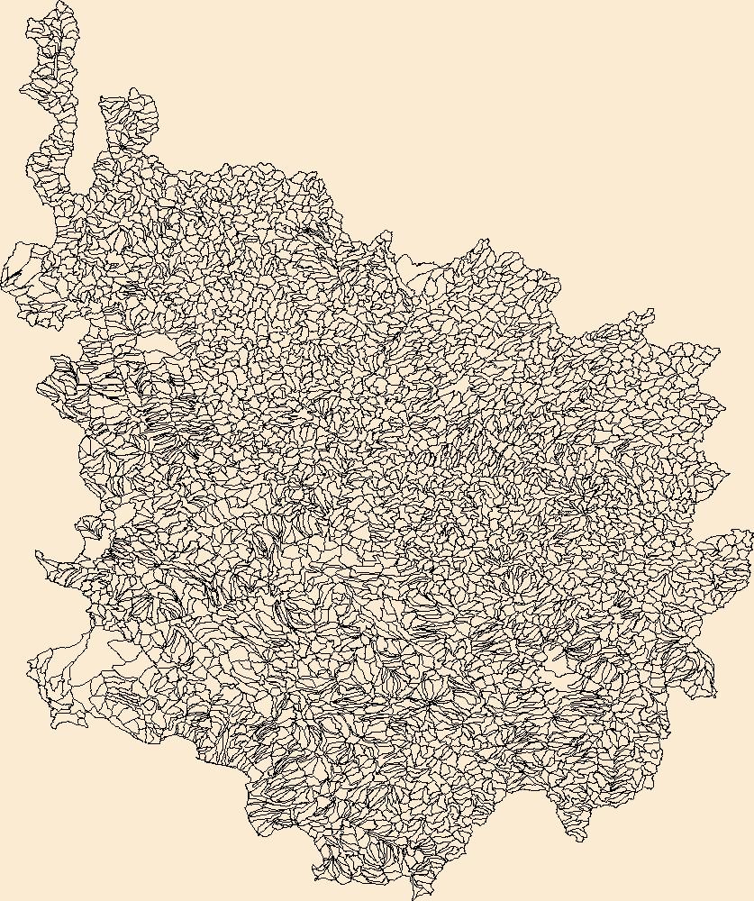
The Watershed Boundary Dataset (WBD) is a comprehensive aggregated collection of hydrologic unit data consistent with the national criteria for delineation and resolution. It defines the areal extent of surface water drainage to a point except in coastal or lake front areas where there could be multiple outlets as stated by the "Federal Standards and Procedures for the National Watershed Boundary Dataset (WBD)" "Standard" (https://pubs.usgs.gov/tm/11/a3/). Watershed boundaries are determined solely upon science-based hydrologic principles, not favoring any administrative boundaries or special projects, nor particular program or agency. This dataset represents the hydrologic unit boundaries to the 12-digit (6th level)...
Tags: 10-digit,
12-digit,
14-digit,
16-digit,
2-digit, All tags...
4-digit,
6-digit,
8-digit,
AK,
Alaska,
Aleutians East,
Aleutians West,
Anchorage,
Basin,
Bethel,
Bristol Bay,
Chugach,
Copper River,
Denali,
Dillingham,
Downloadable Data,
Esri Shapefile nan,
Fairbanks North Star,
HU-2,
HU-2 Region,
HU2_19,
HUC,
Haines,
Hoonah-Angoon,
Hydrography,
Hydrologic Unit Code,
Hydrologic Units,
Juneau,
Kenai Peninsula,
Ketchikan Gateway,
Kodiak Island,
Kusilvak,
Lake and Peninsula,
Matanuska-Susitna,
National Watershed Boundary Dataset (WBD),
National Watershed Boundary Dataset (WBD),
Nome,
North Slope,
Northwest Arctic,
Petersburg,
Prince of Wales-Hyder,
Region,
Shapefile,
Sitka,
Skagway,
Southeast Fairbanks,
Sub-basin,
Sub-region,
Subwatershed,
US,
United States,
WBD,
Watershed,
Watershed Boundary Dataset,
Wrangell,
Yakutat,
Yukon-Koyukuk,
inlandWaters, Fewer tags
|
The Watershed Boundary Dataset (WBD) is a comprehensive aggregated collection of hydrologic unit data consistent with the national criteria for delineation and resolution. It defines the areal extent of surface water drainage to a point except in coastal or lake front areas where there could be multiple outlets as stated by the "Federal Standards and Procedures for the National Watershed Boundary Dataset (WBD)" "Standard" (https://pubs.usgs.gov/tm/11/a3/). Watershed boundaries are determined solely upon science-based hydrologic principles, not favoring any administrative boundaries or special projects, nor particular program or agency. This dataset represents the hydrologic unit boundaries to the 12-digit (6th level)...
Tags: 10-digit,
12-digit,
14-digit,
16-digit,
2-digit, All tags...
4-digit,
6-digit,
8-digit,
Addison,
Androscoggin,
Aroostook,
Barnstable,
Basin,
Belknap,
Bennington,
Berkshire,
Bristol,
CT,
Caledonia,
Capitol,
Carroll,
Cheshire,
Columbia,
Connecticut,
Coos,
Cumberland,
Downloadable Data,
Dukes,
Dutchess,
Essex,
Franklin,
GeoPackage,
Grafton,
Greater Bridgeport,
HU-2,
HU-2 Region,
HU2_01,
HUC,
Hampden,
Hampshire,
Hancock,
Hillsborough,
Hydrography,
Hydrologic Unit Code,
Hydrologic Units,
Kennebec,
Kent,
Knox,
Lincoln,
Lower Connecticut River Valley,
MA,
ME,
Maine,
Massachusetts,
Merrimack,
Middlesex,
NH,
NY,
Nantucket,
National Watershed Boundary Dataset (WBD),
National Watershed Boundary Dataset (WBD),
Naugatuck Valley,
New Hampshire,
New York,
Newport,
Norfolk,
Northeastern Connecticut,
Northwest Hills,
Open Geospatial Consortium GeoPackage 1.2,
Orange,
Orleans,
Oxford,
Penobscot,
Piscataquis,
Plymouth,
Providence,
Putnam,
RI,
Region,
Rhode Island,
Rockingham,
Rutland,
Sagadahoc,
Somerset,
South Central Connecticut,
Southeastern Connecticut,
Strafford,
Sub-basin,
Sub-region,
Subwatershed,
Suffolk,
Sullivan,
US,
United States,
VT,
Vermont,
WBD,
Waldo,
Washington,
Watershed,
Watershed Boundary Dataset,
Westchester,
Western Connecticut,
Windham,
Windsor,
Worcester,
York,
inlandWaters, Fewer tags
|
The Watershed Boundary Dataset (WBD) is a comprehensive aggregated collection of hydrologic unit data consistent with the national criteria for delineation and resolution. It defines the areal extent of surface water drainage to a point except in coastal or lake front areas where there could be multiple outlets as stated by the "Federal Standards and Procedures for the National Watershed Boundary Dataset (WBD)" "Standard" (https://pubs.usgs.gov/tm/11/a3/). Watershed boundaries are determined solely upon science-based hydrologic principles, not favoring any administrative boundaries or special projects, nor particular program or agency. This dataset represents the hydrologic unit boundaries to the 12-digit (6th level)...
Tags: 10-digit,
12-digit,
14-digit,
16-digit,
2-digit, All tags...
4-digit,
6-digit,
8-digit,
AZ,
Apache,
Arizona,
Basin,
CA,
California,
Catron,
Cibola,
Clark,
Cochise,
Coconino,
Downloadable Data,
GeoPackage,
Gila,
Graham,
Grant,
Greenlee,
HU-2,
HU-2 Region,
HU2_15,
HUC,
Hidalgo,
Hydrography,
Hydrologic Unit Code,
Hydrologic Units,
Imperial,
Iron,
Kane,
La Paz,
Lincoln,
Luna,
Maricopa,
McKinley,
Mohave,
NM,
NV,
National Watershed Boundary Dataset (WBD),
National Watershed Boundary Dataset (WBD),
Navajo,
Nevada,
New Mexico,
Nye,
Open Geospatial Consortium GeoPackage 1.2,
Pima,
Pinal,
Region,
Riverside,
San Bernardino,
San Juan,
Santa Cruz,
Sierra,
Sub-basin,
Sub-region,
Subwatershed,
US,
UT,
United States,
Utah,
WBD,
Washington,
Watershed,
Watershed Boundary Dataset,
White Pine,
Yavapai,
Yuma,
inlandWaters, Fewer tags
|
View more...
|