|
|
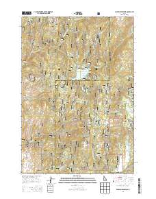
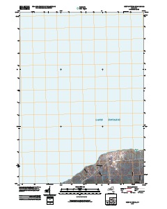
Layered GeoPDF 7.5 Minute Quadrangle Map. Layers of geospatial data include orthoimagery, roads, grids, geographic names, elevation contours, hydrography, and other selected map features.
Tags: 7.5 x 7.5 minute,
Downloadable Data,
EarthCover,
Gem,
GeoPDF, All tags...
Idaho,
Imagery and Base Maps,
Map,
Public Land Survey System,
Sage Hen Reservoir, ID,
U.S. National Grid,
US,
US Topo,
US Topo Historical,
United States,
Valley,
boundary,
contour,
geographic names,
hydrography,
imageryBaseMapsEarthCover,
orthoimage,
structures,
topographic,
transportation,
woodland, Fewer tags
|
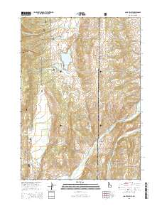
Layered GeoPDF 7.5 Minute Quadrangle Map. Layers of geospatial data include orthoimagery, roads, grids, geographic names, elevation contours, hydrography, and other selected map features.
Tags: 7.5 x 7.5 minute,
Caribou,
Downloadable Data,
EarthCover,
GeoPDF, All tags...
Idaho,
Imagery and Base Maps,
Lincoln,
Map,
Public Land Survey System,
Sage Valley, ID-WY,
U.S. National Grid,
US,
US Topo,
US Topo Historical,
United States,
Wyoming,
boundary,
contour,
geographic names,
hydrography,
imageryBaseMapsEarthCover,
orthoimage,
structures,
topographic,
transportation,
woodland, Fewer tags
|
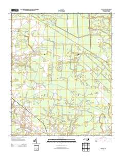
Layered GeoPDF 7.5 Minute Quadrangle Map. Layers of geospatial data include orthoimagery, roads, grids, geographic names, elevation contours, hydrography, and other selected map features.
Tags: 7.5 x 7.5 minute,
Beaufort,
Craven,
Downloadable Data,
EarthCover, All tags...
Ernul, NC,
GeoPDF,
Imagery and Base Maps,
Map,
North Carolina,
Public Land Survey System,
U.S. National Grid,
US,
US Topo,
US Topo Historical,
United States,
boundary,
contour,
geographic names,
hydrography,
imageryBaseMapsEarthCover,
orthoimage,
structures,
topographic,
transportation,
woodland, Fewer tags
|
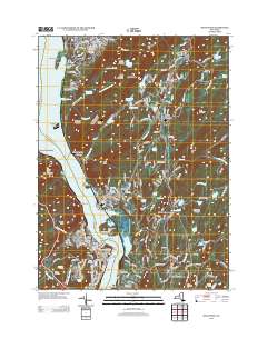
Layered GeoPDF 7.5 Minute Quadrangle Map. Layers of geospatial data include orthoimagery, roads, grids, geographic names, elevation contours, hydrography, and other selected map features.
Tags: 7.5 x 7.5 minute,
Downloadable Data,
Dutchess,
EarthCover,
GeoPDF, All tags...
Imagery and Base Maps,
Map,
New York,
Orange,
Public Land Survey System,
Putnam,
U.S. National Grid,
US,
US Topo,
US Topo Historical,
United States,
West Point, NY,
boundary,
contour,
geographic names,
hydrography,
imageryBaseMapsEarthCover,
orthoimage,
structures,
topographic,
transportation,
woodland, Fewer tags
|
Layered GeoPDF 7.5 Minute Quadrangle Map. Layers of geospatial data include orthoimagery, roads, grids, geographic names, elevation contours, hydrography, and other selected map features.
Tags: 7.5 x 7.5 minute,
Downloadable Data,
EarthCover,
GeoPDF,
Imagery and Base Maps, All tags...
Map,
New York,
Oswego,
U.S. National Grid,
US,
US Topo,
US Topo Historical,
United States,
West of Texas, NY,
contour,
geographic names,
hydrography,
orthoimage,
topographic,
transportation, Fewer tags
|
View more...
|