Filters: Contacts: {oldPartyId:1035} (X)
14 results (40ms)|
Filters
Date Range
Extensions Types
Contacts Categories Tag Types
|
This is a collaborative, two-part project to compile and analyze resource data to support WLCI efforts. Part 1 entails directing data synthesis and assessment activities to ensure that they will inform and support the WLCI LPDTs and Coordination Team in their conservation planning efforts, such as developing conservation priorities and strategies, identifying priority areas for conservation actions, evaluating and ranking conservation projects, and evaluating spatial and ecological relations between proposed habitat projects and WLCI priorities. In FY2014, we helped the Coordination Team complete the WLCI Conservation Action Plan and BLM’s annual report, and we provided maps and other materials to assist with ranking...
Categories: Data,
Project;
Types: Map Service,
OGC WFS Layer,
OGC WMS Layer,
OGC WMS Service,
ScienceBase Project;
Tags: Baseline Synthesis,
Science,
Science Project
As the principal agency charged with conducting WLCI science, the U.S. Geological Survey (USGS) provides multidisciplinary scientific- and technical-assistance support to WLCI partners and works to advance the overall scientific understanding of ecosystems in Southwest Wyoming. Fulfilling these roles entails evaluating the effectiveness of habitat treatments implemented by WLCI partners and collaborators, assessing the cumulative effects of energy development and other land-use changes on wildlife and habitat in the WLCI area, coordinating work activities with the WLCI community, and demonstrating how to integrate research findings into on-the-ground management actions. Work is guided by a Science Strategy based...
Shale gas is a key source of onshore domestic energy for the United States and production of this resource is increasing rapidly. Development and extraction of shale gas requires hydraulic fracturing, which entails horizontal drilling, perforation of steel casing and cement grout using explosive charges, and expansion of fractures using fluids under high pressure. Concern over potential environmental effects of shale gas development is growing and based on a recent review there is very little information in the scientific literature on potential environmental effects of hydraulic fracturing. We propose to conduct the first broad scale, data-based assessment of the potential effects of hydraulic fracturing on water...
Categories: Project;
Tags: All Working Groups,
Completed,
Energy and Minerals,
Hydraulic Fracturing,
Water,
A program as large and complex as the WLCI requires significant coordination and management, as well as the integration of what is learned from science with the decision-making and program-evaluation processes. For the WLCI, coordination and integration are accomplished through the WLCI Coordination Team, which is composed of one member each from the USGS, BLM, FWS, Wyoming Game and Fish Department, and Wyoming Department of Agriculture. There is also a USGS member on the Science and Technical Advisory Committee. Under the direction of the WLCI Executive Committee, the Coordination Team manages the fiscal and logistical operations necessary to meet the goals and objectives of the WLCI. The Coordination Team also...
This project involves a web-based application and information resource focused on ecosystems, energy, and water in northwestern Colorado. The project will be developed and implemented in partnership with land and resource managers and will compliment ongoing and proposed work to support data and information management needs in the region. Representative on-going efforts and entities involved include the U.S. Fish and Wildlife Service Southern Rockies Landscape Conservation Cooperative studies, Bureau of Land Management Rapid Ecoregional Assessments, Americas Great Outdoors Initiative, WaterSMART, Upper Colorado Endangered Fish Recovery Program, Yampa River Legacy Project, Soil Landscape Geochemistry Project, Sage...
Categories: Project
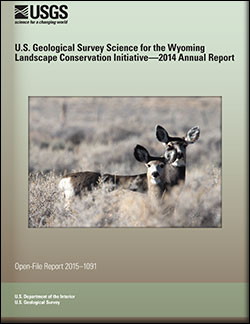
U.S. Geological Survey Science for the Wyoming Landscape Conservation Initiative: 2014 annual report
This is the seventh report produced by the U.S. Geological Survey (USGS) for the Wyoming Landscape Conservation Initiative (WLCI) to detail annual activities conducted by the USGS for addressing specific management needs identified by WLCI partners. In FY2014, there were 26 projects, including a new one that was completed, two others that were also completed, and several that entered new phases or directions. The 26 projects fall into several categories: (1) synthesizing and analyzing existing data to identify current conditions on the landscape and using the data to develop models for projecting past and future landscape conditions; (2) monitoring indicators of ecosystem conditions and the effectiveness of on-the-ground...
Categories: Publication;
Types: Citation,
Map Service,
OGC WFS Layer,
OGC WMS Layer,
OGC WMS Service;
Tags: Open-File Report
Addressing concerns about the types and development of energy and a secure energy future is a high priority for the current United States administration, the Department of the Interior (DOI) in particular. The BLM and other land management agencies within the DOI are charged with balancing energy development with other land uses and values. Decision-making about land uses is often controversial and complex; this necessitates easy access to useful data, literature, and other informative resources that facilitate a better understanding of how energy development affects natural resources, ecosystems, economics, and society. Although there are several valuable on-line resources that provide information about energy...
A dataset comprised of road centerlines in Wyoming, USA, digitized to 2015 aerial photography from the National Agriculture Imagery Program. This dataset is an update to a former U.S. Geological Survey Data Series (“Large scale Wyoming transportation data: a resource planning tool”: O'Donnell and others, 2014) digitized to 2009 aerial photography. The U.S. Geological Survey Fort Collins Science Center created statewide roads data for the Bureau of Land Management Wyoming State Office using 2015 aerial photography from the National Agriculture Imagery Program. To ensure a systematic and repeatable approach of capturing roads on the landscape using on-screen digitizing from true color National Agriculture Imagery...
Western Energy Citation Clearinghouse (WECC) community catalogs energy citations produced for the Wyoming Landscape Conservation Initiative (WLCI; www.wlci.gov). ScienceBase includes other (data, publications, maps, others) cataloged resources for the WLCI in the WLCI community. More information available at: http://pubs.usgs.gov/of/2011/1206/
Heightened concern regarding the potential effects of unconventional oil and gas development on regional water quality has emerged, but the few studies on this topic are limited in geographic scope. Here we evaluate the potential utility of national and publicly available water-quality data sets for addressing questions regarding unconventional oil and gas development. We used existing U.S. Geological Survey and U.S. Environmental Protection Agency data sets to increase understanding of the spatial distribution of unconventional oil and gas development in the U.S. and broadly assess surface water quality trends in these areas. Based on sample size limitations, we were able to estimate trends in specific conductance...
Categories: Publication;
Types: Citation
The data contained in this report was compiled, modified, and analyzed for the Wyoming Landscape Conservation Initiative (WLCI) Integrated Assessment (IA). The WLCI is a long-term science based effort to assess and enhance aquatic and terrestrial habitats at a landscape scale in southwest Wyoming while facilitating responsible energy development through local collaboration and partnerships. The IA is an integrated synthesis and analysis of WLCI resource values based on best available data and information collected from multiple agencies and organizations. It is a support tool for landscape-scale conservation planning and evaluation, and a data and analysis resource that can be used for addressing specific management...
Tags: rare plants
Geospatial data play an increasingly important role in natural resources management, conservation, and science-based projects. The management and effective use of spatial data becomes significantly more complex when the efforts involve a myriad of landscape-scale projects combined with a multiorganizational collaboration. There is sparse literature to guide users on this daunting subject; therefore, we present a framework of considerations for working with geospatial data that will provide direction to data stewards, scientists, collaborators, and managers for developing geospatial management plans. The concepts we present apply to a variety of geospatial programs or projects, which we describe as a “scalable framework”...
Categories: Publication
A study of arroyo evolution in northern New Mexico (Friedman and others, 2015) assessed geomorphic change in the Chaco Wash arroyo from the 1930s to 2000. As part of this study, in October 2000 a trench was excavated across the arroyo bottom and a high-precision (Real-time kinematic) GPS survey was conducted. GPS survey data were used to georeference a 1930s topographic map and to identify key geomorphic features, including the tops of the arroyo walls and the channel thalweg. Linear features were mapped in a GIS for use in extracting channel thalweg profiles, an arroyo cross section, and arroyo widths (1930s and 2000) as a function of distance down-valley. These features have been converted to shapefiles included...
Sagebrush ecosystems are diverse habitats found throughout western North America that support a variety of flora and fauna. Home to unique wildlife such as Sage-grouse, Sage Thrashers, Brewer's Sparrows, Ferruginous Hawks, and pygmy rabbits, these ecosystems have undergone intense changes since the time when millions of bison roamed the plains. European settlement and intense agricultural practices resulted in the loss of over half of the sagebrush ecosystem. Today, sagebrush habitats continue to be threatened by a variety of influences. Conversion of these native landscapes to agriculture, invasion by non-native plant species, energy extraction activities and associated developments, rural expansion, and intense...
|

|
