Location
Folder
ROOT
_ScienceBase Catalog
__National Geospatial Program
___The National Map
____USGS Land Cover - Woodland Downloadable Data Collection
Filters
Date Range
Types
Contacts
Tag Types
Tag Schemes
|

Geospatial data that is a derivative land cover product depicting woodland on topographic maps.
Tags: Agricultural land,
Anderson,
Andrews,
Angelina,
Aransas, All tags...
Archer,
Armstrong,
Atascosa,
Austin,
Bailey,
Bandera,
Barren land,
Bastrop,
Baylor,
Bee,
Bell,
Bexar,
Blanco,
Borden,
Bosque,
Bowie,
Brazoria,
Brazos,
Brewster,
Briscoe,
Brooks,
Brown,
Burleson,
Burnet,
Caldwell,
Calhoun,
Callahan,
Cameron,
Camp,
Carson,
Cass,
Castro,
Chambers,
Cherokee,
Childress,
Clay,
Cochran,
Coke,
Coleman,
Collin,
Collingsworth,
Colorado,
Comal,
Comanche,
Concho,
Cooke,
Coryell,
Cottle,
Crane,
Crockett,
Crosby,
Culberson,
Dallam,
Dallas,
Dawson,
DeWitt,
Deaf Smith,
Delta,
Denton,
Dickens,
Dimmit,
Donley,
Downloadable Data,
Duval,
Eastland,
Ector,
Edwards,
El Paso,
Ellis,
Erath,
Esri File GeoDatabase 10,
Falls,
Fannin,
Fayette,
FileGDB,
Fisher,
Floyd,
Foard,
Forest land,
Fort Bend,
Franklin,
Freestone,
Frio,
Gaines,
Galveston,
Garza,
Gillespie,
Glasscock,
Goliad,
Gonzales,
Gray,
Grayson,
Gregg,
Grimes,
Guadalupe,
Hale,
Hall,
Hamilton,
Hansford,
Hardeman,
Hardin,
Harris,
Harrison,
Hartley,
Haskell,
Hays,
Hemphill,
Henderson,
Hidalgo,
Hill,
Hockley,
Hood,
Hopkins,
Houston,
Howard,
Hudspeth,
Hunt,
Hutchinson,
Irion,
Jack,
Jackson,
Jasper,
Jeff Davis,
Jefferson,
Jim Hogg,
Jim Wells,
Johnson,
Jones,
Karnes,
Kaufman,
Kendall,
Kenedy,
Kent,
Kerr,
Kimble,
King,
Kinney,
Kleberg,
Knox,
La Salle,
Lamar,
Lamb,
Lampasas,
Land Cover,
Land Cover - Woodland,
Land Cover - Woodland,
Lavaca,
Lee,
Leon,
Liberty,
Limestone,
Lipscomb,
Live Oak,
Llano,
Loving,
Lubbock,
Lynn,
Madison,
Marion,
Martin,
Mason,
Matagorda,
Maverick,
McCulloch,
McLennan,
McMullen,
Medina,
Menard,
Midland,
Milam,
Mills,
Mitchell,
Montague,
Montgomery,
Moore,
Morris,
Motley,
Nacogdoches,
Navarro,
Newton,
Nolan,
Not Classified,
Nueces,
Ochiltree,
Oldham,
Orange,
Orthoimage,
Palo Pinto,
Panola,
Parker,
Parmer,
Pecos,
Polk,
Potter,
Presidio,
Rains,
Randall,
Range land,
Reagan,
Real,
Red River,
Reeves,
Refugio,
Roberts,
Robertson,
Rockwall,
Runnels,
Rusk,
Sabine,
San Augustine,
San Jacinto,
San Patricio,
San Saba,
Schleicher,
Scurry,
Shackelford,
Shelby,
Sherman,
Smith,
Somervell,
Starr,
State,
State,
Stephens,
Sterling,
Stonewall,
Sutton,
Swisher,
TX,
Tarrant,
Taylor,
Terrell,
Terry,
Texas,
Throckmorton,
Titus,
Tom Green,
Travis,
Trinity,
Tyler,
US,
United States,
Upshur,
Upton,
Urban and built-up land,
Uvalde,
Val Verde,
Van Zandt,
Victoria,
Walker,
Waller,
Ward,
Washington,
Water,
Webb,
Wetland,
Wharton,
Wheeler,
Wichita,
Wilbarger,
Willacy,
Williamson,
Wilson,
Winkler,
Wise,
Wood,
Woodland,
Yoakum,
Young,
Zapata,
Zavala,
annotations,
biota,
ecology,
environment,
farming,
flora,
habitat,
imagery,
imageryBaseMapsEarthCover,
land cover, Fewer tags

Geospatial data that is a derivative land cover product depicting woodland on topographic maps.
Tags: Agricultural land,
Barren land,
Downloadable Data,
Esri File GeoDatabase 10,
FileGDB, All tags...
Forest land,
GU,
Guam,
Guam,
Land Cover,
Land Cover - Woodland,
Land Cover - Woodland,
Not Classified,
Orthoimage,
Range land,
State,
State,
US,
United States,
Urban and built-up land,
Water,
Wetland,
Woodland,
annotations,
biota,
ecology,
environment,
farming,
flora,
habitat,
imagery,
imageryBaseMapsEarthCover,
land cover, Fewer tags

Geospatial data that is a derivative land cover product depicting woodland on topographic maps.
Tags: Adair,
Agricultural land,
Alfalfa,
Atoka,
Barren land, All tags...
Beaver,
Beckham,
Blaine,
Bryan,
Caddo,
Canadian,
Carter,
Cherokee,
Choctaw,
Cimarron,
Cleveland,
Coal,
Comanche,
Cotton,
Craig,
Creek,
Custer,
Delaware,
Dewey,
Downloadable Data,
Ellis,
Esri File GeoDatabase 10,
FileGDB,
Forest land,
Garfield,
Garvin,
Grady,
Grant,
Greer,
Harmon,
Harper,
Haskell,
Hughes,
Jackson,
Jefferson,
Johnston,
Kay,
Kingfisher,
Kiowa,
Land Cover,
Land Cover - Woodland,
Land Cover - Woodland,
Latimer,
Le Flore,
Lincoln,
Logan,
Love,
Major,
Marshall,
Mayes,
McClain,
McCurtain,
McIntosh,
Murray,
Muskogee,
Noble,
Not Classified,
Nowata,
OK,
Okfuskee,
Oklahoma,
Oklahoma,
Okmulgee,
Orthoimage,
Osage,
Ottawa,
Pawnee,
Payne,
Pittsburg,
Pontotoc,
Pottawatomie,
Pushmataha,
Range land,
Roger Mills,
Rogers,
Seminole,
Sequoyah,
State,
State,
Stephens,
Texas,
Tillman,
Tulsa,
US,
United States,
Urban and built-up land,
Wagoner,
Washington,
Washita,
Water,
Wetland,
Woodland,
Woods,
Woodward,
annotations,
biota,
ecology,
environment,
farming,
flora,
habitat,
imagery,
imageryBaseMapsEarthCover,
land cover, Fewer tags

Geospatial data that is a derivative land cover product depicting woodland on topographic maps.
Tags: Agricultural land,
Albany,
Allegany,
Barren land,
Bronx, All tags...
Broome,
Cattaraugus,
Cayuga,
Chautauqua,
Chemung,
Chenango,
Clinton,
Columbia,
Cortland,
Delaware,
Downloadable Data,
Dutchess,
Erie,
Esri File GeoDatabase 10,
Essex,
FileGDB,
Forest land,
Franklin,
Fulton,
Genesee,
Greene,
Hamilton,
Herkimer,
Jefferson,
Kings,
Land Cover,
Land Cover - Woodland,
Land Cover - Woodland,
Lewis,
Livingston,
Madison,
Monroe,
Montgomery,
NY,
Nassau,
New York,
New York,
Niagara,
Not Classified,
Oneida,
Onondaga,
Ontario,
Orange,
Orleans,
Orthoimage,
Oswego,
Otsego,
Putnam,
Queens,
Range land,
Rensselaer,
Richmond,
Rockland,
Saratoga,
Schenectady,
Schoharie,
Schuyler,
Seneca,
St. Lawrence,
State,
State,
Steuben,
Suffolk,
Sullivan,
Tioga,
Tompkins,
US,
Ulster,
United States,
Urban and built-up land,
Warren,
Washington,
Water,
Wayne,
Westchester,
Wetland,
Woodland,
Wyoming,
Yates,
annotations,
biota,
ecology,
environment,
farming,
flora,
habitat,
imagery,
imageryBaseMapsEarthCover,
land cover, Fewer tags

Geospatial data that is a derivative land cover product depicting woodland on topographic maps.
Tags: Adams,
Agricultural land,
Allen,
Ashland,
Ashtabula, All tags...
Athens,
Auglaize,
Barren land,
Belmont,
Brown,
Butler,
Carroll,
Champaign,
Clark,
Clermont,
Clinton,
Columbiana,
Coshocton,
Crawford,
Cuyahoga,
Darke,
Defiance,
Delaware,
Downloadable Data,
Erie,
Esri File GeoDatabase 10,
Fairfield,
Fayette,
FileGDB,
Forest land,
Franklin,
Fulton,
Gallia,
Geauga,
Greene,
Guernsey,
Hamilton,
Hancock,
Hardin,
Harrison,
Henry,
Highland,
Hocking,
Holmes,
Huron,
Jackson,
Jefferson,
Knox,
Lake,
Land Cover,
Land Cover - Woodland,
Land Cover - Woodland,
Lawrence,
Licking,
Logan,
Lorain,
Lucas,
Madison,
Mahoning,
Marion,
Medina,
Meigs,
Mercer,
Miami,
Monroe,
Montgomery,
Morgan,
Morrow,
Muskingum,
Noble,
Not Classified,
OH,
Ohio,
Orthoimage,
Ottawa,
Paulding,
Perry,
Pickaway,
Pike,
Portage,
Preble,
Putnam,
Range land,
Richland,
Ross,
Sandusky,
Scioto,
Seneca,
Shelby,
Stark,
State,
State,
Summit,
Trumbull,
Tuscarawas,
US,
Union,
United States,
Urban and built-up land,
Van Wert,
Vinton,
Warren,
Washington,
Water,
Wayne,
Wetland,
Williams,
Wood,
Woodland,
Wyandot,
annotations,
biota,
ecology,
environment,
farming,
flora,
habitat,
imagery,
imageryBaseMapsEarthCover,
land cover, Fewer tags

Geospatial data that is a derivative land cover product depicting woodland on topographic maps.
Tags: Adair,
Agricultural land,
Andrew,
Atchison,
Audrain, All tags...
Barren land,
Barry,
Barton,
Bates,
Benton,
Bollinger,
Boone,
Buchanan,
Butler,
Caldwell,
Callaway,
Camden,
Cape Girardeau,
Carroll,
Carter,
Cass,
Cedar,
Chariton,
Christian,
Clark,
Clay,
Clinton,
Cole,
Cooper,
Crawford,
Dade,
Dallas,
Daviess,
DeKalb,
Dent,
Douglas,
Downloadable Data,
Dunklin,
Esri Shapefile nan,
Forest land,
Franklin,
Gasconade,
Gentry,
Greene,
Grundy,
Harrison,
Henry,
Hickory,
Holt,
Howard,
Howell,
Iron,
Jackson,
Jasper,
Jefferson,
Johnson,
Knox,
Laclede,
Lafayette,
Land Cover,
Land Cover - Woodland,
Land Cover - Woodland,
Lawrence,
Lewis,
Lincoln,
Linn,
Livingston,
MO,
Macon,
Madison,
Maries,
Marion,
McDonald,
Mercer,
Miller,
Mississippi,
Missouri,
Moniteau,
Monroe,
Montgomery,
Morgan,
New Madrid,
Newton,
Nodaway,
Not Classified,
Oregon,
Orthoimage,
Osage,
Ozark,
Pemiscot,
Perry,
Pettis,
Phelps,
Pike,
Platte,
Polk,
Pulaski,
Putnam,
Ralls,
Randolph,
Range land,
Ray,
Reynolds,
Ripley,
Saline,
Schuyler,
Scotland,
Scott,
Shannon,
Shapefile,
Shelby,
St. Charles,
St. Clair,
St. Francois,
St. Louis,
State,
State,
Ste. Genevieve,
Stoddard,
Stone,
Sullivan,
Taney,
Texas,
US,
United States,
Urban and built-up land,
Vernon,
Warren,
Washington,
Water,
Wayne,
Webster,
Wetland,
Woodland,
Worth,
Wright,
annotations,
biota,
ecology,
environment,
farming,
flora,
habitat,
imagery,
imageryBaseMapsEarthCover,
land cover, Fewer tags

Geospatial data that is a derivative land cover product depicting woodland on topographic maps.
Types: Citation;
Tags: Adams,
Agricultural land,
Alcorn,
Amite,
Attala, All tags...
Barren land,
Benton,
Bolivar,
Calhoun,
Carroll,
Chickasaw,
Choctaw,
Claiborne,
Clarke,
Clay,
Coahoma,
Copiah,
Covington,
DeSoto,
Downloadable Data,
Esri Shapefile nan,
Forest land,
Forrest,
Franklin,
George,
Greene,
Grenada,
Hancock,
Harrison,
Hinds,
Holmes,
Humphreys,
Issaquena,
Itawamba,
Jackson,
Jasper,
Jefferson,
Jefferson Davis,
Jones,
Kemper,
Lafayette,
Lamar,
Land Cover,
Land Cover - Woodland,
Land Cover - Woodland,
Lauderdale,
Lawrence,
Leake,
Lee,
Leflore,
Lincoln,
Lowndes,
MS,
Madison,
Marion,
Marshall,
Mississippi,
Monroe,
Montgomery,
Neshoba,
Newton,
Not Classified,
Noxubee,
Oktibbeha,
Orthoimage,
Panola,
Pearl River,
Perry,
Pike,
Pontotoc,
Prentiss,
Quitman,
Range land,
Rankin,
Scott,
Shapefile,
Sharkey,
Simpson,
Smith,
State,
State,
Stone,
Sunflower,
Tallahatchie,
Tate,
Tippah,
Tishomingo,
Tunica,
US,
Union,
United States,
Urban and built-up land,
Walthall,
Warren,
Washington,
Water,
Wayne,
Webster,
Wetland,
Wilkinson,
Winston,
Woodland,
Yalobusha,
Yazoo,
annotations,
biota,
ecology,
environment,
farming,
flora,
habitat,
imagery,
imageryBaseMapsEarthCover,
land cover, Fewer tags

Geospatial data that is a derivative land cover product depicting woodland on topographic maps.
Tags: Adams,
Agricultural land,
Barnes,
Barren land,
Benson, All tags...
Billings,
Bottineau,
Bowman,
Burke,
Burleigh,
Cass,
Cavalier,
Dickey,
Divide,
Downloadable Data,
Dunn,
Eddy,
Emmons,
Esri Shapefile nan,
Forest land,
Foster,
Golden Valley,
Grand Forks,
Grant,
Griggs,
Hettinger,
Kidder,
LaMoure,
Land Cover,
Land Cover - Woodland,
Land Cover - Woodland,
Logan,
McHenry,
McIntosh,
McKenzie,
McLean,
Mercer,
Morton,
Mountrail,
ND,
Nelson,
North Dakota,
Not Classified,
Oliver,
Orthoimage,
Pembina,
Pierce,
Ramsey,
Range land,
Ransom,
Renville,
Richland,
Rolette,
Sargent,
Shapefile,
Sheridan,
Sioux,
Slope,
Stark,
State,
State,
Steele,
Stutsman,
Towner,
Traill,
US,
United States,
Urban and built-up land,
Walsh,
Ward,
Water,
Wells,
Wetland,
Williams,
Woodland,
annotations,
biota,
ecology,
environment,
farming,
flora,
habitat,
imagery,
imageryBaseMapsEarthCover,
land cover, Fewer tags

Geospatial data that is a derivative land cover product depicting woodland on topographic maps.
Tags: Agricultural land,
Aitkin,
Anoka,
Barren land,
Becker, All tags...
Beltrami,
Benton,
Big Stone,
Blue Earth,
Brown,
Carlton,
Carver,
Cass,
Chippewa,
Chisago,
Clay,
Clearwater,
Cook,
Cottonwood,
Crow Wing,
Dakota,
Dodge,
Douglas,
Downloadable Data,
Esri File GeoDatabase 10,
Faribault,
FileGDB,
Fillmore,
Forest land,
Freeborn,
Goodhue,
Grant,
Hennepin,
Houston,
Hubbard,
Isanti,
Itasca,
Jackson,
Kanabec,
Kandiyohi,
Kittson,
Koochiching,
Lac qui Parle,
Lake,
Lake of the Woods,
Land Cover,
Land Cover - Woodland,
Land Cover - Woodland,
Le Sueur,
Lincoln,
Lyon,
MN,
Mahnomen,
Marshall,
Martin,
McLeod,
Meeker,
Mille Lacs,
Minnesota,
Morrison,
Mower,
Murray,
Nicollet,
Nobles,
Norman,
Not Classified,
Olmsted,
Orthoimage,
Otter Tail,
Pennington,
Pine,
Pipestone,
Polk,
Pope,
Ramsey,
Range land,
Red Lake,
Redwood,
Renville,
Rice,
Rock,
Roseau,
Scott,
Sherburne,
Sibley,
St. Louis,
State,
State,
Stearns,
Steele,
Stevens,
Swift,
Todd,
Traverse,
US,
United States,
Urban and built-up land,
Wabasha,
Wadena,
Waseca,
Washington,
Water,
Watonwan,
Wetland,
Wilkin,
Winona,
Woodland,
Wright,
Yellow Medicine,
annotations,
biota,
ecology,
environment,
farming,
flora,
habitat,
imagery,
imageryBaseMapsEarthCover,
land cover, Fewer tags

Geospatial data that is a derivative land cover product depicting woodland on topographic maps.
Tags: Agricultural land,
Alameda,
Alpine,
Amador,
Barren land, All tags...
Butte,
CA,
Calaveras,
California,
Colusa,
Contra Costa,
Del Norte,
Downloadable Data,
El Dorado,
Esri File GeoDatabase 10,
FileGDB,
Forest land,
Fresno,
Glenn,
Humboldt,
Imperial,
Inyo,
Kern,
Kings,
Lake,
Land Cover,
Land Cover - Woodland,
Land Cover - Woodland,
Lassen,
Los Angeles,
Madera,
Marin,
Mariposa,
Mendocino,
Merced,
Modoc,
Mono,
Monterey,
Napa,
Nevada,
Not Classified,
Orange,
Orthoimage,
Placer,
Plumas,
Range land,
Riverside,
Sacramento,
San Benito,
San Bernardino,
San Diego,
San Francisco,
San Joaquin,
San Luis Obispo,
San Mateo,
Santa Barbara,
Santa Clara,
Santa Cruz,
Shasta,
Sierra,
Siskiyou,
Solano,
Sonoma,
Stanislaus,
State,
State,
Sutter,
Tehama,
Trinity,
Tulare,
Tuolumne,
US,
United States,
Urban and built-up land,
Ventura,
Water,
Wetland,
Woodland,
Yolo,
Yuba,
annotations,
biota,
ecology,
environment,
farming,
flora,
habitat,
imagery,
imageryBaseMapsEarthCover,
land cover, Fewer tags

Geospatial data that is a derivative land cover product depicting woodland on topographic maps.
Tags: AS,
Agricultural land,
American Samoa,
Barren land,
Downloadable Data, All tags...
Eastern,
Esri Shapefile nan,
Forest land,
Land Cover,
Land Cover - Woodland,
Land Cover - Woodland,
Manu'a,
Not Classified,
Orthoimage,
Range land,
Rose Island,
Shapefile,
State,
State,
Swains Island,
US,
United States,
Urban and built-up land,
Water,
Western,
Wetland,
Woodland,
annotations,
biota,
ecology,
environment,
farming,
flora,
habitat,
imagery,
imageryBaseMapsEarthCover,
land cover, Fewer tags

Geospatial data that is a derivative land cover product depicting woodland on topographic maps.
Tags: Adams,
Agricultural land,
Alexander,
Barren land,
Bond, All tags...
Boone,
Brown,
Bureau,
Calhoun,
Carroll,
Cass,
Champaign,
Christian,
Clark,
Clay,
Clinton,
Coles,
Cook,
Crawford,
Cumberland,
De Witt,
DeKalb,
Douglas,
Downloadable Data,
DuPage,
Edgar,
Edwards,
Effingham,
Esri Shapefile nan,
Fayette,
Ford,
Forest land,
Franklin,
Fulton,
Gallatin,
Greene,
Grundy,
Hamilton,
Hancock,
Hardin,
Henderson,
Henry,
IL,
Illinois,
Iroquois,
Jackson,
Jasper,
Jefferson,
Jersey,
Jo Daviess,
Johnson,
Kane,
Kankakee,
Kendall,
Knox,
LaSalle,
Lake,
Land Cover,
Land Cover - Woodland,
Land Cover - Woodland,
Lawrence,
Lee,
Livingston,
Logan,
Macon,
Macoupin,
Madison,
Marion,
Marshall,
Mason,
Massac,
McDonough,
McHenry,
McLean,
Menard,
Mercer,
Monroe,
Montgomery,
Morgan,
Moultrie,
Not Classified,
Ogle,
Orthoimage,
Peoria,
Perry,
Piatt,
Pike,
Pope,
Pulaski,
Putnam,
Randolph,
Range land,
Richland,
Rock Island,
Saline,
Sangamon,
Schuyler,
Scott,
Shapefile,
Shelby,
St. Clair,
Stark,
State,
State,
Stephenson,
Tazewell,
US,
Union,
United States,
Urban and built-up land,
Vermilion,
Wabash,
Warren,
Washington,
Water,
Wayne,
Wetland,
White,
Whiteside,
Will,
Williamson,
Winnebago,
Woodford,
Woodland,
annotations,
biota,
ecology,
environment,
farming,
flora,
habitat,
imagery,
imageryBaseMapsEarthCover,
land cover, Fewer tags

Geospatial data that is a derivative land cover product depicting woodland on topographic maps.
Tags: Agricultural land,
Barren land,
DC,
District of Columbia,
District of Columbia, All tags...
Downloadable Data,
Esri Shapefile nan,
Forest land,
Land Cover,
Land Cover - Woodland,
Land Cover - Woodland,
Not Classified,
Orthoimage,
Range land,
Shapefile,
State,
State,
US,
United States,
Urban and built-up land,
Water,
Wetland,
Woodland,
annotations,
biota,
ecology,
environment,
farming,
flora,
habitat,
imagery,
imageryBaseMapsEarthCover,
land cover, Fewer tags
Geospatial data that is a derivative land cover product depicting woodland on topographic maps.
Tags: Agricultural land,
Albany,
Barren land,
Big Horn,
Campbell, All tags...
Carbon,
Converse,
Crook,
Downloadable Data,
Esri File GeoDatabase 10,
FileGDB,
Forest land,
Fremont,
Goshen,
Hot Springs,
Johnson,
Land Cover,
Land Cover - Woodland,
Land Cover - Woodland,
Laramie,
Lincoln,
Natrona,
Niobrara,
Not Classified,
Orthoimage,
Park,
Platte,
Range land,
Sheridan,
State,
State,
Sublette,
Sweetwater,
Teton,
US,
Uinta,
United States,
Urban and built-up land,
WY,
Washakie,
Water,
Weston,
Wetland,
Woodland,
Wyoming,
annotations,
biota,
ecology,
environment,
farming,
flora,
habitat,
imagery,
imageryBaseMapsEarthCover,
land cover, Fewer tags
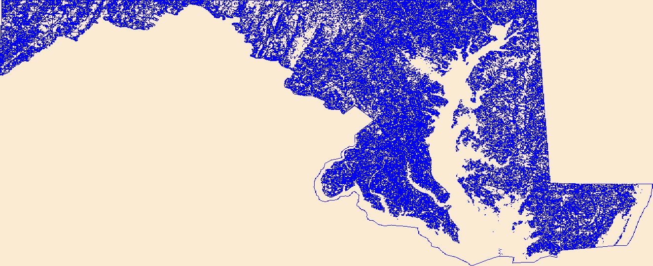
Geospatial data that is a derivative land cover product depicting woodland on topographic maps.
Tags: Agricultural land,
Allegany,
Anne Arundel,
Baltimore,
Barren land, All tags...
Calvert,
Caroline,
Carroll,
Cecil,
Charles,
Dorchester,
Downloadable Data,
Esri File GeoDatabase 10,
FileGDB,
Forest land,
Frederick,
Garrett,
Harford,
Howard,
Kent,
Land Cover,
Land Cover - Woodland,
Land Cover - Woodland,
MD,
Maryland,
Montgomery,
Not Classified,
Orthoimage,
Prince George's,
Queen Anne's,
Range land,
Somerset,
St. Mary's,
State,
State,
Talbot,
US,
United States,
Urban and built-up land,
Washington,
Water,
Wetland,
Wicomico,
Woodland,
Worcester,
annotations,
biota,
ecology,
environment,
farming,
flora,
habitat,
imagery,
imageryBaseMapsEarthCover,
land cover, Fewer tags
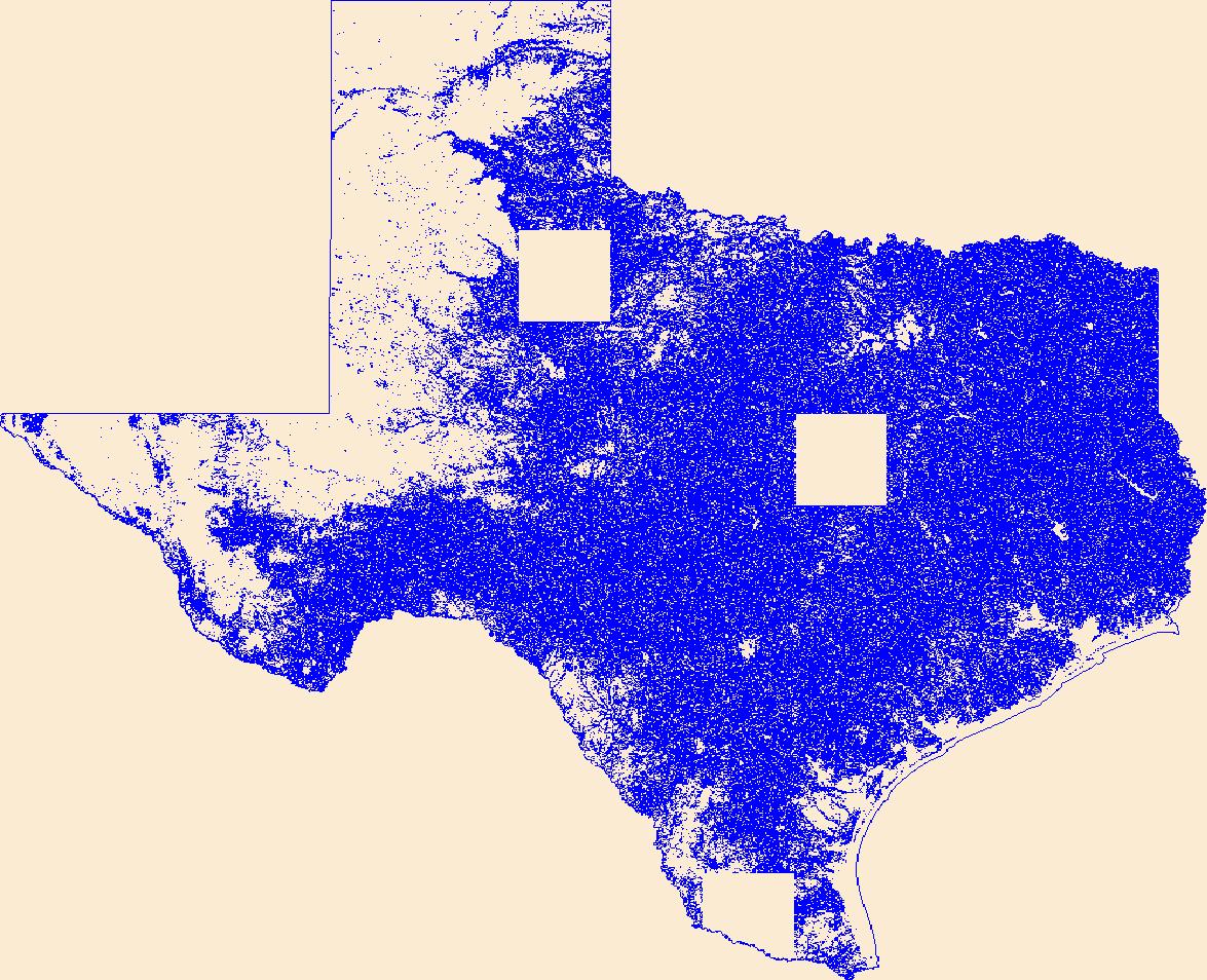
Geospatial data that is a derivative land cover product depicting woodland on topographic maps.
Tags: Agricultural land,
Anderson,
Andrews,
Angelina,
Aransas, All tags...
Archer,
Armstrong,
Atascosa,
Austin,
Bailey,
Bandera,
Barren land,
Bastrop,
Baylor,
Bee,
Bell,
Bexar,
Blanco,
Borden,
Bosque,
Bowie,
Brazoria,
Brazos,
Brewster,
Briscoe,
Brooks,
Brown,
Burleson,
Burnet,
Caldwell,
Calhoun,
Callahan,
Cameron,
Camp,
Carson,
Cass,
Castro,
Chambers,
Cherokee,
Childress,
Clay,
Cochran,
Coke,
Coleman,
Collin,
Collingsworth,
Colorado,
Comal,
Comanche,
Concho,
Cooke,
Coryell,
Cottle,
Crane,
Crockett,
Crosby,
Culberson,
Dallam,
Dallas,
Dawson,
DeWitt,
Deaf Smith,
Delta,
Denton,
Dickens,
Dimmit,
Donley,
Downloadable Data,
Duval,
Eastland,
Ector,
Edwards,
El Paso,
Ellis,
Erath,
Esri Shapefile nan,
Falls,
Fannin,
Fayette,
Fisher,
Floyd,
Foard,
Forest land,
Fort Bend,
Franklin,
Freestone,
Frio,
Gaines,
Galveston,
Garza,
Gillespie,
Glasscock,
Goliad,
Gonzales,
Gray,
Grayson,
Gregg,
Grimes,
Guadalupe,
Hale,
Hall,
Hamilton,
Hansford,
Hardeman,
Hardin,
Harris,
Harrison,
Hartley,
Haskell,
Hays,
Hemphill,
Henderson,
Hidalgo,
Hill,
Hockley,
Hood,
Hopkins,
Houston,
Howard,
Hudspeth,
Hunt,
Hutchinson,
Irion,
Jack,
Jackson,
Jasper,
Jeff Davis,
Jefferson,
Jim Hogg,
Jim Wells,
Johnson,
Jones,
Karnes,
Kaufman,
Kendall,
Kenedy,
Kent,
Kerr,
Kimble,
King,
Kinney,
Kleberg,
Knox,
La Salle,
Lamar,
Lamb,
Lampasas,
Land Cover,
Land Cover - Woodland,
Land Cover - Woodland,
Lavaca,
Lee,
Leon,
Liberty,
Limestone,
Lipscomb,
Live Oak,
Llano,
Loving,
Lubbock,
Lynn,
Madison,
Marion,
Martin,
Mason,
Matagorda,
Maverick,
McCulloch,
McLennan,
McMullen,
Medina,
Menard,
Midland,
Milam,
Mills,
Mitchell,
Montague,
Montgomery,
Moore,
Morris,
Motley,
Nacogdoches,
Navarro,
Newton,
Nolan,
Not Classified,
Nueces,
Ochiltree,
Oldham,
Orange,
Orthoimage,
Palo Pinto,
Panola,
Parker,
Parmer,
Pecos,
Polk,
Potter,
Presidio,
Rains,
Randall,
Range land,
Reagan,
Real,
Red River,
Reeves,
Refugio,
Roberts,
Robertson,
Rockwall,
Runnels,
Rusk,
Sabine,
San Augustine,
San Jacinto,
San Patricio,
San Saba,
Schleicher,
Scurry,
Shackelford,
Shapefile,
Shelby,
Sherman,
Smith,
Somervell,
Starr,
State,
State,
Stephens,
Sterling,
Stonewall,
Sutton,
Swisher,
TX,
Tarrant,
Taylor,
Terrell,
Terry,
Texas,
Throckmorton,
Titus,
Tom Green,
Travis,
Trinity,
Tyler,
US,
United States,
Upshur,
Upton,
Urban and built-up land,
Uvalde,
Val Verde,
Van Zandt,
Victoria,
Walker,
Waller,
Ward,
Washington,
Water,
Webb,
Wetland,
Wharton,
Wheeler,
Wichita,
Wilbarger,
Willacy,
Williamson,
Wilson,
Winkler,
Wise,
Wood,
Woodland,
Yoakum,
Young,
Zapata,
Zavala,
annotations,
biota,
ecology,
environment,
farming,
flora,
habitat,
imagery,
imageryBaseMapsEarthCover,
land cover, Fewer tags
Geospatial data that is a derivative land cover product depicting woodland on topographic maps.
Tags: Agricultural land,
Allen,
Anderson,
Atchison,
Barber, All tags...
Barren land,
Barton,
Bourbon,
Brown,
Butler,
Chase,
Chautauqua,
Cherokee,
Cheyenne,
Clark,
Clay,
Cloud,
Coffey,
Comanche,
Cowley,
Crawford,
Decatur,
Dickinson,
Doniphan,
Douglas,
Downloadable Data,
Edwards,
Elk,
Ellis,
Ellsworth,
Esri File GeoDatabase 10,
FileGDB,
Finney,
Ford,
Forest land,
Franklin,
Geary,
Gove,
Graham,
Grant,
Gray,
Greeley,
Greenwood,
Hamilton,
Harper,
Harvey,
Haskell,
Hodgeman,
Jackson,
Jefferson,
Jewell,
Johnson,
KS,
Kansas,
Kearny,
Kingman,
Kiowa,
Labette,
Land Cover,
Land Cover - Woodland,
Land Cover - Woodland,
Lane,
Leavenworth,
Lincoln,
Linn,
Logan,
Lyon,
Marion,
Marshall,
McPherson,
Meade,
Miami,
Mitchell,
Montgomery,
Morris,
Morton,
Nemaha,
Neosho,
Ness,
Norton,
Not Classified,
Orthoimage,
Osage,
Osborne,
Ottawa,
Pawnee,
Phillips,
Pottawatomie,
Pratt,
Range land,
Rawlins,
Reno,
Republic,
Rice,
Riley,
Rooks,
Rush,
Russell,
Saline,
Scott,
Sedgwick,
Seward,
Shawnee,
Sheridan,
Sherman,
Smith,
Stafford,
Stanton,
State,
State,
Stevens,
Sumner,
Thomas,
Trego,
US,
United States,
Urban and built-up land,
Wabaunsee,
Wallace,
Washington,
Water,
Wetland,
Wichita,
Wilson,
Woodland,
Woodson,
Wyandotte,
annotations,
biota,
ecology,
environment,
farming,
flora,
habitat,
imagery,
imageryBaseMapsEarthCover,
land cover, Fewer tags
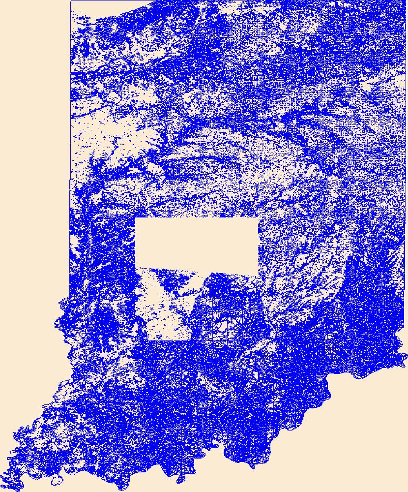
Geospatial data that is a derivative land cover product depicting woodland on topographic maps.
Tags: Adams,
Agricultural land,
Allen,
Barren land,
Bartholomew, All tags...
Benton,
Blackford,
Boone,
Brown,
Carroll,
Cass,
Clark,
Clay,
Clinton,
Crawford,
Daviess,
DeKalb,
Dearborn,
Decatur,
Delaware,
Downloadable Data,
Dubois,
Elkhart,
Esri File GeoDatabase 10,
Fayette,
FileGDB,
Floyd,
Forest land,
Fountain,
Franklin,
Fulton,
Gibson,
Grant,
Greene,
Hamilton,
Hancock,
Harrison,
Hendricks,
Henry,
Howard,
Huntington,
IN,
Indiana,
Jackson,
Jasper,
Jay,
Jefferson,
Jennings,
Johnson,
Knox,
Kosciusko,
LaGrange,
LaPorte,
Lake,
Land Cover,
Land Cover - Woodland,
Land Cover - Woodland,
Lawrence,
Madison,
Marion,
Marshall,
Martin,
Miami,
Monroe,
Montgomery,
Morgan,
Newton,
Noble,
Not Classified,
Ohio,
Orange,
Orthoimage,
Owen,
Parke,
Perry,
Pike,
Porter,
Posey,
Pulaski,
Putnam,
Randolph,
Range land,
Ripley,
Rush,
Scott,
Shelby,
Spencer,
St. Joseph,
Starke,
State,
State,
Steuben,
Sullivan,
Switzerland,
Tippecanoe,
Tipton,
US,
Union,
United States,
Urban and built-up land,
Vanderburgh,
Vermillion,
Vigo,
Wabash,
Warren,
Warrick,
Washington,
Water,
Wayne,
Wells,
Wetland,
White,
Whitley,
Woodland,
annotations,
biota,
ecology,
environment,
farming,
flora,
habitat,
imagery,
imageryBaseMapsEarthCover,
land cover, Fewer tags
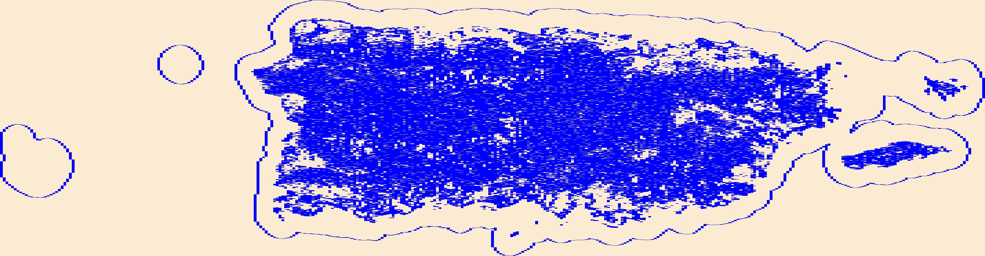
Geospatial data that is a derivative land cover product depicting woodland on topographic maps.
Tags: Adjuntas,
Agricultural land,
Aguada,
Aguadilla,
Aguas Buenas, All tags...
Aibonito,
Arecibo,
Arroyo,
Añasco,
Barceloneta,
Barranquitas,
Barren land,
Bayamón,
Cabo Rojo,
Caguas,
Camuy,
Canóvanas,
Carolina,
Cataño,
Cayey,
Ceiba,
Ciales,
Cidra,
Coamo,
Comerío,
Corozal,
Culebra,
Dorado,
Downloadable Data,
Esri File GeoDatabase 10,
Fajardo,
FileGDB,
Florida,
Forest land,
Guayama,
Guayanilla,
Guaynabo,
Gurabo,
Guánica,
Hatillo,
Hormigueros,
Humacao,
Isabela,
Jayuya,
Juana Díaz,
Juncos,
Lajas,
Land Cover,
Land Cover - Woodland,
Land Cover - Woodland,
Lares,
Las Marías,
Las Piedras,
Loíza,
Luquillo,
Manatí,
Maricao,
Maunabo,
Mayagüez,
Moca,
Morovis,
Naguabo,
Naranjito,
Not Classified,
Orocovis,
Orthoimage,
PR,
Patillas,
Peñuelas,
Ponce,
Puerto Rico,
Quebradillas,
Range land,
Rincón,
Río Grande,
Sabana Grande,
Salinas,
San Germán,
San Juan,
San Lorenzo,
San Sebastián,
Santa Isabel,
State,
State,
Toa Alta,
Toa Baja,
Trujillo Alto,
US,
United States,
Urban and built-up land,
Utuado,
Vega Alta,
Vega Baja,
Vieques,
Villalba,
Water,
Wetland,
Woodland,
Yabucoa,
Yauco,
annotations,
biota,
ecology,
environment,
farming,
flora,
habitat,
imagery,
imageryBaseMapsEarthCover,
land cover, Fewer tags
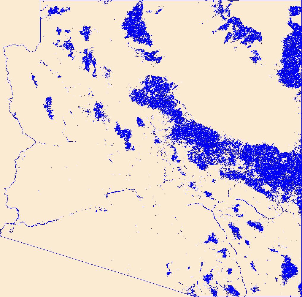
Geospatial data that is a derivative land cover product depicting woodland on topographic maps.
Tags: AZ,
Agricultural land,
Apache,
Arizona,
Barren land, All tags...
Cochise,
Coconino,
Downloadable Data,
Esri File GeoDatabase 10,
FileGDB,
Forest land,
Gila,
Graham,
Greenlee,
La Paz,
Land Cover,
Land Cover - Woodland,
Land Cover - Woodland,
Maricopa,
Mohave,
Navajo,
Not Classified,
Orthoimage,
Pima,
Pinal,
Range land,
Santa Cruz,
State,
State,
US,
United States,
Urban and built-up land,
Water,
Wetland,
Woodland,
Yavapai,
Yuma,
annotations,
biota,
ecology,
environment,
farming,
flora,
habitat,
imagery,
imageryBaseMapsEarthCover,
land cover, Fewer tags
|
|

