Folders: ROOT > ScienceBase Catalog > LC MAP - Landscape Conservation Management and Analysis Portal > Eastern Tallgrass Prairie and Big Rivers Landscape Conservation Cooperative > Mississippi River Basin / Gulf Hypoxia Initiative > Data for Gulf Hypoxia Blueprint > Basemaps for Gulf Hypoxia Blueprint ( Show direct descendants )
12 results (61ms)
Location
Folder
ROOT _ScienceBase Catalog __LC MAP - Landscape Conservation Management and Analysis Portal ___Eastern Tallgrass Prairie and Big Rivers Landscape Conservation Cooperative ____Mississippi River Basin / Gulf Hypoxia Initiative _____Data for Gulf Hypoxia Blueprint ______Basemaps for Gulf Hypoxia Blueprint Filters
Date Range
Extensions
Types
Contacts
Categories Tag Types
|
This EnviroAtlas web service supports research and online mapping activities related to EnviroAtlas (https://www.epa.gov/enviroatlas). The Clean and Plentiful Water category in this web service includes layers illustrating the ecosystems and natural resources that filter and regulate water, the need or demand for clean and plentiful water, the impacts associated with water quality, and factors that place stress on water quality and supply. EnviroAtlas allows the user to interact with a web-based, easy-to-use, mapping application to view and analyze multiple ecosystem services for the conterminous United States. Additional descriptive information about each attribute in this web service is located within each web...
This EnviroAtlas web service supports research and online mapping activities related to EnviroAtlas (https://www.epa.gov/enviroatlas). The Food, Fuel, and Materials category in this web service includes layers illustrating the ecosystems and natural resources that provide or support the production of food, fuel, or other materials, the need or demand for these items, the impacts associated with their presence and accessibility, and factors that place stress on the natural environment's capability to provide these benefits. EnviroAtlas allows the user to interact with a web-based, easy-to-use, mapping application to view and analyze multiple ecosystem services for the conterminous United States. Additional descriptive...

The Watershed Boundary Dataset (WBD) from The National Map (TNM) defines the perimeter of drainage areas formed by the terrain and other landscape characteristics. The drainage areas are nested within each other so that a large drainage area, such as the Upper Mississippi River, will be composed of multiple smaller drainage areas, such as the Wisconsin River. Each of these smaller areas can further be subdivided into smaller and smaller drainage areas. The WBD uses six different levels in this hierarchy, with the smallest averaging about 30,000 acres. The WBD is made up of polygons nested into six levels of data respectively defined by Regions, Subregions, Basins, Subbasins, Watersheds, and Subwatersheds. For additional...
Boundaries of Landscape Conservation Cooperatives participating in the Multi-LCC Mississippi River Basin/Gulf Hypoxia Initiative.
Categories: Data;
Types: ArcGIS REST Map Service,
ArcGIS Service Definition,
Downloadable,
Map Service;
Tags: LCC,
USFWS,
agriculture,
birds,
conservation,
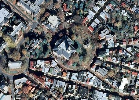
The USGS_EROS_Ortho_SCALE service from The National Map (TNM) contains orthorectified digital aerial photographs and satellite imagery that are commonly referred to as orthoimagery. The imagery in this service is derived from high resolution images that combine the visual attributes of an aerial photograph with the spatial accuracy and geometric characteristics of a map. The resolution is primarily 1-meter, and the source imagery is acquired through partnerships with U.S. Department of Agriculture’s Farm Service Agency and other cooperating Federal, State, and local agencies through the National Agriculture Imagery Program (NAIP). One meter resolution imagery means that each pixel in the orthoimage covers one meter...
Mississippi River Basin major river reaches extracted from Enhanced River Reach File 1 v.2.0
Categories: Data,
Publication;
Types: Citation,
Downloadable,
Map Service,
OGC WFS Layer,
OGC WMS Layer,
Shapefile;
Tags: LCC,
agriculture,
birds,
conservation,
conservation delivery,
Base data layers (e.g., land cover, imagery and boundaries.) intended to orient users of the Multi-LCC Mississippi River Basin/Gulf Hypoxia Initiative’s Conservation Blueprint.
This EnviroAtlas web service supports research and online mapping activities related to EnviroAtlas (https://www.epa.gov/enviroatlas). The Biodiversity Conservation category in this web service includes layers illustrating the ecosystems and natural resources that support biodiversity, the need or demand for conservation, the impacts associated with biodiversity and conservation, and factors that place stress on the natural environment's capability to maintain biodiversity. EnviroAtlas allows the user to interact with a web-based, easy-to-use, mapping application to view and analyze multiple ecosystem services for the conterminous United States. Additional descriptive information about each attribute in this web...
NRCS Common Resource Areas (CRA), version 1.2. A Common Resource Area is defined as a geographical area where resource concerns, problems, or treatment needs are similar. It is considered a subdivision of an existing Major Land Resource Area (MLRA) map delineation or polygon. Landscape conditions, soil, climate, human considerations, and other natural resource information are used to determine the geographic boundaries of a CRA. Features have been conflated with land cover attributes pertinent to the MRB/GHI e.g. cropland, forest, prairie, etc.
Categories: Data,
Publication;
Types: Citation,
Downloadable,
Map Service,
OGC WFS Layer,
OGC WMS Layer,
Shapefile;
Tags: LCC,
agriculture,
birds,
conservation,
conservation delivery,
Landscape Conservation Cooperatives (LCCs) are public-private partnerships composed of states, tribes, federal agencies, non-governmental organizations, universities, international jurisdictions, and others working together to address landscape and seascape scale conservation issues. LCCs inform resource management decisions to address broad-scale stressors-including habitat fragmentation, genetic isolation, spread of invasive species, and water scarcity-all of which are magnified by a rapidly changing climate. For further information go to https://www.fws.gov/science/catalog. The previous 2011 LCC Network Areas data is available at https://www.sciencebase.gov/catalog/item/52f2735ee4b0a6f0bd498c2f
Categories: Data,
Publication;
Types: ArcGIS Map Package,
ArcGIS REST Map Service,
ArcGIS Service Definition,
Citation,
Downloadable,
Map Service;
Tags: Aleutian and Bering Sea Islands,
Appalachian,
Arctic,
California,
Caribbean,
Boundary of Mississippi River Basin derived by dissolving WBD HU-4, July 2012 version.
Categories: Data,
Publication;
Types: Citation,
Downloadable,
Map Service,
OGC WFS Layer,
OGC WMS Layer,
Shapefile;
Tags: Basin,
Hydrography,
Mississippi River Basin,
Watershed
Potential yields and harvested area, by county, within the Mississippi River Basin, of switchgrass planted for biofuel in the year 2030 from the USDOE Billion Ton Update baseline scenario at a farmgate price of $60/dry ton or less. Source: USDOE Billion Ton Update, Scenario: BLY+EC1_BLT (Baseline Yield with 1% Increase in Energy Crops); Year: 2030.
Categories: Data;
Types: ArcGIS REST Map Service,
ArcGIS Service Definition,
Downloadable,
Map Service;
Tags: Biofuels,
LCC,
Switchgrass,
agriculture,
biofuel,
|

|
