Filters: Categories: Data (X) > partyWithName: U.S. Geological Survey (X) > Categories: Publication (X)
78 results (68ms)|
Filters
Date Range
Extensions Types Contacts
Categories Tag Types
|
Small streams in the rapidly developing Matanuska-Susitna Valley in south-central Alaska are known to support anadromous and resident fish but little is known about their hydrologic and riparian conditions, or their sensitivity to the rapid development of the area or climate variability. To help address this need, channel geometry and aquatic habitat data were collected in 2005 as a baseline of stream conditions for selected streams. Three streams were selected as representative of various stream types, and one drainage network, the Big Lake drainage basin, was selected for a systematic assessment. Streams in the Big Lake basin were drawn in a Geographic Information System (GIS), and 55 reaches along 16 miles of...
Categories: Data,
Publication;
Types: Citation,
Downloadable,
Map Service,
OGC WFS Layer,
OGC WMS Layer,
Shapefile;
Tags: Monitoring 2-Standardized Stream and Lake Information
This report contains water-quality and sediment-quality data from samples collected in the Yukon River Basin from March through September during the 2004 water year (WY). Samples were collected throughout the year at five stations in the basin (three on the main stem Yukon River, one each on the Tanana and Porcupine Rivers). A broad range of physical, chemical, and biological analyses are presented.
Categories: Data,
Publication;
Types: Citation,
Downloadable,
Map Service,
OGC WFS Layer,
OGC WMS Layer,
Shapefile;
Tags: Monitoring 2-Standardized Stream and Lake Information
Numerous wind energy projects have been constructed in the central and southern Great Plains, USA, the main wintering area for midcontinent Sandhill Cranes (Grus canadensis). We assessed exposure of wintering Sandhill Cranes to the current distribution of wind towers in the central and southern Great Plains by estimating overlap using location data from platform transmitting terminals (PTT) collected during winters 1998–2004. Because 90% of wind towers in the region were installed 2004–2013, comparing an established distribution of wind towers (as of January 2014) with pre-construction crane (1998-2004) distribution provides an initial assessment of the midcontinent population’s exposure. Distributions of cranes...
Categories: Data,
Publication;
Types: Citation,
Downloadable,
Map Service,
OGC WFS Layer,
OGC WMS Layer,
Shapefile;
Tags: Kansas,
New Mexico,
Oklahoma,
Texas,
animal tracking,
Categories: Data,
Publication;
Types: Citation,
Downloadable,
Map Service,
OGC WFS Layer,
OGC WMS Layer,
Shapefile;
Tags: Baseline 3-Hydrological Datasets
The headwaters of the John River are located near the village of Anaktuvuk Pass in the central Brooks Range of interior Alaska. With the recent construction of a water-supply system and a wastewater-treatment plant, most homes in Anaktuvuk Pass now have modern water and wastewater systems. The effluent from the treatment plant discharges into a settling pond near a tributary of the John River. The headwaters of the John River are adjacent to Gates of the Arctic National Park and Preserve, and the John River is a designated Wild River. Due to the concern about possible water-quality effects from the wastewater effluent, the hydrology of the John River near Anaktuvuk Pass was studied from 2002 through 2003. Three...
Categories: Data,
Publication;
Types: Citation,
Downloadable,
Map Service,
OGC WFS Layer,
OGC WMS Layer,
Shapefile;
Tags: Monitoring 2-Standardized Stream and Lake Information
The Chokosna, Gilahina, and Lakina River basins, and the Long Lake watershed are located along McCarthy Road in Wrangell–St. Elias National Park and Preserve. The rivers and lake support a large run of sockeye (red) salmon that is important to the commercial and recreational fisheries in the larger Copper River. To gain a better understanding of the water quality conditions of these watersheds, these basins were studied as part of a cooperative study with the National Park Service during the open water periods in 2007 and 2008.
Categories: Data,
Publication;
Types: Citation,
Downloadable,
Map Service,
OGC WFS Layer,
OGC WMS Layer,
Shapefile;
Tags: Monitoring 2-Standardized Stream and Lake Information
Categories: Data,
Publication;
Types: Citation,
Downloadable,
Map Service,
OGC WFS Layer,
OGC WMS Layer,
Shapefile;
Tags: MONITORING 5-PHYSICAL SCIENCE
We report chemical analyses of stream-water, stream-sediment, soil, soil-water, bedrock, and vegetation samples collected from the headwaters of the Delta River (Tangle Lakes District, Mount Hayes 1:250,000-scale quadrangle) in east-central Alaska for the period June 20-25, 2006. Additionally, we present mineralogic analyses of stream sediment, concentrated by panning. The study area includes the southwestward extent of the Bureau of Land Management (BLM) Delta River Mining District (Bittenbender and others, 2007), including parts of the Delta River Archeological District, and encompasses an area of about 500 km2(approximately bordered by the Denali Highway to the south, near Round Tangle Lake, northward to the...
Categories: Data,
Publication;
Types: Citation,
Downloadable,
Map Service,
OGC WFS Layer,
OGC WMS Layer,
Shapefile;
Tags: Monitoring 2-Standardized Stream and Lake Information
An acoustic Doppler current profiler interfaced with a differentially corrected global positioning system was used to map bathymetry and multi-dimensional velocities on the Matanuska River near Circle View Estates, Alaska. Data were collected along four spur dikes and a bend in the river during a period of active bank erosion. These data were collected as part of a larger investigation into channel processes being conducted to aid land managers with development of a long-term management plan for land near the river. The banks and streambed are composed of readily erodible material and the braided channels frequently scour and migrate. Lateral channel migration has resulted in the periodic loss of properties and...
Categories: Data,
Publication;
Types: Citation,
Downloadable,
Map Service,
OGC WFS Layer,
OGC WMS Layer,
Shapefile;
Tags: Baseline 3-Hydrological Datasets
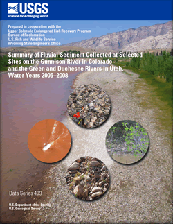
The Colorado River Basin provides habitat for 14 native fish, including four endangered species protected under the Federal Endangered Species Act of 1973 - Colorado pikeminnow (Ptychocheilus lucius), razorback sucker (Xyrauchen texanus), bonytail (Gila elegans), and humpback chub (Gila cypha). These endangered fish species once thrived in the Colorado River system, but water-resource development, including the building of numerous diversion dams and several large reservoirs, and the introduction of nonnative fish, resulted in large reductions in the numbers and range of the four species. Knowledge of sediment dynamics in river reaches important to specifc life-stages of the endangered fishes is critical to understanding...
Categories: Data,
Publication;
Tags: Green River,
Surface water,
aspinall unit,
blue mesa reservoir,
colorado pikeminnow,
Climate refugia management has been proposed as a climate adaptation strategy in the face of global change. Key to this strategy is identification of these areas as well as an understanding of how they are connected on the landscape. Focusing on meadows of the Sierra Nevada in California, we examined multiple factors affecting connectivity using circuit theory, and determined how patches have been and are expected to be affected by climate change. Connectivity surfaces varied depending upon the underlying hypothesis, although meadow area and elevation were important features for higher connectivity. Climate refugia that would promote population persistence were identified from downscaled climate layers, based on...
Categories: Data,
Publication;
Types: Citation;
Tags: Completed,
LCC Network Science Catalog,
Publication,
environment
To facilitate camera-based snow depth observations without additional equipment installation, we developed a novel method implemented in an R package called edger to superimpose virtual measurement devices onto images. The virtual snow stakes can be used to derive snow depth measurements. We validated the method for snow depth estimation using camera data from Latah County, Idaho, USA in winter 2020–2021. Physical snow stakes were installed in the camera viewshed with which snow depth measurements were taken. Then, virtual snow stakes were superimposed on the images using edger and images were cropped to exclude the physical snow stake so that the two snow depth measurements could be compared. This dataset contains...
Categories: Data,
Publication;
Types: Citation;
Tags: Idaho,
Idaho,
Latah,
Latah,
Pacific Northwest,
Amphibians and reptiles (herpetofauna) have been linked to specific microhabitat characteristics, microclimates, and water resources in riparian forests. Our objective was to relate variation in herpetofauna abundance to changes in habitat caused by a beetle used for Tamarix biocontrol (Diorhabda carinulata; Coleoptera: Chrysomelidae) and riparian restoration. During 2013 and 2014, we measured vegetation and monitored herpetofauna via trapping and visual encounter surveys (VES) at locations affected by biocontrol along the Virgin River in the Mojave Desert of the southwestern United States. Twenty-one sites were divided into four riparian stand types based on density and percent cover of dominant trees (Tamarix,...
Categories: Data,
Publication;
Types: Citation,
Map Service,
OGC WFS Layer,
OGC WMS Layer,
OGC WMS Service;
Tags: 2012,
AZ-01,
AZ-02,
AZ-03,
AZ-04,
Remote camera data on snow presence, snow depth, and wildlife detections on Moscow Mountain in Latah County, ID, USA. Reconyx Hyperfire I and Hyperfire II cameras were set to take hourly timelapse images and motion-triggered images from October 2020 - May 2021 at 5 elevation categories (800-925m, 925-1050m, 1050-1175m, 1775-1300m, and > 1300m), 4 aspects (N, S, E, and W), and 3 canopy densities (Sparse [0-35%], Moderate [35-75%], and Dense [75-100%]), in duplicate, plus 17 selected microclimates (137 locations total), on Moscow Mountain in Latah County, ID. Images from 27 other locations were part of a pilot experiment during January to May 2020. Data in the CSVs include image metadata, camera site characteristics,...
Categories: Data,
Publication;
Types: Citation;
Tags: Idaho,
Latah,
Moscow Mountain,
Odocoileus hemionus,
Odocoileus virginianus,
Domestic oil and gas production and clean water are critical for economic growth, public health, and national security of the United States. As domestic oil and gas production increases in new areas and old fields are enhanced, there is increasing public concern about the effects of energy production on surface-water and groundwater quality. To a great extent, this concern arises from the improved hydraulic fracturing techniques being used today, including horizontal drilling, for producing unconventional oil and gas in low-permeability formations. The U.S. Geological Survey (USGS) John Wesley Powell Center for Analysis and Synthesis is hosting an interdisciplinary working group of USGS scientists to conduct a temporal...
Bathymetric and hydraulic data were collected August 26-28, 1996, on the Tanana River at Big Delta, Alaska, at the Richardson Highway bridge and Trans-Alaska Pipeline crossing. Erosion along the right (north) bank of the river between the bridge and the pipeline crossing prompted the data collection. A water-surface profile hydraulic model for the 100- and 500-year recurrence-interval floods was developed using surveyed information. The Delta River enters the Tanana immediately downstream of the highway bridge, causing backwater that extends upstream of the bridge. Four scenarios were considered to simulate the influence of the backwater on flow through the bridge. Contraction and pier scour were computed from model...
Categories: Data,
Publication;
Types: Citation,
Downloadable,
Map Service,
OGC WFS Layer,
OGC WMS Layer,
Shapefile;
Tags: Monitoring 2-Standardized Stream and Lake Information
Categories: Data,
Publication;
Types: Citation,
Downloadable,
Map Service,
OGC WFS Layer,
OGC WMS Layer,
Shapefile;
Tags: Monitoring 2-Standardized Stream and Lake Information
The baseline map of the Butte Basin, the representative basin from the Central Valley, was generated first by delineating the extent of the landscape to be modeled, in agreement with the basin boundaries identified by the Central Valley Joint Venture.The Butte Basin (CV) encompasses a region approximately 44km x 64 km, and the map used contains 10,698 individual habitat patches and 179,964 acres of possible foreageable area. Patch habitat types were identified by a combination of USDA CropScape data (to identify agricultural habitat patches including rice and corn) and other local mapping data made available through collaboration with USGS. Habitat flood schedules were generated using the Water Evaluation and Planning...
Categories: Data,
Publication;
Types: Citation;
Tags: Butte,
California,
Central Valley aquifer system,
Colusa,
Glenn,
|

|
