Filters: partyWithName: Gregory K Boughton (X) > Types: OGC WMS Layer (X)
10 results (11ms)|
Filters
Date Range
Types Contacts
Categories Tag Types Tag Schemes |
The surface water water-quality data were compiled from Water Quality Portal (https://www.waterqualitydata.us/) (National Water Quality Monitoring Council, 2015), USGS’s NAWQA Project’s data compilation (Oelsner and others, 2017) or the Montana Bureau of Mines and Geology (Montana Bureau of Mines, 2021), The compilation contains data for chloride, pH, specific conductance, sulfate, total dissolved solids (TDS) collected between water year 1970 to 2014. In addition 10 metals (aluminum, arsenic, barium, chromium, copper, iron, lead, selenium strontium, and zinc) analyzed during water years 1993 through 2014. National Water-Quality Monitoring Council, 2015, Water Quality Portal: National Water-Quality Monitoring Council,...
Categories: Data;
Types: Map Service,
OGC WFS Layer,
OGC WMS Layer,
OGC WMS Service;
Tags: Montana,
North Dakota,
South Dakota,
Water-Quality Parameters,
Williston Basin,
A set of comma-separated value tables containing data for streamflow, water quality, surface-water features, and produced waters in the energy development area of the Williston Basin in eastern Montana, western North Dakota, and northwest South Dakota.
Categories: Data;
Types: Map Service,
OGC WFS Layer,
OGC WMS Layer,
OGC WMS Service;
Tags: Montana,
North Dakota,
South Dakota,
USGS Science Data Catalog (SDC),
Williston Basin,
Water, bed sediment, and biota were sampled in selected streams from Butte to near Missoula, Montana, as part of a monitoring program in the upper Clark Fork Basin of western Montana. The sampling program was led by the U.S. Geological Survey (USGS), in cooperation with the U.S. Environmental Protection Agency.
Categories: Data;
Types: Map Service,
OGC WFS Layer,
OGC WMS Layer,
OGC WMS Service;
Tags: Aquatic Biology,
Clark Fork Basin,
Hydrology,
Montana,
USGS Science Data Catalog (SDC),
Potential effects of energy development on environmental resources of the Williston Basin in Montana, North Dakota, and South Dakota—Water resources are described in terms of characteristics of the groundwater; streams and rivers; and lakes, reservoirs, and wetlands of the area in terms of physical occurrence, flow characteristics, water quality, and water use.
Categories: Data;
Types: Map Service,
OGC WFS Layer,
OGC WMS Layer,
OGC WMS Service;
Tags: Montana,
North Dakota,
South Dakota,
datasets,
hydrogeology,
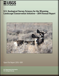
U.S. Geological Survey Science for the Wyoming Landscape Conservation Initiative: 2014 annual report
This is the seventh report produced by the U.S. Geological Survey (USGS) for the Wyoming Landscape Conservation Initiative (WLCI) to detail annual activities conducted by the USGS for addressing specific management needs identified by WLCI partners. In FY2014, there were 26 projects, including a new one that was completed, two others that were also completed, and several that entered new phases or directions. The 26 projects fall into several categories: (1) synthesizing and analyzing existing data to identify current conditions on the landscape and using the data to develop models for projecting past and future landscape conditions; (2) monitoring indicators of ecosystem conditions and the effectiveness of on-the-ground...
Categories: Publication;
Types: Citation,
Map Service,
OGC WFS Layer,
OGC WMS Layer,
OGC WMS Service;
Tags: Open-File Report
The lake and reservoir water-quality data were compiled from Water Quality Portal (https://www.waterqualitydata.us/) (National Water Quality Monitoring Council, 2015), USGS’s NAWQA Project’s data compilation (Oelsner and others, 2017) and the Montana Bureau of Mines and Geology (Montana Bureau of Mines, 2021), The compilation contains data for chloride, pH, specific conductance, sulfate, total dissolved solids (TDS) collected between water year 1970 to 2014. In addition 10 metals (aluminum, arsenic, barium, chromium, copper, iron, lead, selenium strontium, and zinc) analyzed during water years 1993 through 2014. National Water-Quality Monitoring Council, 2015, Water Quality Portal: National Water-Quality Monitoring...
Categories: Data;
Types: Map Service,
OGC WFS Layer,
OGC WMS Layer,
OGC WMS Service;
Tags: Montana,
North Dakota,
South Dakota,
Water-Quality Parameters,
Williston Basin,
A monitoring well was installed in the Wasatch aquifer in the Green River Basin, Sublette County, Wyoming in August 2015. Core collected during drilling activities was described to a depth of 170 feet. The data release contains a detailed description of the lithology and physical characteristics of the core sections, as well as numerous photographs. The data release was produced in compliance with the new 'open data' requirements as a way to make the scientific products associated with USGS investigations available to the public.
Categories: Data;
Types: Map Service,
OGC WFS Layer,
OGC WMS Layer,
OGC WMS Service;
Tags: Hydrogeology,
Sublette County, Wyoming,
USGS Science Data Catalog (SDC),
datasets,
drilling and coring,
A set of comma separated value tables containing analytical results and quality-assurance data for bed-sediment and biota samples collected at sites in the Clark Fork Basin, Montana from October 2015 through September 2016.
Categories: Data;
Types: Map Service,
OGC WFS Layer,
OGC WMS Layer,
OGC WMS Service;
Tags: Aquatic Biology,
Environmental Health,
Geochemistry,
Invertebrates,
Natural Resource Damage Assessment,
The groundwater water-quality data were compiled from Water Quality Portal (https://www.waterqualitydata.us/) (National Water Quality Monitoring Council, 2015), USGS’s NAWQA Project’s data compilation (Oelsner and others, 2017), and the Montana Bureau of Mines and Geology (Montana Bureau of Mines, 2021), The compilation contains data for chloride, pH, specific conductance, sulfate, total dissolved solids (TDS) collected between water year 1970 to 2014. In addition 10 metals (aluminum, arsenic, barium, chromium, copper, iron, lead, selenium strontium, and zinc) analyzed during water years 1993 through 2014. National Water-Quality Monitoring Council, 2015, Water Quality Portal: National Water-Quality Monitoring Council,...
Categories: Data;
Types: Map Service,
OGC WFS Layer,
OGC WMS Layer,
OGC WMS Service;
Tags: Montana,
North Dakota,
South Dakota,
Water-Quality Parameters,
Williston Basin,
Water resources of the energy development area of the Williston Basin in eastern Montana, western North Dakota, and northwest South Dakota are described in terms of characteristics of the produced water and other deep formation water.
Categories: Data;
Types: Map Service,
OGC WFS Layer,
OGC WMS Layer,
OGC WMS Service;
Tags: Montana,
North Dakota,
South Dakota,
datasets,
hydrogeology,
|

|
