Folders: ROOT > ScienceBase Catalog > National Geospatial Program > The National Map > USGS 3D Elevation Program (3DEP) Datasets from The National Map > 1/3rd arc-second Digital Elevation Models (DEMs) - USGS National Map 3DEP Downloadable Data Collection ( Show all descendants )
3,327 results (25ms)
Location
Folder
ROOT _ScienceBase Catalog __National Geospatial Program ___The National Map ____USGS 3D Elevation Program (3DEP) Datasets from The National Map _____1/3rd arc-second Digital Elevation Models (DEMs) - USGS National Map 3DEP Downloadable Data Collection Filters
Date Range
Contacts Tag Types Tag Schemes |

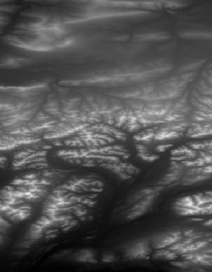
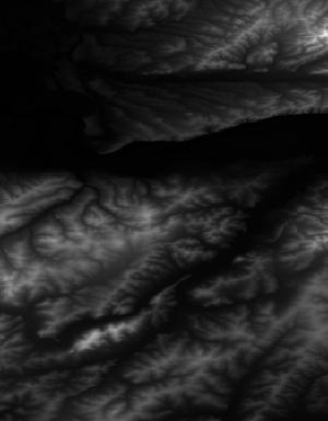
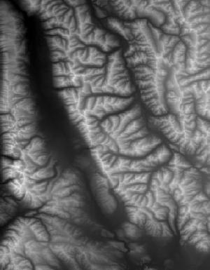
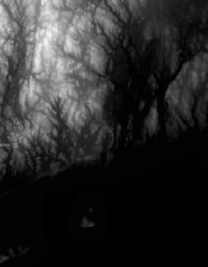
This tile of the 3D Elevation Program (3DEP) seamless products is 13 arc-second resolution. 3DEP data serve as the elevation layer of The National Map, and provide basic elevation information for Earth science studies and mapping applications in the United States. Scientists and resource managers use 3DEP data for global change research, hydrologic modeling, resource monitoring, mapping and visualization, and many other applications. 3DEP data compose an elevation dataset that consists of seamless layers and a high resolution layer. Each of these layers consists of the best available raster elevation data of the conterminous United States, Alaska, Hawaii, territorial islands, Mexico and Canada. 3DEP data are updated...
This tile of the 3D Elevation Program (3DEP) seamless products is 13 arc-second resolution. 3DEP data serve as the elevation layer of The National Map, and provide basic elevation information for Earth science studies and mapping applications in the United States. Scientists and resource managers use 3DEP data for global change research, hydrologic modeling, resource monitoring, mapping and visualization, and many other applications. 3DEP data compose an elevation dataset that consists of seamless layers and a high resolution layer. Each of these layers consists of the best available raster elevation data of the conterminous United States, Alaska, Hawaii, territorial islands, Mexico and Canada. 3DEP data are updated...
This tile of the 3D Elevation Program (3DEP) seamless products is 13 arc-second resolution. 3DEP data serve as the elevation layer of The National Map, and provide basic elevation information for Earth science studies and mapping applications in the United States. Scientists and resource managers use 3DEP data for global change research, hydrologic modeling, resource monitoring, mapping and visualization, and many other applications. 3DEP data compose an elevation dataset that consists of seamless layers and a high resolution layer. Each of these layers consists of the best available raster elevation data of the conterminous United States, Alaska, Hawaii, territorial islands, Mexico and Canada. 3DEP data are updated...

This tile of the 3D Elevation Program (3DEP) seamless products is 13 arc-second resolution. 3DEP data serve as the elevation layer of The National Map, and provide basic elevation information for Earth science studies and mapping applications in the United States. Scientists and resource managers use 3DEP data for global change research, hydrologic modeling, resource monitoring, mapping and visualization, and many other applications. 3DEP data compose an elevation dataset that consists of seamless layers and a high resolution layer. Each of these layers consists of the best available raster elevation data of the conterminous United States, Alaska, Hawaii, territorial islands, Mexico and Canada. 3DEP data are updated...
This tile of the 3D Elevation Program (3DEP) seamless products is 13 arc-second resolution. 3DEP data serve as the elevation layer of The National Map, and provide basic elevation information for Earth science studies and mapping applications in the United States. Scientists and resource managers use 3DEP data for global change research, hydrologic modeling, resource monitoring, mapping and visualization, and many other applications. 3DEP data compose an elevation dataset that consists of seamless layers and a high resolution layer. Each of these layers consists of the best available raster elevation data of the conterminous United States, Alaska, Hawaii, territorial islands, Mexico and Canada. 3DEP data are updated...
This tile of the 3D Elevation Program (3DEP) seamless products is 13 arc-second resolution. 3DEP data serve as the elevation layer of The National Map, and provide basic elevation information for Earth science studies and mapping applications in the United States. Scientists and resource managers use 3DEP data for global change research, hydrologic modeling, resource monitoring, mapping and visualization, and many other applications. 3DEP data compose an elevation dataset that consists of seamless layers and a high resolution layer. Each of these layers consists of the best available raster elevation data of the conterminous United States, Alaska, Hawaii, territorial islands, Mexico and Canada. 3DEP data are updated...
This tile of the 3D Elevation Program (3DEP) seamless products is 13 arc-second resolution. 3DEP data serve as the elevation layer of The National Map, and provide basic elevation information for Earth science studies and mapping applications in the United States. Scientists and resource managers use 3DEP data for global change research, hydrologic modeling, resource monitoring, mapping and visualization, and many other applications. 3DEP data compose an elevation dataset that consists of seamless layers and a high resolution layer. Each of these layers consists of the best available raster elevation data of the conterminous United States, Alaska, Hawaii, territorial islands, Mexico and Canada. 3DEP data are updated...
This tile of the 3D Elevation Program (3DEP) seamless products is 13 arc-second resolution. 3DEP data serve as the elevation layer of The National Map, and provide basic elevation information for Earth science studies and mapping applications in the United States. Scientists and resource managers use 3DEP data for global change research, hydrologic modeling, resource monitoring, mapping and visualization, and many other applications. 3DEP data compose an elevation dataset that consists of seamless layers and a high resolution layer. Each of these layers consists of the best available raster elevation data of the conterminous United States, Alaska, Hawaii, territorial islands, Mexico and Canada. 3DEP data are updated...
This tile of the 3D Elevation Program (3DEP) seamless products is 13 arc-second resolution. 3DEP data serve as the elevation layer of The National Map, and provide basic elevation information for Earth science studies and mapping applications in the United States. Scientists and resource managers use 3DEP data for global change research, hydrologic modeling, resource monitoring, mapping and visualization, and many other applications. 3DEP data compose an elevation dataset that consists of seamless layers and a high resolution layer. Each of these layers consists of the best available raster elevation data of the conterminous United States, Alaska, Hawaii, territorial islands, Mexico and Canada. 3DEP data are updated...
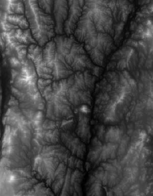
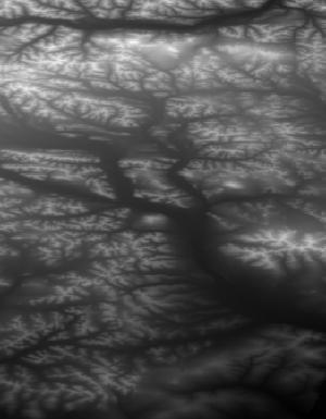
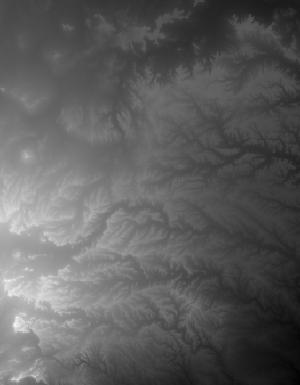
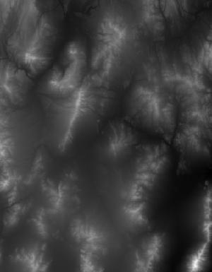
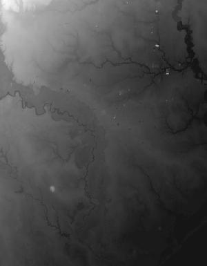
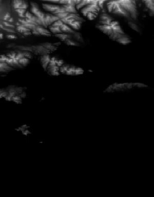
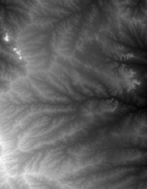
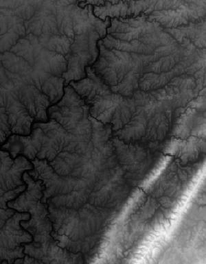
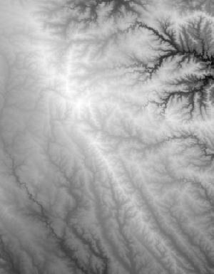
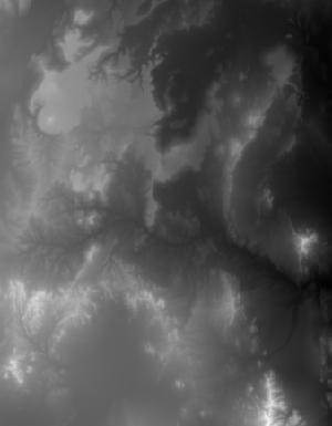
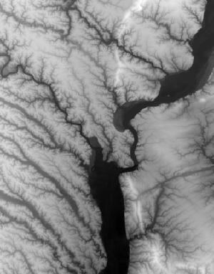
This tile of the 3D Elevation Program (3DEP) seamless products is 1/3 arc-second resolution. 3DEP data serve as the elevation layer of The National Map, and provide basic elevation information for Earth science studies and mapping applications in the United States. Scientists and resource managers use 3DEP data for global change research, hydrologic modeling, resource monitoring, mapping and visualization, and many other applications. 3DEP data compose an elevation dataset that consists of seamless layers and a high resolution layer. Each of these layers consists of the best available raster elevation data of the conterminous United States, Alaska, Hawaii, territorial islands, Mexico and Canada. 3DEP data are updated...
This tile of the 3D Elevation Program (3DEP) seamless products is 1/3 arc-second resolution. 3DEP data serve as the elevation layer of The National Map, and provide basic elevation information for Earth science studies and mapping applications in the United States. Scientists and resource managers use 3DEP data for global change research, hydrologic modeling, resource monitoring, mapping and visualization, and many other applications. 3DEP data compose an elevation dataset that consists of seamless layers and a high resolution layer. Each of these layers consists of the best available raster elevation data of the conterminous United States, Alaska, Hawaii, territorial islands, Mexico and Canada. 3DEP data are updated...
This tile of the 3D Elevation Program (3DEP) seamless products is 1/3 arc-second resolution. 3DEP data serve as the elevation layer of The National Map, and provide basic elevation information for Earth science studies and mapping applications in the United States. Scientists and resource managers use 3DEP data for global change research, hydrologic modeling, resource monitoring, mapping and visualization, and many other applications. 3DEP data compose an elevation dataset that consists of seamless layers and a high resolution layer. Each of these layers consists of the best available raster elevation data of the conterminous United States, Alaska, Hawaii, territorial islands, Mexico and Canada. 3DEP data are updated...

This tile of the 3D Elevation Program (3DEP) seamless products is 1/3 arc-second resolution. 3DEP data serve as the elevation layer of The National Map, and provide basic elevation information for Earth science studies and mapping applications in the United States. Scientists and resource managers use 3DEP data for global change research, hydrologic modeling, resource monitoring, mapping and visualization, and many other applications. 3DEP data compose an elevation dataset that consists of seamless layers and a high resolution layer. Each of these layers consists of the best available raster elevation data of the conterminous United States, Alaska, Hawaii, territorial islands, Mexico and Canada. 3DEP data are updated...

This tile of the 3D Elevation Program (3DEP) seamless products is 1/3 arc-second resolution. 3DEP data serve as the elevation layer of The National Map, and provide basic elevation information for Earth science studies and mapping applications in the United States. Scientists and resource managers use 3DEP data for global change research, hydrologic modeling, resource monitoring, mapping and visualization, and many other applications. 3DEP data compose an elevation dataset that consists of seamless layers and a high resolution layer. Each of these layers consists of the best available raster elevation data of the conterminous United States, Alaska, Hawaii, territorial islands, Mexico and Canada. 3DEP data are updated...
This tile of the 3D Elevation Program (3DEP) seamless products is 13 arc-second resolution. 3DEP data serve as the elevation layer of The National Map, and provide basic elevation information for Earth science studies and mapping applications in the United States. Scientists and resource managers use 3DEP data for global change research, hydrologic modeling, resource monitoring, mapping and visualization, and many other applications. 3DEP data compose an elevation dataset that consists of seamless layers and a high resolution layer. Each of these layers consists of the best available raster elevation data of the conterminous United States, Alaska, Hawaii, territorial islands, Mexico and Canada. 3DEP data are updated...

This tile of the 3D Elevation Program (3DEP) seamless products is 1/3 arc-second resolution. 3DEP data serve as the elevation layer of The National Map, and provide basic elevation information for Earth science studies and mapping applications in the United States. Scientists and resource managers use 3DEP data for global change research, hydrologic modeling, resource monitoring, mapping and visualization, and many other applications. 3DEP data compose an elevation dataset that consists of seamless layers and a high resolution layer. Each of these layers consists of the best available raster elevation data of the conterminous United States, Alaska, Hawaii, territorial islands, Mexico and Canada. 3DEP data are updated...
This tile of the 3D Elevation Program (3DEP) seamless products is 1/3 Arc Second resolution. 3DEP data serve as the elevation layer of The National Map, and provide basic elevation information for Earth science studies and mapping applications in the United States. Scientists and resource managers use 3DEP data for global change research, hydrologic modeling, resource monitoring, mapping and visualization, and many other applications. 3DEP data compose an elevation dataset that consists of seamless layers and a high resolution layer. Each of these layers consists of the best available raster elevation data of the conterminous United States, Alaska, Hawaii, territorial islands, Mexico and Canada. 3DEP data are updated...
This tile of the 3D Elevation Program (3DEP) seamless products is 1/3 Arc Second resolution. 3DEP data serve as the elevation layer of The National Map, and provide basic elevation information for Earth science studies and mapping applications in the United States. Scientists and resource managers use 3DEP data for global change research, hydrologic modeling, resource monitoring, mapping and visualization, and many other applications. 3DEP data compose an elevation dataset that consists of seamless layers and a high resolution layer. Each of these layers consists of the best available raster elevation data of the conterminous United States, Alaska, Hawaii, territorial islands, Mexico and Canada. 3DEP data are updated...
This tile of the 3D Elevation Program (3DEP) seamless products is 1/3 Arc Second resolution. 3DEP data serve as the elevation layer of The National Map, and provide basic elevation information for Earth science studies and mapping applications in the United States. Scientists and resource managers use 3DEP data for global change research, hydrologic modeling, resource monitoring, mapping and visualization, and many other applications. 3DEP data compose an elevation dataset that consists of seamless layers and a high resolution layer. Each of these layers consists of the best available raster elevation data of the conterminous United States, Alaska, Hawaii, territorial islands, Mexico and Canada. 3DEP data are updated...
This tile of the 3D Elevation Program (3DEP) seamless products is 1/3 Arc Second resolution. 3DEP data serve as the elevation layer of The National Map, and provide basic elevation information for Earth science studies and mapping applications in the United States. Scientists and resource managers use 3DEP data for global change research, hydrologic modeling, resource monitoring, mapping and visualization, and many other applications. 3DEP data compose an elevation dataset that consists of seamless layers and a high resolution layer. Each of these layers consists of the best available raster elevation data of the conterminous United States, Alaska, Hawaii, territorial islands, Mexico and Canada. 3DEP data are updated...
|

|
