Filters: Tags: Albuquerque (X)
49 results (123ms)|
Filters
Date Range
Extensions Types
Contacts
Categories Tag Types Tag Schemes |
The USGS Central Region Energy Team assesses oil and gas resources of the United States. The onshore and State water areas of the United States comprise 71 provinces. Within these provinces, Total Petroleum Systems are defined and Assessment Units are defined and assessed. Each of these provinces is defined geologically, and most province boundaries are defined by major geologic changes. The San Juan Basin Province is located in South Western Colorado and North Western New Mexico, encompassing all or parts of Montezuma, La Plata, and Archuletta Counties in Colorado and all or parts of San Juan, Rio Arriba, Sandoval, Mckinley, Bernalillo, and Cibola Counties in New Mexico. The main population centers within the study...
This part of the Data Release contains the raster representation of the water-level altitude and water-level change maps developed every 5 years from 1980-2015 for the upper Rio Grande Focus Area Study. The input point data used to generate the water-level altitude maps can be found in the "Groundwater level measurement data used to develop water-level altitude maps in the upper Rio Grande Alluvial Basins" child item of this data release. These digital data accompany Houston, N.A., Thomas, J.V., Foster, L.K., Pedraza, D.E., and Welborn, T.L., 2020, Hydrogeologic framework, groundwater-level altitudes, groundwater-level changes, and groundwater-storage changes in selected alluvial basins of the upper Rio Grande...
Types: Map Service,
OGC WFS Layer,
OGC WMS Layer,
OGC WMS Service;
Tags: Abiquiu Reservoir,
Ahumada,
Alamosa,
Alamosa County,
Alamosa Creek,

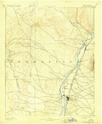
USGS Historical Quadrangle in GeoPDF.

USGS Historical Quadrangle in GeoPDF.
This child page contains the model input and output data used in the model validation process for one Program for Predicting Polluting Particle Passage through Pits, Puddles and Ponds (P8) model during the validation period of the study detailed in the associated Scientific Investigations Report "Comparison of Storm Runoff Models for a Small Watershed in an Urban Metropolitan Area, Albuquerque, New Mexico" (Shephard and Douglas-Mankin, 2020). This model was used to simulate storm runoff in the Hahn Arroyo Watershed, an urbanized watershed with concrete lined channels in the northeastern quadrant of Albuquerque that exhibits flashy, monsoonal-driven storm runoff events. The model is described in detail in the associated...

USGS Historical Quadrangle in GeoPDF.
The Total Petroleum System is used in the National Assessment Project and incorporates the Assessment Unit, which is the fundamental geologic unit used for the assessment of undiscovered oil and gas resources. The Total Petroleum System is shown here as a geographic boundary defined and mapped by the geologist responsible for the province and incorporates not only the set of known or postulated oil and (or) gas accumulations, but also the geologic interpretation of the essential elements and processes within the petroleum system that relate to source, generation, migration, accumulation, and trapping of the discovered and undiscovered petroleum resource(s).

USGS Historical Quadrangle in GeoPDF.

USGS Historical Quadrangle in GeoPDF.
This child page contains the requisite folder structure along with model input and output data used in the model validation process for two Hydrologic Engineering Center Hydrologic Modeling System (HEC-HMS) models during the validation period of the study detailed in the associated Scientific Investigations Report "Comparison of Storm Runoff Models for a Small Watershed in an Urban Metropolitan Area, Albuquerque, New Mexico" (Shephard and Douglas-Mankin, 2020). One model uses a curve-number (CN) based loss method approach, and the other model uses an initial and constant (IC) infiltration rate loss method. Each model was used to simulate storm runoff in the Hahn Arroyo Watershed, an urbanized watershed with concrete...
USGS Historical Quadrangle in GeoPDF.

USGS Historical Quadrangle in GeoPDF.
This dataset represents the network-adjusted results of relative- and absolute-gravity surveys. Relative-gravity surveys were carried out using a Zero Length Spring, Inc. Burris relative-gravity meter. The effect of solid Earth tides and ocean loading were removed from the data. Instrument drift was removed by evaluating gravity change during repeated measurements at one or more base stations. Absolute-gravity surveys were carried out using a Micro-g LaCoste, Inc. A-10 absolute-gravity meter. Vertical gradients between the different measuring heights of the absolute- and relative-gravity meters were measured using a relative-gravity meter and tripod, and used to correlate the measurements between the two instruments....
Categories: Data,
Data Release - Revised;
Types: Citation,
Map Service,
OGC WFS Layer,
OGC WMS Layer,
OGC WMS Service;
Tags: Albuquerque,
Bernalillo County,
NCCWSC,
New Mexico,
Southwest Gravity Program,
Consumptive use (CU) of water is an important factor for determining water availability and groundwater storage. Many regional stakeholders and water-supply managers in the Upper Rio Grande Basin have indicated CU is of primary concern in their water-management strategies, yet CU data is sparse for this area. This polygon feature class, which represents irrigated acres for 2015, is a geospatial component of the U.S. Geological Survey National Water Census Upper Rio Grande Basin (URGB) focus area study's effort to improve quantification of CU in parts of New Mexico, west Texas, and northern Chihuahua. These digital data accompany Ivahnenko, T.I., Flickinger, A.K., Galanter, A.E., Douglas-Mankin, K.R., Pedraza, D.E.,...
Types: Map Service,
OGC WFS Layer,
OGC WMS Layer,
OGC WMS Service;
Tags: Abiquiu Reservoir,
Ahumada,
Alamosa,
Alamosa County,
Alamosa Creek,

A three-dimensional groundwater-flow model of a 73.2 square mile area in southeastern Albuquerque, New Mexico was designed and coupled to a regional (parent) model of the Middle Rio Grande Basin with the local-grid refinement numerical code MODFLOW-LGR2. This fine-gridded local (child) model was designed to simulate the response of the aquifer to pumping stresses and simulate advective groundwater flow. The child model was calibrated by inverse modeling by nonlinear regression (UCODE_2005) for 1949 to 2013 conditions, the period for which observation data was most complete and reliable. The simulation period spanned from predevelopment to future conditions (1900 to 2050). As part of an effort to protect the source...
The dataset includes Escherichia coli concentrations in water and sediment collected by James Fluke in the Middle Rio Grande in Albuquerque, NM, from 2017 to 2018.
This United States Geological Survey (USGS) dataset contains Darcy flux data measured in Albuquerque, New Mexico, using passive flux meters (PFMs) in sentinel wells associated with the Kirtland Air Force Base (KAFB) Bulk Fuels Facility (BFF). The measurements were conducted by the USGS in cooperation with KAFB, the Air Force Civil Engineer Center (AFCEC), EA Engineering, Science and Technology, Inc. (an engineering consulting firm), and the University of Florida.
Categories: Data;
Tags: Albuquerque,
Bernalillo County,
Darcy flux,
Kirtland Airforce Base Bulk Fuels Facility,
New Mexico,
This United States Geological Survey (USGS) dataset contains Darcy flux, ethylene dibromide (EDB) mass flux, benzene mass flux, toluene mass flux, ethylbenzene mass flux, and xylene mass flux measured in Albuquerque, New Mexico, using passive flux meters (PFMs) in the wells associated with the Kirtland Air Force Base (KAFB) Bulk Fuels Facility (BFF). The measurements were conducted by the USGS in cooperation with KAFB, the Air Force Civil Engineer Center, EA Engineering, Science and Technology, Inc. (an engineering consulting firm), and the University of Florida.
Categories: Data;
Tags: Albuquerque,
Bernalillo County,
Bulk Fuels Facility,
Darcy flux,
EDB mass flux,
This tabular dataset contains the location and construction information of select wells in the Albuquerque area, central New Mexico, and groundwater-level measurements at those wells from 2014 to 2018. Wells in this dataset are screened or assumed to be screened in the production zone (generally the interval of the aquifer where production wells are screened) of the Santa Fe Group aquifer system. Groundwater-level elevations from this dataset were used to create groundwater-level contours for winter of water year 2016.
Categories: Data;
Tags: Albuquerque,
Arroyo de las Calabacillas,
Hydrogeology,
Kirtland Airforce Base,
Rio Grande,
The dataset includes Escherichia coli concentrations collected by the Bosque Ecosystem Monitoring Program in the Middle Rio Grande in Albuquerque, NM, from 2017 to 2020.
|

|
