Filters: Tags: Ano Nuevo (X)
25 results (60ms)|
Filters
Date Range
Extensions Types Contacts
Categories Tag Types Tag Schemes |
This part of DS 781 presents data for the sediment-thickness map of the Pigeon Point to Monterey, California, map region. The raster data file is included in "SedimentThickness_PigeonPointToMontereyBay.zip," which is accessible from https://doi.org/10.5066/F7N29V0Z. As part of the USGS's California State Waters Mapping Project, a 50-m-resolution grid of sediment thickness for the seafloor within the limit of California’s State Waters between Pigeon Point and southern Monterey Bay was generated from seismic-reflection data collected in 2009, 2010, and 2011 (USGS activities (S-15-10-NC, S-N1-09-MB, and S-06-11-MB) supplemented with outcrop and geologic structure from DS 781. Isopach contours at 2.5-meter intervals...
Categories: Data;
Types: Downloadable,
GeoTIFF,
Map Service,
Raster;
Tags: Ano Nuevo,
Aptos,
Distributions,
Marina,
Monterey,
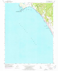
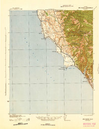
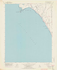
USGS Historical Quadrangle in GeoPDF.
This part of DS 781 presents data for the sediment-thickness isopachs for the Pigeon Point to Monterey Bay, California, map region. The vector data file is included in "Isopachs_PigeonPointToMonterey.zip," which is accessible from https://doi.org/10.5066/F7N29V0Z. As part of the USGS's California State Waters Mapping Project, a 50-m-resolution grid of sediment thickness for the seafloor within the limit of California’s State Waters between Pigeon Point and southern Monterey Bay was generated from seismic-reflection data collected in 2009, 2010, and 2011 (USGS activities (S-15-10-NC, S-N1-09-MB, and S-06-11-MB) supplemented with outcrop and geologic structure from DS 781. Isopach contours at 2.5-meter intervals were...
Categories: Data;
Types: Downloadable,
Map Service,
OGC WFS Layer,
OGC WMS Layer,
Shapefile;
Tags: Ano Nuevo,
Aptos,
Distributions,
Marina,
Monterey,
The U.S. Geological Survey acquired high-resolution P- and S-wave seismic data across the Frijoles Fault strand of the San Gregorio Fault Zone (SGFZ) at northern Año Nuevo, California in 2012. SGFZ is a right-lateral fault system that is mainly offshore, and prior studies provide highly variable slip estimates, which indicates uncertainty about the seismic hazard it poses. Therefore, the primary goal of the seismic survey was to better understand the structure and geometry of the onshore section of the Frijoles Fault strand of the SGFZ. We deployed 118 geophones (channels) at 5-m spacing along a linear profile centered on the mapped surface trace of the Frijoles Fault and co-located active P- and S-wave sources...
Categories: Data;
Types: Map Service,
OGC WFS Layer,
OGC WMS Layer,
OGC WMS Service;
Tags: Ano Nuevo,
California,
Central California Coastal,
Geophysics,
Seismology,
This part of DS 781 presents data for the transgressive contours for the depth-to-transition map of the Pigeon Point to Monterey, California, map region. The vector file is included in T "TransgressiveContours_PigeonPointToMonterey.zip," which is accessible from https://doi.org/10.5066/F7N29V0Z. As part of the USGS's California State Waters Mapping Project, a 50-m grid of sediment thickness for the seafloor within the limit of California’s State Waters between Pigeon Point and southern Monterey Bay was generated from seismic-reflection data collected in 2009 and 2010 (USGS activities (S-15-10-NC, S-N1-09-MB, and S-06-11-MB) supplemented with outcrop and geologic structure from DS 781. The resulting grid covers was...
Categories: Data;
Types: Downloadable,
Map Service,
OGC WFS Layer,
OGC WMS Layer,
Shapefile;
Tags: Ano Nuevo,
Aptos,
Distributions,
Marina,
Monterey,
USGS Historical Quadrangle in GeoPDF.
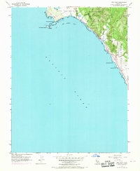
USGS Historical Quadrangle in GeoPDF.
This part of DS 781 presents data for the acoustic-backscatter map of Offshore of Pigeon Point map area, California. Backscatter data are provided as three separate grids depending on mapping system. This metadata file refers to the data included in "BackscatterB_7125_OffshorePigeonPoint.zip," which is accessible from https://doi.org/10.5066/F7513W80. These data accompany the pamphlet and map sheets of Cochrane, G.R., Watt, J.T., Dartnell, P., Greene, H.G., Erdey, M.D., Dieter, B.E., Golden, N.E., Johnson, S.Y., Endris, C.A., Hartwell, S.R., Kvitek, R.G., Davenport, C.W., Krigsman, L.M., Ritchie, A.C., Sliter, R.W., Finlayson, D.P., and Maier, K.L. (G.R. Cochrane and S.A. Cochran, eds.), 2015, California State Waters...
Categories: Data;
Types: Downloadable,
GeoTIFF,
Map Service,
Raster;
Tags: Acoustic Reflectivity,
Ano Nuevo,
Backscatter,
CMHRP,
Coastal and Marine Hazards and Resources Program,
This part of DS 781 presents data for the bathymetric contours for several seafloor maps of the Offshore Pigeon Point map area, California. The vector data file is included in "Contours_OffshorePigeonPoint.zip", which is accessible from https://doi.org/10.5066/F7513W80. These data accompany the pamphlet and map sheets of Cochrane, G.R., Watt, J.T., Dartnell, P., Greene, H.G., Erdey, M.D., Dieter, B.E., Golden, N.E., Johnson, S.Y., Endris, C.A., Hartwell, S.R., Kvitek, R.G., Davenport, C.W., Krigsman, L.M., Ritchie, A.C., Sliter, R.W., Finlayson, D.P., and Maier, K.L. (G.R. Cochrane and S.A. Cochran, eds.), 2015, California State Waters Map Series—Offshore of Pigeon Point, California: U.S. Geological Survey Open-File...
Categories: Data;
Types: Downloadable,
Map Service,
OGC WFS Layer,
OGC WMS Layer,
Shapefile;
Tags: Ano Nuevo,
Bathymetry,
CMHRP,
Coastal and Marine Hazards and Resources Program,
Continental/Island Shelf,
USGS Historical Quadrangle in GeoPDF.
USGS Historical Quadrangle in GeoPDF.
USGS Historical Quadrangle in GeoPDF.
The U.S. Geological Survey acquired high-resolution P- and S-wave seismic data across the Frijoles Fault strand of the San Gregorio Fault Zone (SGFZ) at Año Nuevo, California in 2012. The SGFZ is a Holocene-active, dominantly right-lateral fault system that trends more than 200 km along the California coastline. The Frijoles Fault is one of several onshore strands of the SGF system, and together the strands represent a 3- to 4-km wide fault zone at Año Nuevo. Prior paleoseismology studies indicate highly variable slip-rate estimates, indicating considerable uncertainty about the slip history of the SGFZ and the seismic hazard it poses. Amongst the onshore strands of the SGFZ at Año Nuevo, the Frijoles Fault presented...
Categories: Data;
Types: Map Service,
OGC WFS Layer,
OGC WMS Layer,
OGC WMS Service;
Tags: Ano Nuevo,
Geophysics,
Northern California Coastal,
San Mateo,
Seismology,
USGS Historical Quadrangle in GeoPDF.
USGS Historical Quadrangle in GeoPDF.
USGS Historical Quadrangle in GeoPDF.

USGS Historical Quadrangle in GeoPDF.
This part of DS 781 presents data for the acoustic-backscatter map of Offshore of Pigeon Point map area, California. Backscatter data are provided as three separate grids depending on mapping system. This metadata file refers to the data included in "BackscatterA_8101_OffshorePigeonPoint.zip," which is accessible from https://doi.org/10.5066/F7513W80. These data accompany the pamphlet and map sheets of Cochrane, G.R., Watt, J.T., Dartnell, P., Greene, H.G., Erdey, M.D., Dieter, B.E., Golden, N.E., Johnson, S.Y., Endris, C.A., Hartwell, S.R., Kvitek, R.G., Davenport, C.W., Krigsman, L.M., Ritchie, A.C., Sliter, R.W., Finlayson, D.P., and Maier, K.L. (G.R. Cochrane and S.A. Cochran, eds.), 2015, California State Waters...
Categories: Data;
Types: Downloadable,
GeoTIFF,
Map Service,
Raster;
Tags: Acoustic Reflectivity,
Ano Nuevo,
Backscatter,
CMHRP,
Coastal and Marine Hazards and Resources Program,
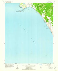
This part of DS 781 presents data for the shaded-relief bathymetry map of Offshore Pigeon Point, California. The raster data file is included in "BathymetryHS_OffshorePigeonPoint.zip", which is accessible from https://doi.org/10.5066/F7513W80. These data accompany the pamphlet and map sheets of Cochrane, G.R., Watt, J.T., Dartnell, P., Greene, H.G., Erdey, M.D., Dieter, B.E., Golden, N.E., Johnson, S.Y., Endris, C.A., Hartwell, S.R., Kvitek, R.G., Davenport, C.W., Krigsman, L.M., Ritchie, A.C., Sliter, R.W., Finlayson, D.P., and Maier, K.L. (G.R. Cochrane and S.A. Cochran, eds.), 2015, California State Waters Map Series—Offshore of Pigeon Point, California: U.S. Geological Survey Open-File Report 2015–1232, pamphlet...
Categories: Data;
Types: Downloadable,
GeoTIFF,
Map Service,
Raster;
Tags: Ano Nuevo,
Bathymetry,
CMHRP,
Coastal and Marine Hazards and Resources Program,
Continental/Island Shelf,
This part of DS 781 presents data for the acoustic-backscatter map of Offshore of Pigeon Point map area, California. Backscatter data are provided as three separate grids depending on mapping system. This metadata file refers to the data included in "BackscatterC_SWATH_OffshorePigeonPoint.zip," which is accessible from https://doi.org/10.5066/F7513W80. These data accompany the pamphlet and map sheets of Cochrane, G.R., Watt, J.T., Dartnell, P., Greene, H.G., Erdey, M.D., Dieter, B.E., Golden, N.E., Johnson, S.Y., Endris, C.A., Hartwell, S.R., Kvitek, R.G., Davenport, C.W., Krigsman, L.M., Ritchie, A.C., Sliter, R.W., Finlayson, D.P., and Maier, K.L. (G.R. Cochrane and S.A. Cochran, eds.), 2015, California State...
Categories: Data;
Types: Downloadable,
GeoTIFF,
Map Service,
Raster;
Tags: Acoustic Reflectivity,
Ano Nuevo,
Backscatter,
CMHRP,
Coastal and Marine Hazards and Resources Program,
|

|
