Filters
Date Range
Contacts
Categories
Tag Types
Tag Schemes
|

ADMMR map collection: Sections Through Drill Holes 1 & 2, Antler Mine; 1 in. to 50 feet; 18 x 22 in.
Categories: Data;
Tags: 1940s,
Antler,
Arizona,
Bismuth,
Cadmium, All tags...
Clay, Refractory,
Copper, Sulfide,
Dataset,
Gold, Lode,
Hualapai Mts. physiographic area,
Hualapai metallic mineral dist.,
Iron, Sulfide,
Lead, Sulfide,
Mohave County,
Silicon,
Silver,
Spuyten Duyvil,
T17N R16W Sec 4 E2,
United States,
Wabayuma Peak - 7.5 Min,
Zinc, Sulfide,
chemical analysis,
copper,
drilling and coring,
geochemistry,
geoscientificInformation,
gold ores,
lead,
maps and atlases,
mining and quarrying,
natural resource exploration,
sections,
silver,
subsurface maps,
zinc, Fewer tags

ADMMR map collection: Antler Mine Assay Map; 1 in. to 60 feet; 22 x 16 in.
Categories: Data;
Tags: Antler,
Arizona,
Bismuth,
Cadmium,
Clay, Refractory, All tags...
Copper, Sulfide,
Dataset,
Gold, Lode,
Iron, Sulfide,
Lead, Sulfide,
Mohave County,
Silicon,
Silver,
Spuyten Duyvil,
T17N R16W Sec 4 E2,
United States,
Wabayuma Peak - 7.5 Min,
Zinc, Sulfide,
chemical analysis,
copper,
drilling and coring,
geoscientificInformation,
gold ores,
lead,
maps and atlases,
mineral resources,
mining and quarrying,
natural resource exploration,
sections,
silver,
zinc, Fewer tags

ADMMR map collection: Workings From Lower Adit, Antler Mine; 1 in. to 80 feet; 13 x 15 in.
Categories: Data;
Tags: 1940s,
Antler,
Arizona,
Bismuth,
Cadmium, All tags...
Clay, Refractory,
Copper, Sulfide,
Dataset,
Gold, Lode,
Iron, Sulfide,
Lead, Sulfide,
Mohave County,
Silicon,
Silver,
Spuyten Duyvil,
T17N R16W Sec 4 E2,
United States,
Wabayuma Peak - 7.5 Min,
Zinc, Sulfide,
geoscientificInformation,
maps and atlases,
mining and quarrying,
natural resource exploration,
subsurface maps, Fewer tags

ADMMR map collection: Antler Mine Geologic Map; 1 in. to 100 feet; 30 x 11 in.
Categories: Data;
Tags: 1940s,
Antler,
Arizona,
Bismuth,
Cadmium, All tags...
Clay, Refractory,
Copper, Sulfide,
Dataset,
Gold, Lode,
Hualapai Mts. physiographic area,
Hualapai metallic mineral dist.,
Iron, Sulfide,
Lead, Sulfide,
Mohave County,
Silicon,
Silver,
Spuyten Duyvil,
T17N R16W Sec 4 E2,
United States,
Wabayuma Peak - 7.5 Min,
Zinc, Sulfide,
geologic maps,
geology,
geoscientificInformation,
maps and atlases,
mining and quarrying,
natural resource exploration,
topography, Fewer tags

ADMMR map collection: Sections Through Drill Holes 5 & 6, Antler Mine; 1 in. to 100 feet; 18 x 25 in.
Categories: Data;
Tags: 1940s,
Antler,
Arizona,
Bismuth,
Cadmium, All tags...
Clay, Refractory,
Copper, Sulfide,
Dataset,
Gold, Lode,
Iron, Sulfide,
Lead, Sulfide,
Mohave County,
Silicon,
Silver,
Spuyten Duyvil,
T17N R16W Sec 4 E2,
United States,
Wabayuma Peak - 7.5 Min,
Zinc, Sulfide,
chemical analysis,
copper,
drilling and coring,
geochemistry,
geoscientificInformation,
gold ores,
lead,
maps and atlases,
mining and quarrying,
natural resource exploration,
sections,
silver,
subsurface maps,
zinc, Fewer tags

ADMMR map collection: Sections Through Drill Holes 3 & 4, Antler Mine; 1 in. to 100 feet; 21 x 27 in.
Categories: Data;
Tags: 1940s,
Antler,
Arizona,
Bismuth,
Cadmium, All tags...
Clay, Refractory,
Copper, Sulfide,
Dataset,
Gold, Lode,
Iron, Sulfide,
Lead, Sulfide,
Mohave County,
Silicon,
Silver,
Spuyten Duyvil,
T17N R16W Sec 4 E2,
United States,
Wabayuma Peak - 7.5 Min,
Zinc, Sulfide,
chemical analysis,
copper,
drilling and coring,
geochemistry,
geoscientificInformation,
gold ores,
lead,
maps and atlases,
mineral resources,
mining and quarrying,
natural resource exploration,
sections,
silver,
subsurface maps,
zinc, Fewer tags

ADMMR map collection: Workings From Upper Adit, Antler Mine; 1 in. to 20 feet; 14 x 16 in.
Categories: Data;
Tags: 1940s,
Antler,
Arizona,
Bismuth,
Cadmium, All tags...
Clay, Refractory,
Copper, Sulfide,
Dataset,
Gold, Lode,
Hualapai Mts. physiographic area,
Hualapai metallic mineral dist.,
Iron, Sulfide,
Lead, Sulfide,
Mohave County,
Silicon,
Silver,
Spuyten Duyvil,
T17N R16W Sec 4 E2,
United States,
Wabayuma Peak - 7.5 Min,
Zinc, Sulfide,
geoscientificInformation,
maps and atlases,
mining and quarrying,
natural resource exploration,
plans,
subsurface maps, Fewer tags

ADMMR map collection: Antler Mine - 5th Level Plan; 1 in. to 50 feet; 23 x 11 in.
Categories: Data;
Tags: 1950s,
Antler,
Arizona,
Bismuth,
Cadmium, All tags...
Clay, Refractory,
Copper, Sulfide,
Dataset,
Gold, Lode,
Hualapai Mts. physiographic area,
Hualapai metallic mineral dist.,
Iron, Sulfide,
Lead, Sulfide,
Mohave County,
Silicon,
Silver,
Spuyten Duyvil,
T17N R16W Sec 4 E2,
United States,
Wabayuma Peak - 7.5 Min,
Zinc, Sulfide,
chemical analysis,
copper,
drilling and coring,
geochemistry,
geoscientificInformation,
lead,
maps and atlases,
mining and quarrying,
natural resource exploration,
plans,
subsurface maps,
zinc, Fewer tags
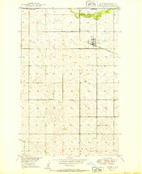
USGS Historical Quadrangle in GeoPDF.
Tags: 7.5 x 7.5 minute,
Antler,
Downloadable Data,
GeoPDF,
GeoTIFF, All tags...
Historical Topographic Maps,
Historical Topographic Maps 7.5 x 7.5 Minute Map Series,
Map,
ND,
imageryBaseMapsEarthCover, Fewer tags

ADMMR map collection: Composite and Sections of Upper Adit Workings, Antler Mine; 1 in. to 20 feet; 25 x 23 in.
Categories: Data;
Tags: 1940s,
Antler,
Arizona,
Bismuth,
Cadmium, All tags...
Clay, Refractory,
Copper, Sulfide,
Dataset,
Gold, Lode,
Hualapai Mts. physiographic area,
Hualapai metallic mineral dist.,
Iron, Sulfide,
Lead, Sulfide,
Mohave County,
Silicon,
Silver,
Spuyten Duyvil,
T17N R16W Sec 4 E2,
United States,
Wabayuma Peak - 7.5 Min,
Zinc, Sulfide,
geoscientificInformation,
maps and atlases,
mining and quarrying,
natural resource exploration,
plans,
subsurface maps, Fewer tags

ADMMR map collection: Antler Copper - Zinc Project 1480, Ore Reserve Blocks; 12 x 9 in.
Categories: Data;
Tags: 1940s,
Antler,
Arizona,
Bismuth,
Cadmium, All tags...
Clay, Refractory,
Copper, Sulfide,
Dataset,
Gold, Lode,
Iron, Sulfide,
Lead, Sulfide,
Mohave County,
Silicon,
Silver,
Spuyten Duyvil,
T17N R16W Sec 4 E2,
United States,
Wabayuma Peak - 7.5 Min,
Zinc, Sulfide,
geoscientificInformation,
maps and atlases,
mining and quarrying,
natural resource exploration,
sections,
subsurface maps,
zinc, Fewer tags

ADMMR map collection: Antler Mine - Three Lower Levels; 1 in. to 50 feet; 20 x 15 in.
Categories: Data;
Tags: 1950s,
Antler,
Arizona,
Bismuth,
Cadmium, All tags...
Clay, Refractory,
Copper, Sulfide,
Dataset,
Gold, Lode,
Hualapai Mts. physiographic area,
Hualapai metallic mineral dist.,
Iron, Sulfide,
Lead, Sulfide,
Mohave County,
Silicon,
Silver,
Spuyten Duyvil,
T17N R16W Sec 4 E2,
United States,
Wabayuma Peak - 7.5 Min,
Zinc, Sulfide,
geology,
geoscientificInformation,
maps and atlases,
mineral resources,
mining and quarrying,
natural resource exploration,
sections,
subsurface maps, Fewer tags

ADMMR map collection: Main Workings, Antler Mine; 1 in. to 20 feet; 18 x 24 in.
Categories: Data;
Tags: 1940s,
Antler,
Arizona,
Bismuth,
Cadmium, All tags...
Clay, Refractory,
Copper, Sulfide,
Dataset,
Gold, Lode,
Iron, Sulfide,
Lead, Sulfide,
Mohave County,
Silicon,
Silver,
Spuyten Duyvil,
T17N R16W Sec 4 E2,
United States,
Wabayuma Peak - 7.5 Min,
Zinc, Sulfide,
geoscientificInformation,
maps and atlases,
mining and quarrying,
natural resource exploration,
plans,
subsurface maps, Fewer tags

ADMMR map collection: Antler and Spuyten Duyvil Claim Map; 1 in. to 400 feet; 8 x 11 in.
Categories: Data;
Tags: Antler,
Arizona,
Bismuth,
Cadmium,
Clay, Refractory, All tags...
Copper, Sulfide,
Dataset,
Gold, Lode,
Hualapai Mts. physiographic area,
Hualapai metallic mineral dist.,
Iron, Sulfide,
Lead, Sulfide,
Mohave County,
Silicon,
Silver,
Spuyten Duyvil,
T17N R16W Sec 4 E2,
United States,
Wabayuma Peak - 7.5 Min,
Zinc, Sulfide,
claim maps,
geoscientificInformation,
maps and atlases,
mining and quarrying, Fewer tags

ADMMR map collection: Antler Mine Composite Level Map and Longitudinal Projection; 1 in. to 50 feet; 23 x 26 in.
Categories: Data;
Tags: 1950s,
Antler,
Arizona,
Bismuth,
Cadmium, All tags...
Clay, Refractory,
Copper, Sulfide,
Dataset,
Gold, Lode,
Hualapai Mts. physiographic area,
Hualapai metallic mineral dist.,
Iron, Sulfide,
Lead, Sulfide,
Mohave County,
Silicon,
Silver,
Spuyten Duyvil,
T17N R16W Sec 4 E2,
United States,
Wabayuma Peak - 7.5 Min,
Zinc, Sulfide,
copper,
geoscientificInformation,
maps and atlases,
metallic ores,
mineral resources,
mining and quarrying,
natural resource exploration,
plans,
sections,
subsurface maps,
zinc, Fewer tags

ADMMR map collection: Antler Mine Geologic Map; 1 in. to 100 feet; 21 x 27 in.
Categories: Data;
Tags: 1940s,
Antler,
Arizona,
Bismuth,
Cadmium, All tags...
Clay, Refractory,
Copper, Sulfide,
Dataset,
Gold, Lode,
Hualapai Mts. physiographic area,
Hualapai metallic mineral dist.,
Iron, Sulfide,
Lead, Sulfide,
Mohave County,
Silicon,
Silver,
Spuyten Duyvil,
T17N R16W Sec 4 E2,
United States,
Wabayuma Peak - 7.5 Min,
Zinc, Sulfide,
geologic maps,
geology,
geoscientificInformation,
maps and atlases,
mining and quarrying,
natural resource exploration, Fewer tags

ADMMR map collection: Composite and Sections of Lower Adit Workings, Antler Mine; 1 in. to 20 feet; 18 x 20 in.
Categories: Data;
Tags: 1940s,
Antler,
Arizona,
Bismuth,
Cadmium, All tags...
Clay, Refractory,
Copper, Sulfide,
Dataset,
Gold, Lode,
Iron, Sulfide,
Lead, Sulfide,
Mohave County,
Silicon,
Silver,
Spuyten Duyvil,
T17N R16W Sec 4 E2,
United States,
Wabayuma Peak - 7.5 Min,
Zinc, Sulfide,
geoscientificInformation,
maps and atlases,
mining and quarrying,
natural resource exploration,
plans,
subsurface maps, Fewer tags

ADMMR map collection: Antler Mine Map; 1 in. to 100 feet; 31 x 14 in.
Categories: Data;
Tags: 1940s,
Antler,
Arizona,
Bismuth,
Cadmium, All tags...
Clay, Refractory,
Copper, Sulfide,
Dataset,
Gold, Lode,
Hualapai Mts. physiographic area,
Hualapai metallic mineral dist.,
Iron, Sulfide,
Lead, Sulfide,
Mohave County,
Silicon,
Silver,
Spuyten Duyvil,
T17N R16W Sec 4 E2,
United States,
Wabayuma Peak - 7.5 Min,
Zinc, Sulfide,
geoscientificInformation,
maps and atlases,
mining and quarrying,
topography, Fewer tags

ADMMR map collection: Antler Mine - 5th Level Plan; 1 in. to 50 feet; 22 x 12 in.
Categories: Data;
Tags: Antler,
Arizona,
Bismuth,
Cadmium,
Clay, Refractory, All tags...
Copper, Sulfide,
Dataset,
Gold, Lode,
Hualapai Mts. physiographic area,
Hualapai metallic mineral dist.,
Iron, Sulfide,
Lead, Sulfide,
Mohave County,
Silicon,
Silver,
Spuyten Duyvil,
T17N R16W Sec 4 E2,
United States,
Wabayuma Peak - 7.5 Min,
Zinc, Sulfide,
geoscientificInformation,
maps and atlases,
mining and quarrying,
natural resource exploration,
plans,
subsurface maps, Fewer tags

ADMMR map collection: Antler Mine - 5th Level Plan; 1 in. to 50 feet; 22 x 10 in.
Categories: Data;
Tags: 1950s,
Antler,
Arizona,
Bismuth,
Cadmium, All tags...
Clay, Refractory,
Copper, Sulfide,
Dataset,
Gold, Lode,
Iron, Sulfide,
Lead, Sulfide,
Mohave County,
Silicon,
Silver,
Spuyten Duyvil,
T17N R16W Sec 4 E2,
United States,
Wabayuma Peak - 7.5 Min,
Zinc, Sulfide,
chemical analysis,
copper,
drilling and coring,
geochemistry,
geoscientificInformation,
lead,
maps and atlases,
mining and quarrying,
natural resource exploration,
plans,
subsurface maps,
zinc, Fewer tags
|
|

