Filters: Tags: Antonito (X)
10 results (152ms)|
Filters
Date Range
Types Contacts
Categories Tag Types Tag Schemes |
This part of the Data Release contains the raster representation of the water-level altitude and water-level change maps developed every 5 years from 1980-2015 for the upper Rio Grande Focus Area Study. The input point data used to generate the water-level altitude maps can be found in the "Groundwater level measurement data used to develop water-level altitude maps in the upper Rio Grande Alluvial Basins" child item of this data release. These digital data accompany Houston, N.A., Thomas, J.V., Foster, L.K., Pedraza, D.E., and Welborn, T.L., 2020, Hydrogeologic framework, groundwater-level altitudes, groundwater-level changes, and groundwater-storage changes in selected alluvial basins of the upper Rio Grande...
Types: Map Service,
OGC WFS Layer,
OGC WMS Layer,
OGC WMS Service;
Tags: Abiquiu Reservoir,
Ahumada,
Alamosa,
Alamosa County,
Alamosa Creek,
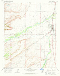
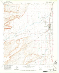
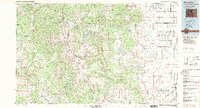
USGS Historical Quadrangle in GeoPDF.
USGS Historical Quadrangle in GeoPDF.
Consumptive use (CU) of water is an important factor for determining water availability and groundwater storage. Many regional stakeholders and water-supply managers in the Upper Rio Grande Basin have indicated CU is of primary concern in their water-management strategies, yet CU data is sparse for this area. This polygon feature class, which represents irrigated acres for 2015, is a geospatial component of the U.S. Geological Survey National Water Census Upper Rio Grande Basin (URGB) focus area study's effort to improve quantification of CU in parts of New Mexico, west Texas, and northern Chihuahua. These digital data accompany Ivahnenko, T.I., Flickinger, A.K., Galanter, A.E., Douglas-Mankin, K.R., Pedraza, D.E.,...
Types: Map Service,
OGC WFS Layer,
OGC WMS Layer,
OGC WMS Service;
Tags: Abiquiu Reservoir,
Ahumada,
Alamosa,
Alamosa County,
Alamosa Creek,
USGS Historical Quadrangle in GeoPDF.
Alluvial basin boundaries in the Upper Rio Grande Basin (URGB) were a needed dataset for the groundwater component of the URGB Focus Area Study (FAS). A literature and data search revealed not all of the alluvial fill basins existed in a digital format that could be imported and used in a Geographic Information System (GIS). Available resources such as georeferenced report figures, digital elevation models (DEMs), principal aquifer dataset, surficial geology, and structural features, such as faults, were used to aid in defining the alluvial basin boundaries. An Esri ArcGIS geodatabase was created to house the final digitized dataset of the following alluvial basins: San Luis, Espanola, Socorro, La Jencia, San Marcial,...
Types: Map Service,
OGC WFS Layer,
OGC WMS Layer,
OGC WMS Service;
Tags: Abiquiu Reservoir,
Ahumada,
Alamosa,
Alamosa,
Alamosa County,
This part of the data release contains the water-level measurement data compiled and synthesized from various sources. This collection includes two tables that contain all the water-level measurements that were considered to develop the water-level altitude maps (Input_VisGWDB), and a table of median water-level data that were used to develop the water-level altitude maps (MedianWaterLevelData). These digital data accompany Houston, N.A., Thomas, J.V., Foster, L.K., Pedraza, D.E., and Welborn, T.L., 2020, Hydrogeologic framework, groundwater-level Altitudes, groundwater-level changes, and groundwater-storage changes in selected alluvial basins of the upper Rio Grande Focus Area Study, Colorado, New Mexico, and...
Categories: Data;
Types: Map Service,
OGC WFS Layer,
OGC WMS Layer,
OGC WMS Service;
Tags: Abiquiu Reservoir,
Ahumada,
Alamosa,
Alamosa County,
Alamosa Creek,
USGS Historical Quadrangle in GeoPDF.
The dataset includes whole-rock geochemistry and 40Ar-39Ar geochronology for Pleistocene to Oligocene volcanic and intrusive rocks. These data support figures and tables in days 2 and 3 of the Field-trip guide to continental arc to rift volcanism of the southern Rocky Mountains-Southern Rocky Mountain, Taos Plateau, and Jemez Mountains volcanic fields of southern Colorado and northern New Mexico (Thompson and others, 2022). Additional 40Ar-39Ar geochronology data are included for age reported in the Geologic map of Ute Mountain quadrangle (Thompson and others, 2014b) and the Geologic map of Sunshine quadrangle (Thompson and others, 2014a). Other samples not associated with any of these referenced publications are...
This Data Release contains various types of hydrologic and geologic data from the Upper Rio Grande Focus Area Study from 1921-2017, including groundwater-level measurement data compiled and synthesized from various sources, water-level altitude and water-level change maps developed from the water-level measurement data every 5 years from 1980-2015, and the horizontal extent of 13 alluvial basins in the Upper Rio Grande Basin
Types: Map Service,
OGC WFS Layer,
OGC WMS Layer,
OGC WMS Service;
Tags: Abiquiu Reservoir,
Ahumada,
Alamosa,
Alamosa County,
Alamosa Creek,
|

|
