Filters
Date Range
Extensions
Types
Contacts
Categories
Tag Types
Tag Schemes
|

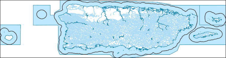
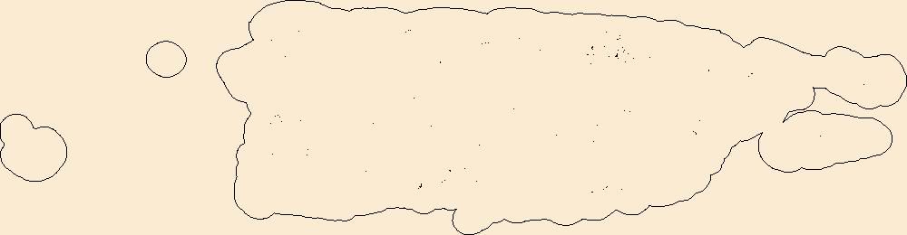
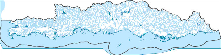
This data represents the map extent for current and historical USGS topographic maps for the United States and Territories, including 1 X 2 Degree, 1 X 1 Degree, 30 X 60 Minute, 15 X 15 Minute, 7.5 X 7.5 Minute, and 3.75 X 3.75 Minute. The grid was generated using ESRI ArcInfo GIS software.
Tags: Adjuntas,
Aguada,
Aguadilla,
Aguas Buenas,
Aibonito, All tags...
Arecibo,
Arroyo,
Añasco,
Barceloneta,
Barranquitas,
Bayamón,
Boundaries,
Cabo Rojo,
Caguas,
Camuy,
Canóvanas,
Carolina,
Cataño,
Cayey,
Ceiba,
Ciales,
Cidra,
Coamo,
Comerío,
Corozal,
Culebra,
Dorado,
Downloadable Data,
Esri File GeoDatabase 10,
Fajardo,
FileGDB,
Florida,
Guayama,
Guayanilla,
Guaynabo,
Gurabo,
Guánica,
Hatillo,
Hormigueros,
Humacao,
Isabela,
Jayuya,
Juana Díaz,
Juncos,
Lajas,
Lares,
Las Marías,
Las Piedras,
Loíza,
Luquillo,
Manatí,
Map Indices,
Map Indices,
Map Indices,
Maricao,
Maunabo,
Mayagüez,
Moca,
Morovis,
Naguabo,
Naranjito,
Orocovis,
PR,
Patillas,
Peñuelas,
Ponce,
Puerto Rico,
Quebradillas,
Rincón,
Río Grande,
Sabana Grande,
Salinas,
San Germán,
San Juan,
San Lorenzo,
San Sebastián,
Santa Isabel,
State,
State,
Toa Alta,
Toa Baja,
Trujillo Alto,
US,
United States,
United States of America,
Utuado,
Vega Alta,
Vega Baja,
Vieques,
Villalba,
Yabucoa,
Yauco,
cells,
map indices,
polygon grid, Fewer tags

Surficial geologic map the Newman Peak Quadrangle of the Picacho Basin. The Picacho basin is a large and complex graben surrounded by horsts and half-horsts, which are now the Picacho, Casa Grande, Silverbell, and Sacaton mountains. It formed mainly in response to late Miocene extension. Internal drainage probably persisted until about 3 million years ago. Several thousand meters of sediments fill the basin; 2000 m of evaporites and claystone form the bulk of the basin fill (Scarborough and Pierce, 1978). The upper 200 meters or so of basin fill was deposited by a gradually aggrading, regionally integrated drainage system. Young alluvium of the Santa Cruz River is up to 30 m thick and is found within 3.2 km of the...
Tags: Arizona,
Basin and range Province,
Casa grande mountains,
Flooding,
Geology, All tags...
McClellan Wash,
Pcacho peak state park,
Picacho Basin,
Picacho Mountains,
Picacho Peak,
alkaline soils,
alluvial fan,
alluvium,
arroyo,
basin-fill,
braided channel,
debris flow,
desert pavement,
duripan,
earth fissures,
eolian landforms,
evaporite,
floodplain,
geologic hazards,
geomorphology,
geoscientificInformation,
half-graben,
holocene,
late tertiary,
overbank deposits,
piedmont,
pinal county,
pleistocene,
problem soils,
quaternary,
recent,
river terrace,
sacaton mountain,
santa cruz river,
silverbell mountains,
soils,
surficial geology, Fewer tags

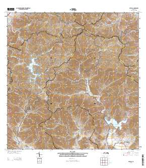
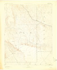
USGS Historical Quadrangle in GeoPDF.
Tags: 30 x 30 minute,
Arroyo,
CO,
Downloadable Data,
GeoPDF, All tags...
GeoTIFF,
Historical Topographic Maps,
Historical Topographic Maps 30 x 30 Minute Map Series,
Map,
imageryBaseMapsEarthCover, Fewer tags
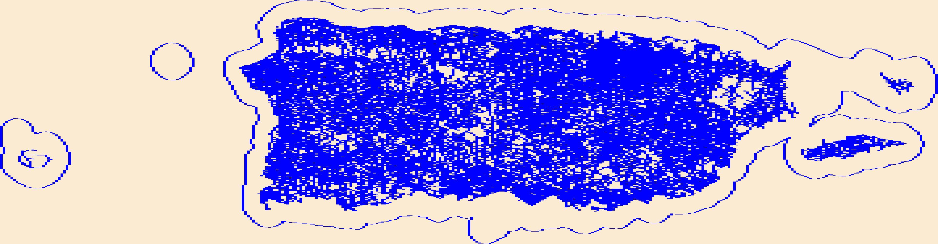
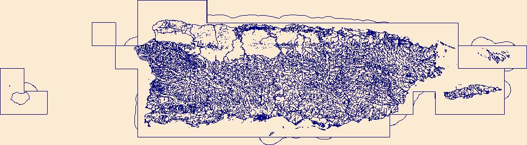
The National Hydrography Dataset (NHD) is a feature-based database that interconnects and uniquely identifies the stream segments or reaches that make up the nation's surface water drainage system. NHD data was originally developed at 1:100,000-scale and exists at that scale for the whole country. This high-resolution NHD, generally developed at 1:24,000/1:12,000 scale, adds detail to the original 1:100,000-scale NHD. (Data for Alaska, Puerto Rico and the Virgin Islands was developed at high-resolution, not 1:100,000 scale.) Local resolution NHD is being developed where partners and data exist. The NHD contains reach codes for networked features, flow direction, names, and centerline representations for areal water...
Tags: Adjuntas,
Administrative watershed units,
Administrative watershed units,
Aguada,
Aguadilla, All tags...
Aguas Buenas,
Aibonito,
Area of Complex Channels,
Area to be submerged,
Arecibo,
Arroyo,
Añasco,
Barceloneta,
Barranquitas,
Basin,
Basin,
Bay/Inlet,
Bayamón,
Boundaries,
Boundary,
Bridge,
Cabo Rojo,
Caguas,
Camuy,
Canal/Ditch,
Canóvanas,
Carolina,
Cataño,
Cayey,
Ceiba,
Ciales,
Cidra,
Coamo,
Coastline,
Comerío,
Connector,
Corozal,
Culebra,
Dam/Weir,
Dorado,
Downloadable Data,
Drainage areas for surface water,
Drainageway,
Esri Shapefile nan,
Estuary,
Fajardo,
Florida,
Flow direction network,
Flume,
ForeShore,
Gaging Station,
Gate,
Guayama,
Guayanilla,
Guaynabo,
Gurabo,
Guánica,
HU-4,
HU-4 Subregion,
HU10,
HU12,
HU14,
HU16,
HU2,
HU4,
HU4_2101,
HU6,
HU8,
HUC,
Hatillo,
Hazard Zone,
Hormigueros,
Humacao,
Hydrographic,
Hydrography,
Hydrography,
Hydrography,
Hydrologic Unit Code,
Hydrologic Units,
Ice mass,
Inundation Area,
Isabela,
Jayuya,
Juana Díaz,
Juncos,
Lajas,
Lares,
Las Marías,
Las Piedras,
Levee,
Line,
Lock Chamber,
Loíza,
Luquillo,
Manatí,
Maricao,
Marsh,
Maunabo,
Mayagüez,
Moca,
Morovis,
Naguabo,
Naranjito,
National Hydrography Dataset (NHD),
National Hydrography Dataset (NHD) Best Resolution,
National Hydrography Dataset (NHD) Best Resolution,
Nonearthen Shore,
Orocovis,
Orthoimage,
PR,
Patillas,
Peñuelas,
Playa,
Point,
PointEvent,
Ponce,
Pond,
Puerto Rico,
Quebradillas,
Rapids,
Rapids,
Reach,
Reach code,
Reef,
Region,
Reservoir,
Rincón,
Rock,
Río Grande,
Sabana Grande,
Salinas,
San Germán,
San Juan,
San Lorenzo,
San Sebastián,
Santa Isabel,
Sea/Ocean,
Shapefile,
Sink/Rise,
Sounding Datum Line,
Special Use Zone,
Special Use Zone Limit,
Spillway,
Stream,
Stream/River,
Sub-basin,
Sub-region,
Subbasin,
Submerged Stream,
Subregion,
Subwatershed,
Surface water systems,
Swamp,
Toa Alta,
Toa Baja,
Topographic,
Trujillo Alto,
Tunnel,
US,
Underground Conduit,
United States,
Utuado,
Vega Alta,
Vega Baja,
Vieques,
Villalba,
WBD,
WBD,
Wall,
Wash,
Water Intake Outflow,
Waterfall,
Watershed,
Watershed Boundaries,
Watershed Boundary Dataset,
Watershed Boundary Dataset,
Well,
Yabucoa,
Yauco,
artificial path,
boundaries,
dams,
drainage systems and characteristics,
inlandWaters,
lakes,
ngda,
rivers, Fewer tags
USGS Historical Quadrangle in GeoPDF.
Tags: 30 x 30 minute,
Arroyo,
CO,
Downloadable Data,
GeoPDF, All tags...
GeoTIFF,
Historical Topographic Maps,
Historical Topographic Maps 30 x 30 Minute Map Series,
Map,
imageryBaseMapsEarthCover, Fewer tags
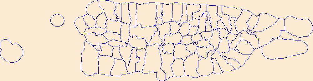
Geospatial data is comprised of government boundaries.
Tags: Adjuntas,
Aguada,
Aguadilla,
Aguas Buenas,
Aibonito, All tags...
Arecibo,
Arroyo,
Añasco,
Barceloneta,
Barranquitas,
Bayamón,
Boundaries,
Cabo Rojo,
Caguas,
Camuy,
Canóvanas,
Carolina,
Cataño,
Cayey,
Ceiba,
Ciales,
Cidra,
Coamo,
Comerío,
Corozal,
County or Equivalent,
Culebra,
Dorado,
Downloadable Data,
Fajardo,
Florida,
GeoPackage,
Guayama,
Guayanilla,
Guaynabo,
Gurabo,
Guánica,
Hatillo,
Hormigueros,
Humacao,
Incorporated Place,
Isabela,
Jayuya,
Juana Díaz,
Juncos,
Jurisdictional,
Lajas,
Lares,
Las Marías,
Las Piedras,
Loíza,
Luquillo,
Manatí,
Maricao,
Maunabo,
Mayagüez,
Minor Civil Division,
Moca,
Morovis,
Naguabo,
Naranjito,
National Boundary Dataset (NBD),
National Boundary Dataset (NBD),
Native American Area,
Open Geospatial Consortium GeoPackage 1.2,
Orocovis,
PLSS First Division,
PLSS Special Survey,
PLSS Township,
PR,
Patillas,
Peñuelas,
Ponce,
Public Land Survey System,
Puerto Rico,
Quebradillas,
Reserve,
Rincón,
Río Grande,
Sabana Grande,
Salinas,
San Germán,
San Juan,
San Lorenzo,
San Sebastián,
Santa Isabel,
State,
State,
State or Territory,
Toa Alta,
Toa Baja,
Trujillo Alto,
U.S. National Grid,
US,
Unincorporated Place,
United States,
Utuado,
Vega Alta,
Vega Baja,
Vieques,
Villalba,
Yabucoa,
Yauco,
boundaries,
boundary,
cadastral surveys,
geographic names,
land ownership,
land use maps,
legal land descriptions,
political and administrative boundaries,
zoning maps, Fewer tags

Surficial geologic maps of the Eloy South Quadrangle of the Picacho Basin. The Picacho basin is a large and complex graben surrounded by horsts and half-horsts, which are now the Picacho, Casa Grande, Silverbell, and Sacaton mountains. It formed mainly in response to late Miocene extension. Internal drainage probably persisted until about 3 million years ago. Several thousand meters of sediments fill the basin; 2000 m of evaporites and claystone form the bulk of the basin fill (Scarborough and Pierce, 1978). The upper 200 meters or so of basin fill was deposited by a gradually aggrading, regionally integrated drainage system. Young alluvium of the Santa Cruz River is up to 30 m thick and is found within 3.2 km of...
Tags: Arizona,
Basin and range Province,
Casa grande mountains,
Flooding,
Geology, All tags...
McClellan Wash,
Pcacho peak state park,
Picacho Basin,
Picacho Mountains,
Picacho Peak,
alkaline soils,
alluvial fan,
alluvium,
arroyo,
basin-fill,
braided channel,
debris flow,
desert pavement,
duripan,
earth fissures,
eolian landforms,
evaporite,
floodplain,
geologic hazards,
geomorphology,
geoscientificInformation,
half-graben,
holocene,
late tertiary,
overbank deposits,
piedmont,
pinal county,
pleistocene,
problem soils,
quaternary,
recent,
river terrace,
sacaton mountain,
santa cruz river,
silverbell mountains,
soils,
surficial geology, Fewer tags
Layers of geospatial data include roads, airports, trails, and railroads.
Tags: Adjuntas,
Aguada,
Aguadilla,
Aguas Buenas,
Aibonito, All tags...
Airport Complex,
Airport Point,
Airport Runway,
Airports,
Airstrips,
Arecibo,
Arroyo,
Añasco,
Barceloneta,
Barranquitas,
Bayamón,
Cabo Rojo,
Caguas,
Camuy,
Canóvanas,
Carolina,
Cataño,
Cayey,
Ceiba,
Ciales,
Cidra,
Coamo,
Comerío,
Corozal,
Culebra,
Dorado,
Downloadable Data,
Fajardo,
Florida,
GeoPackage,
Geographic names,
Guayama,
Guayanilla,
Guaynabo,
Gurabo,
Guánica,
Hatillo,
Hormigueros,
Humacao,
Isabela,
Jayuya,
Juana Díaz,
Juncos,
Lajas,
Lares,
Las Marías,
Las Piedras,
Loíza,
Luquillo,
Manatí,
Maricao,
Maunabo,
Mayagüez,
Moca,
Morovis,
Naguabo,
Naranjito,
National Transportation Dataset (NTD),
National Transportation Dataset (NTD),
Open Geospatial Consortium GeoPackage 1.2,
Orocovis,
PR,
Patillas,
Peñuelas,
Ponce,
Puerto Rico,
Quebradillas,
Railways,
Rincón,
Roads,
Río Grande,
Sabana Grande,
Salinas,
San Germán,
San Juan,
San Lorenzo,
San Sebastián,
Santa Isabel,
State,
State,
Toa Alta,
Toa Baja,
Trail,
Trails,
Transportation,
Transportation,
Trujillo Alto,
US,
United States,
Utuado,
Vega Alta,
Vega Baja,
Vieques,
Villalba,
Waterway,
Yabucoa,
Yauco,
transportation, Fewer tags
Geospatial data includes structures and other selected map features.
Tags: Adjuntas,
Aguada,
Aguadilla,
Aguas Buenas,
Aibonito, All tags...
Arecibo,
Arroyo,
Añasco,
Barceloneta,
Barranquitas,
Bayamón,
Cabo Rojo,
Caguas,
Campground,
Camuy,
Canóvanas,
Carolina,
Cataño,
Cayey,
Ceiba,
Ciales,
Cidra,
Coamo,
College / University,
Comerío,
Corozal,
Courthouse,
Culebra,
Dorado,
Downloadable Data,
Esri File GeoDatabase 10,
Fajardo,
FileGDB,
Fire Station/ EMS Station,
Florida,
Guayama,
Guayanilla,
Guaynabo,
Gurabo,
Guánica,
Hatillo,
Hormigueros,
Hospital/Medical Center,
Humacao,
Information Center,
Isabela,
Jayuya,
Juana Díaz,
Juncos,
Lajas,
Lares,
Las Marías,
Las Piedras,
Law Enforcement,
Loíza,
Luquillo,
Manatí,
Maricao,
Maunabo,
Mayagüez,
Moca,
Morovis,
Naguabo,
Naranjito,
National Structures Dataset (NSD),
National Structures Dataset (NSD),
Orocovis,
PR,
Patillas,
Peñuelas,
Ponce,
Post Office,
Prison/ Correctional Facility,
Puerto Rico,
Quebradillas,
Rincón,
Río Grande,
Sabana Grande,
Salinas,
San Germán,
San Juan,
San Lorenzo,
San Sebastián,
Santa Isabel,
School,
School:Elementary,
School:High School,
School:Middle School,
State,
State,
State Capitol,
Structures,
Technical School,
Toa Alta,
Toa Baja,
Town Hall,
Trade School,
Trailhead,
Trujillo Alto,
US,
United States,
Utuado,
Vega Alta,
Vega Baja,
Vieques,
Villalba,
Visitor Center,
Yabucoa,
Yauco,
structure, Fewer tags
Layered GeoPDF Quadrangle Map. Layers of geospatial data include orthoimagery, roads, grids, geographic names, elevation contours, hydrography, and other selected map features.
Tags: 7.5 x 7.5 minute,
Arroyo,
Caguas,
Cayey,
Downloadable Data, All tags...
EarthCover,
GeoPDF,
Guayama,
Imagery and Base Maps,
Map,
Patillas,
Patillas, PR,
Public Land Survey System,
Puerto Rico,
San Lorenzo,
U.S. National Grid,
US,
US Topo,
US Topo Historical,
United States,
Yabucoa,
boundary,
contour,
geographic names,
hydrography,
imageryBaseMapsEarthCover,
orthoimage,
structures,
topographic,
transportation,
woodland, Fewer tags
The National Hydrography Dataset (NHD) is a feature-based database that interconnects and uniquely identifies the stream segments or reaches that make up the nation's surface water drainage system. NHD data was originally developed at 1:100,000-scale and exists at that scale for the whole country. This high-resolution NHD, generally developed at 1:24,000/1:12,000 scale, adds detail to the original 1:100,000-scale NHD. (Data for Alaska, Puerto Rico and the Virgin Islands was developed at high-resolution, not 1:100,000 scale.) Local resolution NHD is being developed where partners and data exist. The NHD contains reach codes for networked features, flow direction, names, and centerline representations for areal water...
Tags: Adjuntas,
Administrative watershed units,
Administrative watershed units,
Aguada,
Aguadilla, All tags...
Aguas Buenas,
Aibonito,
Area of Complex Channels,
Area to be submerged,
Arecibo,
Arroyo,
Añasco,
Barceloneta,
Barranquitas,
Basin,
Basin,
Bay/Inlet,
Bayamón,
Boundaries,
Boundary,
Bridge,
Cabo Rojo,
Caguas,
Camuy,
Canal/Ditch,
Canóvanas,
Carolina,
Cataño,
Cayey,
Ceiba,
Ciales,
Cidra,
Coamo,
Coastline,
Comerío,
Connector,
Corozal,
Culebra,
Dam/Weir,
Dorado,
Downloadable Data,
Drainage areas for surface water,
Drainageway,
Esri Shapefile nan,
Estuary,
Fajardo,
Florida,
Flow direction network,
Flume,
ForeShore,
Gaging Station,
Gate,
Guayama,
Guayanilla,
Guaynabo,
Gurabo,
Guánica,
HU10,
HU12,
HU14,
HU16,
HU2,
HU4,
HU6,
HU8,
HUC,
Hatillo,
Hazard Zone,
Hormigueros,
Humacao,
Hydrographic,
Hydrography,
Hydrography,
Hydrography,
Hydrologic Unit Code,
Hydrologic Units,
Ice mass,
Inundation Area,
Isabela,
Jayuya,
Juana Díaz,
Juncos,
Lajas,
Lares,
Las Marías,
Las Piedras,
Levee,
Line,
Lock Chamber,
Loíza,
Luquillo,
Manatí,
Maricao,
Marsh,
Maunabo,
Mayagüez,
Moca,
Morovis,
Naguabo,
Naranjito,
National Hydrography Dataset (NHD),
National Hydrography Dataset (NHD) Best Resolution,
National Hydrography Dataset (NHD) Best Resolution,
Nonearthen Shore,
Orocovis,
Orthoimage,
PR,
Patillas,
Peñuelas,
Playa,
Point,
PointEvent,
Ponce,
Pond,
Puerto Rico,
Quebradillas,
Rapids,
Rapids,
Reach,
Reach code,
Reef,
Region,
Reservoir,
Rincón,
Rock,
Río Grande,
Sabana Grande,
Salinas,
San Germán,
San Juan,
San Lorenzo,
San Sebastián,
Santa Isabel,
Sea/Ocean,
Shapefile,
Sink/Rise,
Sounding Datum Line,
Special Use Zone,
Special Use Zone Limit,
Spillway,
State,
State,
State_Puerto Rico,
Stream,
Stream/River,
Sub-basin,
Sub-region,
Subbasin,
Submerged Stream,
Subregion,
Subwatershed,
Surface water systems,
Swamp,
Toa Alta,
Toa Baja,
Topographic,
Trujillo Alto,
Tunnel,
US,
Underground Conduit,
United States,
Utuado,
Vega Alta,
Vega Baja,
Vieques,
Villalba,
WBD,
WBD,
Wall,
Wash,
Water Intake Outflow,
Waterfall,
Watershed,
Watershed Boundaries,
Watershed Boundary Dataset,
Watershed Boundary Dataset,
Well,
Yabucoa,
Yauco,
artificial path,
boundaries,
dams,
drainage systems and characteristics,
inlandWaters,
lakes,
ngda,
rivers, Fewer tags

The National Hydrography Dataset (NHD) is a feature-based database that interconnects and uniquely identifies the stream segments or reaches that make up the nation's surface water drainage system. NHD data was originally developed at 1:100,000-scale and exists at that scale for the whole country. This high-resolution NHD, generally developed at 1:24,000/1:12,000 scale, adds detail to the original 1:100,000-scale NHD. (Data for Alaska, Puerto Rico and the Virgin Islands was developed at high-resolution, not 1:100,000 scale.) Local resolution NHD is being developed where partners and data exist. The NHD contains reach codes for networked features, flow direction, names, and centerline representations for areal water...
Tags: Adjuntas,
Administrative watershed units,
Administrative watershed units,
Aguada,
Aguadilla, All tags...
Aguas Buenas,
Aibonito,
Area of Complex Channels,
Area to be submerged,
Arecibo,
Arroyo,
Añasco,
Barceloneta,
Barranquitas,
Basin,
Basin,
Bay/Inlet,
Bayamón,
Boundaries,
Boundary,
Bridge,
Cabo Rojo,
Caguas,
Camuy,
Canal/Ditch,
Canóvanas,
Carolina,
Cataño,
Cayey,
Ceiba,
Ciales,
Cidra,
Coamo,
Coastline,
Comerío,
Connector,
Corozal,
Culebra,
Dam/Weir,
Dorado,
Downloadable Data,
Drainage areas for surface water,
Drainageway,
Estuary,
Fajardo,
Florida,
Flow direction network,
Flume,
ForeShore,
Gaging Station,
Gate,
GeoPackage,
Guayama,
Guayanilla,
Guaynabo,
Gurabo,
Guánica,
HU10,
HU12,
HU14,
HU16,
HU2,
HU4,
HU6,
HU8,
HUC,
Hatillo,
Hazard Zone,
Hormigueros,
Humacao,
Hydrographic,
Hydrography,
Hydrography,
Hydrography,
Hydrologic Unit Code,
Hydrologic Units,
Ice mass,
Inundation Area,
Isabela,
Jayuya,
Juana Díaz,
Juncos,
Lajas,
Lares,
Las Marías,
Las Piedras,
Levee,
Line,
Lock Chamber,
Loíza,
Luquillo,
Manatí,
Maricao,
Marsh,
Maunabo,
Mayagüez,
Moca,
Morovis,
Naguabo,
Naranjito,
National Hydrography Dataset (NHD),
National Hydrography Dataset (NHD) Best Resolution,
National Hydrography Dataset (NHD) Best Resolution,
Nonearthen Shore,
Open Geospatial Consortium GeoPackage 1.2,
Orocovis,
Orthoimage,
PR,
Patillas,
Peñuelas,
Playa,
Point,
PointEvent,
Ponce,
Pond,
Puerto Rico,
Quebradillas,
Rapids,
Rapids,
Reach,
Reach code,
Reef,
Region,
Reservoir,
Rincón,
Rock,
Río Grande,
Sabana Grande,
Salinas,
San Germán,
San Juan,
San Lorenzo,
San Sebastián,
Santa Isabel,
Sea/Ocean,
Sink/Rise,
Sounding Datum Line,
Special Use Zone,
Special Use Zone Limit,
Spillway,
State,
State,
State_Puerto Rico,
Stream,
Stream/River,
Sub-basin,
Sub-region,
Subbasin,
Submerged Stream,
Subregion,
Subwatershed,
Surface water systems,
Swamp,
Toa Alta,
Toa Baja,
Topographic,
Trujillo Alto,
Tunnel,
US,
Underground Conduit,
United States,
Utuado,
Vega Alta,
Vega Baja,
Vieques,
Villalba,
WBD,
WBD,
Wall,
Wash,
Water Intake Outflow,
Waterfall,
Watershed,
Watershed Boundaries,
Watershed Boundary Dataset,
Watershed Boundary Dataset,
Well,
Yabucoa,
Yauco,
artificial path,
boundaries,
dams,
drainage systems and characteristics,
inlandWaters,
lakes,
ngda,
rivers, Fewer tags
The Geographic Names Information System (GNIS) is the Federal standard for geographic nomenclature. The U.S. Geological Survey developed the GNIS for the U.S. Board on Geographic Names, a Federal inter-agency body chartered by public law to maintain uniform feature name usage throughout the Government and to promulgate standard names to the public. The GNIS is the official repository of domestic geographic names data; the official vehicle for geographic names use by all departments of the Federal Government; and the source for applying geographic names to Federal electronic and printed products of all types.
Tags: Adjuntas,
Aguada,
Aguadilla,
Aguas Buenas,
Aibonito, All tags...
Antarctica,
Antarctica,
Arecibo,
Arroyo,
Añasco,
BGN,
Barceloneta,
Barranquitas,
Bayamón,
Board on Geographic Names,
Borough,
Cabo Rojo,
Caguas,
Camuy,
Canóvanas,
Carolina,
Cataño,
Cayey,
Ceiba,
Census Area,
Ciales,
Cidra,
Coamo,
Comerío,
Commonwealth,
Corozal,
County,
Culebra,
District,
Dorado,
Downloadable Data,
Fajardo,
Feature class,
Feature coordinates,
Feature county,
Feature description,
Feature designation,
Feature history,
Feature indentification,
Feature name,
Feature state,
Florida,
GNIS,
GeoPackage,
Geographic Names,
Geographic Names Full Model,
Geographic Names Information System,
Geographic feature,
Geographic name,
Geographical feature,
Geographical name,
Guayama,
Guayanilla,
Guaynabo,
Gurabo,
Guánica,
Hatillo,
Hormigueros,
Humacao,
Isabela,
Jayuya,
Juana Díaz,
Juncos,
Lajas,
Lares,
Las Marías,
Las Piedras,
Loíza,
Luquillo,
Manatí,
Maricao,
Maunabo,
Mayagüez,
Moca,
Morovis,
Municipio,
Naguabo,
Naranjito,
National Geographic Names Information System (GNIS),
National Geographic Names Information System (GNIS),
Official feature name,
Open Geospatial Consortium GeoPackage 1.2,
Orocovis,
Outlying Area,
PR,
Parish,
Patillas,
Peñuelas,
Place name,
Ponce,
Populated Place,
Puerto Rico,
Quebradillas,
Rincón,
Río Grande,
Sabana Grande,
Salinas,
San Germán,
San Juan,
San Lorenzo,
San Sebastián,
Santa Isabel,
State,
Territories,
Territory,
Toa Alta,
Toa Baja,
Topographic Map,
Trujillo Alto,
U.S. Board on Geographic Names,
U.S. Geological Survey,
US,
USA,
USBGN,
USGS,
United States,
United States,
United States,
Utuado,
Variant name,
Vega Alta,
Vega Baja,
Vieques,
Villalba,
Yabucoa,
Yauco,
antarctic,
database,
economy,
environment,
feature,
gazetteer,
geographic,
geographic names,
geographical,
geography,
geospatial,
imageryBaseMapsEarthCover,
inlandWaters,
location,
map,
name,
place,
placename,
society,
structure,
topographic map,
toponymy, Fewer tags
The National Hydrography Dataset (NHD) is a feature-based database that interconnects and uniquely identifies the stream segments or reaches that make up the nation's surface water drainage system. NHD data was originally developed at 1:100,000-scale and exists at that scale for the whole country. This high-resolution NHD, generally developed at 1:24,000/1:12,000 scale, adds detail to the original 1:100,000-scale NHD. (Data for Alaska, Puerto Rico and the Virgin Islands was developed at high-resolution, not 1:100,000 scale.) Local resolution NHD is being developed where partners and data exist. The NHD contains reach codes for networked features, flow direction, names, and centerline representations for areal water...
Tags: Adjuntas,
Administrative watershed units,
Administrative watershed units,
Aibonito,
Area of Complex Channels, All tags...
Area to be submerged,
Arroyo,
Barranquitas,
Basin,
Basin,
Bay/Inlet,
Boundaries,
Boundary,
Bridge,
Cabo Rojo,
Canal/Ditch,
Cayey,
Coamo,
Coastline,
Connector,
Dam/Weir,
Downloadable Data,
Drainage areas for surface water,
Drainageway,
Esri File GeoDatabase 10,
Estuary,
FileGDB,
Flow direction network,
Flume,
ForeShore,
Gaging Station,
Gate,
Guayama,
Guayanilla,
Guánica,
HU-8,
HU-8 Subbasin,
HU10,
HU12,
HU14,
HU16,
HU2,
HU4,
HU6,
HU8,
HU8_21010004,
HUC,
Hazard Zone,
Hydrographic,
Hydrography,
Hydrography,
Hydrography,
Hydrologic Unit Code,
Hydrologic Units,
Ice mass,
Inundation Area,
Jayuya,
Juana Díaz,
Lajas,
Levee,
Line,
Lock Chamber,
Maricao,
Marsh,
Maunabo,
National Hydrography Dataset (NHD),
National Hydrography Dataset (NHD) Best Resolution,
National Hydrography Dataset (NHD) Best Resolution,
Nonearthen Shore,
Orocovis,
Orthoimage,
PR,
Patillas,
Peñuelas,
Playa,
Point,
PointEvent,
Ponce,
Pond,
Puerto Rico,
Rapids,
Rapids,
Reach,
Reach code,
Reef,
Region,
Reservoir,
Rock,
Sabana Grande,
Salinas,
San Germán,
San Lorenzo,
Santa Isabel,
Sea/Ocean,
Sink/Rise,
Sounding Datum Line,
Special Use Zone,
Special Use Zone Limit,
Spillway,
Stream,
Stream/River,
Sub-basin,
Sub-region,
Subbasin,
Submerged Stream,
Subregion,
Subwatershed,
Surface water systems,
Swamp,
Topographic,
Tunnel,
US,
Underground Conduit,
United States,
Utuado,
Villalba,
WBD,
WBD,
Wall,
Wash,
Water Intake Outflow,
Waterfall,
Watershed,
Watershed Boundaries,
Watershed Boundary Dataset,
Watershed Boundary Dataset,
Well,
Yabucoa,
Yauco,
artificial path,
boundaries,
dams,
drainage systems and characteristics,
inlandWaters,
lakes,
ngda,
rivers, Fewer tags

The National Hydrography Dataset (NHD) is a feature-based database that interconnects and uniquely identifies the stream segments or reaches that make up the nation's surface water drainage system. NHD data was originally developed at 1:100,000-scale and exists at that scale for the whole country. This high-resolution NHD, generally developed at 1:24,000/1:12,000 scale, adds detail to the original 1:100,000-scale NHD. (Data for Alaska, Puerto Rico and the Virgin Islands was developed at high-resolution, not 1:100,000 scale.) Local resolution NHD is being developed where partners and data exist. The NHD contains reach codes for networked features, flow direction, names, and centerline representations for areal water...
Tags: Adjuntas,
Administrative watershed units,
Administrative watershed units,
Aibonito,
Area of Complex Channels, All tags...
Area to be submerged,
Arroyo,
Barranquitas,
Basin,
Basin,
Bay/Inlet,
Boundaries,
Boundary,
Bridge,
Cabo Rojo,
Canal/Ditch,
Cayey,
Coamo,
Coastline,
Connector,
Dam/Weir,
Downloadable Data,
Drainage areas for surface water,
Drainageway,
Estuary,
Flow direction network,
Flume,
ForeShore,
Gaging Station,
Gate,
GeoPackage,
Guayama,
Guayanilla,
Guánica,
HU-8,
HU-8 Subbasin,
HU10,
HU12,
HU14,
HU16,
HU2,
HU4,
HU6,
HU8,
HU8_21010004,
HUC,
Hazard Zone,
Hydrographic,
Hydrography,
Hydrography,
Hydrography,
Hydrologic Unit Code,
Hydrologic Units,
Ice mass,
Inundation Area,
Jayuya,
Juana Díaz,
Lajas,
Levee,
Line,
Lock Chamber,
Maricao,
Marsh,
Maunabo,
National Hydrography Dataset (NHD),
National Hydrography Dataset (NHD) Best Resolution,
National Hydrography Dataset (NHD) Best Resolution,
Nonearthen Shore,
Open Geospatial Consortium GeoPackage 1.2,
Orocovis,
Orthoimage,
PR,
Patillas,
Peñuelas,
Playa,
Point,
PointEvent,
Ponce,
Pond,
Puerto Rico,
Rapids,
Rapids,
Reach,
Reach code,
Reef,
Region,
Reservoir,
Rock,
Sabana Grande,
Salinas,
San Germán,
San Lorenzo,
Santa Isabel,
Sea/Ocean,
Sink/Rise,
Sounding Datum Line,
Special Use Zone,
Special Use Zone Limit,
Spillway,
Stream,
Stream/River,
Sub-basin,
Sub-region,
Subbasin,
Submerged Stream,
Subregion,
Subwatershed,
Surface water systems,
Swamp,
Topographic,
Tunnel,
US,
Underground Conduit,
United States,
Utuado,
Villalba,
WBD,
WBD,
Wall,
Wash,
Water Intake Outflow,
Waterfall,
Watershed,
Watershed Boundaries,
Watershed Boundary Dataset,
Watershed Boundary Dataset,
Well,
Yabucoa,
Yauco,
artificial path,
boundaries,
dams,
drainage systems and characteristics,
inlandWaters,
lakes,
ngda,
rivers, Fewer tags
Many ephemeral streams in western North America flowed over smooth valley floors before transformation from shallow discontinuous channels into deep arroyos. These inherently unstable streams of semiarid regions are sensitive to short-term climatic changes, and to human impacts, because hillslopes supply abundant sediment to infrequent large streamflow events. Discontinuous ephemeral streams appear to be constantly changing as they alternate between two primary modes of operation; either aggradation or degradation may become dominant. Attainment of equilibrium conditions is brief. Disequilibrium is promoted by channel entrenchment that causes the fall of local base level, and by deposition of channel fans that causes...
USGS Historical Quadrangle in GeoPDF.
Tags: 30 x 30 minute,
Arroyo,
CO,
Downloadable Data,
GeoPDF, All tags...
GeoTIFF,
Historical Topographic Maps,
Historical Topographic Maps 30 x 30 Minute Map Series,
Map,
imageryBaseMapsEarthCover, Fewer tags

Surficial geologic maps of the Eloy North Quadrangle of the Picacho Basin. The Picacho basin is a large and complex graben surrounded by horsts and half-horsts, which are now the Picacho, Casa Grande, Silverbell, and Sacaton mountains. It formed mainly in response to late Miocene extension. Internal drainage probably persisted until about 3 million years ago. Several thousand meters of sediments fill the basin; 2000 m of evaporites and claystone form the bulk of the basin fill (Scarborough and Pierce, 1978). The upper 200 meters or so of basin fill was deposited by a gradually aggrading, regionally integrated drainage system. Young alluvium of the Santa Cruz River is up to 30 m thick and is found within 3.2 km of...
Tags: Arizona,
Basin and range Province,
Casa grande mountains,
Flooding,
Geology, All tags...
McClellan Wash,
Pcacho peak state park,
Picacho Basin,
Picacho Mountains,
Picacho Peak,
alkaline soils,
alluvial fan,
alluvium,
arroyo,
basin-fill,
braided channel,
debris flow,
desert pavement,
duripan,
earth fissures,
eolian landforms,
evaporite,
floodplain,
geologic hazards,
geomorphology,
geoscientificInformation,
half-graben,
holocene,
late tertiary,
overbank deposits,
piedmont,
pinal county,
pleistocene,
problem soils,
quaternary,
recent,
river terrace,
sacaton mountain,
santa cruz river,
silverbell mountains,
soils,
surficial geology, Fewer tags

Surficial geologic map of the Picacho Reservoir Quadrangle of the Picacho Basin. The Picacho basin is a large and complex graben surrounded by horsts and half-horsts, which are now the Picacho, Casa Grande, Silverbell, and Sacaton mountains. It formed mainly in response to late Miocene extension. Internal drainage probably persisted until about 3 million years ago. Several thousand meters of sediments fill the basin; 2000 m of evaporites and claystone form the bulk of the basin fill (Scarborough and Pierce, 1978). The upper 200 meters or so of basin fill was deposited by a gradually aggrading, regionally integrated drainage system. Young alluvium of the Santa Cruz River is up to 30 m thick and is found within 3.2...
Tags: Arizona,
Basin and range Province,
Casa grande mountains,
Flooding,
Geology, All tags...
McClellan Wash,
Pcacho peak state park,
Picacho Basin,
Picacho Mountains,
Picacho Peak,
alkaline soils,
alluvial fan,
alluvium,
arroyo,
basin-fill,
braided channel,
debris flow,
desert pavement,
duripan,
earth fissures,
eolian landforms,
evaporite,
floodplain,
geologic hazards,
geomorphology,
geoscientificInformation,
half-graben,
holocene,
late tertiary,
overbank deposits,
piedmont,
pinal county,
pleistocene,
problem soils,
quaternary,
recent,
river terrace,
sacaton mountain,
santa cruz river,
silverbell mountains,
soils,
surficial geology, Fewer tags

Layers of geospatial data include roads, airports, trails, and railroads.
Tags: Adjuntas,
Aguada,
Aguadilla,
Aguas Buenas,
Aibonito, All tags...
Airport Complex,
Airport Point,
Airport Runway,
Airports,
Airstrips,
Arecibo,
Arroyo,
Añasco,
Barceloneta,
Barranquitas,
Bayamón,
Cabo Rojo,
Caguas,
Camuy,
Canóvanas,
Carolina,
Cataño,
Cayey,
Ceiba,
Ciales,
Cidra,
Coamo,
Comerío,
Corozal,
Culebra,
Dorado,
Downloadable Data,
Esri File GeoDatabase 10,
Fajardo,
FileGDB,
Florida,
Geographic names,
Guayama,
Guayanilla,
Guaynabo,
Gurabo,
Guánica,
Hatillo,
Hormigueros,
Humacao,
Isabela,
Jayuya,
Juana Díaz,
Juncos,
Lajas,
Lares,
Las Marías,
Las Piedras,
Loíza,
Luquillo,
Manatí,
Maricao,
Maunabo,
Mayagüez,
Moca,
Morovis,
Naguabo,
Naranjito,
National Transportation Dataset (NTD),
National Transportation Dataset (NTD),
Orocovis,
PR,
Patillas,
Peñuelas,
Ponce,
Puerto Rico,
Quebradillas,
Railways,
Rincón,
Roads,
Río Grande,
Sabana Grande,
Salinas,
San Germán,
San Juan,
San Lorenzo,
San Sebastián,
Santa Isabel,
State,
State,
Toa Alta,
Toa Baja,
Trail,
Trails,
Transportation,
Transportation,
Trujillo Alto,
US,
United States,
Utuado,
Vega Alta,
Vega Baja,
Vieques,
Villalba,
Waterway,
Yabucoa,
Yauco,
transportation, Fewer tags
|
|

