Filters: Tags: Bighorn Basin (X)
9 results (44ms)|
Filters
Date Range
Extensions Types
Contacts
Categories Tag Types Tag Schemes
|
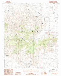
USGS Historical Quadrangle in GeoPDF.
Drilling-density cell maps show the number of wells that have been drilled into the storage assessment unit (SAU). Each 1-square-mile cell has a count for the number of unique well boreholes drilled into the SAU. For a given sedimentary basin, the USGS National Geologic CO2 Sequestration Assessment Project identifies SAUs containing the potential for storage and sequestration of carbon dioxide. Proprietary well header data from IHS ENERDEQ through 2010 were queried to determine which wells were drilled into specific SAUs. The coordinates of wells are proprietary and cannot be released; however, counts of the number of wells per square mile are presented in the well drilling density data layer.
This raster file represents classification and mapping results for priority area 1 of the Cody Region and Yellowstone National Park land cover remote sensing project. Extensive field collected reference data describing the range of plant communities and habitat types comprising the Bighorn Basin have been analyzed to produce a classification of land cover types based on the Wyoming Game and Fish Department (WGFD) Wildlife Observation System (WOS). Corresponding land cover classes were subsequently spatially modeled using a non-parametric Classification and Regression Tree (CART) algorithm that integrated both spectral data from Landsat Thematic Mapper satellite imagery and a variety of ancillary environmental data...
Categories: Data;
Types: Downloadable;
Tags: Absaroka,
Bighorn Basin,
Land Cover,
Land Use,
Landcover,
Cell maps for each oil and gas assessment unit were created by the USGS to illustrate the degree of exploration, type of production, and distribution of production in an assessment unit or province. Each cell represents a quarter-mile square of the land surface, and the cells were then coded to indicate whether the wells included within the cell are predominantly oil-producing, gas-producing, are both oil- and gas-producing, or are dry or the type of production is unknown. The well information was initially retrieved from the IHS Energy Group, PI/Dwights PLUS Well Data on CD-ROM, which is a proprietary, commercial database containing information for most oil and gas wells in the U.S. Cells were developed as a graphic...
Categories: Data,
pre-SM502.8;
Types: Downloadable,
Map Service,
OGC WFS Layer,
OGC WMS Layer,
Shapefile;
Tags: 503401 = Phosphoria,
50340101 = Paleozoic-Mesozoic Conventional Oil and Gas,
503402 = Cretaceous-Tertiary Composite,
50340201 = Cretaceous-Tertiary Conventional Oil and Gas,
50340261 = Muddy-Frontier Sandstone and Mowry Fractured Shale Continuous Gas,
In 2019 the U.S. Geological Survey (USGS) quantitively assessed the potential for undiscovered, technically recoverable continuous (unconventional) oil and gas resources in the Niobrara interval of the Cody Shale in the Bighorn Basin Province (Finn and others, 2019). Leading up to the assessment, in 2017, the USGS collected samples from the Niobrara and underlying Sage Breaks intervals (Finn, 2019) to better characterize the source rock potential of the Niobrara interval. Eighty-two samples from 31 wells were collected from the well cuttings collection stored at the USGS Core Research Center in Lakewood, Colorado. The selected wells are located near the outcrop belt along the shallow margins of the basin to obtain...
The Total Petroleum System is used in the National Assessment Project and incorporates the Assessment Unit, which is the fundamental geologic unit used for the assessment of undiscovered oil and gas resources. The Total Petroleum System is shown here as a geographic boundary defined and mapped by the geologist responsible for the province and incorporates not only the set of known or postulated oil and (or) gas accumulations, but also the geologic interpretation of the essential elements and processes within the petroleum system that relate to source, generation, migration, accumulation, and trapping of the discovered and undiscovered petroleum resource(s).
Categories: Data,
pre-SM502.8;
Types: Downloadable,
Map Service,
OGC WFS Layer,
OGC WMS Layer,
Shapefile;
Tags: 503401 = Phosphoria,
50340101 = Paleozoic-Mesozoic Conventional Oil and Gas,
503402 = Cretaceous-Tertiary Composite,
50340201 = Cretaceous-Tertiary Conventional Oil and Gas,
50340261 = Muddy-Frontier Sandstone and Mowry Fractured Shale Continuous Gas,
The late Paleocene and early Eocene megafossil floras in North America are found primarily in the Williston, Green River, Powder River, Bighorn, and Alberta Basins of the northern Rocky Mountains and Western Interior. A few rare sites occur in the Mississippi Embayment of the Southeast. In contrast to the abrupt floristic changes seen at the K/T boundary, these floras document a gradual transition in species turnover, or, in the case of the Bighorn Basin, a long-term decrease in taxonomic diversity. This gradual transition is also in marked contrast to the rapid speciation among mam- mals of the early Eocene. Both preservation, and ability to place these floras within a temporal scale, determine how use- ful they...
Categories: Publication;
Types: Citation,
Journal Citation;
Tags: Almont/Beicegel Creek flora,
Bighorn Basin,
Bulletin of Geosciences,
Fort Union Formation,
Golden Valley flora,
The USGS Central Region Energy Team assesses oil and gas resources of the United States. The onshore and State water areas of the United States comprise 71 provinces. Within these provinces, Total Petroleum Systems are defined and Assessment Units are defined and assessed. Each of these provinces is defined geologically, and most province boundaries are defined by major geologic changes. The Bighorn Basin Province is located in Wyoming and south central Montana. The main population centers within the study area are Cody and Thermopolis, Wyoming. The main highways, I-70 and I-90, generally traverse the area from north to south. The Bighorn River and its tributaries drain the area. The province boundary was drawn...
Categories: Data,
pre-SM502.8;
Types: Downloadable,
Map Service,
OGC WFS Layer,
OGC WMS Layer,
Shapefile;
Tags: 34 = Bighorn Basin,
503401 = Phosphoria,
50340101 = Paleozoic-Mesozoic Conventional Oil and Gas,
503402 = Cretaceous-Tertiary Composite,
50340201 = Cretaceous-Tertiary Conventional Oil and Gas,
The Assessment Unit is the fundamental unit used in the National Assessment Project for the assessment of undiscovered oil and gas resources. The Assessment Unit is defined within the context of the higher-level Total Petroleum System. The Assessment Unit is shown here as a geographic boundary interpreted, defined, and mapped by the geologist responsible for the province and incorporates a set of known or postulated oil and (or) gas accumulations sharing similar geologic, geographic, and temporal properties within the Total Petroleum System, such as source rock, timing, migration pathways, trapping mechanism, and hydrocarbon type. The Assessment Unit boundary is defined geologically as the limits of the geologic...
Categories: Data,
pre-SM502.8;
Types: Downloadable,
Map Service,
OGC WFS Layer,
OGC WMS Layer,
Shapefile;
Tags: 503401 = Phosphoria,
50340101 = Paleozoic-Mesozoic Conventional Oil and Gas,
503402 = Cretaceous-Tertiary Composite,
50340201 = Cretaceous-Tertiary Conventional Oil and Gas,
50340261 = Muddy-Frontier Sandstone and Mowry Fractured Shale Continuous Gas,
|

|
