Filters: Tags: Bill (X)
23 results (72ms)|
Filters
Date Range
Types Contacts Categories Tag Types Tag Schemes |
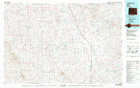
USGS Historical Quadrangle in GeoPDF.
Heinrichs Geoexploration Co. Maps: Don-Matilda Area, Sectional Data Sheet, Line No. 5; 1 in. to 500 feet; 32 x 21 in.
Heinrichs Geoexploration Co. Maps: Don-Matilda Area, Magnetic Contour and I.P. Survey; 1 in. to 500 feet; 37 x 28 in.
USGS Historical Quadrangle in GeoPDF.
USGS Historical Quadrangle in GeoPDF.
Fault features within the Bill, Wyoming 30' x 60' quadrangle. It is a digitized version of bedrock geology map series developed by the Wyoming Geological Survey. The information provides basic bedrock geologic information and features to include named and geologic map units based on the rock types present. It is a STATEMAP product. This dataset is available for purchase through the WSGS, Digital Product MS-72, http://sales.wsgs.uwyo.edu/catalog/advanced_search_result.php?keywords=MS-72
USGS Historical Quadrangle in GeoPDF.
Heinrichs Geoexploration Co. Maps: Clint-Scooter Claims, Don-Matilda Area, Bouger Gravity Survey; 1 in. to 500 feet; 19 x 17 in.
Heinrichs Geoexploration Co. Maps: Clint-Scooter Claims, Don-Matilda Area, Elevation Survey; 1 in. to 500 feet; 17 x 19 in.
Heinrichs Geoexploration Co. Maps: Don and Matilda Areas, Magnetic Profiles; 1 in. to 500 feet; 36 x 70 in.
Heinrichs Geoexploration Co. Maps: Don-Matilda Area, Sectional Data Sheet, Line No. 18; 1 in. to 1000 feet; 25 x 21 in.
Heinrichs Geoexploration Co. Maps: Matilda, Don, Etc. Area Work Sheet; 1 in. to 500 feet; 40 x 29 in.
Heinrichs Geoexploration Co. Maps: Don-Matilda Area, Sectional Data Sheet, Line No. 17; 1 in. to 1000 feet; 32 x 21 in.
Heinrichs Geoexploration Co. Maps: Don-Matilda Area, Sectional Data Sheet, Line No. 7; 1 in. to 500 feet; 32 x 21 in.
Heinrichs Geoexploration Co. Maps: Don-Matilda Area, Clint-Scooter Claims, Gravity Profiles; 1 in. to 500 feet; 23 x 40 in.
Heinrichs Geoexploration Co. Maps: Matilda, North Side, Pay Check Areas, Geophysical Location Map; 1 in. to 1000 feet; 35 x 40 in.
Heinrichs Geoexploration Co. Maps: Don-Matilda, Scooter Claim Area, Sectional Data Sheet, Line No. 6 A and B; 1 in. to 500 feet; 32 x 21 in.
Heinrichs Geoexploration Co. Maps: Don-Matilda Area, Bill and Finger Claims, Sectional Data Sheet, Line No. 8; 1 in. to 500 feet; 25 x 21 in.
USGS Historical Quadrangle in GeoPDF.
Heinrichs Geoexploration Co. Maps: Matilda, North Side, Pay Check Areas; 1 in. to 1000 feet; 35 x 28 in.
|

|
