Filters: Tags: Brush Creek (X)
19 results (108ms)|
Filters
Date Range
Extensions Types
Contacts
Categories Tag Types Tag Schemes |
This is a geochemical data set from the reanalysis of 44 rock samples collected between 1966 and 1970, and 107 sediment samples collected in 1966 and 1967. These samples were collected by the U.S. Geological Survey for a study investigating the mineral resources of the Idaho Primitive Area (Cater et al., 1973). The samples are from the Lower Middle Fork of the Salmon River, including the tributaries of Big Creek, Camas Creek, Brush Creek, Wilson Creek, Waterfall Creek, Ship Island Creek, Reese Creek, Stoddard Creek, and Papoose Creek. The overall objective of this study is to characterize the regional impact of legacy mining for the Frank Church River of No Return Wilderness Area. Mary P. Rossillon (1981) explored...
Categories: Data;
Tags: Annie Creek,
Atomic absorption analysis,
Atomic emission spectroscopy,
Beaver Creek,
Big Creek,
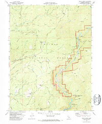
USGS Historical Quadrangle in GeoPDF.

USGS Historical Quadrangle in GeoPDF.
USGS Historical Quadrangle in GeoPDF.
Surface electrical resistivity tomography, magnetic, and gravity surveys were conducted in July 2017 in the greater East River Watershed near Crested Butte Colorado with a focused effort in Redwell Basin as part of a broader study of the role of bedrock groundwater in the hydrogeology of mineralized mountain watersheds. Approximately ten kilometers of total field magnetics data were acquired on July 29, 2017 with a Geometrics G-858 cesium vapor magnetometer that detects changes in deep (tens of meters to kilometers) geologic structure based on variations in the magnetic properties of different formations. This data release includes the raw and processed magnetics data. They are provided as digital data, and data...
Categories: Data;
Types: Downloadable,
Map Service,
OGC WFS Layer,
OGC WMS Layer,
Shapefile;
Tags: Brush Creek,
Colorado,
Crested Butte,
East River,
GGGSC,
Surface electrical resistivity tomography, magnetic, and gravity surveys were conducted in July 2017 in the greater East River Watershed near Crested Butte Colorado with a focused effort in Redwell Basin as part of a broader study of the role of bedrock groundwater in the hydrogeology of mineralized mountain watersheds. Ten gravity stations were acquired with a LaCoste and Romberg G-model relative gravimeter to map density variations. This data release includes principal facts for the gravity stations provided as digital data. Data fields are defined in the data dictionary.
Categories: Data;
Types: Downloadable,
Map Service,
OGC WFS Layer,
OGC WMS Layer,
OGC WMS Service,
Shapefile;
Tags: Brush Creek,
Colorado,
Crested Butte,
East River,
GGGSC,

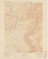
USGS Historical Quadrangle in GeoPDF.
USGS Historical Quadrangle in GeoPDF.
USGS Historical Quadrangle in GeoPDF.
These data were released prior to the October 1, 2016 effective date for the USGS’s policy dictating the review, approval, and release of scientific data as referenced in USGS Survey Manual Chapter 502.8 Fundamental Science Practices: Review and Approval of Scientific Data for Release. This vector data set delineates the approximate boundary of the Eagle River watershed valley-fill aquifer (ERWVFA). This data set was developed by a cooperative project between the U.S. Geological Survey, Eagle County, the Eagle River Water and Sanitation District, the Town of Eagle, the Town of Gypsum, and the Upper Eagle Regional Water Authority. This project was designed to evaluate potential land-development effects on groundwater...
These data were released prior to the October 1, 2016 effective date for the USGS’s policy dictating the review, approval, and release of scientific data as referenced in USGS Survey Manual Chapter 502.8 Fundamental Science Practices: Review and Approval of Scientific Data for Release. This raster data set delineates the predicted probability of elevated nitrate concentrations in groundwater in the Eagle River watershed valley-fill aquifer, Eagle County, North-Central Colorado, 2006-2007. This data set was developed by a cooperative project between the U.S. Geological Survey, Eagle County, the Eagle River Water and Sanitation District, the Town of Eagle, the Town of Gypsum, and the Upper Eagle Regional Water Authority....
Surface electrical resistivity tomography (ERT), time-domain electromagnetics (TEM), nuclear magnetic resonance (NMR), magnetics, and gravity data were acquired in 2016, 2017 and 2018 in the greater East River Watershed near Crested Butte Colorado with a focused effort in Redwell Basin. Five ERT profiles were acquired within Redwell Basin and Brush Creek to map geologic structure at depths up to 40 meters, depending on the subsurface resistivity, using the Advanced Geosciences, Inc. SuperSting R8 resistivity meter. Approximately ten kilometers of total field magnetics data were acquired with a Geometrics G-858 cesium vapor magnetometer that detects changes in deep (tens of meters to kilometers) geologic structure...
Categories: Data;
Types: Downloadable,
Map Service,
OGC WFS Layer,
OGC WMS Layer,
Shapefile;
Tags: Brush Creek,
Colorado,
Crested Butte,
East River,
Environmental Health,

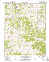
USGS Historical Quadrangle in GeoPDF.

USGS Historical Quadrangle in GeoPDF.

USGS Historical Quadrangle in GeoPDF.
These data were released prior to the October 1, 2016 effective date for the USGS’s policy dictating the review, approval, and release of scientific data as referenced in USGS Survey Manual Chapter 502.8 Fundamental Science Practices: Review and Approval of Scientific Data for Release. This raster data set delineates the predicted probability of elevated volatile organic compound (VOC) concentrations in groundwater in the Eagle River watershed valley-fill aquifer, Eagle County, North-Central Colorado, 2006-2007. This data set was developed by a cooperative project between the U.S. Geological Survey, Eagle County, the Eagle River Water and Sanitation District, the Town of Eagle, the Town of Gypsum, and the Upper...
These data were released prior to the October 1, 2016 effective date for the USGS’s policy dictating the review, approval, and release of scientific data as referenced in USGS Survey Manual Chapter 502.8 Fundamental Science Practices: Review and Approval of Scientific Data for Release. This raster data set delineates the predicted probability of unmixed young groundwater (defined using chlorofluorocarbon-11 concentrations and tritium activities) in groundwater in the Eagle River watershed valley-fill aquifer, Eagle County, North-Central Colorado, 2006-2007. This data set was developed by a cooperative project between the U.S. Geological Survey, Eagle County, the Eagle River Water and Sanitation District, the Town...

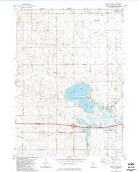
USGS Historical Quadrangle in GeoPDF.
Surface geophysical surveys were conducted from 2016 to 2018 in the greater East River Watershed near Crested Butte Colorado with a focused effort in Redwell Basin as part of a broader study of the role of bedrock groundwater in the hydrogeology of mineralized mountain watersheds. Five electrical resistivity tomography (ERT) profiles were acquired within Redwell Basin and Brush Creek to map geologic structure at depths up to 40 meters, depending on the subsurface resistivity, using the Advanced Geosciences, Inc. SuperSting R8 resistivity meter. This data release includes the raw and processed resistivity data as well as inverted resistivity models. All are provided as digital data, and data fields for each file...
Categories: Data;
Types: Downloadable,
Map Service,
OGC WFS Layer,
OGC WMS Layer,
Shapefile;
Tags: Brush Creek,
Colorado,
Crested Butte,
East River,
GGGSC,
|

|
