Filters
Date Range
Types
Contacts
Categories
Tag Types
Tag Schemes
|

ADMMR map collection: Gallagher Vanadium Area Geology and Assay Map Sheet 1 with Additions; 1 in. to 100 feet; 24 x 18 in.
Categories: Data;
Tags: Arizona,
Bradsher,
Buena Vista,
Cochise County,
Copper, Oxides, All tags...
Dataset,
Fairbank - 7.5 Min,
Gallagher Vanadium,
Gold, Lode,
Lead,
Silver,
Stella,
T20S R21E Sec 36 SE,
Tombstone Hills physiographic area,
Tombstone metallic mineral dist.,
United States,
Vanadium,
Vogel,
chemical analysis,
claim maps,
geochemistry,
geology,
geoscientificInformation,
maps and atlases,
mineral resources,
mining and quarrying,
natural resource exploration, Fewer tags

Heinrichs Geoexploration Co. Maps: Tombstone Project Land Status; 1 in. to 2000 feet; 36 x 24 in.
Categories: Data;
Tags: 1990s,
Arizona,
Bradsher,
Buena Vista,
Cochise County, All tags...
Cochise180,
Copper, Oxides,
Dataset,
Fairbank - 7.5 Min,
Gold, Lode,
Lead,
Silver,
Stella,
T20S R21E Sec 36 SE,
Tombstone Hills physiographic area,
Tombstone metallic mineral dist.,
United States,
Vanadium,
Vogel,
claim maps,
geoscientificInformation,
maps and atlases,
mineral resources, Fewer tags

ADMMR map collection: Gallagher Vanadium Area Geology and Assay Map Sheet 1; 1 in. to 100 feet; 21 x 18 in.
Categories: Data;
Tags: Arizona,
Bradsher,
Buena Vista,
Cochise County,
Copper, Oxides, All tags...
Dataset,
Fairbank - 7.5 Min,
Gallagher Vanadium,
Gold, Lode,
Lead,
Silver,
Stella,
T20S R21E Sec 36 SE,
Tombstone Hills physiographic area,
Tombstone metallic mineral dist.,
United States,
Vanadium,
Vogel,
chemical analysis,
claim maps,
geochemistry,
geology,
geoscientificInformation,
maps and atlases,
mineral resources,
mining and quarrying,
natural resource exploration, Fewer tags
Layered GeoPDF 7.5 Minute Quadrangle Map. Layers of geospatial data include orthoimagery, roads, grids, geographic names, elevation contours, hydrography, and other selected map features.
Tags: 7.5 x 7.5 minute,
Buena Vista,
Cherokee,
Downloadable Data,
EarthCover, All tags...
GeoPDF,
Imagery and Base Maps,
Iowa,
Map,
Peterson SW, IA,
Public Land Survey System,
U.S. National Grid,
US,
US Topo,
US Topo Historical,
United States,
boundary,
contour,
geographic names,
hydrography,
imageryBaseMapsEarthCover,
orthoimage,
structures,
topographic,
transportation,
woodland, Fewer tags
Layered GeoPDF 7.5 Minute Quadrangle Map. Layers of geospatial data include orthoimagery, roads, grids, geographic names, elevation contours, hydrography, and other selected map features.
Tags: 7.5 x 7.5 minute,
Buena Vista,
Downloadable Data,
EarthCover,
GeoPDF, All tags...
Imagery and Base Maps,
Iowa,
Map,
Public Land Survey System,
Sac,
Schaller North, IA,
U.S. National Grid,
US,
US Topo,
US Topo Historical,
United States,
boundary,
contour,
geographic names,
hydrography,
imageryBaseMapsEarthCover,
orthoimage,
structures,
topographic,
transportation,
woodland, Fewer tags
Layered GeoPDF 7.5 Minute Quadrangle Map. Layers of geospatial data include orthoimagery, roads, grids, geographic names, elevation contours, hydrography, and other selected map features.
Tags: 7.5 x 7.5 minute,
Buena Vista,
Downloadable Data,
EarthCover,
GeoPDF, All tags...
Imagery and Base Maps,
Iowa,
Map,
Public Land Survey System,
Rembrandt, IA,
U.S. National Grid,
US,
US Topo,
US Topo Historical,
United States,
boundary,
contour,
geographic names,
hydrography,
imageryBaseMapsEarthCover,
orthoimage,
structures,
topographic,
transportation,
woodland, Fewer tags

Layers of geospatial data include roads, airports, trails, and railroads.
Tags: Accomack,
Airport Complex,
Airport Point,
Airport Runway,
Airports, All tags...
Airstrips,
Albemarle,
Alexandria,
Alleghany,
Amelia,
Amherst,
Appomattox,
Arlington,
Augusta,
Bath,
Bedford,
Bland,
Botetourt,
Bristol,
Brunswick,
Buchanan,
Buckingham,
Buena Vista,
Campbell,
Caroline,
Carroll,
Charles City,
Charlotte,
Charlottesville,
Chesapeake,
Chesterfield,
Clarke,
Colonial Heights,
Covington,
Craig,
Culpeper,
Cumberland,
Danville,
Dickenson,
Dinwiddie,
Downloadable Data,
Emporia,
Essex,
Fairfax,
Falls Church,
Fauquier,
Floyd,
Fluvanna,
Franklin,
Frederick,
Fredericksburg,
Galax,
GeoPackage,
Geographic names,
Giles,
Gloucester,
Goochland,
Grayson,
Greene,
Greensville,
Halifax,
Hampton,
Hanover,
Harrisonburg,
Henrico,
Henry,
Highland,
Hopewell,
Isle of Wight,
James City,
King George,
King William,
King and Queen,
Lancaster,
Lee,
Lexington,
Loudoun,
Louisa,
Lunenburg,
Lynchburg,
Madison,
Manassas,
Manassas Park,
Martinsville,
Mathews,
Mecklenburg,
Middlesex,
Montgomery,
National Transportation Dataset (NTD),
National Transportation Dataset (NTD),
Nelson,
New Kent,
Newport News,
Norfolk,
Northampton,
Northumberland,
Norton,
Nottoway,
Open Geospatial Consortium GeoPackage 1.2,
Orange,
Page,
Patrick,
Petersburg,
Pittsylvania,
Poquoson,
Portsmouth,
Powhatan,
Prince Edward,
Prince George,
Prince William,
Pulaski,
Radford,
Railways,
Rappahannock,
Richmond,
Roads,
Roanoke,
Rockbridge,
Rockingham,
Russell,
Salem,
Scott,
Shenandoah,
Smyth,
Southampton,
Spotsylvania,
Stafford,
State,
State,
Staunton,
Suffolk,
Surry,
Sussex,
Tazewell,
Trail,
Trails,
Transportation,
Transportation,
US,
United States,
VA,
Virginia,
Virginia Beach,
Warren,
Washington,
Waterway,
Waynesboro,
Westmoreland,
Williamsburg,
Winchester,
Wise,
Wythe,
York,
transportation, Fewer tags

The Watershed Boundary Dataset (WBD) is a comprehensive aggregated collection of hydrologic unit data consistent with the national criteria for delineation and resolution. It defines the areal extent of surface water drainage to a point except in coastal or lake front areas where there could be multiple outlets as stated by the "Federal Standards and Procedures for the National Watershed Boundary Dataset (WBD)" "Standard" (https://pubs.usgs.gov/tm/11/a3/). Watershed boundaries are determined solely upon science-based hydrologic principles, not favoring any administrative boundaries or special projects, nor particular program or agency. This dataset represents the hydrologic unit boundaries to the 12-digit (6th level)...
Tags: 10-digit,
12-digit,
14-digit,
16-digit,
2-digit, All tags...
4-digit,
6-digit,
8-digit,
Adair,
Adams,
Albany,
Allen,
Anderson,
Andrew,
Antelope,
Appanoose,
Arapahoe,
Arthur,
Atchison,
Audrain,
Audubon,
Aurora,
Banner,
Barnes,
Barton,
Basin,
Bates,
Beadle,
Beaverhead,
Bennett,
Benton,
Big Horn,
Billings,
Blaine,
Bon Homme,
Boone,
Boulder,
Bourbon,
Bowman,
Box Butte,
Boyd,
Broadwater,
Brookings,
Broomfield,
Brown,
Brule,
Buchanan,
Buena Vista,
Buffalo,
Burke,
Burleigh,
Burt,
Butler,
Butte,
CO,
Caldwell,
Callaway,
Camden,
Campbell,
Carbon,
Carroll,
Carter,
Cascade,
Cass,
Cedar,
Chaffee,
Chariton,
Charles Mix,
Chase,
Cherokee,
Cherry,
Cheyenne,
Chouteau,
Christian,
Clark,
Clarke,
Clay,
Clear Creek,
Clinton,
Cloud,
Codington,
Coffey,
Cole,
Colfax,
Colorado,
Converse,
Cooper,
Corson,
Crawford,
Crook,
Cuming,
Custer,
Dade,
Dakota,
Dallas,
Daniels,
Daviess,
Davis,
Davison,
Dawes,
Dawson,
Day,
DeKalb,
Decatur,
Deer Lodge,
Dent,
Denver,
Deuel,
Dewey,
Dickey,
Dickinson,
Divide,
Dixon,
Dodge,
Doniphan,
Douglas,
Downloadable Data,
Dundy,
Dunn,
Eddy,
Edmunds,
El Paso,
Elbert,
Ellis,
Ellsworth,
Emmet,
Emmons,
Fall River,
Fallon,
Faulk,
Fergus,
Fillmore,
Flathead,
Foster,
Franklin,
Fremont,
Frontier,
Furnas,
Gage,
Gallatin,
Garden,
Garfield,
Gasconade,
Geary,
Gentry,
GeoPackage,
Gilpin,
Glacier,
Golden Valley,
Goshen,
Gosper,
Gove,
Graham,
Grand,
Granite,
Grant,
Greeley,
Greene,
Gregory,
Grundy,
Guthrie,
HU-2,
HU-2 Region,
HU2_10,
HUC,
Haakon,
Hall,
Hamilton,
Hamlin,
Hand,
Hanson,
Harding,
Harlan,
Harrison,
Hayes,
Henry,
Hettinger,
Hickory,
Hill,
Hitchcock,
Holt,
Hooker,
Hot Springs,
Howard,
Howell,
Hughes,
Hutchinson,
Hyde,
Hydrography,
Hydrologic Unit Code,
Hydrologic Units,
IA,
ID,
Ida,
Idaho,
Iowa,
Jackson,
Jefferson,
Jerauld,
Jewell,
Johnson,
Jones,
Judith Basin,
KS,
Kansas,
Kearney,
Keith,
Keya Paha,
Kidder,
Kimball,
Kingsbury,
Kit Carson,
Knox,
LaMoure,
Laclede,
Lafayette,
Lake,
Lancaster,
Lane,
Laramie,
Larimer,
Lawrence,
Leavenworth,
Lemhi,
Lewis and Clark,
Liberty,
Lincoln,
Linn,
Livingston,
Logan,
Loup,
Lucas,
Lyman,
Lyon,
MN,
MO,
MT,
Macon,
Madison,
Maries,
Marion,
Marshall,
McCone,
McCook,
McHenry,
McIntosh,
McKenzie,
McLean,
McPherson,
Meade,
Meagher,
Mellette,
Mercer,
Merrick,
Miami,
Miller,
Mills,
Miner,
Minnehaha,
Minnesota,
Missouri,
Mitchell,
Moniteau,
Monona,
Monroe,
Montana,
Montgomery,
Moody,
Morgan,
Morrill,
Morris,
Morton,
Mountrail,
Murray,
Musselshell,
ND,
NE,
Nance,
National Watershed Boundary Dataset (WBD),
National Watershed Boundary Dataset (WBD),
Natrona,
Nebraska,
Nemaha,
Ness,
Niobrara,
Nobles,
Nodaway,
North Dakota,
Norton,
Nuckolls,
O'Brien,
Oglala Lakota,
Oliver,
Open Geospatial Consortium GeoPackage 1.2,
Osage,
Osborne,
Osceola,
Otoe,
Ottawa,
Page,
Palo Alto,
Park,
Pawnee,
Pennington,
Perkins,
Petroleum,
Pettis,
Phelps,
Phillips,
Pierce,
Pipestone,
Platte,
Plymouth,
Polk,
Pondera,
Pottawatomie,
Pottawattamie,
Potter,
Powder River,
Powell,
Prairie,
Pulaski,
Putnam,
Randolph,
Ransom,
Ravalli,
Rawlins,
Ray,
Red Willow,
Region,
Republic,
Rice,
Richardson,
Richland,
Riley,
Ringgold,
Roberts,
Rock,
Rooks,
Roosevelt,
Rosebud,
Routt,
Rush,
Russell,
SD,
Sac,
Saline,
Sanborn,
Sargent,
Sarpy,
Saunders,
Schuyler,
Scott,
Scotts Bluff,
Sedgwick,
Seward,
Shawnee,
Shelby,
Sheridan,
Sherman,
Silver Bow,
Sioux,
Slope,
Smith,
South Dakota,
Spink,
St. Charles,
St. Clair,
St. Louis,
Stanley,
Stanton,
Stark,
Stillwater,
Stutsman,
Sub-basin,
Sub-region,
Sublette,
Subwatershed,
Sullivan,
Sully,
Summit,
Sweet Grass,
Sweetwater,
Taylor,
Teller,
Teton,
Texas,
Thayer,
Thomas,
Thurston,
Todd,
Toole,
Treasure,
Trego,
Tripp,
Turner,
US,
Union,
United States,
Valley,
Vernon,
WBD,
WY,
Wabaunsee,
Wallace,
Walworth,
Ward,
Warren,
Washakie,
Washington,
Watershed,
Watershed Boundary Dataset,
Wayne,
Webster,
Weld,
Wells,
Weston,
Wheatland,
Wheeler,
Wibaux,
Wichita,
Williams,
Woodbury,
Worth,
Wright,
Wyandotte,
Wyoming,
Yankton,
Yellowstone,
York,
Yuma,
Ziebach,
inlandWaters, Fewer tags
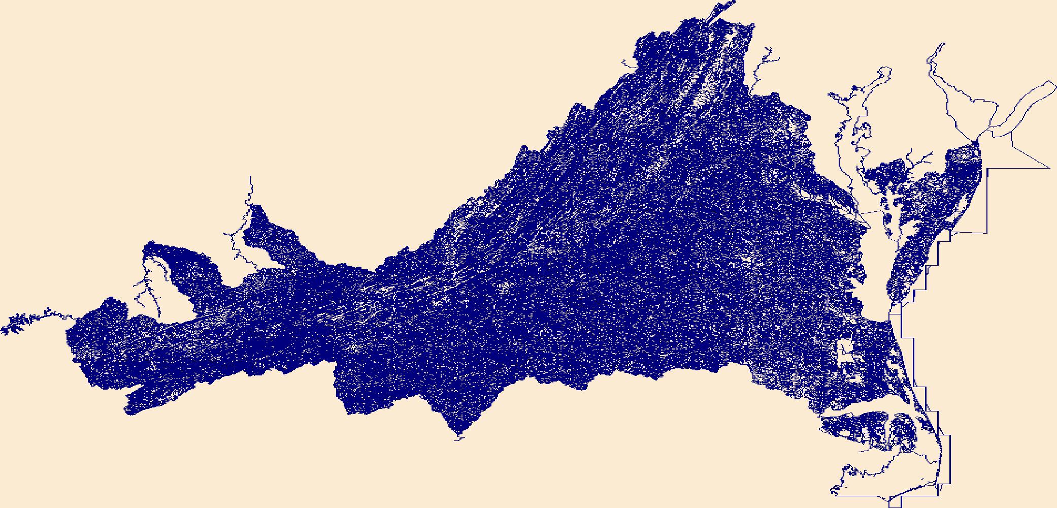
The National Hydrography Dataset (NHD) is a feature-based database that interconnects and uniquely identifies the stream segments or reaches that make up the nation's surface water drainage system. NHD data was originally developed at 1:100,000-scale and exists at that scale for the whole country. This high-resolution NHD, generally developed at 1:24,000/1:12,000 scale, adds detail to the original 1:100,000-scale NHD. (Data for Alaska, Puerto Rico and the Virgin Islands was developed at high-resolution, not 1:100,000 scale.) Local resolution NHD is being developed where partners and data exist. The NHD contains reach codes for networked features, flow direction, names, and centerline representations for areal water...
Tags: Accomack,
Administrative watershed units,
Administrative watershed units,
Albemarle,
Alexandria, All tags...
Alleghany,
Amelia,
Amherst,
Appomattox,
Area of Complex Channels,
Area to be submerged,
Arlington,
Augusta,
Basin,
Basin,
Bath,
Bay/Inlet,
Bedford,
Bland,
Botetourt,
Boundaries,
Boundary,
Bridge,
Bristol,
Brunswick,
Buchanan,
Buckingham,
Buena Vista,
Campbell,
Canal/Ditch,
Caroline,
Carroll,
Charles City,
Charlotte,
Charlottesville,
Chesapeake,
Chesterfield,
Clarke,
Coastline,
Colonial Heights,
Connector,
Covington,
Craig,
Culpeper,
Cumberland,
Dam/Weir,
Danville,
Dickenson,
Dinwiddie,
Downloadable Data,
Drainage areas for surface water,
Drainageway,
Emporia,
Esri Shapefile nan,
Essex,
Estuary,
Fairfax,
Falls Church,
Fauquier,
Flow direction network,
Floyd,
Flume,
Fluvanna,
ForeShore,
Franklin,
Frederick,
Fredericksburg,
Gaging Station,
Galax,
Gate,
Giles,
Gloucester,
Goochland,
Grayson,
Greene,
Greensville,
HU10,
HU12,
HU14,
HU16,
HU2,
HU4,
HU6,
HU8,
HUC,
Halifax,
Hampton,
Hanover,
Harrisonburg,
Hazard Zone,
Henrico,
Henry,
Highland,
Hopewell,
Hydrographic,
Hydrography,
Hydrography,
Hydrography,
Hydrologic Unit Code,
Hydrologic Units,
Ice mass,
Inundation Area,
Isle of Wight,
James City,
King George,
King William,
King and Queen,
Lancaster,
Lee,
Levee,
Lexington,
Line,
Lock Chamber,
Loudoun,
Louisa,
Lunenburg,
Lynchburg,
Madison,
Manassas,
Manassas Park,
Marsh,
Martinsville,
Mathews,
Mecklenburg,
Middlesex,
Montgomery,
National Hydrography Dataset (NHD),
National Hydrography Dataset (NHD) Best Resolution,
National Hydrography Dataset (NHD) Best Resolution,
Nelson,
New Kent,
Newport News,
Nonearthen Shore,
Norfolk,
Northampton,
Northumberland,
Norton,
Nottoway,
Orange,
Orthoimage,
Page,
Patrick,
Petersburg,
Pittsylvania,
Playa,
Point,
PointEvent,
Pond,
Poquoson,
Portsmouth,
Powhatan,
Prince Edward,
Prince George,
Prince William,
Pulaski,
Radford,
Rapids,
Rapids,
Rappahannock,
Reach,
Reach code,
Reef,
Region,
Reservoir,
Richmond,
Roanoke,
Rock,
Rockbridge,
Rockingham,
Russell,
Salem,
Scott,
Sea/Ocean,
Shapefile,
Shenandoah,
Sink/Rise,
Smyth,
Sounding Datum Line,
Southampton,
Special Use Zone,
Special Use Zone Limit,
Spillway,
Spotsylvania,
Stafford,
State,
State,
State_Virginia,
Staunton,
Stream,
Stream/River,
Sub-basin,
Sub-region,
Subbasin,
Submerged Stream,
Subregion,
Subwatershed,
Suffolk,
Surface water systems,
Surry,
Sussex,
Swamp,
Tazewell,
Topographic,
Tunnel,
US,
Underground Conduit,
United States,
VA,
Virginia,
Virginia Beach,
WBD,
WBD,
Wall,
Warren,
Wash,
Washington,
Water Intake Outflow,
Waterfall,
Watershed,
Watershed Boundaries,
Watershed Boundary Dataset,
Watershed Boundary Dataset,
Waynesboro,
Well,
Westmoreland,
Williamsburg,
Winchester,
Wise,
Wythe,
York,
artificial path,
boundaries,
dams,
drainage systems and characteristics,
inlandWaters,
lakes,
ngda,
rivers, Fewer tags
USGS Historical Quadrangle in GeoPDF.
Tags: 7.5 x 7.5 minute,
Buena Vista,
Downloadable Data,
GA,
GeoPDF, All tags...
GeoTIFF,
Historical Topographic Maps,
Historical Topographic Maps 7.5 x 7.5 Minute Map Series,
Map,
imageryBaseMapsEarthCover, Fewer tags
USGS Historical Quadrangle in GeoPDF.
Tags: 7.5 x 7.5 minute,
Buena Vista,
Downloadable Data,
GeoPDF,
GeoTIFF, All tags...
Historical Topographic Maps,
Historical Topographic Maps 7.5 x 7.5 Minute Map Series,
Map,
TN,
imageryBaseMapsEarthCover, Fewer tags
USGS Historical Quadrangle in GeoPDF.
Tags: 30 x 30 minute,
Buena Vista,
Downloadable Data,
GeoPDF,
GeoTIFF, All tags...
Historical Topographic Maps,
Historical Topographic Maps 30 x 30 Minute Map Series,
Map,
VA,
imageryBaseMapsEarthCover, Fewer tags
USGS Historical Quadrangle in GeoPDF.
Tags: 7.5 x 7.5 minute,
Buena Vista,
Downloadable Data,
GeoPDF,
GeoTIFF, All tags...
Historical Topographic Maps,
Historical Topographic Maps 7.5 x 7.5 Minute Map Series,
Map,
VA,
imageryBaseMapsEarthCover, Fewer tags
USGS Historical Quadrangle in GeoPDF.
Tags: 15 x 15 minute,
Buena Vista,
Downloadable Data,
GeoPDF,
GeoTIFF, All tags...
Historical Topographic Maps,
Historical Topographic Maps 15 x 15 Minute Map Series,
Map,
VA,
imageryBaseMapsEarthCover, Fewer tags

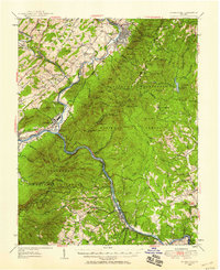
USGS Historical Quadrangle in GeoPDF.
Tags: 15 x 15 minute,
Buena Vista,
Downloadable Data,
GeoPDF,
GeoTIFF, All tags...
Historical Topographic Maps,
Historical Topographic Maps 15 x 15 Minute Map Series,
Map,
VA,
imageryBaseMapsEarthCover, Fewer tags
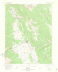
USGS Historical Quadrangle in GeoPDF.
Tags: 15 x 15 minute,
Buena Vista,
CO,
Downloadable Data,
GeoPDF, All tags...
GeoTIFF,
Historical Topographic Maps,
Historical Topographic Maps 15 x 15 Minute Map Series,
Map,
imageryBaseMapsEarthCover, Fewer tags
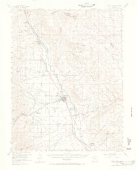
USGS Historical Quadrangle in GeoPDF.
Tags: 15 x 15 minute,
Buena Vista,
CO,
Downloadable Data,
GeoPDF, All tags...
GeoTIFF,
Historical Topographic Maps,
Historical Topographic Maps 15 x 15 Minute Map Series,
Map,
imageryBaseMapsEarthCover, Fewer tags
The National Hydrography Dataset (NHD) is a feature-based database that interconnects and uniquely identifies the stream segments or reaches that make up the nation's surface water drainage system. NHD data was originally developed at 1:100,000-scale and exists at that scale for the whole country. This high-resolution NHD, generally developed at 1:24,000/1:12,000 scale, adds detail to the original 1:100,000-scale NHD. (Data for Alaska, Puerto Rico and the Virgin Islands was developed at high-resolution, not 1:100,000 scale.) Local resolution NHD is being developed where partners and data exist. The NHD contains reach codes for networked features, flow direction, names, and centerline representations for areal water...
Tags: Administrative watershed units,
Administrative watershed units,
Area of Complex Channels,
Area to be submerged,
Basin, All tags...
Basin,
Bay/Inlet,
Boone,
Boundaries,
Boundary,
Bridge,
Buena Vista,
Calhoun,
Canal/Ditch,
Carroll,
Clay,
Coastline,
Connector,
Dallas,
Dam/Weir,
Downloadable Data,
Drainage areas for surface water,
Drainageway,
Esri Shapefile nan,
Estuary,
Flow direction network,
Flume,
ForeShore,
Gaging Station,
Gate,
Greene,
Guthrie,
HU-8,
HU-8 Subbasin,
HU10,
HU12,
HU14,
HU16,
HU2,
HU4,
HU6,
HU8,
HU8_07100006,
HUC,
Hazard Zone,
Hydrographic,
Hydrography,
Hydrography,
Hydrography,
Hydrologic Unit Code,
Hydrologic Units,
IA,
Ice mass,
Inundation Area,
Iowa,
Levee,
Line,
Lock Chamber,
Madison,
Marsh,
National Hydrography Dataset (NHD),
National Hydrography Dataset (NHD) Best Resolution,
National Hydrography Dataset (NHD) Best Resolution,
Nonearthen Shore,
Orthoimage,
Palo Alto,
Playa,
Pocahontas,
Point,
PointEvent,
Polk,
Pond,
Rapids,
Rapids,
Reach,
Reach code,
Reef,
Region,
Reservoir,
Rock,
Sac,
Sea/Ocean,
Shapefile,
Sink/Rise,
Sounding Datum Line,
Special Use Zone,
Special Use Zone Limit,
Spillway,
Stream,
Stream/River,
Sub-basin,
Sub-region,
Subbasin,
Submerged Stream,
Subregion,
Subwatershed,
Surface water systems,
Swamp,
Topographic,
Tunnel,
US,
Underground Conduit,
United States,
WBD,
WBD,
Wall,
Warren,
Wash,
Water Intake Outflow,
Waterfall,
Watershed,
Watershed Boundaries,
Watershed Boundary Dataset,
Watershed Boundary Dataset,
Webster,
Well,
artificial path,
boundaries,
dams,
drainage systems and characteristics,
inlandWaters,
lakes,
ngda,
rivers, Fewer tags

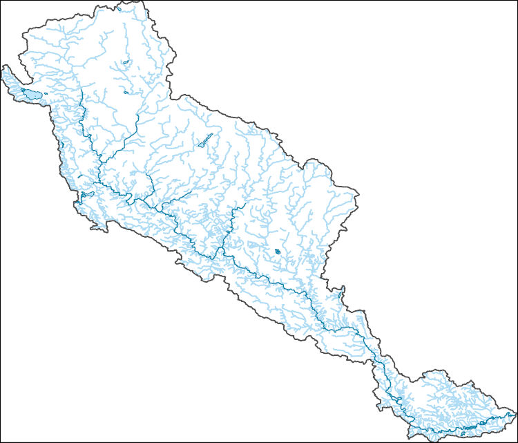
The National Hydrography Dataset (NHD) is a feature-based database that interconnects and uniquely identifies the stream segments or reaches that make up the nation's surface water drainage system. NHD data was originally developed at 1:100,000-scale and exists at that scale for the whole country. This high-resolution NHD, generally developed at 1:24,000/1:12,000 scale, adds detail to the original 1:100,000-scale NHD. (Data for Alaska, Puerto Rico and the Virgin Islands was developed at high-resolution, not 1:100,000 scale.) Local resolution NHD is being developed where partners and data exist. The NHD contains reach codes for networked features, flow direction, names, and centerline representations for areal water...
Tags: Administrative watershed units,
Administrative watershed units,
Area of Complex Channels,
Area to be submerged,
Basin, All tags...
Basin,
Bay/Inlet,
Boone,
Boundaries,
Boundary,
Bridge,
Buena Vista,
Calhoun,
Canal/Ditch,
Carroll,
Clay,
Coastline,
Connector,
Dallas,
Dam/Weir,
Downloadable Data,
Drainage areas for surface water,
Drainageway,
Estuary,
Flow direction network,
Flume,
ForeShore,
Gaging Station,
Gate,
GeoPackage,
Greene,
Guthrie,
HU-8,
HU-8 Subbasin,
HU10,
HU12,
HU14,
HU16,
HU2,
HU4,
HU6,
HU8,
HU8_07100006,
HUC,
Hazard Zone,
Hydrographic,
Hydrography,
Hydrography,
Hydrography,
Hydrologic Unit Code,
Hydrologic Units,
IA,
Ice mass,
Inundation Area,
Iowa,
Levee,
Line,
Lock Chamber,
Madison,
Marsh,
National Hydrography Dataset (NHD),
National Hydrography Dataset (NHD) Best Resolution,
National Hydrography Dataset (NHD) Best Resolution,
Nonearthen Shore,
Open Geospatial Consortium GeoPackage 1.2,
Orthoimage,
Palo Alto,
Playa,
Pocahontas,
Point,
PointEvent,
Polk,
Pond,
Rapids,
Rapids,
Reach,
Reach code,
Reef,
Region,
Reservoir,
Rock,
Sac,
Sea/Ocean,
Sink/Rise,
Sounding Datum Line,
Special Use Zone,
Special Use Zone Limit,
Spillway,
Stream,
Stream/River,
Sub-basin,
Sub-region,
Subbasin,
Submerged Stream,
Subregion,
Subwatershed,
Surface water systems,
Swamp,
Topographic,
Tunnel,
US,
Underground Conduit,
United States,
WBD,
WBD,
Wall,
Warren,
Wash,
Water Intake Outflow,
Waterfall,
Watershed,
Watershed Boundaries,
Watershed Boundary Dataset,
Watershed Boundary Dataset,
Webster,
Well,
artificial path,
boundaries,
dams,
drainage systems and characteristics,
inlandWaters,
lakes,
ngda,
rivers, Fewer tags

ADMMR map collection: Alto Mine Surface Geology; 1 in. to 200 feet; 11 x 8 in.
Categories: Data;
Tags: 1930s,
Alto Group,
Arizona,
B And R,
Buena Vista, All tags...
Copper,
Dataset,
El Plomo,
Excelsior,
Gold,
Gold Tree,
Lead,
Long Contact,
Mount Wrightson - 15 Min,
Salero metallic mineral dist.,
Santa Cruz County,
Santa Rita Mts. physiographic area,
Silver,
Stone,
T21S R14E Sec 21 S2,
United States,
Zinc,
geologic maps,
geoscientificInformation,
maps and atlases,
mineral resources,
mining and quarrying,
natural resource exploration, Fewer tags
|
|

