Filters
Date Range
Contacts
Categories
Tag Types
Tag Schemes
|
Core Research Center, core R612, from well operated by CALIFORNIA OILRaw Properties from download, web scrape, MapServer, and Macrostrat API{"Lib Num": "R612", "API Num": "4900105128", "Operator": "CALIFORNIA OIL", "Well Name": "5 WILSON", "Field": "QUEALY", "State": "WY", "County": "ALBANY", "Type": "FULL", "Photos": "F", "Thin Sec": "F", "Analysis": "F", "Latitude": "41.44246", "Longitude": "-105.98038", "coordinates_geohash": "9xkeu277y4mp", "Source": "FROM STATE RECORDS", "Security Flag": "NO SPECIAL RESTRICTIONS", "crc_collection_name": "core", "sb_parent_id": "4f4e49dae4b07f02db5e0486", "intervals": [{"Formation": "CHUGWATER", "Age": "TRIA", "Min Depth": "5248", "Max Depth": "5293"}, {"Formation": "TENSLEEP",...
Core Research Center, core T968, from well operated by OHIO O & GRaw Properties from download, web scrape, MapServer, and Macrostrat API{"Lib Num": "T968", "API Num": "4900306412", "Operator": "OHIO O & G", "Well Name": "1 BYRON UNION", "Field": "BYRON", "State": "WY", "County": "BIG HORN", "Type": "FULL", "Photos": "T", "Thin Sec": "F", "Analysis": "F", "Latitude": "44.82442", "Longitude": "-108.51151", "coordinates_geohash": "9xfz4b034t98", "Source": "FROM STATE RECORDS", "Security Flag": "NO SPECIAL RESTRICTIONS", "crc_collection_name": "core", "sb_parent_id": "4f4e49dae4b07f02db5e0486", "intervals": [{"Formation": "FRONTIER", "Age": "CRET", "Min Depth": "2295", "Max Depth": "2315"}, {"Formation": "FRONTIER",...
Categories: Physical Item;
Tags: CHUGWATER,
CHUGWATER,
CHUGWATER,
CHUGWATER,
CHUGWATER, All tags...
CRET,
CRET,
CRET,
CRET,
CRET,
CRET,
CRET,
CRET,
CRET,
CRET,
Campanian,
Cody Shale,
Cody Shale,
FRONTIER,
FRONTIER,
FRONTIER,
FRONTIER,
FRONTIER,
FRONTIER,
FRONTIER,
FRONTIER,
FRONTIER,
FRONTIER,
GYPSUM SPRINGS,
JURA,
PENN,
TENSLEEP,
TRIA,
TRIA,
TRIA,
TRIA,
TRIA,
sandstone,
shale,
siltstone, Fewer tags

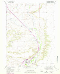
USGS Historical Quadrangle in GeoPDF.
Tags: 7.5 x 7.5 minute,
Chugwater,
Downloadable Data,
GeoPDF,
GeoTIFF, All tags...
Historical Topographic Maps,
Historical Topographic Maps 7.5 x 7.5 Minute Map Series,
Map,
WY,
imageryBaseMapsEarthCover, Fewer tags
Core Research Center, core S642, from well operated by CHEVRON OILRaw Properties from download, web scrape, MapServer, and Macrostrat API{"Lib Num": "S642", "API Num": "4900105175", "Operator": "CHEVRON OIL", "Well Name": "1 GEORGE GOVERNMENT", "Field": "JAMES LAKE", "State": "WY", "County": "ALBANY", "Type": "FULL", "Photos": "F", "Thin Sec": "F", "Analysis": "F", "Latitude": "41.47685", "Longitude": "-105.83232", "coordinates_geohash": "9xkezwxk0jnx", "Source": "FROM STATE RECORDS", "Security Flag": "NO SPECIAL RESTRICTIONS", "crc_collection_name": "core", "sb_parent_id": "4f4e49dae4b07f02db5e0486", "intervals": [{"Formation": "LAKOTA", "Age": "CRET", "Min Depth": "4542", "Max Depth": "4594"}, {"Formation": "SUNDANCE",...
Categories: Physical Item;
Tags: CASPER,
CHUGWATER,
CRET,
CRET,
CRET, All tags...
CRET,
FRONTIER,
Holocene and Pleistocene,
JURA,
JURA,
LAKOTA,
MUDDY,
Mixed alluvium and colluvium,
PENN,
PENN,
SHANNON,
SUNDANCE,
SUNDANCE,
TENSLEEP,
TRIA,
alluvium,
clay,
gravel,
sand,
silt, Fewer tags
Core Research Center, core S660, from well operated by CALIFORNIA OILRaw Properties from download, web scrape, MapServer, and Macrostrat API{"Lib Num": "S660", "API Num": "4900105153", "Operator": "CALIFORNIA OIL", "Well Name": "14 HOLST", "Field": "QUEALY", "State": "WY", "County": "ALBANY", "Type": "FULL", "Photos": "F", "Thin Sec": "F", "Analysis": "F", "Latitude": "41.44654", "Longitude": "-105.98536", "coordinates_geohash": "9xkeu1pgd559", "Source": "FROM STATE RECORDS", "Security Flag": "NO SPECIAL RESTRICTIONS", "crc_collection_name": "core", "sb_parent_id": "4f4e49dae4b07f02db5e0486", "intervals": [{"Formation": "TENSLEEP", "Age": "PENN", "Min Depth": "5530", "Max Depth": "5600"}, {"Formation": "CHUGWATER",...
Categories: Physical Item;
Tags: CHUGWATER,
PENN,
PENN,
Steele Shale,
Steele Shale, All tags...
TENSLEEP,
TENSLEEP,
TRIA,
Upper Cretaceous,
shale,
siltstone, Fewer tags
Core Research Center, core S024, from well operated by CALIFORNIA OILRaw Properties from download, web scrape, MapServer, and Macrostrat API{"Lib Num": "S024", "API Num": "4900105164", "Operator": "CALIFORNIA OIL", "Well Name": "3 SEVEN MILE", "Field": "SEVEN MILE", "State": "WY", "County": "ALBANY", "Type": "FULL", "Photos": "F", "Thin Sec": "F", "Analysis": "F", "Latitude": "41.45673", "Longitude": "-106.05423", "coordinates_geohash": "9xkefdvwvqd7", "Source": "FROM STATE RECORDS", "Security Flag": "NO SPECIAL RESTRICTIONS", "crc_collection_name": "core", "sb_parent_id": "4f4e49dae4b07f02db5e0486", "intervals": [{"Formation": "MORRISON", "Age": "JURA", "Min Depth": "6304", "Max Depth": "6335"}, {"Formation": "SUNDANCE",...
Categories: Physical Item;
Tags: CHUGWATER,
CRET,
CRET,
CRET,
CRET, All tags...
DAKOTA,
DAKOTA,
Gravel, pediment, and fan deposits,
JELM,
JURA,
JURA,
JURA,
JURA,
JURA,
LAKOTA,
MORRISON,
MORRISON,
PENN,
PENN,
Pleistocene - Holocene,
SHANNON,
SUNDANCE,
SUNDANCE,
SUNDANCE,
TENSLEEP,
TENSLEEP,
TRIA,
TRIA,
gravel, Fewer tags
Core Research Center, core F060, from well operated by MARATHON OILRaw Properties from download, web scrape, MapServer, and Macrostrat API{"Lib Num": "F060", "API Num": "4902920707", "Operator": "MARATHON OIL", "Well Name": "FRISBY-A-18", "Field": "OREGON BASIN N", "State": "WY", "County": "PARK", "Type": "SLABBED", "Photos": "T", "Thin Sec": "F", "Analysis": "F", "Latitude": "44.44167", "Longitude": "-108.90479", "coordinates_geohash": "9xfscf3gqrwz", "Source": "FROM STATE RECORDS", "Security Flag": "NO SPECIAL RESTRICTIONS", "crc_collection_name": "core", "sb_parent_id": "4f4e49dae4b07f02db5e0486", "intervals": [{"Formation": "CHUGWATER", "Age": "CRET", "Min Depth": "2540", "Max Depth": "2742"}], "crcwc_url":...
Core Research Center, core T882, from well operated by OHIO OILRaw Properties from download, web scrape, MapServer, and Macrostrat API{"Lib Num": "T882", "API Num": "4900705969", "Operator": "OHIO OIL", "Well Name": "3 UNIT", "Field": "BIG SANDY", "State": "WY", "County": "CARBON", "Type": "SLABBED", "Photos": "T", "Thin Sec": "F", "Analysis": "F", "Latitude": "42.23276", "Longitude": "-107.16178", "coordinates_geohash": "9xeb32pptt16", "Source": "FROM STATE RECORDS", "Security Flag": "NO SPECIAL RESTRICTIONS", "crc_collection_name": "core", "sb_parent_id": "4f4e49dae4b07f02db5e0486", "intervals": [{"Formation": "CLOVERLY", "Age": "CRET", "Min Depth": "1770", "Max Depth": "1789"}, {"Formation": "SUNDANCE", "Age":...
Categories: Physical Item;
Tags: CHUGWATER,
CLOVERLY,
CRET,
CRET,
CRET, All tags...
CRET,
CRET,
CRET,
FRONTIER,
FRONTIER,
MUDDY,
MUDDY,
MUDDY,
PENN,
PENN,
Pediment deposits,
Quaternary,
SUNDANCE,
SUNDANCE,
TENSLEEP,
TENSLEEP,
TRIA,
TRIA,
TRIA, Fewer tags
Core Research Center, core W122, from well operated by MARATHON OILRaw Properties from download, web scrape, MapServer, and Macrostrat API{"Lib Num": "W122", "API Num": "4902920838", "Operator": "MARATHON OIL", "Well Name": "79 KINNEY COASTAL", "Field": "GARLAND", "State": "WY", "County": "PARK", "Type": "SLABBED", "Photos": "F", "Thin Sec": "F", "Analysis": "F", "Latitude": "44.82159", "Longitude": "-108.62028", "coordinates_geohash": "9xfybr90sjby", "Source": "FROM STATE RECORDS", "Security Flag": "NO SPECIAL RESTRICTIONS", "crc_collection_name": "core", "sb_parent_id": "4f4e49dae4b07f02db5e0486", "intervals": [{"Formation": "CHUGWATER", "Age": "TRIA", "Min Depth": "5014", "Max Depth": "5067"}], "crcwc_url": "https://my.usgs.gov/crcwc/core/report/14700",...
Core Research Center, core T983, from well operated by OHIO OIL CORaw Properties from download, web scrape, MapServer, and Macrostrat API{"Lib Num": "T983", "API Num": "4901706269", "Operator": "OHIO OIL CO", "Well Name": "14T LU SHEEP", "Field": "GRASS CREEK", "State": "WY", "County": "HOT SPRINGS", "Type": "FULL - DISCONTINUOUS SEGMENTS", "Photos": "T", "Thin Sec": "F", "Analysis": "F", "Latitude": "43.94154", "Longitude": "-108.64938", "coordinates_geohash": "9xf9zx7fjby2", "Source": "FROM STATE RECORDS", "Security Flag": "NO SPECIAL RESTRICTIONS", "crc_collection_name": "core", "sb_parent_id": "4f4e49dae4b07f02db5e0486", "intervals": [{"Formation": "CHUGWATER", "Age": "TRIA", "Min Depth": "3155", "Max Depth":...
Categories: Physical Item;
Tags: CHUGWATER,
CURTIS,
Campanian,
Cody Shale,
Cody Shale, All tags...
JURA,
TRIA,
sandstone,
shale,
siltstone, Fewer tags
Core Research Center, core E521, from well operated by MOBIL OILRaw Properties from download, web scrape, MapServer, and Macrostrat API{"Lib Num": "E521", "API Num": "4900705565", "Operator": "MOBIL OIL", "Well Name": "F-14-4G UNIT", "Field": "CARBON", "State": "WY", "County": "CARBON", "Type": "SLABBED", "Photos": "F", "Thin Sec": "T", "Analysis": "T", "Latitude": "41.81464", "Longitude": "-106.30375", "coordinates_geohash": "9xkmuupgzjfg", "Source": "FROM STATE RECORDS", "Security Flag": "NO SPECIAL RESTRICTIONS", "crc_collection_name": "core", "sb_parent_id": "4f4e49dae4b07f02db5e0486", "intervals": [{"Formation": "QUEALY", "Age": "CRET", "Min Depth": "6304", "Max Depth": "6348"}, {"Formation": "SUNDANCE", "Age":...
Categories: Physical Item;
Tags: 602,
CHUGWATER,
CRET,
CRET,
JURA, All tags...
JURA,
JURA,
Late Cretaceous,
MUDDY,
MUDDY,
Medicine Bow Formation,
Medicine Bow Formation,
NUGGET,
PENN,
PENN,
QUEALY,
SUNDANCE,
SUNDANCE,
TENSLEEP,
TENSLEEP,
TRIA,
coal,
sandstone,
shale, Fewer tags

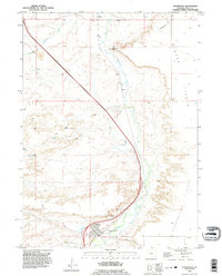
USGS Historical Quadrangle in GeoPDF.
Tags: 7.5 x 7.5 minute,
Chugwater,
Downloadable Data,
GeoPDF,
GeoTIFF, All tags...
Historical Topographic Maps,
Historical Topographic Maps 7.5 x 7.5 Minute Map Series,
Map,
WY,
imageryBaseMapsEarthCover, Fewer tags
Core Research Center, core E988, from well operated by CALIFORNIA OILRaw Properties from download, web scrape, MapServer, and Macrostrat API{"Lib Num": "E988", "API Num": "4900105146", "Operator": "CALIFORNIA OIL", "Well Name": "6 WILSON", "Field": "QUEALY", "State": "WY", "County": "ALBANY", "Type": "SLABBED", "Photos": "T", "Thin Sec": "F", "Analysis": "F", "Latitude": "41.44552", "Longitude": "-105.9814", "coordinates_geohash": "9xkeu2ftwkuk", "Source": "FROM STATE RECORDS", "Security Flag": "NO SPECIAL RESTRICTIONS", "crc_collection_name": "core", "sb_parent_id": "4f4e49dae4b07f02db5e0486", "intervals": [{"Formation": "CHUGWATER", "Age": "TRIA", "Min Depth": "5310", "Max Depth": "5336"}, {"Formation": "TENSLEEP",...
Categories: Physical Item;
Tags: CHUGWATER,
PENN,
PENN,
Steele Shale,
Steele Shale, All tags...
TENSLEEP,
TENSLEEP,
TRIA,
Upper Cretaceous,
shale,
siltstone, Fewer tags
Core Research Center, core S043, from well operated by BRITISH AMERICAN OILRaw Properties from download, web scrape, MapServer, and Macrostrat API{"Lib Num": "S043", "API Num": "4900705562", "Operator": "BRITISH AMERICAN OIL", "Well Name": "2 HORNE BROTHERS", "Field": "HORNE BROTHERS", "State": "WY", "County": "CARBON", "Type": "SLABBED", "Photos": "T", "Thin Sec": "F", "Analysis": "F", "Latitude": "41.79788", "Longitude": "-106.19303", "coordinates_geohash": "9xkmz90d719d", "Source": "FROM STATE RECORDS", "Security Flag": "NO SPECIAL RESTRICTIONS", "crc_collection_name": "core", "sb_parent_id": "4f4e49dae4b07f02db5e0486", "intervals": [{"Formation": "MORRISON", "Age": "JURA", "Min Depth": "6103", "Max Depth": "6169"},...
Categories: Physical Item;
Tags: CHUGWATER,
CHUGWATER,
JURA,
JURA,
Late Cretaceous, All tags...
MORRISON,
Mesaverde Formation,
Mesaverde Formation or Mesaverde Group,
PENN,
PENN,
SUNDANCE,
TENSLEEP,
TENSLEEP,
TRIA,
TRIA,
coal,
conglomerate,
sandstone,
shale, Fewer tags
Core Research Center, core A544, from well operated by TEXACO INCORPORATEDRaw Properties from download, web scrape, MapServer, and Macrostrat API{"Lib Num": "A544", "API Num": "4903706394", "Operator": "TEXACO INCORPORATED", "Well Name": "15 UNIT TABLE ROCK", "Field": "TABLE ROCK", "State": "WY", "County": "SWEETWATER", "Type": "CHIPS", "Photos": "T", "Thin Sec": "T", "Analysis": "T", "Latitude": "41.5611", "Longitude": "-108.42162", "coordinates_geohash": "9x6ukvcycnsd", "Source": "FROM STATE RECORDS", "Security Flag": "NO SPECIAL RESTRICTIONS", "crc_collection_name": "core", "sb_parent_id": "4f4e49dae4b07f02db5e0486", "intervals": [{"Formation": "WEBER", "Age": "PENN", "Min Depth": "17026", "Max Depth": "17204"},...
Categories: Physical Item;
Tags: CHUGWATER,
PENN,
PENN,
PERM,
PHOSPHORIA, All tags...
Paleocene - Eocene,
TRIA,
WEBER,
WEBER,
WEBER,
WEBER,
Wasatch Formation,
Wasatch Formation - Main Body,
claystone,
conglomerate,
siltstone, Fewer tags
Core Research Center, core S496, from well operated by CALIFORNIA OILRaw Properties from download, web scrape, MapServer, and Macrostrat API{"Lib Num": "S496", "API Num": "4900105135", "Operator": "CALIFORNIA OIL", "Well Name": "7 WILSON", "Field": "QUEALY", "State": "WY", "County": "ALBANY", "Type": "FULL", "Photos": "T", "Thin Sec": "F", "Analysis": "T", "Latitude": "41.43994", "Longitude": "-105.97998", "coordinates_geohash": "9xkesrgtpkxq", "Source": "FROM STATE RECORDS", "Security Flag": "NO SPECIAL RESTRICTIONS", "crc_collection_name": "core", "sb_parent_id": "4f4e49dae4b07f02db5e0486", "intervals": [{"Formation": "TENSLEEP", "Age": "TRIA", "Min Depth": "5376", "Max Depth": "5379"}, {"Formation": "TENSLEEP",...
Categories: Physical Item;
Tags: CHUGWATER,
CHUGWATER,
PENN,
PENN,
Steele Shale, All tags...
Steele Shale,
TENSLEEP,
TENSLEEP,
TENSLEEP,
TRIA,
TRIA,
TRIA,
Upper Cretaceous,
shale,
siltstone, Fewer tags
Core Research Center, core S658, from well operated by CALIFORNIA OILRaw Properties from download, web scrape, MapServer, and Macrostrat API{"Lib Num": "S658", "API Num": "4900105141", "Operator": "CALIFORNIA OIL", "Well Name": "2 HOLST", "Field": "QUEALY", "State": "WY", "County": "ALBANY", "Type": "FULL", "Photos": "F", "Thin Sec": "F", "Analysis": "F", "Latitude": "41.43761", "Longitude": "-105.97619", "coordinates_geohash": "9xkesrqrxf37", "Source": "FROM STATE RECORDS", "Security Flag": "NO SPECIAL RESTRICTIONS", "crc_collection_name": "core", "sb_parent_id": "4f4e49dae4b07f02db5e0486", "intervals": [{"Formation": "JELM", "Age": "TRIA", "Min Depth": "5111", "Max Depth": "5117"}, {"Formation": "EMBAR", "Age":...
Categories: Physical Item;
Tags: CHUGWATER,
CHUGWATER,
CHUGWATER,
CRET,
EMBAR, All tags...
EMBAR,
EMBAR,
EMBAR,
EMBAR,
EMBAR,
FRONTIER,
JELM,
JELM,
Lewis Shale,
Lewis Shale,
PERM,
PERM,
PERM,
PERM,
PERM,
PERM,
TRIA,
TRIA,
TRIA,
TRIA,
TRIA,
Upper Cretaceous,
sandstone,
shale,
siltstone, Fewer tags

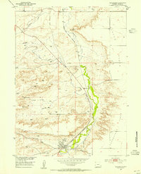
USGS Historical Quadrangle in GeoPDF.
Tags: 7.5 x 7.5 minute,
Chugwater,
Downloadable Data,
GeoPDF,
GeoTIFF, All tags...
Historical Topographic Maps,
Historical Topographic Maps 7.5 x 7.5 Minute Map Series,
Map,
WY,
imageryBaseMapsEarthCover, Fewer tags
Core Research Center, core T889, from well operated by OHIO OILRaw Properties from download, web scrape, MapServer, and Macrostrat API{"Lib Num": "T889", "API Num": "4901706076", "Operator": "OHIO OIL", "Well Name": "1 L U SHEEP CO", "Field": "ENOS CREEK", "State": "WY", "County": "HOT SPRINGS", "Type": "FULL", "Photos": "F", "Thin Sec": "F", "Analysis": "T", "Latitude": "43.92679", "Longitude": "-108.80814", "coordinates_geohash": "9xf9uh8k4e4k", "Source": "FROM STATE RECORDS", "Security Flag": "NO SPECIAL RESTRICTIONS", "crc_collection_name": "core", "sb_parent_id": "4f4e49dae4b07f02db5e0486", "intervals": [{"Formation": "CHUGWATER", "Age": "TRIA", "Min Depth": "5820", "Max Depth": "5824"}, {"Formation": "DINWOODY",...
Categories: Physical Item;
Tags: AMSDEN,
CHUGWATER,
CHUGWATER,
Campanian,
Cody Shale, All tags...
Cody Shale,
DINWOODY,
DINWOODY,
MADISON,
MADISON,
MADISON,
MISS,
MISS,
MISS,
PENN,
PENN,
PERM,
PERM,
PERM,
PHOSPHORIA,
PHOSPHORIA,
PHOSPHORIA,
TENSLEEP,
TRIA,
TRIA,
TRIA,
TRIA,
sandstone,
shale,
siltstone, Fewer tags
Core Research Center, core R586, from well operated by MOUNTAIN FUEL SUPPLYRaw Properties from download, web scrape, MapServer, and Macrostrat API{"Lib Num": "R586", "API Num": "4903705440", "Operator": "MOUNTAIN FUEL SUPPLY", "Well Name": "2 CR HETZLER", "Field": "BAXTER BASIN MID", "State": "WY", "County": "SWEETWATER", "Type": "FULL - DISCONTINUOUS SEGMENTS", "Photos": "T", "Thin Sec": "F", "Analysis": "F", "Latitude": "41.56071", "Longitude": "-109.06147", "coordinates_geohash": "9x6kqjzuetcu", "Source": "FROM STATE RECORDS", "Security Flag": "NO SPECIAL RESTRICTIONS", "crc_collection_name": "core", "sb_parent_id": "4f4e49dae4b07f02db5e0486", "intervals": [{"Formation": "ASPEN", "Age": null, "Min Depth": "2050",...
Categories: Physical Item;
Tags: ASPEN,
Alluvial deposits,
CHUGWATER,
CURTIS,
DAKOTA, All tags...
DINWOODY,
ENTRADA,
FRONTIER,
Holocene and Pleistocene,
JELM,
MORRISON,
NUGGET,
PHOSPHORIA,
TENSLEEP,
TWIN CREEK,
colluvium, Fewer tags
|
|