Filters: Tags: Calumet (X)
104 results (27ms)|
Filters
Date Range
Types Contacts
Categories Tag Types Tag Schemes |
ADMMR map collection: Old Reliable Mine Assay Map, 200 ft. Level; 1 in. to 40 feet; 11 x 16 in.
Categories: Data;
Tags: 1940s,
Amt International Mining,
Arizona,
Az. Mining Co. Of Bisbee,
Barium, Barite,
ADMMR map collection: Old Reliable Mine Assay Map, 100 ft. Level; 1 in. to 40 feet; 11 x 17 in.
Categories: Data;
Tags: 1940s,
Amt International Mining,
Arizona,
Az. Mining Co. Of Bisbee,
Barium, Barite,
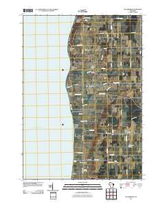
Layered GeoPDF 7.5 Minute Quadrangle Map. Layers of geospatial data include orthoimagery, roads, grids, geographic names, elevation contours, hydrography, and other selected map features.
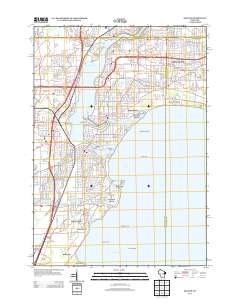
Layered GeoPDF 7.5 Minute Quadrangle Map. Layers of geospatial data include orthoimagery, roads, grids, geographic names, elevation contours, hydrography, and other selected map features.
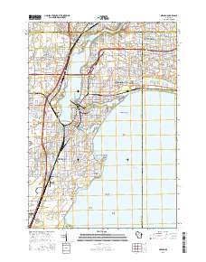
Layered geospatial PDF Map. Layers of geospatial data include orthoimagery, roads, grids, geographic names, elevation contours, hydrography, and other selected map features.
Layered GeoPDF 7.5 Minute Quadrangle Map. Layers of geospatial data include orthoimagery, roads, grids, geographic names, elevation contours, hydrography, and other selected map features.
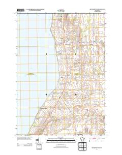
Layered GeoPDF 7.5 Minute Quadrangle Map. Layers of geospatial data include orthoimagery, roads, grids, geographic names, elevation contours, hydrography, and other selected map features.

USGS National Boundary Dataset (NBD) in Wisconsin State or Territory (published 20240215) GeoPackage
Geospatial data is comprised of government boundaries.

This data represents the map extent for current and historical USGS topographic maps for the United States and Territories, including 1 X 2 Degree, 1 X 1 Degree, 30 X 60 Minute, 15 X 15 Minute, 7.5 X 7.5 Minute, and 3.75 X 3.75 Minute. The grid was generated using ESRI ArcInfo GIS software.

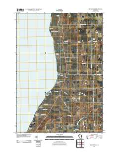
USGS Historical Quadrangle in GeoPDF.

USGS Historical Quadrangle in GeoPDF.
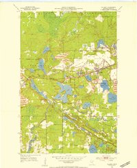
USGS Historical Quadrangle in GeoPDF.
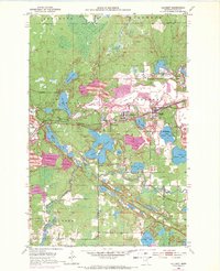
USGS Historical Quadrangle in GeoPDF.
ADMMR map collection: Old Reliable Mine Assay Map, 200 ft. Level; 1 in. to 40 feet; 12 x 16 in.
Categories: Data;
Tags: 1940s,
Amt International Mining,
Arizona,
Az. Mining Co. Of Bisbee,
Barium, Barite,
ADMMR map collection: Old Reliable Mine Cross-Sections; 1 in. to 20 feet; 30 x 24 in.
Categories: Data;
Tags: Amt International Mining,
Arizona,
Az. Mining Co. Of Bisbee,
Barium, Barite,
Bunker Hill metallic mineral dist.,
ADMMR map collection: Old Reliable Mine Assay Map, 100 ft. Level; 1 in. to 40 feet; 11 x 17 in.
Categories: Data;
Tags: 1940s,
Amt International Mining,
Arizona,
Az. Mining Co. Of Bisbee,
Barium, Barite,
ADMMR map collection: Old Reliable Copper Mine Devlopment on 200 Foot Level; 1 in. to 40 feet; 8 x 11 in.
Categories: Data;
Tags: 1940s,
Amt International Mining,
Arizona,
Az. Mining Co. Of Bisbee,
Barium, Barite,
ADMMR map collection: Old Reliable Mine Composite Map; 1 in. to 50 feet; 23 x 27 in.
Categories: Data;
Tags: Amt International Mining,
Arizona,
Az. Mining Co. Of Bisbee,
Barium, Barite,
Bunker Hill metallic mineral dist.,
ADMMR map collection: Old Reliable Mine Plan and Cross-Sections; 1 in. to 40 feet; 16 x 17 in.
Categories: Data;
Tags: Amt International Mining,
Arizona,
Az. Mining Co. Of Bisbee,
Barium, Barite,
Bunker Hill metallic mineral dist.,
The area of the Old Reliable mine with the mine above the automobile in the photograph.
Categories: Data;
Tags: 1950s,
Amt International Mining,
Arizona,
Az. Mining Co. Of Bisbee,
Bunker Hill metallic mineral dist.,
|

|
