Filters: Tags: Canada (X)
741 results (74ms)|
Filters
Date Range
Extensions Types Contacts
Categories
Tag Types
|
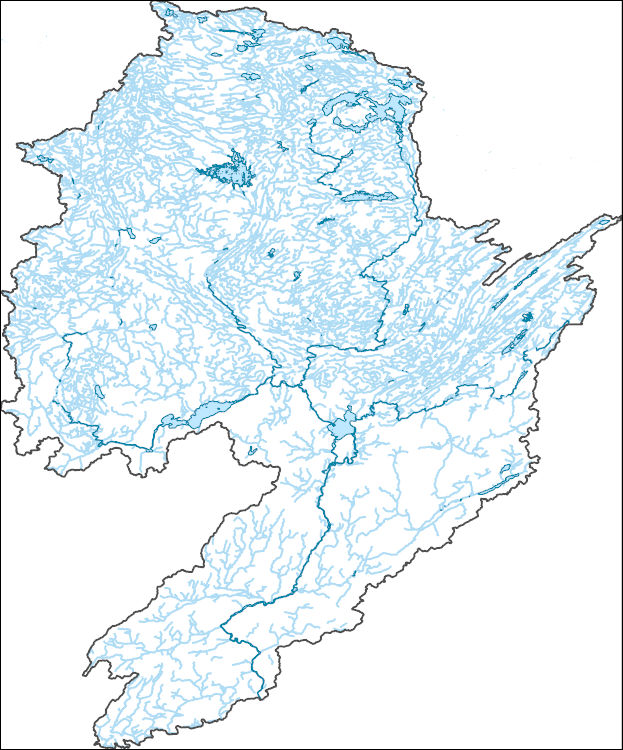
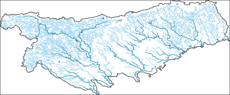
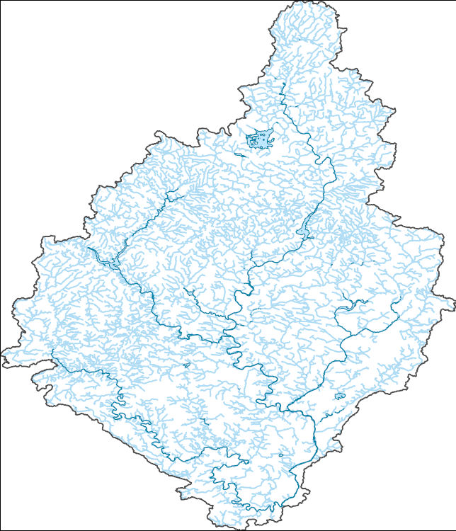
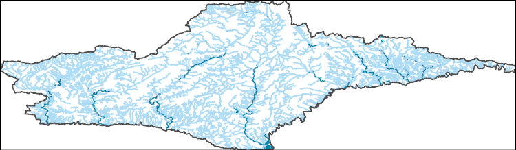
The National Hydrography Dataset (NHD) is a feature-based database that interconnects and uniquely identifies the stream segments or reaches that make up the nation's surface water drainage system. NHD data was originally developed at 1:100,000-scale and exists at that scale for the whole country. This high-resolution NHD, generally developed at 1:24,000/1:12,000 scale, adds detail to the original 1:100,000-scale NHD. (Data for Alaska, Puerto Rico and the Virgin Islands was developed at high-resolution, not 1:100,000 scale.) Local resolution NHD is being developed where partners and data exist. The NHD contains reach codes for networked features, flow direction, names, and centerline representations for areal water...
The National Hydrography Dataset (NHD) is a feature-based database that interconnects and uniquely identifies the stream segments or reaches that make up the nation's surface water drainage system. NHD data was originally developed at 1:100,000-scale and exists at that scale for the whole country. This high-resolution NHD, generally developed at 1:24,000/1:12,000 scale, adds detail to the original 1:100,000-scale NHD. (Data for Alaska, Puerto Rico and the Virgin Islands was developed at high-resolution, not 1:100,000 scale.) Local resolution NHD is being developed where partners and data exist. The NHD contains reach codes for networked features, flow direction, names, and centerline representations for areal water...
The National Hydrography Dataset (NHD) is a feature-based database that interconnects and uniquely identifies the stream segments or reaches that make up the nation's surface water drainage system. NHD data was originally developed at 1:100,000-scale and exists at that scale for the whole country. This high-resolution NHD, generally developed at 1:24,000/1:12,000 scale, adds detail to the original 1:100,000-scale NHD. (Data for Alaska, Puerto Rico and the Virgin Islands was developed at high-resolution, not 1:100,000 scale.) Local resolution NHD is being developed where partners and data exist. The NHD contains reach codes for networked features, flow direction, names, and centerline representations for areal water...
The National Hydrography Dataset (NHD) is a feature-based database that interconnects and uniquely identifies the stream segments or reaches that make up the nation's surface water drainage system. NHD data was originally developed at 1:100,000-scale and exists at that scale for the whole country. This high-resolution NHD, generally developed at 1:24,000/1:12,000 scale, adds detail to the original 1:100,000-scale NHD. (Data for Alaska, Puerto Rico and the Virgin Islands was developed at high-resolution, not 1:100,000 scale.) Local resolution NHD is being developed where partners and data exist. The NHD contains reach codes for networked features, flow direction, names, and centerline representations for areal water...
The National Hydrography Dataset (NHD) is a feature-based database that interconnects and uniquely identifies the stream segments or reaches that make up the nation's surface water drainage system. NHD data was originally developed at 1:100,000-scale and exists at that scale for the whole country. This high-resolution NHD, generally developed at 1:24,000/1:12,000 scale, adds detail to the original 1:100,000-scale NHD. (Data for Alaska, Puerto Rico and the Virgin Islands was developed at high-resolution, not 1:100,000 scale.) Local resolution NHD is being developed where partners and data exist. The NHD contains reach codes for networked features, flow direction, names, and centerline representations for areal water...
The National Hydrography Dataset (NHD) is a feature-based database that interconnects and uniquely identifies the stream segments or reaches that make up the nation's surface water drainage system. NHD data was originally developed at 1:100,000-scale and exists at that scale for the whole country. This high-resolution NHD, generally developed at 1:24,000/1:12,000 scale, adds detail to the original 1:100,000-scale NHD. (Data for Alaska, Puerto Rico and the Virgin Islands was developed at high-resolution, not 1:100,000 scale.) Local resolution NHD is being developed where partners and data exist. The NHD contains reach codes for networked features, flow direction, names, and centerline representations for areal water...
The National Hydrography Dataset (NHD) is a feature-based database that interconnects and uniquely identifies the stream segments or reaches that make up the nation's surface water drainage system. NHD data was originally developed at 1:100,000-scale and exists at that scale for the whole country. This high-resolution NHD, generally developed at 1:24,000/1:12,000 scale, adds detail to the original 1:100,000-scale NHD. (Data for Alaska, Puerto Rico and the Virgin Islands was developed at high-resolution, not 1:100,000 scale.) Local resolution NHD is being developed where partners and data exist. The NHD contains reach codes for networked features, flow direction, names, and centerline representations for areal water...
The National Hydrography Dataset (NHD) is a feature-based database that interconnects and uniquely identifies the stream segments or reaches that make up the nation's surface water drainage system. NHD data was originally developed at 1:100,000-scale and exists at that scale for the whole country. This high-resolution NHD, generally developed at 1:24,000/1:12,000 scale, adds detail to the original 1:100,000-scale NHD. (Data for Alaska, Puerto Rico and the Virgin Islands was developed at high-resolution, not 1:100,000 scale.) Local resolution NHD is being developed where partners and data exist. The NHD contains reach codes for networked features, flow direction, names, and centerline representations for areal water...
The National Hydrography Dataset (NHD) is a feature-based database that interconnects and uniquely identifies the stream segments or reaches that make up the nation's surface water drainage system. NHD data was originally developed at 1:100,000-scale and exists at that scale for the whole country. This high-resolution NHD, generally developed at 1:24,000/1:12,000 scale, adds detail to the original 1:100,000-scale NHD. (Data for Alaska, Puerto Rico and the Virgin Islands was developed at high-resolution, not 1:100,000 scale.) Local resolution NHD is being developed where partners and data exist. The NHD contains reach codes for networked features, flow direction, names, and centerline representations for areal water...
Canada. East side of Vancouver Island, British Columbia. 1899.
Canada. Glacial tongue of Grinnell ice cap calving off into Watts Bay on Baffin Island. August 21, 1984.
Corescan© Hyperspectral Core Imager Mark III (HCI-III) system data were acquired for hand samples, and subsequent billets made from the hand samples, collected during the U.S. Geological Survey (USGS) 2014, 2015, and 2016 field seasons in the Nabesna area of the eastern Alaska Range. This area contains exposed porphyry deposits and hand samples were collected throughout the region in support of the HyMap imaging spectrometer survey (https://doi.org/10.5066/F7DN435W) (Kokaly and others, 2017a). The HCI-III system consists of three different components. The first is an imaging spectrometer which collects reflectance data with a spatial resolution of approximately 500 nanometers (nm) for 514 spectral channels covering...
The NABat sampling frame is a grid-based finite-area frame spanning Canada, the United States, and Mexico consisting of N total number of 10- by 10-km (100-km2) grid cell sample units for the continental United States, Canada, and Alaska and 5- by 5-km (25km2) for Hawaii and Puerto Rico. This grain size is biologically appropriate given the scale of movement of most bat species, which routinely travel many kilometers each night between roosts and foraging areas and along foraging routes. A Generalized Random-Tessellation Stratified (GRTS) Survey Design draw was added to the sample units from the raw sampling grids (https://doi.org/10.5066/P9M00P17). This dataset represents the final 2018 NABat Sampling grid with...
Categories: Data;
Types: Downloadable,
Map Service,
OGC WFS Layer,
OGC WMS Layer,
Shapefile;
Tags: Alaska,
Canada,
Hawaii,
Mexico,
Puerto Rico,
This data release contains relevant datasets used in the analysis for the Chesapeake Bay stressor identification project, for which results are described in Fanelli and others (2022). For this project, two existing information sources were compiled and summarized to identify key in-stream stressors reported by the scientific literature or through regulatory assessments to be likely affecting benthic macroinvertebrate community metrics in the Chesapeake Bay region: 1) the peer reviewed multi-stressor literature, in which the effects multiple in-stream stressors on benthic macroinvertebrate community metrics are simultaneously assessed; and 2) reported causes of biological impairment as listed by state or district...
The NABat sampling frame is a grid-based finite-area frame spanning Canada, the United States, and Mexico consisting of N total number of 10- by 10-km (100-km2) grid cell sample units for the continental United States, Canada, and Alaska and 5- by 5-km (25km2) for Hawaii and Puerto Rico. This grain size is biologically appropriate given the scale of movement of most bat species, which routinely travel many kilometers each night between roosts and foraging areas and along foraging routes. A Generalized Random-Tessellation Stratified (GRTS) Survey Design draw was added to the sample units from the raw sampling grids (https://doi.org/10.5066/P9M00P17). This sampling design produces an ordered list of units such that...
The Critical Minerals in Archived Mine Samples Database (CMDB) contains chemistry and geologic information for historic ore and ore-related rock samples from mineral deposits in the United States. In addition, the database contains samples from archetypal deposits from 27 other countries in North America, South America, Asia, Africa and Europe. Samples were obtained from archived ore collections under the U.S. Geological Survey's project titled "Quick Assessment of Rare and Critical Metals in Ore Deposits: A National Assessment" (2008 to 2013) in an effort to begin an assessment of the Nations' previously mined ore deposits for critical minerals. Mineralized and altered rock samples were provided by the Colorado...
Categories: Data;
Types: ArcGIS REST Map Service,
ArcGIS Service Definition,
Downloadable,
Map Service,
OGC WFS Layer,
OGC WMS Layer,
Shapefile;
Tags: Alaska,
Argentina,
Arizona,
Arkansas,
Australia,
Canadian discrete water quality data and daily streamflow records were evaluated using the Weighted Regression on Time, Discharge, and Seasons (WRTDS) model implemented with the EGRET R package (Hirsch et al. 2010, Hirsch and De Cicco 2015). Models were used to estimate loads of solutes and evaluate trends for three constituents of interest (selenium, nitrate, and sulfate). Six models were generated; one model for each of the three constituents of interest, in each of the two major tributaries to Lake Koocanusa: the Kootenay River at Fenwick (BC08NG0009), and the Elk River above Highway 93 Near Elko (BC08NK0003). Data were obtained by downloading data from the British Columbia Water Tool (https://kwt.bcwatertool.ca/surface-water-quality,...
WHISPers stands for Wildlife Health Information Sharing Partnership - event reporting system. It is a web-based repository for sharing basic information about historic and ongoing wildlife mortality (death) and morbidity (illness) events. The system possesses a searchable archive of wildlife mortality and morbidity event data that is available to the public. The information is opportunistically collected and does not reflect all the mortality events that occur in North America.
Coalbed methane is one of the most important and valuable natural resources in the Western United States. The natural gas that results from CBM development is the cleanest burning fossil fuel, and the extensive domestic supply makes it a central element of the national goal of a secure supply of energy. Demand for natural gas will continue to grow and CBM will play an increasingly larger role in meeting that demand. CBM production has expanded tremendously over the past decade, and the rapidity with which development has expanded has resulted in stresses and tension in affected communities. Development of this important energy resource must be balanced with a number of other important goals of protecting water,...
Categories: Publication;
Types: Citation;
Tags: Canada,
Commentary,
Information,
considerations,
diamond,
The paper investigates whether the Clean Development Mechanism (CDM) under the Kyoto Protocol has played a significant role in the development of rural communities, specifically investigating uptake of small-scale renewable energy projects. The investigation involved an assessment of 500 registered small-scale CDM projects under the Kyoto Protocol in terms of their potential impact on the envisaged sustainable development goals for rural communities. Five case studies from the Indian subcontinent were also examined. The paper concludes that the CDM in its current state and design has typically failed to deliver the promised benefits with regard to development objectives in rural areas. Successful projects were found...
|

|
