Filters: Tags: Crested Butte (X)
33 results (67ms)|
Filters
Date Range
Extensions Types
Contacts
Categories Tag Types
|
This U.S. Geological Survey (USGS) data release provides whole rock major, minor, and trace element geochemical data from the fluorine-rich Mount Emmons-Redwell porphyry molybdenum (Climax-type) deposit (Mt. Emmons-Redwell deposit), located approximately 5.6 km (3.5 mi) northwest of Crested Butte, Colorado. The Mt. Emmons-Redwell deposit partly underlies Redwell Basin on the northwest flank of Mount Emmons in the west-central region of the Colorado Mineral Belt. Mineralization of the Mt. Emmons-Redwell deposit occurs at depth as vein, veinlet, stockwork, and fracture-hosted Climax-type mineralization [308 Mt at 0.32% Mo (Galey, 1978; Guarnera and Anderson, 2007)], and is associated with the Mt. Emmons igneous complex....
Categories: Data;
Types: Downloadable,
Map Service,
OGC WFS Layer,
OGC WMS Layer,
Shapefile;
Tags: <1GB,
Climax-type deposit,
Colorado,
Colorado Mineral Belt,
Crested Butte,
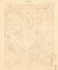
USGS Historical Quadrangle in GeoPDF.
These are shapefiles and coverages of final unioned polygon coverages used to calculate coal resources of the Cameo/Fairfield coal group east of 107 deg 15' longitude, and the Cameo/Wheeler, South Canyon, and Coal Ridge coal zones west of 107 deg 15' longitude in the southern Piceance Basin, northwestern Colorado. Pscbfing was used for the area east of 107 deg 15' longitude; pscwfing was used for the Cameo/Wheeler coal zone; psscfing was used for the South Canyon coal zone; pscrfing was used for the Coal Ridge coal zone. Polygons that make up the final unioned polygons include counties, 7.5' quadrangles, townships, surface and coal ownership, reliability, and, overburden. The final unioned coverage for each coal...
Categories: Data,
pre-SM502.8;
Types: Downloadable,
Map Service,
OGC WFS Layer,
OGC WMS Layer,
Shapefile;
Tags: Colorado,
Colorado Plateau,
Colorado Plateau,
Crested Butte,
National Coal Resource Assessment (NCRA),
This data release consists of 1,984 line-kilometers of airborne electromagnetic (AEM), magnetic data and radiometric data collected from October to November 2017 in the upper East River and surrounding watersheds in central Colorado. The U.S. Geological Survey contracted Geotech Ltd. to acquire these data as part of regional investigations into the geologic structure and hydrologic framework of the area. The AEM data have been inverted to produce a series of regional cross-sections that constrain the electrical properties of the subsurface to a depth of ~500m. Data were acquired using the VTEM ET time-domain helicopter-borne electromagnetic system along flight lines that cross important geological structures over...
Categories: Data;
Types: Downloadable,
Map Service,
OGC WFS Layer,
OGC WMS Layer,
OGC WMS Service,
Shapefile;
Tags: Colorado,
Crested Butte,
East River,
GGGSC,
Geology, Geophysics, and Geochemistry Science Center,
USGS Historical Quadrangle in GeoPDF.
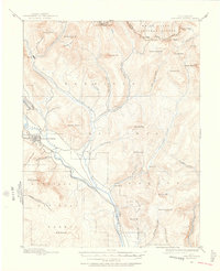
USGS Historical Quadrangle in GeoPDF.
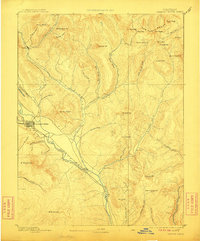
USGS Historical Quadrangle in GeoPDF.
Boreholes were drilled in 2017 and 2018 in Redwell Basin, a headwater catchment underlain by mineralized and hydrothermally altered sedimentary rock in the Elk Mountains near the town of Crested Butte, Colorado. Site locations and drilling procedures are documented under the main page of this data release. Borehole geophysical data were collected in boreholes MW1, MW1UZ, and MW2.1 as open holes prior to well construction. Logging was performed by a combination of USGS and Mount Sopris Instruments (MW1) and University of Wyoming (MW1UZ and MW2.1) staff. Log types vary by well on the basis of available equipment, site limitations, and borehole conditions. In borehole MW1, log types include fluid temperature and conductivity,...
Types: Map Service,
OGC WFS Layer,
OGC WMS Layer,
OGC WMS Service;
Tags: Colorado,
Crested Butte,
Cretaceous,
Elk Mountains,
GGGSC,
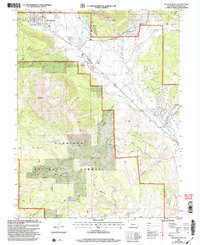
USGS Historical Quadrangle in GeoPDF.
USGS Historical Quadrangle in GeoPDF.

USGS Historical Quadrangle in GeoPDF.
Surface electrical resistivity tomography, magnetic, and gravity surveys were conducted in July 2017 in the greater East River Watershed near Crested Butte Colorado with a focused effort in Redwell Basin as part of a broader study of the role of bedrock groundwater in the hydrogeology of mineralized mountain watersheds. Approximately ten kilometers of total field magnetics data were acquired on July 29, 2017 with a Geometrics G-858 cesium vapor magnetometer that detects changes in deep (tens of meters to kilometers) geologic structure based on variations in the magnetic properties of different formations. This data release includes the raw and processed magnetics data. They are provided as digital data, and data...
Categories: Data;
Types: Downloadable,
Map Service,
OGC WFS Layer,
OGC WMS Layer,
Shapefile;
Tags: Brush Creek,
Colorado,
Crested Butte,
East River,
GGGSC,
Four boreholes (MW1, MW1UZ, MW2, MW2.1) were drilled in the fall of 2017 and summer of 2018 in upper Redwell Basin, a headwater catchment underlain by hydrothermally altered sedimentary rock in the Elk Mountains near the town of Crested Butte, Colorado. The boreholes were continuously cored using a wireline HQ-sized coring system and sample a combination of Quaternary-aged surficial colluvium and the Cretaceous-aged Mesaverde Formation. In-situ injection-based hydraulic tests were performed in MW1 and MW2 during drilling while advancing using a single-packer apparatus in tandem with an in-line flow meter and interval pressure monitoring. Borehole geophysical logging was performed in MW1, MW1UZ, and MW2.1 in the...
Categories: Data;
Types: Downloadable,
Map Service,
OGC WFS Layer,
OGC WMS Layer,
OGC WMS Service,
Shapefile;
Tags: Colorado,
Crested Butte,
Cretaceous,
Elk Mountains,
GGGSC,
This dataset contains environmental tracer data from surface water and groundwater samples collected by the U.S. Geological Survey in Redwell Basin, an alpine watershed in the Elk Mountains near the town of Crested Butte, Colorado. The basin is underlain by interbedded shale and sandstone that have been variably hydrothermally altered and silicified by local magmatic intrusions. Samples were collected from 2017 to 2019 from bedrock monitoring wells completed at multiple depths, shallow hand-installed piezometers and mini boreholes, springs, mine adits, and streams. The tracer data include stable isotopes of water (oxygen-18 and deuterium), tritium, dissolved noble gases (He, Ne, Ar, Kr, Xe, and helium-3/helium-4...
Categories: Data;
Types: Downloadable,
Map Service,
OGC WFS Layer,
OGC WMS Layer,
Shapefile;
Tags: Colorado,
Crested Butte,
Elk Mountains,
Environmental Health,
GGGSC,
Surface electrical resistivity tomography, magnetic, and gravity surveys were conducted in July 2017 in the greater East River Watershed near Crested Butte Colorado with a focused effort in Redwell Basin as part of a broader study of the role of bedrock groundwater in the hydrogeology of mineralized mountain watersheds. Ten gravity stations were acquired with a LaCoste and Romberg G-model relative gravimeter to map density variations. This data release includes principal facts for the gravity stations provided as digital data. Data fields are defined in the data dictionary.
Categories: Data;
Types: Downloadable,
Map Service,
OGC WFS Layer,
OGC WMS Layer,
OGC WMS Service,
Shapefile;
Tags: Brush Creek,
Colorado,
Crested Butte,
East River,
GGGSC,
Surface electrical resistivity tomography (ERT), time-domain electromagnetics (TEM), nuclear magnetic resonance (NMR), magnetics, and gravity data were acquired in 2016, 2017 and 2018 in the greater East River Watershed near Crested Butte Colorado with a focused effort in Redwell Basin. Five ERT profiles were acquired within Redwell Basin and Brush Creek to map geologic structure at depths up to 40 meters, depending on the subsurface resistivity, using the Advanced Geosciences, Inc. SuperSting R8 resistivity meter. Approximately ten kilometers of total field magnetics data were acquired with a Geometrics G-858 cesium vapor magnetometer that detects changes in deep (tens of meters to kilometers) geologic structure...
Categories: Data;
Types: Downloadable,
Map Service,
OGC WFS Layer,
OGC WMS Layer,
Shapefile;
Tags: Brush Creek,
Colorado,
Crested Butte,
East River,
Environmental Health,
This data release consists of 1,984 line-kilometers of airborne electromagnetic (AEM), magnetic data and radiometric data collected from October to November 2017 in the upper East River and surrounding watersheds in central Colorado. The U.S. Geological Survey contracted Geotech Ltd. to acquire these data as part of regional investigations into the geologic structure and hydrologic framework of the area. The AEM data have been inverted to produce a series of regional cross-sections that constrain the electrical properties of the subsurface to a depth of ~500m. Data were acquired using the VTEM ET time-domain helicopter-borne electromagnetic system along flight lines that cross important geological structures over...
Categories: Data;
Types: Map Service,
OGC WFS Layer,
OGC WMS Layer,
OGC WMS Service;
Tags: Colorado,
Crested Butte,
East River,
GGGSC,
Geology, Geophysics, and Geochemistry Science Center,
Boreholes were drilled in 2017 and 2018 in Redwell Basin, a headwater catchment underlain by hydrothermally altered sedimentary rock in the Elk Mountains near the town of Crested Butte, Colorado. Two boreholes were completed as vertically discrete nested monitoring wells (MW1 as MW1A-MW1D and MW2.1 as MW2.1A-MW2.1C) and one borehole was completed as a single monitoring well (MW2 as RP8). Site locations and well construction are documented under the main page of this data release. Absolute (non-vented) pressure and temperature data loggers (PTDs) were deployed in these wells to monitor groundwater levels and fluid temperature over time. The period of record covers August 2018-September 2019 for all wells; the period...
Categories: Data;
Types: Map Service,
OGC WFS Layer,
OGC WMS Layer,
OGC WMS Service;
Tags: Colorado,
Crested Butte,
Cretaceous,
Elk Mountains,
GGGSC,
The data set includes temperature data from the base of the water column along the sediment interface of the East River near Crested Butte Colorado, USA, in support of ongoing study regarding groundwater/surface water exchange. The data were collected from 08/09/2016 to 08/31/2016 using a fiber-optic distributed temperature sensing system that has 1.01 m spatial resolution along the linear fiber-optic cable. During data analysis, the original 10 min measurments were averaged (arithmetic mean) for the entire period to potentially indicate colder groundwater inflows. Additionally, the standard devation for the entire measurement period for each distance along the cable was calculated to indicate buffered zones (reduced...
|

|
