Filters: Tags: Daniels Creek (X)
4 results (10ms)|
Filters
Date Range
Contacts
Tag Types Tag Schemes
|
This publication, GPR 2017-1, provides geophysical data produced from an airborne geophysical survey conducted in 2001 and released in 2002 for 276 sq miles of the Liberty Bell area, western Bonnifield mining district, central Alaska. Aeromagnetic and electromagnetic data were acquired during the survey. During 2016, the same digital data were reformatted for ease of use with modern processing tools; vector shapefiles and the analytic signal and calculated first vertical derivative grids were added. Other than the creation of calculated grids, no new processing was done. Data provided in GPR 2017-1 include processed (1) linedata ASCII databases, (2) gridded files of magnetic and resistivity data, (3) vector files...
Aerial photographs of the coastline from Nome to Elim were collected on August 23, 2015. The photographs were processed using Structure-from-Motion (SfM) photogrammetric techniques. Global Positioning System (GPS) checkpoints were collected via a Global Navigation Satellite System (GNSS) survey conducted between August 15 and September 14, 2015. For the purposes of open access to elevation and orthoimagery datasets in coastal regions of Alaska, this collection is being released as a Raw Data File with an open end-user license. This file is a single-band, 32-bit float DSM (digital surface model) which represents surface elevations of buildings, vegetation, and uncovered ground surfaces in meters with 20 cm GSD. The...
Aerial photographs of the coastline from Nome to Elim were collected on August 23, 2015. The photographs were processed using Structure-from-Motion (SfM) photogrammetric techniques. Global Positioning System (GPS) checkpoints were collected via a Global Navigation Satellite System (GNSS) survey conducted between August 15 and September 14, 2015. For the purposes of open access to elevation and orthoimagery datasets in coastal regions of Alaska, this collection is being released as a Raw Data File with an open end-user license. Orthoimages contain 4-band, 8-bit, unsigned raster data (red/green/blue/no data; file format-GeoTIFF; source-Fairbanks Fodar) with 20 cm GSD. No-data values are found in band 4 or shown as...
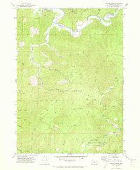
USGS Historical Quadrangle in GeoPDF.
|

|
