Filters
Date Range
Types
Contacts
Categories
Tag Types
Tag Schemes
|
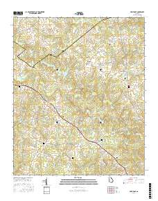
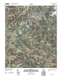
Layered geospatial PDF Map. Layers of geospatial data include orthoimagery, roads, grids, geographic names, elevation contours, hydrography, and other selected map features.
Tags: 7.5 x 7.5 minute,
Dewy Rose, GA,
Downloadable Data,
EarthCover,
Elbert, All tags...
GeoPDF,
Georgia,
Hart,
Imagery and Base Maps,
Map,
Public Land Survey System,
U.S. National Grid,
US,
US Topo,
US Topo Historical,
United States,
boundary,
contour,
geographic names,
hydrography,
imageryBaseMapsEarthCover,
orthoimage,
structures,
topographic,
transportation,
woodland, Fewer tags
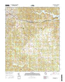
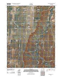
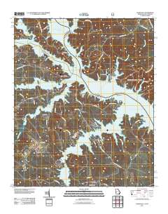
Layered geospatial PDF Map. Layers of geospatial data include orthoimagery, roads, grids, geographic names, elevation contours, hydrography, and other selected map features.
Tags: 7.5 x 7.5 minute,
Downloadable Data,
EarthCover,
Elbert,
Elberton East, GA, All tags...
GeoPDF,
Georgia,
Imagery and Base Maps,
Map,
Public Land Survey System,
U.S. National Grid,
US,
US Topo,
US Topo Historical,
United States,
boundary,
contour,
geographic names,
hydrography,
imageryBaseMapsEarthCover,
orthoimage,
structures,
topographic,
transportation,
woodland, Fewer tags
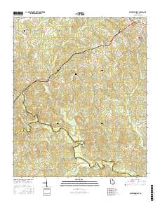
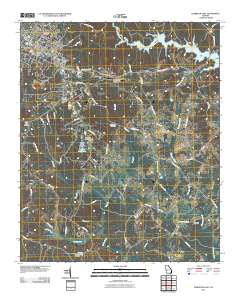
Layered geospatial PDF Map. Layers of geospatial data include orthoimagery, roads, grids, geographic names, elevation contours, hydrography, and other selected map features.
Tags: 7.5 x 7.5 minute,
Downloadable Data,
EarthCover,
Elbert,
Elberton West, GA, All tags...
GeoPDF,
Georgia,
Imagery and Base Maps,
Madison,
Map,
Oglethorpe,
Public Land Survey System,
U.S. National Grid,
US,
US Topo,
US Topo Historical,
United States,
boundary,
contour,
geographic names,
hydrography,
imageryBaseMapsEarthCover,
orthoimage,
structures,
topographic,
transportation,
woodland, Fewer tags
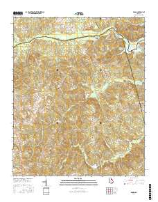
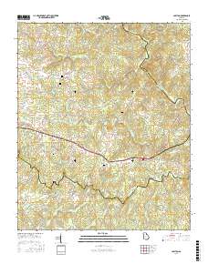
Layered geospatial PDF Map. Layers of geospatial data include orthoimagery, roads, grids, geographic names, elevation contours, hydrography, and other selected map features.
Tags: 7.5 x 7.5 minute,
Broad, GA,
Downloadable Data,
EarthCover,
Elbert, All tags...
GeoPDF,
Georgia,
Imagery and Base Maps,
Lincoln,
Map,
Public Land Survey System,
U.S. National Grid,
US,
US Topo,
US Topo Historical,
United States,
Wilkes,
boundary,
contour,
geographic names,
hydrography,
imageryBaseMapsEarthCover,
orthoimage,
structures,
topographic,
transportation,
woodland, Fewer tags
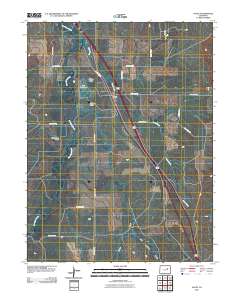
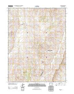
Layered GeoPDF 7.5 Minute Quadrangle Map. Layers of geospatial data include orthoimagery, roads, grids, geographic names, elevation contours, hydrography, and other selected map features.
Tags: 7.5 x 7.5 minute,
Downloadable Data,
EarthCover,
Elbert,
GeoPDF, All tags...
Georgia,
Hart,
Hartwell, GA,
Imagery and Base Maps,
Map,
U.S. National Grid,
US,
US Topo,
US Topo Historical,
United States,
contour,
geographic names,
hydrography,
imageryBaseMapsEarthCover,
orthoimage,
topographic,
transportation, Fewer tags
Layered geospatial PDF Map. Layers of geospatial data include orthoimagery, roads, grids, geographic names, elevation contours, hydrography, and other selected map features.
Tags: 7.5 x 7.5 minute,
Colorado,
Downloadable Data,
EarthCover,
Elbert, All tags...
GeoPDF,
Imagery and Base Maps,
Lake, CO,
Lincoln,
Map,
Public Land Survey System,
U.S. National Grid,
US,
US Topo,
US Topo Historical,
United States,
boundary,
contour,
geographic names,
hydrography,
imageryBaseMapsEarthCover,
orthoimage,
structures,
topographic,
transportation,
woodland, Fewer tags
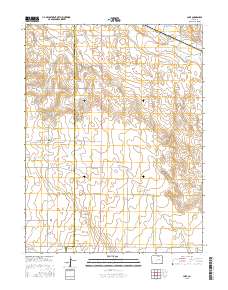
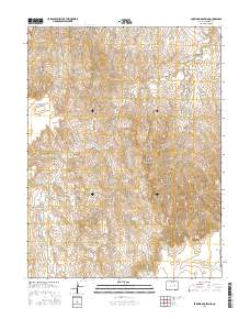
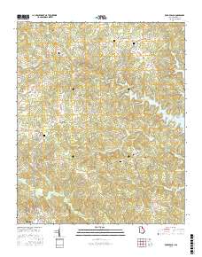
Layered GeoPDF 7.5 Minute Quadrangle Map. Layers of geospatial data include orthoimagery, roads, grids, geographic names, elevation contours, hydrography, and other selected map features.
Tags: 7.5 x 7.5 minute,
Barking Dog Spring, CO,
Colorado,
Downloadable Data,
EarthCover, All tags...
Elbert,
GeoPDF,
Imagery and Base Maps,
Map,
U.S. National Grid,
US,
US Topo,
US Topo Historical,
United States,
contour,
geographic names,
hydrography,
imageryBaseMapsEarthCover,
orthoimage,
topographic,
transportation, Fewer tags
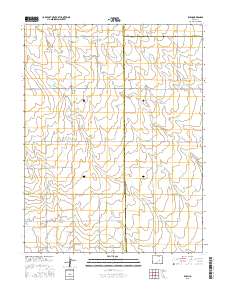
Layered GeoPDF 7.5 Minute Quadrangle Map. Layers of geospatial data include orthoimagery, roads, grids, geographic names, elevation contours, hydrography, and other selected map features.
Tags: 7.5 x 7.5 minute,
Beuck Draw, CO,
Colorado,
Downloadable Data,
EarthCover, All tags...
Elbert,
GeoPDF,
Imagery and Base Maps,
Map,
U.S. National Grid,
US,
US Topo,
US Topo Historical,
United States,
contour,
geographic names,
hydrography,
imageryBaseMapsEarthCover,
orthoimage,
topographic,
transportation, Fewer tags
Layered geospatial PDF Map. Layers of geospatial data include orthoimagery, roads, grids, geographic names, elevation contours, hydrography, and other selected map features.
Tags: 7.5 x 7.5 minute,
Barking Dog Spring, CO,
Colorado,
Downloadable Data,
EarthCover, All tags...
Elbert,
GeoPDF,
Imagery and Base Maps,
Map,
Public Land Survey System,
U.S. National Grid,
US,
US Topo,
US Topo Historical,
United States,
boundary,
contour,
geographic names,
hydrography,
imageryBaseMapsEarthCover,
orthoimage,
structures,
topographic,
transportation,
woodland, Fewer tags
Layered GeoPDF 7.5 Minute Quadrangle Map. Layers of geospatial data include orthoimagery, roads, grids, geographic names, elevation contours, hydrography, and other selected map features.
Tags: 7.5 x 7.5 minute,
Agate, CO,
Colorado,
Downloadable Data,
EarthCover, All tags...
Elbert,
GeoPDF,
Imagery and Base Maps,
Map,
U.S. National Grid,
US,
US Topo,
US Topo Historical,
United States,
contour,
geographic names,
hydrography,
imageryBaseMapsEarthCover,
orthoimage,
topographic,
transportation, Fewer tags
Layered GeoPDF 7.5 Minute Quadrangle Map. Layers of geospatial data include orthoimagery, roads, grids, geographic names, elevation contours, hydrography, and other selected map features.
Tags: 7.5 x 7.5 minute,
Arapahoe,
Colorado,
Downloadable Data,
EarthCover, All tags...
Elbert,
GeoPDF,
Imagery and Base Maps,
Map,
Strasburg SE, CO,
U.S. National Grid,
US,
US Topo,
US Topo Historical,
United States,
contour,
geographic names,
hydrography,
imageryBaseMapsEarthCover,
orthoimage,
topographic,
transportation, Fewer tags
Layered geospatial PDF Map. Layers of geospatial data include orthoimagery, roads, grids, geographic names, elevation contours, hydrography, and other selected map features.
Tags: 7.5 x 7.5 minute,
Colorado,
Downloadable Data,
EarthCover,
El Paso, All tags...
Elbert,
GeoPDF,
Imagery and Base Maps,
Lincoln,
Map,
Public Land Survey System,
Rush, CO,
U.S. National Grid,
US,
US Topo,
US Topo Historical,
United States,
boundary,
contour,
geographic names,
hydrography,
imageryBaseMapsEarthCover,
orthoimage,
structures,
topographic,
transportation,
woodland, Fewer tags
Layered GeoPDF 7.5 Minute Quadrangle Map. Layers of geospatial data include orthoimagery, roads, grids, geographic names, elevation contours, hydrography, and other selected map features.
Tags: 7.5 x 7.5 minute,
Cabin Gulch, CO,
Colorado,
Downloadable Data,
EarthCover, All tags...
Elbert,
GeoPDF,
Imagery and Base Maps,
Map,
U.S. National Grid,
US,
US Topo,
US Topo Historical,
United States,
contour,
geographic names,
hydrography,
imageryBaseMapsEarthCover,
orthoimage,
topographic,
transportation, Fewer tags
Layered GeoPDF 7.5 Minute Quadrangle Map. Layers of geospatial data include orthoimagery, roads, grids, geographic names, elevation contours, hydrography, and other selected map features.
Tags: 7.5 x 7.5 minute,
Chennault, GA-SC,
Downloadable Data,
EarthCover,
Elbert, All tags...
GeoPDF,
Georgia,
Imagery and Base Maps,
Lincoln,
Map,
McCormick,
South Carolina,
U.S. National Grid,
US,
US Topo,
US Topo Historical,
United States,
Wilkes,
contour,
geographic names,
hydrography,
imageryBaseMapsEarthCover,
orthoimage,
structures,
topographic,
transportation, Fewer tags
Layered GeoPDF 7.5 Minute Quadrangle Map. Layers of geospatial data include orthoimagery, roads, grids, geographic names, elevation contours, hydrography, and other selected map features.
Tags: 7.5 x 7.5 minute,
Downloadable Data,
EarthCover,
Elbert,
Elberton East, GA, All tags...
GeoPDF,
Georgia,
Imagery and Base Maps,
Map,
U.S. National Grid,
US,
US Topo,
US Topo Historical,
United States,
contour,
geographic names,
hydrography,
imageryBaseMapsEarthCover,
orthoimage,
topographic,
transportation, Fewer tags
Layered geospatial PDF Map. Layers of geospatial data include orthoimagery, roads, grids, geographic names, elevation contours, hydrography, and other selected map features.
Tags: 7.5 x 7.5 minute,
Carlton, GA,
Downloadable Data,
EarthCover,
Elbert, All tags...
GeoPDF,
Georgia,
Imagery and Base Maps,
Madison,
Map,
Oglethorpe,
Public Land Survey System,
U.S. National Grid,
US,
US Topo,
US Topo Historical,
United States,
boundary,
contour,
geographic names,
hydrography,
imageryBaseMapsEarthCover,
orthoimage,
structures,
topographic,
transportation,
woodland, Fewer tags
Layered GeoPDF 7.5 Minute Quadrangle Map. Layers of geospatial data include orthoimagery, roads, grids, geographic names, elevation contours, hydrography, and other selected map features.
Tags: 7.5 x 7.5 minute,
Colorado,
Downloadable Data,
EarthCover,
Elbert, All tags...
GeoPDF,
Imagery and Base Maps,
Kiowa, CO,
Map,
Public Land Survey System,
U.S. National Grid,
US,
US Topo,
US Topo Historical,
United States,
boundary,
contour,
geographic names,
hydrography,
imageryBaseMapsEarthCover,
orthoimage,
structures,
topographic,
transportation,
woodland, Fewer tags
Layered geospatial PDF Map. Layers of geospatial data include orthoimagery, roads, grids, geographic names, elevation contours, hydrography, and other selected map features.
Tags: 7.5 x 7.5 minute,
Downloadable Data,
EarthCover,
Elbert,
GeoPDF, All tags...
Georgia,
Imagery and Base Maps,
Map,
Public Land Survey System,
Rock Branch, GA,
U.S. National Grid,
US,
US Topo,
US Topo Historical,
United States,
boundary,
contour,
geographic names,
hydrography,
imageryBaseMapsEarthCover,
orthoimage,
structures,
topographic,
transportation,
woodland, Fewer tags

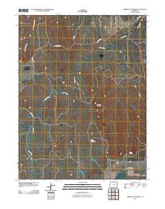
The Watershed Boundary Dataset (WBD) is a comprehensive aggregated collection of hydrologic unit data consistent with the national criteria for delineation and resolution. It defines the areal extent of surface water drainage to a point except in coastal or lake front areas where there could be multiple outlets as stated by the "Federal Standards and Procedures for the National Watershed Boundary Dataset (WBD)" "Standard" (https://pubs.usgs.gov/tm/11/a3/). Watershed boundaries are determined solely upon science-based hydrologic principles, not favoring any administrative boundaries or special projects, nor particular program or agency. This dataset represents the hydrologic unit boundaries to the 12-digit (6th level)...
Tags: 10-digit,
12-digit,
14-digit,
16-digit,
2-digit, All tags...
4-digit,
6-digit,
8-digit,
AL,
Abbeville,
Aiken,
Alabama,
Alachua,
Alamance,
Alexander,
Alleghany,
Allendale,
Anderson,
Anson,
Appling,
Appomattox,
Ashe,
Atkinson,
Attala,
Autauga,
Avery,
Bacon,
Baker,
Baldwin,
Bamberg,
Banks,
Barbour,
Barnwell,
Barrow,
Bartow,
Basin,
Bay,
Beaufort,
Bedford,
Ben Hill,
Berkeley,
Berrien,
Bertie,
Bibb,
Bladen,
Bleckley,
Blount,
Botetourt,
Bradford,
Bradley,
Brantley,
Brevard,
Brooks,
Broward,
Brunswick,
Bryan,
Bulloch,
Bullock,
Buncombe,
Burke,
Butler,
Butts,
Cabarrus,
Caldwell,
Calhoun,
Camden,
Campbell,
Candler,
Carroll,
Carteret,
Caswell,
Catawba,
Chambers,
Charleston,
Charlotte,
Charlton,
Chatham,
Chattahoochee,
Chattooga,
Cherokee,
Chesapeake,
Chester,
Chesterfield,
Chickasaw,
Chilton,
Choctaw,
Chowan,
Citrus,
Clarendon,
Clarke,
Clay,
Clayton,
Cleburne,
Cleveland,
Clinch,
Cobb,
Coffee,
Colleton,
Collier,
Colquitt,
Columbia,
Columbus,
Conecuh,
Cook,
Coosa,
Copiah,
Covington,
Coweta,
Craig,
Craven,
Crawford,
Crenshaw,
Crisp,
Cullman,
Cumberland,
Currituck,
Dade,
Dale,
Dallas,
Danville,
Dare,
Darlington,
Davidson,
Davie,
Dawson,
DeKalb,
DeSoto,
Decatur,
Dillon,
Dinwiddie,
Dixie,
Dodge,
Dooly,
Dorchester,
Dougherty,
Douglas,
Downloadable Data,
Duplin,
Durham,
Duval,
Early,
Echols,
Edgecombe,
Edgefield,
Effingham,
Elbert,
Elmore,
Emanuel,
Emporia,
Escambia,
Esri File GeoDatabase 10,
Etowah,
Evans,
FL,
Fairfield,
Fannin,
Fayette,
FileGDB,
Flagler,
Florence,
Florida,
Floyd,
Forrest,
Forsyth,
Franklin,
Fulton,
GA,
Gadsden,
Gaston,
Gates,
Geneva,
George,
Georgetown,
Georgia,
Gilchrist,
Gilmer,
Glades,
Glascock,
Glynn,
Gordon,
Grady,
Granville,
Grayson,
Greene,
Greensville,
Greenville,
Greenwood,
Guilford,
Gulf,
Gwinnett,
HU-2,
HU-2 Region,
HU2_03,
HUC,
Habersham,
Hale,
Halifax,
Hall,
Hamilton,
Hampton,
Hancock,
Haralson,
Hardee,
Harnett,
Harris,
Harrison,
Hart,
Heard,
Henderson,
Hendry,
Henry,
Hernando,
Hertford,
Highlands,
Hillsborough,
Hinds,
Hoke,
Holmes,
Horry,
Houston,
Hyde,
Hydrography,
Hydrologic Unit Code,
Hydrologic Units,
Indian River,
Iredell,
Irwin,
Isle of Wight,
Itawamba,
Jackson,
Jasper,
Jeff Davis,
Jefferson,
Jefferson Davis,
Jenkins,
Johnson,
Johnston,
Jones,
Kemper,
Kershaw,
LA,
Lafayette,
Lake,
Lamar,
Lancaster,
Lanier,
Lauderdale,
Laurens,
Lawrence,
Leake,
Lee,
Lenoir,
Leon,
Levy,
Lexington,
Liberty,
Lincoln,
Long,
Louisiana,
Lowndes,
Lumpkin,
Lunenburg,
MS,
Macon,
Madison,
Manatee,
Marengo,
Marion,
Marlboro,
Marshall,
Martin,
Martinsville,
McCormick,
McDowell,
McDuffie,
McIntosh,
Mecklenburg,
Meriwether,
Miami-Dade,
Miller,
Mississippi,
Mitchell,
Mobile,
Monroe,
Montgomery,
Moore,
Morgan,
Murray,
Muscogee,
NC,
Nash,
Nassau,
National Watershed Boundary Dataset (WBD),
National Watershed Boundary Dataset (WBD),
Neshoba,
New Hanover,
Newberry,
Newton,
North Carolina,
Northampton,
Nottoway,
Noxubee,
Oconee,
Oglethorpe,
Okaloosa,
Okeechobee,
Oktibbeha,
Onslow,
Orange,
Orangeburg,
Osceola,
Palm Beach,
Pamlico,
Pasco,
Pasquotank,
Patrick,
Paulding,
Peach,
Pearl River,
Pender,
Perquimans,
Perry,
Person,
Petersburg,
Pickens,
Pierce,
Pike,
Pinellas,
Pitt,
Pittsylvania,
Polk,
Pontotoc,
Prentiss,
Prince Edward,
Prince George,
Pulaski,
Putnam,
Quitman,
Rabun,
Randolph,
Rankin,
Region,
Richland,
Richmond,
Roanoke,
Robeson,
Rockdale,
Rockingham,
Rowan,
Russell,
Rutherford,
SC,
Salem,
Saluda,
Sampson,
Santa Rosa,
Sarasota,
Schley,
Scotland,
Scott,
Screven,
Seminole,
Shelby,
Simpson,
Smith,
South Carolina,
Southampton,
Spalding,
Spartanburg,
St. Bernard,
St. Clair,
St. Johns,
St. Lucie,
St. Tammany,
Stanly,
Stephens,
Stewart,
Stokes,
Stone,
Sub-basin,
Sub-region,
Subwatershed,
Suffolk,
Sumter,
Surry,
Sussex,
Suwannee,
TN,
Talbot,
Taliaferro,
Talladega,
Tallapoosa,
Tangipahoa,
Tattnall,
Taylor,
Telfair,
Tennessee,
Terrell,
Thomas,
Tift,
Tippah,
Tishomingo,
Toombs,
Towns,
Transylvania,
Treutlen,
Troup,
Turner,
Tuscaloosa,
Twiggs,
Tyrrell,
US,
Union,
United States,
Upson,
VA,
Vance,
Virginia,
Virginia Beach,
Volusia,
WBD,
Wake,
Wakulla,
Walker,
Walthall,
Walton,
Ware,
Warren,
Washington,
Watauga,
Watershed,
Watershed Boundary Dataset,
Wayne,
Webster,
Wheeler,
White,
Whitfield,
Wilcox,
Wilkes,
Wilkinson,
Williamsburg,
Wilson,
Winston,
Worth,
Yadkin,
Yancey,
York,
inlandWaters, Fewer tags

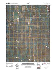
The Watershed Boundary Dataset (WBD) is a comprehensive aggregated collection of hydrologic unit data consistent with the national criteria for delineation and resolution. It defines the areal extent of surface water drainage to a point except in coastal or lake front areas where there could be multiple outlets as stated by the "Federal Standards and Procedures for the National Watershed Boundary Dataset (WBD)" "Standard" (https://pubs.usgs.gov/tm/11/a3/). Watershed boundaries are determined solely upon science-based hydrologic principles, not favoring any administrative boundaries or special projects, nor particular program or agency. This dataset represents the hydrologic unit boundaries to the 12-digit (6th level)...
Tags: 10-digit,
12-digit,
14-digit,
16-digit,
2-digit, All tags...
4-digit,
6-digit,
8-digit,
Adair,
Adams,
Albany,
Allen,
Anderson,
Andrew,
Antelope,
Appanoose,
Arapahoe,
Arthur,
Atchison,
Audrain,
Audubon,
Aurora,
Banner,
Barnes,
Barton,
Basin,
Bates,
Beadle,
Beaverhead,
Bennett,
Benton,
Big Horn,
Billings,
Blaine,
Bon Homme,
Boone,
Boulder,
Bourbon,
Bowman,
Box Butte,
Boyd,
Broadwater,
Brookings,
Broomfield,
Brown,
Brule,
Buchanan,
Buena Vista,
Buffalo,
Burke,
Burleigh,
Burt,
Butler,
Butte,
CO,
Caldwell,
Callaway,
Camden,
Campbell,
Carbon,
Carroll,
Carter,
Cascade,
Cass,
Cedar,
Chaffee,
Chariton,
Charles Mix,
Chase,
Cherokee,
Cherry,
Cheyenne,
Chouteau,
Christian,
Clark,
Clarke,
Clay,
Clear Creek,
Clinton,
Cloud,
Codington,
Coffey,
Cole,
Colfax,
Colorado,
Converse,
Cooper,
Corson,
Crawford,
Crook,
Cuming,
Custer,
Dade,
Dakota,
Dallas,
Daniels,
Daviess,
Davis,
Davison,
Dawes,
Dawson,
Day,
DeKalb,
Decatur,
Deer Lodge,
Dent,
Denver,
Deuel,
Dewey,
Dickey,
Dickinson,
Divide,
Dixon,
Dodge,
Doniphan,
Douglas,
Downloadable Data,
Dundy,
Dunn,
Eddy,
Edmunds,
El Paso,
Elbert,
Ellis,
Ellsworth,
Emmet,
Emmons,
Fall River,
Fallon,
Faulk,
Fergus,
Fillmore,
Flathead,
Foster,
Franklin,
Fremont,
Frontier,
Furnas,
Gage,
Gallatin,
Garden,
Garfield,
Gasconade,
Geary,
Gentry,
GeoPackage,
Gilpin,
Glacier,
Golden Valley,
Goshen,
Gosper,
Gove,
Graham,
Grand,
Granite,
Grant,
Greeley,
Greene,
Gregory,
Grundy,
Guthrie,
HU-2,
HU-2 Region,
HU2_10,
HUC,
Haakon,
Hall,
Hamilton,
Hamlin,
Hand,
Hanson,
Harding,
Harlan,
Harrison,
Hayes,
Henry,
Hettinger,
Hickory,
Hill,
Hitchcock,
Holt,
Hooker,
Hot Springs,
Howard,
Howell,
Hughes,
Hutchinson,
Hyde,
Hydrography,
Hydrologic Unit Code,
Hydrologic Units,
IA,
ID,
Ida,
Idaho,
Iowa,
Jackson,
Jefferson,
Jerauld,
Jewell,
Johnson,
Jones,
Judith Basin,
KS,
Kansas,
Kearney,
Keith,
Keya Paha,
Kidder,
Kimball,
Kingsbury,
Kit Carson,
Knox,
LaMoure,
Laclede,
Lafayette,
Lake,
Lancaster,
Lane,
Laramie,
Larimer,
Lawrence,
Leavenworth,
Lemhi,
Lewis and Clark,
Liberty,
Lincoln,
Linn,
Livingston,
Logan,
Loup,
Lucas,
Lyman,
Lyon,
MN,
MO,
MT,
Macon,
Madison,
Maries,
Marion,
Marshall,
McCone,
McCook,
McHenry,
McIntosh,
McKenzie,
McLean,
McPherson,
Meade,
Meagher,
Mellette,
Mercer,
Merrick,
Miami,
Miller,
Mills,
Miner,
Minnehaha,
Minnesota,
Missouri,
Mitchell,
Moniteau,
Monona,
Monroe,
Montana,
Montgomery,
Moody,
Morgan,
Morrill,
Morris,
Morton,
Mountrail,
Murray,
Musselshell,
ND,
NE,
Nance,
National Watershed Boundary Dataset (WBD),
National Watershed Boundary Dataset (WBD),
Natrona,
Nebraska,
Nemaha,
Ness,
Niobrara,
Nobles,
Nodaway,
North Dakota,
Norton,
Nuckolls,
O'Brien,
Oglala Lakota,
Oliver,
Open Geospatial Consortium GeoPackage 1.2,
Osage,
Osborne,
Osceola,
Otoe,
Ottawa,
Page,
Palo Alto,
Park,
Pawnee,
Pennington,
Perkins,
Petroleum,
Pettis,
Phelps,
Phillips,
Pierce,
Pipestone,
Platte,
Plymouth,
Polk,
Pondera,
Pottawatomie,
Pottawattamie,
Potter,
Powder River,
Powell,
Prairie,
Pulaski,
Putnam,
Randolph,
Ransom,
Ravalli,
Rawlins,
Ray,
Red Willow,
Region,
Republic,
Rice,
Richardson,
Richland,
Riley,
Ringgold,
Roberts,
Rock,
Rooks,
Roosevelt,
Rosebud,
Routt,
Rush,
Russell,
SD,
Sac,
Saline,
Sanborn,
Sargent,
Sarpy,
Saunders,
Schuyler,
Scott,
Scotts Bluff,
Sedgwick,
Seward,
Shawnee,
Shelby,
Sheridan,
Sherman,
Silver Bow,
Sioux,
Slope,
Smith,
South Dakota,
Spink,
St. Charles,
St. Clair,
St. Louis,
Stanley,
Stanton,
Stark,
Stillwater,
Stutsman,
Sub-basin,
Sub-region,
Sublette,
Subwatershed,
Sullivan,
Sully,
Summit,
Sweet Grass,
Sweetwater,
Taylor,
Teller,
Teton,
Texas,
Thayer,
Thomas,
Thurston,
Todd,
Toole,
Treasure,
Trego,
Tripp,
Turner,
US,
Union,
United States,
Valley,
Vernon,
WBD,
WY,
Wabaunsee,
Wallace,
Walworth,
Ward,
Warren,
Washakie,
Washington,
Watershed,
Watershed Boundary Dataset,
Wayne,
Webster,
Weld,
Wells,
Weston,
Wheatland,
Wheeler,
Wibaux,
Wichita,
Williams,
Woodbury,
Worth,
Wright,
Wyandotte,
Wyoming,
Yankton,
Yellowstone,
York,
Yuma,
Ziebach,
inlandWaters, Fewer tags
|
|

