Filters: Tags: Falmouth (X)
67 results (136ms)|
Filters
Date Range
Extensions Types Contacts
Categories Tag Types
|
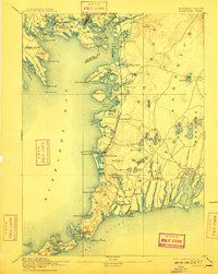
USGS Historical Quadrangle in GeoPDF.
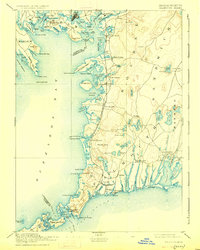
USGS Historical Quadrangle in GeoPDF.

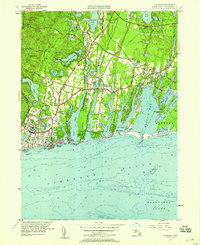
USGS Historical Quadrangle in GeoPDF.
The accretion history of fringing salt marshes located on the south shore of Cape Cod is reconstructed from sediment cores collected in low and high marsh vegetation zones. These marshes are micro-tidal, with a mean tidal range of 0.442 m. Their location within protected embayments and the absence of large rivers results in minimal sediment supply and a dominance of organic matter contributions to sediment peat. Age models based on 210-lead and 137-cesium are constructed to evaluate how vertical accretion and carbon burial rates have changed over the past century. The continuous rate of supply age model was used to age date 11 cores (10 low marsh and 1 high marsh) across four salt marshes. Both vertical accretion...
Categories: Data;
Tags: 137-cesium,
210-lead,
Barnstable County,
Cape Cod,
Commonwealth of Massachusetts,
This data release provides a comprehensive dataset of sampling-site characteristics and baseline groundwater-quality data collected from a network of multilevel sampling wells installed in a densely developed coastal neighborhood undergoing a conversion from onsite septic systems to municipal sewering. Groundwater samples were collected during multiple events from a total of 227 well screens at 15 locations using a peristaltic pump between June 2016 and September 2021. Samples were collected and preserved following methods documented in the U.S. Geological Survey National Field Manual (variously dated) and Savoie and others (2012). This dataset provides well construction information, groundwater levels, water-quality...
Categories: Data,
Data Release - Revised;
Tags: Falmouth,
Mara Vista,
Massachusetts,
USGS Science Data Catalog (SDC),
groundwater,
This dataset contains field measurements of lakebed groundwater temperatures collected during three surveys in July 2008, August 2014, and August 2015, by using a handheld thermocouple probe and GPS at a permeable reactive barrier at Ashumet Pond, Falmouth, MA. The comma-separated file includes unique site identifiers, locations of measurement points, temperatures, dates, and types of measurement (groundwater, surface water, or control). Also included are ESRI raster datasets for each measurement date for (1) interpolated lakebed groundwater temperatures, and (2) interpolated lakebed groundwater temperatures normalized to the surface water temperature at the time of measurement. This data release is provided...
Low-altitude (80 and 100 meters above ground level) digital images were collected at Sage Lot Pond in Waquoit, Massachusetts, two sites on the Mill River in Taunton, MA, Great Marsh in Barnstable, MA, the Wells National Estuarine Research Reserve in Wells, ME, and on the Woods Hole Oceanographic Institution Quissett Campus in Woods Hole, MA using 3DR Solo unoccupied aircraft systems (UAS) during 2018. These images were collected to support science and data needs in wetland research, topographic mapping, and landcover detection at the U.S. Geological Survey Woods Hole Coastal and Marine Science Center. The imagery and associated ground control points can be used to create Digital Elevation Models (DEMs), orthoimages,...
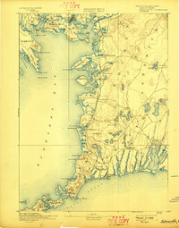
USGS Historical Quadrangle in GeoPDF.
USGS Historical Quadrangle in GeoPDF.
USGS Historical Quadrangle in GeoPDF.
USGS Historical Quadrangle in GeoPDF.
USGS Historical Quadrangle in GeoPDF.
This dataset contains field measurements of temperature in shallow vertical profiles beneath a lake-bottom in the vicinity of a permeable reactive barrier (PRB) at Ashumet Pond, Falmouth, MA. From August 21, 2015 – September 3, 2015 vertical temperature profilers designed to quantify groundwater upwelling dynamics were installed at seven locations. Hollow stainless steel pipes (2.5 cm OD) were slotted horizontally to allow installation of iButton thermal data loggers (Maxim Integrated DS1922L, 0.0625 oC precision) protected with waterproof silicone caulking. The temperature profilers were gently tapped into the cobbly bed by first driving guide-hole of slightly smaller diameter. After installation, the thermal loggers...
Categories: Data;
Tags: Cape Cod,
Falmouth,
Massachusetts,
groundwater,
groundwater and surface-water interaction,
Imagery acquired with unmanned aerial systems (UAS) and coupled with structure-from-motion (SfM) photogrammetry can produce high-resolution topographic and visual reflectance datasets that rival or exceed lidar and orthoimagery. These new techniques are particularly useful for data collection of coastal systems, which requires high temporal and spatial resolution datasets. The U.S. Geological Survey worked in collaboration with members of the Marine Biological Laboratory and Woods Hole Analytics at Black Beach, in Falmouth, Massachusetts to explore scientific research demands on UAS technology for topographic and habitat mapping applications. This project explored the application of consumer-grade UAS platforms...
Categories: Data;
Types: Citation;
Tags: Airborne imagery,
Atlantic Ocean,
Barnstable,
Black Beach,
Buzzards Bay,
USGS Historical Quadrangle in GeoPDF.

USGS Historical Quadrangle in GeoPDF.

USGS Historical Quadrangle in GeoPDF.

USGS Historical Quadrangle in GeoPDF.

USGS Historical Quadrangle in GeoPDF.
|

|
