Filters
Date Range
Extensions
Types
Contacts
Categories
Tag Types
Tag Schemes
|

Cell maps for each oil and gas assessment unit were created by the USGS as a method for illustrating the degree of exploration, type of production, and distribution of production in an assessment unit or province. Each cell represents a quarter-mile square of the land surface, and the cells are coded to represent whether the wells included within the cell are predominantly oil-producing, gas-producing, both oil and gas-producing, dry, or the type of production of the wells located within the cell is unknown. The well information was initially retrieved from the IHS Energy Group, PI/Dwights PLUS Well Data on CD-ROM, which is a proprietary, commercial database containing information for most oil and gas wells in the...
Categories: Data,
pre-SM502.8;
Types: Downloadable,
Map Service,
OGC WFS Layer,
OGC WMS Layer,
Shapefile;
Tags: 504501 = Barnett Paleozoic,
50450101 = Paleozoic Shelf and Bank Carbonate Oil and Gas,
50450102 = Mississippian Chappel Pinnacle Reef Oil and Gas,
50450161 = Greater Newark East Frac-Barrier Continuous Barnett Shale Gas,
50450162 = Extended Continuous Barnett Shale Gas, All tags...
50450163 = Hypothetical Basin-Arch Continuous Barnett Shale Oil,
504502 = Barnett-Hardeman Basin,
50450201 = Mississippian Dolomitized Chappel Waulsortian Mound Oil,
50450202 = Paleozoic Clastic-Carbonate Oil,
50450261 = Hypothetical Continuous Fractured Barnett Shale Oil,
504503 = Pennsylvanian Bend-Broken Bone Graben,
50450301 = Fluvial Sandstone-Carbonate Bank Gas and Oil,
504504 = Pennsylvanian-Lower Permian Coal Bed Gas,
50450481 = Hypothetical Pennsylvanian Bituminous Coal Bed Gas,
Assessment Unit,
Bend Arch,
Bend Arch-Fort Worth Basin,
Cells,
Coalbed methane resources,
Earth Science,
Economic geology,
Energy Resources,
Fort Worth,
Fort Worth-Bend Arch Basin,
Gas hydrate resources,
Geology,
National Assessment of Oil and Gas,
Natural Gas,
Natural Resources,
Natural gas resources,
OK,
Oil,
Oil sand resources,
Oil shale resources,
Pollastro, R.M.,
Resource Assessment,
TX,
U.S. Geological Survey,
US40 = Oklahoma,
US48 = Texas,
USGS,
USGS Science Data Catalog (SDC),
USGS World Energy Region 5,
USGS World Energy Region 5,
United States,
geoscientificInformation,
noga2000,
nogafort,
oilgas, Fewer tags
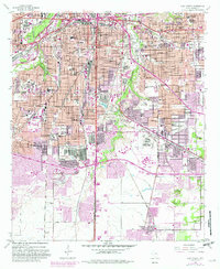
USGS Historical Quadrangle in GeoPDF.
Tags: 7.5 x 7.5 minute,
Downloadable Data,
Fort Worth,
GeoPDF,
GeoTIFF, All tags...
Historical Topographic Maps,
Historical Topographic Maps 7.5 x 7.5 Minute Map Series,
Map,
TX,
imageryBaseMapsEarthCover, Fewer tags
USGS Historical Quadrangle in GeoPDF.
Tags: 30 x 60 minute,
Downloadable Data,
Fort Worth,
GeoPDF,
GeoTIFF, All tags...
Historical Topographic Maps,
Historical Topographic Maps 30 x 60 Minute Map Series,
Map,
Planimetric,
TX,
imageryBaseMapsEarthCover, Fewer tags
USGS Historical Quadrangle in GeoPDF.
Tags: 30 x 60 minute,
Downloadable Data,
Fort Worth,
GeoPDF,
GeoTIFF, All tags...
Historical Topographic Maps,
Historical Topographic Maps 30 x 60 Minute Map Series,
Map,
TX,
imageryBaseMapsEarthCover, Fewer tags
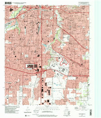
USGS Historical Quadrangle in GeoPDF.
Tags: 7.5 x 7.5 minute,
Downloadable Data,
Fort Worth,
GeoPDF,
GeoTIFF, All tags...
Historical Topographic Maps,
Historical Topographic Maps 7.5 x 7.5 Minute Map Series,
Map,
TX,
imageryBaseMapsEarthCover, Fewer tags
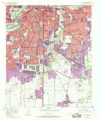
USGS Historical Quadrangle in GeoPDF.
Tags: 7.5 x 7.5 minute,
Downloadable Data,
Fort Worth,
GeoPDF,
GeoTIFF, All tags...
Historical Topographic Maps,
Historical Topographic Maps 7.5 x 7.5 Minute Map Series,
Map,
TX,
imageryBaseMapsEarthCover, Fewer tags
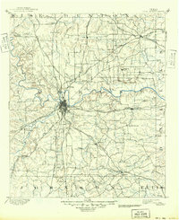
USGS Historical Quadrangle in GeoPDF.
Tags: 30 x 30 minute,
Downloadable Data,
Fort Worth,
GeoPDF,
GeoTIFF, All tags...
Historical Topographic Maps,
Historical Topographic Maps 30 x 30 Minute Map Series,
Map,
TX,
imageryBaseMapsEarthCover, Fewer tags
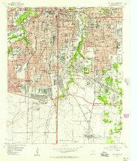
USGS Historical Quadrangle in GeoPDF.
Tags: 7.5 x 7.5 minute,
Downloadable Data,
Fort Worth,
GeoPDF,
GeoTIFF, All tags...
Historical Topographic Maps,
Historical Topographic Maps 7.5 x 7.5 Minute Map Series,
Map,
TX,
imageryBaseMapsEarthCover, Fewer tags
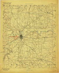
USGS Historical Quadrangle in GeoPDF.
Tags: 30 x 30 minute,
Downloadable Data,
Fort Worth,
GeoPDF,
GeoTIFF, All tags...
Historical Topographic Maps,
Historical Topographic Maps 30 x 30 Minute Map Series,
Map,
TX,
imageryBaseMapsEarthCover, Fewer tags
USGS Historical Quadrangle in GeoPDF.
Tags: 30 x 30 minute,
Downloadable Data,
Fort Worth,
GeoPDF,
GeoTIFF, All tags...
Historical Topographic Maps,
Historical Topographic Maps 30 x 30 Minute Map Series,
Map,
TX,
imageryBaseMapsEarthCover, Fewer tags
USGS Historical Quadrangle in GeoPDF.
Tags: 7.5 x 7.5 minute,
Downloadable Data,
Fort Worth,
GeoPDF,
GeoTIFF, All tags...
Historical Topographic Maps,
Historical Topographic Maps 7.5 x 7.5 Minute Map Series,
Map,
TX,
imageryBaseMapsEarthCover, Fewer tags

Dispersal, establishment, and spread of aquatic invasive species such as the zebra mussel (Dreissena polymorpha) can be influenced by riverine velocities and volumetric flows in invaded lake-stream ecosystems. Zebra mussels, which have a planktonic larval form (veliger), disperse rapidly downstream from a source population. Concentrations, dispersal, and body conditions of zebra mussel veligers were studied under different volumetric flow, or discharge, conditions in a coupled lake-stream ecosystem in northern Texas, USA. Veliger densities in lotic environments were strongly related to population dynamics in upstream lentic source populations. A strong exponential decrease in veliger density was observed through...
Categories: Data;
Tags: Aquatic Biology,
Aquatic ecosystem,
Dallas,
Dispersal,
Ecology, All tags...
Elm Fork Trinity River,
Fort Worth,
Geographical distribution,
Lake Lewisville,
Lake Texoma,
Larvae,
Oklahoma,
Planktonic,
Population dynamics,
Ray Roberts Lake,
Red River,
River discharge,
Texas,
Trinity River,
USGS Science Data Catalog (SDC),
Water Quality,
Water Resources,
Wildlife Biology, Fewer tags
USGS Historical Quadrangle in GeoPDF.
Tags: 7.5 x 7.5 minute,
Downloadable Data,
Fort Worth,
GeoPDF,
GeoTIFF, All tags...
Historical Topographic Maps,
Historical Topographic Maps 7.5 x 7.5 Minute Map Series,
Map,
TX,
imageryBaseMapsEarthCover, Fewer tags
|
|
