Filters: Tags: Frontier (X)
397 results (13ms)|
Filters
Date Range
Extensions Types Contacts
Categories Tag Types Tag Schemes |
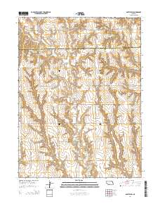
Layered GeoPDF 7.5 Minute Quadrangle Map. Layers of geospatial data include orthoimagery, roads, grids, geographic names, elevation contours, hydrography, and other selected map features.
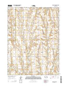
Layered GeoPDF 7.5 Minute Quadrangle Map. Layers of geospatial data include orthoimagery, roads, grids, geographic names, elevation contours, hydrography, and other selected map features.
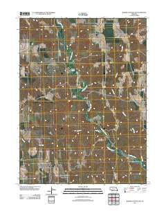
Layered GeoPDF 7.5 Minute Quadrangle Map. Layers of geospatial data include orthoimagery, roads, grids, geographic names, elevation contours, hydrography, and other selected map features.
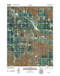
Layered GeoPDF 7.5 Minute Quadrangle Map. Layers of geospatial data include orthoimagery, roads, grids, geographic names, elevation contours, hydrography, and other selected map features.
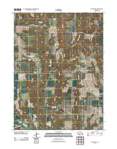
Layered GeoPDF 7.5 Minute Quadrangle Map. Layers of geospatial data include orthoimagery, roads, grids, geographic names, elevation contours, hydrography, and other selected map features.

The Watershed Boundary Dataset (WBD) is a comprehensive aggregated collection of hydrologic unit data consistent with the national criteria for delineation and resolution. It defines the areal extent of surface water drainage to a point except in coastal or lake front areas where there could be multiple outlets as stated by the "Federal Standards and Procedures for the National Watershed Boundary Dataset (WBD)" "Standard" (https://pubs.usgs.gov/tm/11/a3/). Watershed boundaries are determined solely upon science-based hydrologic principles, not favoring any administrative boundaries or special projects, nor particular program or agency. This dataset represents the hydrologic unit boundaries to the 12-digit (6th level)...
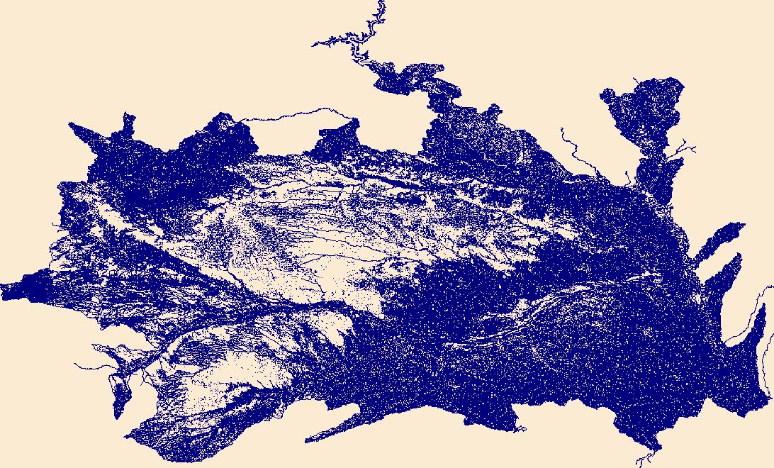
The National Hydrography Dataset (NHD) is a feature-based database that interconnects and uniquely identifies the stream segments or reaches that make up the nation's surface water drainage system. NHD data was originally developed at 1:100,000-scale and exists at that scale for the whole country. This high-resolution NHD, generally developed at 1:24,000/1:12,000 scale, adds detail to the original 1:100,000-scale NHD. (Data for Alaska, Puerto Rico and the Virgin Islands was developed at high-resolution, not 1:100,000 scale.) Local resolution NHD is being developed where partners and data exist. The NHD contains reach codes for networked features, flow direction, names, and centerline representations for areal water...
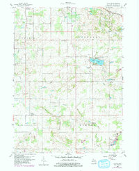
USGS Historical Quadrangle in GeoPDF.
Core Research Center, core A464, from well operated by MOUNTAIN PETROLEUMRaw Properties from download, web scrape, MapServer, and Macrostrat API{"Lib Num": "A464", "API Num": "4903120028", "Operator": "MOUNTAIN PETROLEUM", "Well Name": "1-7 ASSOCIATED ENTERPRISES", "Field": "WILDCAT", "State": "WY", "County": "PLATTE", "Type": "SLABBED", "Photos": "T", "Thin Sec": "F", "Analysis": "F", "Latitude": "41.97479", "Longitude": "-104.82449", "coordinates_geohash": "9xmqy9m0u7gp", "Source": "FROM STATE RECORDS", "Security Flag": "NO SPECIAL RESTRICTIONS", "crc_collection_name": "core", "sb_parent_id": "4f4e49dae4b07f02db5e0486", "intervals": [{"Formation": "FRONTIER", "Age": "CRET", "Min Depth": "3375", "Max Depth": "3437"}],...
Categories: Physical Item;
Tags: CRET,
FRONTIER,
Priabonian - Rupelian,
White River Formation,
White River Formation,
Core Research Center, core D131, from well operated by NATURAL GAS CORPRaw Properties from download, web scrape, MapServer, and Macrostrat API{"Lib Num": "D131", "API Num": "4902320507", "Operator": "NATURAL GAS CORP", "Well Name": "41-14-E FEDERAL", "Field": "FONTENELLE", "State": "WY", "County": "LINCOLN", "Type": "SLABBED", "Photos": "T", "Thin Sec": "F", "Analysis": "F", "Latitude": "42.15368", "Longitude": "-110.11371", "coordinates_geohash": "9x3xy3cdux6z", "Source": "FROM STATE RECORDS", "Security Flag": "NO SPECIAL RESTRICTIONS", "crc_collection_name": "core", "sb_parent_id": "4f4e49dae4b07f02db5e0486", "intervals": [{"Formation": "FRONTIER", "Age": "CRET", "Min Depth": "8652", "Max Depth": "8710"}, {"Formation":...
Core Research Center, core E540, from well operated by ENRON O&G COMPANYRaw Properties from download, web scrape, MapServer, and Macrostrat API{"Lib Num": "E540", "API Num": "4902321038", "Operator": "ENRON O&G COMPANY", "Well Name": "134-7 GREEN RIVER BEND UNIT", "Field": "FONTENELLE", "State": "WY", "County": "LINCOLN", "Type": "SLABBED", "Photos": "F", "Thin Sec": "F", "Analysis": "T", "Latitude": "42.25156", "Longitude": "-110.20258", "coordinates_geohash": "9x98k78vjv8s", "Source": "FROM STATE RECORDS", "Security Flag": "NO SPECIAL RESTRICTIONS", "crc_collection_name": "core", "sb_parent_id": "4f4e49dae4b07f02db5e0486", "intervals": [{"Formation": "FRONTIER", "Age": "CRET", "Min Depth": "7214", "Max Depth":...
Categories: Physical Item;
Tags: Alluvium and Colluvium,
CRET,
FRONTIER,
Pleistocene - Holocene,
clay,
Core Research Center, core R017, from well operated by CALIFORNIA OILRaw Properties from download, web scrape, MapServer, and Macrostrat API{"Lib Num": "R017", "API Num": "4903505776", "Operator": "CALIFORNIA OIL", "Well Name": "1 PINE GROOVE RIDGE UNIT", "Field": "DEADLINE RIDGE", "State": "WY", "County": "SUBLETTE", "Type": "FULL", "Photos": "F", "Thin Sec": "F", "Analysis": "F", "Latitude": "42.41101", "Longitude": "-110.45326", "coordinates_geohash": "9x93q8dqh3rc", "Source": "FROM STATE RECORDS", "Security Flag": "NO SPECIAL RESTRICTIONS", "crc_collection_name": "core", "sb_parent_id": "4f4e49dae4b07f02db5e0486", "intervals": [{"Formation": "MUDDY", "Age": "CRET", "Min Depth": "9457", "Max Depth": "9511"},...
Core Research Center, core B121, from well operated by C & K PETROLEUMRaw Properties from download, web scrape, MapServer, and Macrostrat API{"Lib Num": "B121", "API Num": "4902320252", "Operator": "C & K PETROLEUM", "Well Name": "1 CHRISMAN ET AL", "Field": "WILSON RANCH", "State": "WY", "County": "LINCOLN", "Type": "SLABBED", "Photos": "T", "Thin Sec": "T", "Analysis": "T", "Latitude": "41.71722", "Longitude": "-110.10753", "coordinates_geohash": "9x3tq6qhkt6y", "Source": "FROM STATE RECORDS", "Security Flag": "NO SPECIAL RESTRICTIONS", "crc_collection_name": "core", "sb_parent_id": "4f4e49dae4b07f02db5e0486", "intervals": [{"Formation": "FRONTIER", "Age": "CRET", "Min Depth": "11090", "Max Depth": "11103"}, {"Formation":...
Core Research Center, core E777, from well operated by PRESIDIO EXPL INCRaw Properties from download, web scrape, MapServer, and Macrostrat API{"Lib Num": "E777", "API Num": "4903723278", "Operator": "PRESIDIO EXPL INC", "Well Name": "40-36 RICH STATE", "Field": "MESA", "State": "WY", "County": "SWEETWATER", "Type": "SLABBED", "Photos": "T", "Thin Sec": "T", "Analysis": "F", "Latitude": "42.01068", "Longitude": "-109.95221", "coordinates_geohash": "9x3yczz1zy3g", "Source": "FROM STATE RECORDS", "Security Flag": "NO SPECIAL RESTRICTIONS", "crc_collection_name": "core", "sb_parent_id": "4f4e49dae4b07f02db5e0486", "intervals": [{"Formation": "FRONTIER", "Age": "CRET", "Min Depth": "10342", "Max Depth": "10397"}], "crcwc_url":...
Categories: Physical Item;
Tags: CRET,
Eocene,
FRONTIER,
Laney Member,
Laney Shale Member of Green River Formation,
Core Research Center, core E167, from well operated by ENRON O&G COMPANYRaw Properties from download, web scrape, MapServer, and Macrostrat API{"Lib Num": "E167", "API Num": "4902320802", "Operator": "ENRON O&G COMPANY", "Well Name": "1-22 FONTENELLE RESERVOIR", "Field": "FONTENELLE RESERVOIR", "State": "WY", "County": "LINCOLN", "Type": "SLABBED", "Photos": "T", "Thin Sec": "T", "Analysis": "F", "Latitude": "42.13684", "Longitude": "-110.13512", "coordinates_geohash": "9x3xtyf0csq3", "Source": "FROM STATE RECORDS", "Security Flag": "NO SPECIAL RESTRICTIONS", "crc_collection_name": "core", "sb_parent_id": "4f4e49dae4b07f02db5e0486", "intervals": [{"Formation": "FRONTIER", "Age": "CRET", "Min Depth": "8581", "Max...
Categories: Physical Item;
Tags: CRET,
Eocene,
FRONTIER,
Green River Formation - Laney Member,
Laney Member,
Core Research Center, core E547, from well operated by GENERAL ATLANTICRaw Properties from download, web scrape, MapServer, and Macrostrat API{"Lib Num": "E547", "API Num": "4903723308", "Operator": "GENERAL ATLANTIC", "Well Name": "10-3 HAVEN UNIT", "Field": "STORM SHELTER", "State": "WY", "County": "SWEETWATER", "Type": "SLABBED", "Photos": "T", "Thin Sec": "F", "Analysis": "T", "Latitude": "42.00382", "Longitude": "-109.99248", "coordinates_geohash": "9x3ycn9cvrw6", "Source": "FROM STATE RECORDS", "Security Flag": "NO SPECIAL RESTRICTIONS", "crc_collection_name": "core", "sb_parent_id": "4f4e49dae4b07f02db5e0486", "intervals": [{"Formation": "FRONTIER", "Age": "CRET", "Min Depth": "10233", "Max Depth": "10282"}],...
Categories: Physical Item;
Tags: CRET,
Eocene,
FRONTIER,
Laney Member,
Laney Shale Member of Green River Formation,
Core Research Center, core A433, from well operated by AMERADA HESS CORPRaw Properties from download, web scrape, MapServer, and Macrostrat API{"Lib Num": "A433", "API Num": "4902506106", "Operator": "AMERADA HESS CORP", "Well Name": "12 UNIT", "Field": "SAGE SPRING CREEK", "State": "WY", "County": "NATRONA", "Type": "SLABBED", "Photos": "T", "Thin Sec": "T", "Analysis": "F", "Latitude": "43.13537", "Longitude": "-106.13466", "coordinates_geohash": "9xst2ue1epv8", "Source": "FROM STATE RECORDS", "Security Flag": "NO SPECIAL RESTRICTIONS", "crc_collection_name": "core", "sb_parent_id": "4f4e49dae4b07f02db5e0486", "intervals": [{"Formation": "FRONTIER", "Age": "CRET", "Min Depth": "6404", "Max Depth": "6430"}, {"Formation":...
Core Research Center, core D117, from well operated by ANSCHUTZ CORPORATIONRaw Properties from download, web scrape, MapServer, and Macrostrat API{"Lib Num": "D117", "API Num": "4902921289", "Operator": "ANSCHUTZ CORPORATION", "Well Name": "2-24 BADGER CREEK FEDERAL", "Field": "OREGON BASIN SOUTHEAST", "State": "WY", "County": "PARK", "Type": "SLABBED", "Photos": "T", "Thin Sec": "F", "Analysis": "F", "Latitude": "44.29739", "Longitude": "-108.82299", "coordinates_geohash": "9xfs58je0812", "Source": "FROM STATE RECORDS", "Security Flag": "NO SPECIAL RESTRICTIONS", "crc_collection_name": "core", "sb_parent_id": "4f4e49dae4b07f02db5e0486", "intervals": [{"Formation": "FRONTIER", "Age": "CRET", "Min Depth": "4926",...
Categories: Physical Item;
Tags: CRET,
CRET,
FRONTIER,
FRONTIER,
Gravel, pediment, and fan deposits,
Core Research Center, core F053, from well operated by MARATHON OIL COMPANYRaw Properties from download, web scrape, MapServer, and Macrostrat API{"Lib Num": "F053", "API Num": "4901720590", "Operator": "MARATHON OIL COMPANY", "Well Name": "6-31 MARATHON - AMERADA", "Field": "ADAM", "State": "WY", "County": "HOT SPRINGS", "Type": "SLABBED", "Photos": "T", "Thin Sec": "F", "Analysis": "T", "Latitude": "43.90247", "Longitude": "-108.77681", "coordinates_geohash": "9xf9u8pnkted", "Source": "FROM STATE RECORDS", "Security Flag": "NO SPECIAL RESTRICTIONS", "crc_collection_name": "core", "sb_parent_id": "4f4e49dae4b07f02db5e0486", "intervals": [{"Formation": "FRONTIER", "Age": "CRET", "Min Depth": "3682", "Max Depth":...
Categories: Physical Item;
Tags: Alluvium and Colluvium,
CRET,
FRONTIER,
Pleistocene - Holocene,
clay,
Core Research Center, core T900, from well operated by OHIO OILRaw Properties from download, web scrape, MapServer, and Macrostrat API{"Lib Num": "T900", "API Num": "4902906941", "Operator": "OHIO OIL", "Well Name": "3 MACK OPC-1", "Field": "ELK BASIN", "State": "WY", "County": "PARK", "Type": "FULL", "Photos": "T", "Thin Sec": "F", "Analysis": "F", "Latitude": "44.97611", "Longitude": "-108.86481", "coordinates_geohash": "9xfxfexhf4d4", "Source": "FROM STATE RECORDS", "Security Flag": "NO SPECIAL RESTRICTIONS", "crc_collection_name": "core", "sb_parent_id": "4f4e49dae4b07f02db5e0486", "intervals": [{"Formation": "FRONTIER", "Age": "CRETACEOUS", "Min Depth": "2182", "Max Depth": "2223"}, {"Formation": "FRONTIER",...
|

|
