Filters: Tags: Gaviota (X)
32 results (456ms)|
Filters
Date Range
Extensions Types Contacts
Categories Tag Types Tag Schemes |

This part of DS 781 presents 2-m-resolution data collected by the U.S. Geological Survey in 2007 for the acoustic-backscatter map of the Offshore of Gaviota Map Area, California. The GeoTiff is included in "Backscatter_[USGS07]_OffshoreGaviota.zip," which is accessible from https://doi.org/10.5066/F7TH8JWJ. The acoustic-backscatter map of the Offshore of Gaviota map area in southern California was generated from acoustic-backscatter data collected by the U.S. Geological Survey (USGS) and by Fugro Pelagos Inc. Acoustic mapping was completed between 2007 and 2008 using a combination of 400-kHz Reson 7125, 240-kHz Reson 8101, and 100-kHz Reson 8111 multibeam echosounders, as well as a 234-kHz SEA SWATHplus bathymetric...
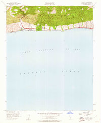
USGS Historical Quadrangle in GeoPDF.

USGS Historical Quadrangle in GeoPDF.

USGS Historical Quadrangle in GeoPDF.

This part of DS 781 presents data for the transgressive contours for the Point Conception to Hueneme Canyon, California, region. The vector file is included in "TransgressiveContours_PointConceptionToHuenemeCanyon.zip," which is accessible from http://dx.doi.org/10.5066/F7891424. As part of the USGS's California State Waters Mapping Project, a 50-m grid of sediment thickness for the seafloor within the 3-nautical mile limit between Point Conception and Hueneme Canyon was generated from seismic-reflection data collected in 2014 (USGS activity 2014-632-FA) supplemented with outcrop and geologic structure (fault) information following the methodology of Wong (2012). Water depths determined from bathymetry data were...
Categories: Data;
Types: Citation,
Downloadable,
Map Service,
OGC WFS Layer,
OGC WMS Layer,
Shapefile;
Tags: Carpinteria,
Coal Oil Point,
Gaviota,
Hueneme Canyon,
Pacific Ocean,

This part of DS 781 presents data for the isopachs for the Point Conception to Hueneme Canyon, California, region. The vector data file is included in "Isopachs_PointConceptionToHuenemeCanyon.zip," which is accessible from https://doi.org/10.5066/F7891424. As part of the USGS's California State Waters Mapping Project, a 50-m grid of sediment thickness for the seafloor within the 3-nautical mile limit between Point Conception and Hueneme Canyon was generated from seismic-reflection data collected in 2014 (USGS activity 2014-632-FA) supplemented with outcrop and geologic structure (fault) information following the methodology of Wong (2012). This sediment thickness layer was merged with a previously published sediment...
Categories: Data;
Types: Citation,
Downloadable,
Map Service,
OGC WFS Layer,
OGC WMS Layer,
Shapefile;
Tags: Carpinteria,
Coal Oil Point,
Gaviota,
Hueneme Canyon,
Pacific Ocean,
High-resolution multichannel minkisparker seismic-reflection (MCS) profiles were collected by the U.S. Geological Survey in September and October of 2016 from the northern portion of the Santa Barbara Basin offshore southern California. Data were collected aboard the USGS R/V Parke Snavely and NOAA R/V Shearwater during field activity 2016-666-FA using a SIG 2-mille minisparker and recorded using 48- or 24-channel Geometrics digital hydrophone streamer. Sub-bottom acoustic penetration spans several hundreds of meters and is variable by location.

This part of DS 781 presents data for the habitat map of the Offshore of Gaviota Map Area, California. The vector data file is included in "Habitat_OffshoreGaviota.zip," which is accessible from https://doi.org/10.5066/F7TH8JWJ. This map shows physical marine benthic habitats in the Offshore of Gaviota map area. Marine benthic habitats represent a particular type of water quality, substrate, geomorphology, seafloor process, or any other attribute that may provide a habitat for a specific species or an assemblage of organisms. Marine benthic habitats are classified using the Coastal and Marine Ecological Classification Standard (CMECS), developed by representatives from a consortium of federal agencies. CMECS is...

This part of DS 781 presents data for the geologic and geomorphic map of the Offshore of Gaviota Map Area, California. The vector data file is included in "Geology_OffshoreGaviota.zip," which is accessible from https://doi.org/10.5066/F7TH8JWJ. The offshore portion of the Gaviota map area largely consists of a narrow (4- to 5-km-wide), gently (about 1 degree to 1.5 degrees) offshore-dipping shelf, underlain by Neogene bedrock and Holocene sediments derived primarily from Gaviota Creek and smaller coastal watersheds draining the Santa Ynez Mountains (fig. 1-2). Holocene nearshore and shelf deposits are primarily sand (unit Qms). More coarse-grained sediments (unit Qmsc) are mainly found along the Gaviota bar, a prominent...

This part of DS 781 presents data for bathymetric contours for several seafloor maps of the Offshore of Gaviota Map Area, California. The vector data file is included in "Contours_OffshoreGaviota.zip," which is accessible from https://doi.org/10.5066/F7TH8JWJ. Bathymetry contours of the Offshore of Gaviota map area in southern California was generated from acoustic-bathymetry data collected largely by the U.S. Geological Survey (USGS) and by Fugro Pelagos Inc. Acoustic mapping was completed between 2007 and 2008 using a combination of 400-kHz Reson 7125, 240-kHz Reson 8101, and 100-kHz Reson 8111 multibeam echosounders, as well as a 234-kHz SEA SWATHplus bathymetric sidescan-sonar system. In addition, bathymetric-lidar...

This part of DS 781 presents 2-m-resolution data collected by the U.S. Geological Survey in 2008 for the acoustic-backscatter map of the Offshore of Gaviota Map Area, California. The GeoTiff is included in "Backscatter_[USGS08]_OffshoreGaviota.zip," which is accessible from https://doi.org/10.5066/F7TH8JWJ. The acoustic-backscatter map of the Offshore of Gaviota map area in southern California was generated from acoustic-backscatter data collected by the U.S. Geological Survey (USGS) and by Fugro Pelagos Inc. Acoustic mapping was completed between 2007 and 2008 using a combination of 400-kHz Reson 7125, 240-kHz Reson 8101, and 100-kHz Reson 8111 multibeam echosounders, as well as a 234-kHz SEA SWATHplus bathymetric...
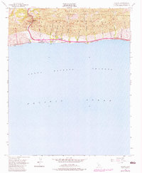
USGS Historical Quadrangle in GeoPDF.

This part of DS 781 presents fault data for the geologic and geomorphic map of the Offshore of Gaviota map area, California. The vector data file is included in "Faults_OffshoreGaviota.zip," which is accessible from https://doi.org/10.5066/F7TH8JWJ. The southwest-striking south strand of the Santa Ynez fault obliquely cuts the shelf in the western part of the map area. As mapped onshore by Dibblee (1950, 1988a) this fault is unique among Santa Barbara fold belt structures in that it obliquely crosses the Santa Ynez Mountains and the dominant east-west structural grain. The fault was difficult to map in the offshore, even with our dense seismic-reflection data coverage, because the pre-LGM section on the shelf includes...

USGS Historical Quadrangle in GeoPDF.
High-resolution chirp sub-bottom data were collected by the U.S. Geological Survey in July of 2018 between Point Conception and Coal Oil Point in the Santa Barbara Channel, California. Data were collected aboard the USGS R/V Parke Snavely during field activity 2018-645-FA, using an EdgeTech SB-512i sub-bottom profiler. Sub-bottom acoustic penetration spans several tens of meters and is variable by location.
These metadata describe acoustic-backscatter data collected during an October 2016 multibeam-echosounder survey of the northern portion of the Santa Barbara Channel, California. Data were collected and processed by the U.S. Geological Survey (USGS), Pacific Coastal and Marine Science Center (PCMSC) with fieldwork activity number 2016-666-FA. The acoustic-backscatter data are provided as a GeoTIFF image.
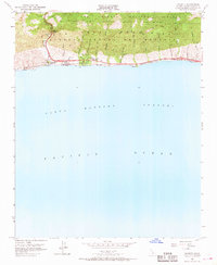
USGS Historical Quadrangle in GeoPDF.

USGS Historical Quadrangle in GeoPDF.
High-resolution multichannel minisparker seismic-reflection data were collected by the U.S. Geological Survey in July of 2018 between Point Conception and Coal Oil Point in the Santa Barbara Channel, California. Data were collected aboard the USGS R/V Parke Snavely during field activity 2018-645-FA, using SIG 2-mille minisparker and recorded using an 8-channel Geometrics digital hydrophone streamer. Sub-bottom acoustic penetration spans several hundreds of meters and is variable by location.

USGS Historical Quadrangle in GeoPDF.
|

|
