Filters: Tags: Gillette (X)
12 results (123ms)|
Filters
Date Range
Extensions Types Contacts
Categories Tag Types Tag Schemes |

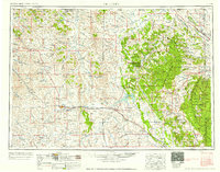
USGS Historical Quadrangle in GeoPDF.
This ArcView shapefile contains a polygon representation of the Wyodak-Anderson clinker in the Powder River Basin, Wyoming and Montana. This theme was created specifically for the National Coal Resource Assessment in the Northern Rocky Mountains and Great Plains Region.
Categories: Data,
pre-SM502.8;
Types: Downloadable,
Map Service,
OGC WFS Layer,
OGC WMS Layer,
Shapefile;
Tags: Big Horn County,
Burned coal,
Campbell County,
Clinker,
Coal,
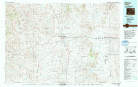
USGS Historical Quadrangle in GeoPDF.
This ArcView shapefile is a polygon representation of the area of the Gillette Coalfield. This theme was created specifically for the National Coal Resource Assessment in the Northern Rocky Mountains and Great Plains Region.
Categories: Data,
pre-SM502.8;
Types: Downloadable,
Map Service,
OGC WFS Layer,
OGC WMS Layer,
Shapefile;
Tags: Cambell County,
Coal,
Coalfield,
Converse County,
Gillette,

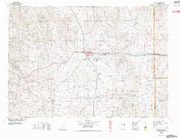
USGS Historical Quadrangle in GeoPDF.
This ArcView shapefile contains a polygon representation of overburden thickness above the Wyodak-Anderson coal zone in the area of Gillette coalfield, Wyoming. This theme was created specifically for the National Coal Resource Assessment in the Northern Rocky Mountains and Great Plains Region
Categories: Data,
pre-SM502.8;
Types: Downloadable,
Map Service,
OGC WFS Layer,
OGC WMS Layer,
Shapefile;
Tags: Campbell County,
Converse County,
Gillette,
Gillette coalfield,
Isopach,
This shapefile contains a polygon representation of the Wyodak-Anderson net coal thickness in the Gillette coalfield study area. This theme was created specifically for the National Coal Resource Assessment in the Northern Rocky Mountains and Great Plains Region.
Categories: Data,
pre-SM502.8;
Types: Downloadable,
Map Service,
OGC WFS Layer,
OGC WMS Layer,
Shapefile;
Tags: Campbell County,
Coal,
Coal thickness,
Converse County,
Gillette,
This ArcView shapefile contains a polygon representation of numerous themes for the Gillette Coalfield. These themes are listed in the process steps. The purpose of this shapefile is to allow the users to perform multiple theme queries. This theme was created specifically for the National Coal Resource Assessment in the Northern Rocky Mountains and Great Plains Region
Categories: Data,
pre-SM502.8;
Types: Downloadable,
Map Service,
OGC WFS Layer,
OGC WMS Layer,
Shapefile;
Tags: Campbell County,
Coal,
Converse County,
Gillette,
Gillette coalfield,

USGS Historical Quadrangle in GeoPDF.
USGS Historical Quadrangle in GeoPDF.

USGS Historical Quadrangle in GeoPDF.
USGS Historical Quadrangle in GeoPDF.
|

|
