Filters
Date Range
Types
Contacts
Categories
Tag Types
Tag Schemes
|
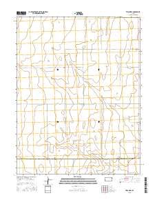
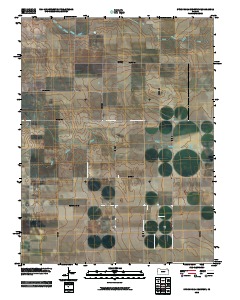
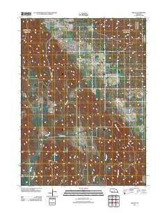
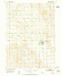
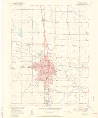
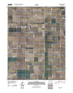
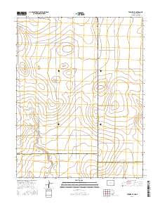
Layered GeoPDF 7.5 Minute Quadrangle Map. Layers of geospatial data include orthoimagery, roads, grids, geographic names, elevation contours, hydrography, and other selected map features.
Tags: 7.5 x 7.5 minute,
Cheyenne,
Colony Township NW, CO-KS,
Colorado,
Downloadable Data, All tags...
EarthCover,
GeoPDF,
Greeley,
Imagery and Base Maps,
Kansas,
Map,
Public Land Survey System,
U.S. National Grid,
US,
US Topo,
US Topo Historical,
United States,
Wallace,
boundary,
contour,
geographic names,
hydrography,
imageryBaseMapsEarthCover,
orthoimage,
structures,
topographic,
transportation,
woodland, Fewer tags
Layered GeoPDF 7.5 Minute Quadrangle Map. Layers of geospatial data include orthoimagery, roads, grids, geographic names, elevation contours, hydrography, and other selected map features.
Tags: 7.5 x 7.5 minute,
Downloadable Data,
EarthCover,
GeoPDF,
Greeley, All tags...
Imagery and Base Maps,
Map,
Nebraska,
North Loup, NE,
Sherman,
U.S. National Grid,
US,
US Topo,
US Topo Historical,
United States,
Valley,
contour,
geographic names,
hydrography,
imageryBaseMapsEarthCover,
orthoimage,
structures,
topographic,
transportation, Fewer tags
Layered GeoPDF 7.5 Minute Quadrangle Map. Layers of geospatial data include orthoimagery, roads, grids, geographic names, elevation contours, hydrography, and other selected map features.
Tags: 7.5 x 7.5 minute,
Downloadable Data,
EarthCover,
GeoPDF,
Greeley, All tags...
Imagery and Base Maps,
Kansas,
Map,
Public Land Survey System,
Tribune, KS,
U.S. National Grid,
US,
US Topo,
US Topo Historical,
United States,
boundary,
contour,
geographic names,
hydrography,
imageryBaseMapsEarthCover,
orthoimage,
structures,
topographic,
transportation,
woodland, Fewer tags
Layered GeoPFD 7.5 Minute Quadrangle Map. Layers of geospatial data include orthoimagery, roads, grids, geographic names, elevation contours, hydrography, and other selected map features.
Tags: 7.5 x 7.5 minute,
Downloadable Data,
EarthCover,
GeoPDF,
Greeley, All tags...
Imagery and Base Maps,
Kansas,
Map,
Tribune NW, KS,
U.S. National Grid,
US,
US Topo,
US Topo Historical,
United States,
contour,
geographic names,
hydrography,
orthoimage,
topographic,
transportation, Fewer tags
Layered GeoPDF 7.5 Minute Quadrangle Map. Layers of geospatial data include orthoimagery, roads, grids, geographic names, elevation contours, hydrography, and other selected map features.
Tags: 7.5 x 7.5 minute,
Downloadable Data,
EarthCover,
GeoPDF,
Greeley, All tags...
Hamilton,
Imagery and Base Maps,
Kansas,
Map,
Public Land Survey System,
Tribune SE, KS,
U.S. National Grid,
US,
US Topo,
US Topo Historical,
United States,
boundary,
contour,
geographic names,
hydrography,
imageryBaseMapsEarthCover,
orthoimage,
structures,
topographic,
transportation,
woodland, Fewer tags
Layered GeoPDF 7.5 Minute Quadrangle Map. Layers of geospatial data include orthoimagery, roads, grids, geographic names, elevation contours, hydrography, and other selected map features.
Tags: 7.5 x 7.5 minute,
Downloadable Data,
EarthCover,
GeoPDF,
Greeley, All tags...
Imagery and Base Maps,
Map,
Nebraska,
Spalding SW, NE,
U.S. National Grid,
US,
US Topo,
US Topo Historical,
United States,
contour,
geographic names,
hydrography,
imageryBaseMapsEarthCover,
orthoimage,
structures,
topographic,
transportation, Fewer tags
Layered GeoPFD 7.5 Minute Quadrangle Map. Layers of geospatial data include orthoimagery, roads, grids, geographic names, elevation contours, hydrography, and other selected map features.
Tags: 7.5 x 7.5 minute,
Downloadable Data,
EarthCover,
GeoPDF,
Greeley, All tags...
Imagery and Base Maps,
Kansas,
Map,
Stockholm Cemetery, KS,
U.S. National Grid,
US,
US Topo,
US Topo Historical,
United States,
Wallace,
contour,
geographic names,
hydrography,
orthoimage,
topographic,
transportation, Fewer tags
Layered GeoPDF 7.5 Minute Quadrangle Map. Layers of geospatial data include orthoimagery, roads, grids, geographic names, elevation contours, hydrography, and other selected map features.
Tags: 7.5 x 7.5 minute,
Downloadable Data,
EarthCover,
GeoPDF,
Greeley, All tags...
Imagery and Base Maps,
Map,
Nebraska,
Spalding NW, NE,
U.S. National Grid,
US,
US Topo,
US Topo Historical,
United States,
Wheeler,
contour,
geographic names,
hydrography,
imageryBaseMapsEarthCover,
orthoimage,
structures,
topographic,
transportation, Fewer tags
Layered GeoPDF 7.5 Minute Quadrangle Map. Layers of geospatial data include orthoimagery, roads, grids, geographic names, elevation contours, hydrography, and other selected map features.
Tags: 7.5 x 7.5 minute,
Downloadable Data,
EarthCover,
Garfield,
GeoPDF, All tags...
Greeley,
Imagery and Base Maps,
Map,
Nebraska,
Ord NE, NE,
U.S. National Grid,
US,
US Topo,
US Topo Historical,
United States,
Valley,
Wheeler,
contour,
geographic names,
hydrography,
imageryBaseMapsEarthCover,
orthoimage,
structures,
topographic,
transportation, Fewer tags

The Watershed Boundary Dataset (WBD) is a comprehensive aggregated collection of hydrologic unit data consistent with the national criteria for delineation and resolution. It defines the areal extent of surface water drainage to a point except in coastal or lake front areas where there could be multiple outlets as stated by the "Federal Standards and Procedures for the National Watershed Boundary Dataset (WBD)" "Standard" (https://pubs.usgs.gov/tm/11/a3/). Watershed boundaries are determined solely upon science-based hydrologic principles, not favoring any administrative boundaries or special projects, nor particular program or agency. This dataset represents the hydrologic unit boundaries to the 12-digit (6th level)...
Tags: 10-digit,
12-digit,
14-digit,
16-digit,
2-digit, All tags...
4-digit,
6-digit,
8-digit,
Adair,
Adams,
Albany,
Allen,
Anderson,
Andrew,
Antelope,
Appanoose,
Arapahoe,
Arthur,
Atchison,
Audrain,
Audubon,
Aurora,
Banner,
Barnes,
Barton,
Basin,
Bates,
Beadle,
Beaverhead,
Bennett,
Benton,
Big Horn,
Billings,
Blaine,
Bon Homme,
Boone,
Boulder,
Bourbon,
Bowman,
Box Butte,
Boyd,
Broadwater,
Brookings,
Broomfield,
Brown,
Brule,
Buchanan,
Buena Vista,
Buffalo,
Burke,
Burleigh,
Burt,
Butler,
Butte,
CO,
Caldwell,
Callaway,
Camden,
Campbell,
Carbon,
Carroll,
Carter,
Cascade,
Cass,
Cedar,
Chaffee,
Chariton,
Charles Mix,
Chase,
Cherokee,
Cherry,
Cheyenne,
Chouteau,
Christian,
Clark,
Clarke,
Clay,
Clear Creek,
Clinton,
Cloud,
Codington,
Coffey,
Cole,
Colfax,
Colorado,
Converse,
Cooper,
Corson,
Crawford,
Crook,
Cuming,
Custer,
Dade,
Dakota,
Dallas,
Daniels,
Daviess,
Davis,
Davison,
Dawes,
Dawson,
Day,
DeKalb,
Decatur,
Deer Lodge,
Dent,
Denver,
Deuel,
Dewey,
Dickey,
Dickinson,
Divide,
Dixon,
Dodge,
Doniphan,
Douglas,
Downloadable Data,
Dundy,
Dunn,
Eddy,
Edmunds,
El Paso,
Elbert,
Ellis,
Ellsworth,
Emmet,
Emmons,
Fall River,
Fallon,
Faulk,
Fergus,
Fillmore,
Flathead,
Foster,
Franklin,
Fremont,
Frontier,
Furnas,
Gage,
Gallatin,
Garden,
Garfield,
Gasconade,
Geary,
Gentry,
GeoPackage,
Gilpin,
Glacier,
Golden Valley,
Goshen,
Gosper,
Gove,
Graham,
Grand,
Granite,
Grant,
Greeley,
Greene,
Gregory,
Grundy,
Guthrie,
HU-2,
HU-2 Region,
HU2_10,
HUC,
Haakon,
Hall,
Hamilton,
Hamlin,
Hand,
Hanson,
Harding,
Harlan,
Harrison,
Hayes,
Henry,
Hettinger,
Hickory,
Hill,
Hitchcock,
Holt,
Hooker,
Hot Springs,
Howard,
Howell,
Hughes,
Hutchinson,
Hyde,
Hydrography,
Hydrologic Unit Code,
Hydrologic Units,
IA,
ID,
Ida,
Idaho,
Iowa,
Jackson,
Jefferson,
Jerauld,
Jewell,
Johnson,
Jones,
Judith Basin,
KS,
Kansas,
Kearney,
Keith,
Keya Paha,
Kidder,
Kimball,
Kingsbury,
Kit Carson,
Knox,
LaMoure,
Laclede,
Lafayette,
Lake,
Lancaster,
Lane,
Laramie,
Larimer,
Lawrence,
Leavenworth,
Lemhi,
Lewis and Clark,
Liberty,
Lincoln,
Linn,
Livingston,
Logan,
Loup,
Lucas,
Lyman,
Lyon,
MN,
MO,
MT,
Macon,
Madison,
Maries,
Marion,
Marshall,
McCone,
McCook,
McHenry,
McIntosh,
McKenzie,
McLean,
McPherson,
Meade,
Meagher,
Mellette,
Mercer,
Merrick,
Miami,
Miller,
Mills,
Miner,
Minnehaha,
Minnesota,
Missouri,
Mitchell,
Moniteau,
Monona,
Monroe,
Montana,
Montgomery,
Moody,
Morgan,
Morrill,
Morris,
Morton,
Mountrail,
Murray,
Musselshell,
ND,
NE,
Nance,
National Watershed Boundary Dataset (WBD),
National Watershed Boundary Dataset (WBD),
Natrona,
Nebraska,
Nemaha,
Ness,
Niobrara,
Nobles,
Nodaway,
North Dakota,
Norton,
Nuckolls,
O'Brien,
Oglala Lakota,
Oliver,
Open Geospatial Consortium GeoPackage 1.2,
Osage,
Osborne,
Osceola,
Otoe,
Ottawa,
Page,
Palo Alto,
Park,
Pawnee,
Pennington,
Perkins,
Petroleum,
Pettis,
Phelps,
Phillips,
Pierce,
Pipestone,
Platte,
Plymouth,
Polk,
Pondera,
Pottawatomie,
Pottawattamie,
Potter,
Powder River,
Powell,
Prairie,
Pulaski,
Putnam,
Randolph,
Ransom,
Ravalli,
Rawlins,
Ray,
Red Willow,
Region,
Republic,
Rice,
Richardson,
Richland,
Riley,
Ringgold,
Roberts,
Rock,
Rooks,
Roosevelt,
Rosebud,
Routt,
Rush,
Russell,
SD,
Sac,
Saline,
Sanborn,
Sargent,
Sarpy,
Saunders,
Schuyler,
Scott,
Scotts Bluff,
Sedgwick,
Seward,
Shawnee,
Shelby,
Sheridan,
Sherman,
Silver Bow,
Sioux,
Slope,
Smith,
South Dakota,
Spink,
St. Charles,
St. Clair,
St. Louis,
Stanley,
Stanton,
Stark,
Stillwater,
Stutsman,
Sub-basin,
Sub-region,
Sublette,
Subwatershed,
Sullivan,
Sully,
Summit,
Sweet Grass,
Sweetwater,
Taylor,
Teller,
Teton,
Texas,
Thayer,
Thomas,
Thurston,
Todd,
Toole,
Treasure,
Trego,
Tripp,
Turner,
US,
Union,
United States,
Valley,
Vernon,
WBD,
WY,
Wabaunsee,
Wallace,
Walworth,
Ward,
Warren,
Washakie,
Washington,
Watershed,
Watershed Boundary Dataset,
Wayne,
Webster,
Weld,
Wells,
Weston,
Wheatland,
Wheeler,
Wibaux,
Wichita,
Williams,
Woodbury,
Worth,
Wright,
Wyandotte,
Wyoming,
Yankton,
Yellowstone,
York,
Yuma,
Ziebach,
inlandWaters, Fewer tags

These data were released prior to the October 1, 2016 effective date for the USGS’s policy dictating the review, approval, and release of scientific data as referenced in USGS Survey Manual Chapter 502.8 Fundamental Science Practices: Review and Approval of Scientific Data for Release. The U.S. Geological Survey developed this dataset as part of the Colorado Front Range Infrastructure Resources Project (FRIRP). One goal of the FRIRP was to provide information on the availability of those hydrogeologic resources that are either critical to maintaining infrastructure along the northern Front Range or that may become less available because of urban expansion in the northern Front Range. This dataset extends from the...
Tags: Boulder,
Colorado,
Denver,
Fort Collins,
Greeley, All tags...
NSDI,
USGS Science Data Catalog (SDC),
aquifer,
bedrock,
environment,
geology,
geoscientificInformation,
hydrology,
inlandWaters,
inlandWaters,
overburden, Fewer tags
This data represents the map extent for current and historical USGS topographic maps for the United States and Territories, including 1 X 2 Degree, 1 X 1 Degree, 30 X 60 Minute, 15 X 15 Minute, 7.5 X 7.5 Minute, and 3.75 X 3.75 Minute. The grid was generated using ESRI ArcInfo GIS software.
Tags: Allen,
Anderson,
Atchison,
Barber,
Barton, All tags...
Boundaries,
Bourbon,
Brown,
Butler,
Chase,
Chautauqua,
Cherokee,
Cheyenne,
Clark,
Clay,
Cloud,
Coffey,
Comanche,
Cowley,
Crawford,
Decatur,
Dickinson,
Doniphan,
Douglas,
Downloadable Data,
Edwards,
Elk,
Ellis,
Ellsworth,
Esri File GeoDatabase 10,
FileGDB,
Finney,
Ford,
Franklin,
Geary,
Gove,
Graham,
Grant,
Gray,
Greeley,
Greenwood,
Hamilton,
Harper,
Harvey,
Haskell,
Hodgeman,
Jackson,
Jefferson,
Jewell,
Johnson,
KS,
Kansas,
Kearny,
Kingman,
Kiowa,
Labette,
Lane,
Leavenworth,
Lincoln,
Linn,
Logan,
Lyon,
Map Indices,
Map Indices,
Map Indices,
Marion,
Marshall,
McPherson,
Meade,
Miami,
Mitchell,
Montgomery,
Morris,
Morton,
Nemaha,
Neosho,
Ness,
Norton,
Osage,
Osborne,
Ottawa,
Pawnee,
Phillips,
Pottawatomie,
Pratt,
Rawlins,
Reno,
Republic,
Rice,
Riley,
Rooks,
Rush,
Russell,
Saline,
Scott,
Sedgwick,
Seward,
Shawnee,
Sheridan,
Sherman,
Smith,
Stafford,
Stanton,
State,
State,
Stevens,
Sumner,
Thomas,
Trego,
US,
United States,
United States of America,
Wabaunsee,
Wallace,
Washington,
Wichita,
Wilson,
Woodson,
Wyandotte,
cells,
map indices,
polygon grid, Fewer tags

The National Hydrography Dataset (NHD) is a feature-based database that interconnects and uniquely identifies the stream segments or reaches that make up the nation's surface water drainage system. NHD data was originally developed at 1:100,000-scale and exists at that scale for the whole country. This high-resolution NHD, generally developed at 1:24,000/1:12,000 scale, adds detail to the original 1:100,000-scale NHD. (Data for Alaska, Puerto Rico and the Virgin Islands was developed at high-resolution, not 1:100,000 scale.) Local resolution NHD is being developed where partners and data exist. The NHD contains reach codes for networked features, flow direction, names, and centerline representations for areal water...
Tags: Administrative watershed units,
Administrative watershed units,
Allen,
Anderson,
Area of Complex Channels, All tags...
Area to be submerged,
Atchison,
Barber,
Barton,
Basin,
Basin,
Bay/Inlet,
Boundaries,
Boundary,
Bourbon,
Bridge,
Brown,
Butler,
Canal/Ditch,
Chase,
Chautauqua,
Cherokee,
Cheyenne,
Clark,
Clay,
Cloud,
Coastline,
Coffey,
Comanche,
Connector,
Cowley,
Crawford,
Dam/Weir,
Decatur,
Dickinson,
Doniphan,
Douglas,
Downloadable Data,
Drainage areas for surface water,
Drainageway,
Edwards,
Elk,
Ellis,
Ellsworth,
Estuary,
Finney,
Flow direction network,
Flume,
Ford,
ForeShore,
Franklin,
Gaging Station,
Gate,
Geary,
GeoPackage,
Gove,
Graham,
Grant,
Gray,
Greeley,
Greenwood,
HU10,
HU12,
HU14,
HU16,
HU2,
HU4,
HU6,
HU8,
HUC,
Hamilton,
Harper,
Harvey,
Haskell,
Hazard Zone,
Hodgeman,
Hydrographic,
Hydrography,
Hydrography,
Hydrography,
Hydrologic Unit Code,
Hydrologic Units,
Ice mass,
Inundation Area,
Jackson,
Jefferson,
Jewell,
Johnson,
KS,
Kansas,
Kearny,
Kingman,
Kiowa,
Labette,
Lane,
Leavenworth,
Levee,
Lincoln,
Line,
Linn,
Lock Chamber,
Logan,
Lyon,
Marion,
Marsh,
Marshall,
McPherson,
Meade,
Miami,
Mitchell,
Montgomery,
Morris,
Morton,
National Hydrography Dataset (NHD),
National Hydrography Dataset (NHD) Best Resolution,
National Hydrography Dataset (NHD) Best Resolution,
Nemaha,
Neosho,
Ness,
Nonearthen Shore,
Norton,
Open Geospatial Consortium GeoPackage 1.2,
Orthoimage,
Osage,
Osborne,
Ottawa,
Pawnee,
Phillips,
Playa,
Point,
PointEvent,
Pond,
Pottawatomie,
Pratt,
Rapids,
Rapids,
Rawlins,
Reach,
Reach code,
Reef,
Region,
Reno,
Republic,
Reservoir,
Rice,
Riley,
Rock,
Rooks,
Rush,
Russell,
Saline,
Scott,
Sea/Ocean,
Sedgwick,
Seward,
Shawnee,
Sheridan,
Sherman,
Sink/Rise,
Smith,
Sounding Datum Line,
Special Use Zone,
Special Use Zone Limit,
Spillway,
Stafford,
Stanton,
State,
State,
State_Kansas,
Stevens,
Stream,
Stream/River,
Sub-basin,
Sub-region,
Subbasin,
Submerged Stream,
Subregion,
Subwatershed,
Sumner,
Surface water systems,
Swamp,
Thomas,
Topographic,
Trego,
Tunnel,
US,
Underground Conduit,
United States,
WBD,
WBD,
Wabaunsee,
Wall,
Wallace,
Wash,
Washington,
Water Intake Outflow,
Waterfall,
Watershed,
Watershed Boundaries,
Watershed Boundary Dataset,
Watershed Boundary Dataset,
Well,
Wichita,
Wilson,
Woodson,
Wyandotte,
artificial path,
boundaries,
dams,
drainage systems and characteristics,
inlandWaters,
lakes,
ngda,
rivers, Fewer tags
The National Hydrography Dataset (NHD) is a feature-based database that interconnects and uniquely identifies the stream segments or reaches that make up the nation's surface water drainage system. NHD data was originally developed at 1:100,000-scale and exists at that scale for the whole country. This high-resolution NHD, generally developed at 1:24,000/1:12,000 scale, adds detail to the original 1:100,000-scale NHD. (Data for Alaska, Puerto Rico and the Virgin Islands was developed at high-resolution, not 1:100,000 scale.) Local resolution NHD is being developed where partners and data exist. The NHD contains reach codes for networked features, flow direction, names, and centerline representations for areal water...
Tags: Administrative watershed units,
Administrative watershed units,
Allen,
Anderson,
Area of Complex Channels, All tags...
Area to be submerged,
Atchison,
Barber,
Barton,
Basin,
Basin,
Bay/Inlet,
Boundaries,
Boundary,
Bourbon,
Bridge,
Brown,
Butler,
Canal/Ditch,
Chase,
Chautauqua,
Cherokee,
Cheyenne,
Clark,
Clay,
Cloud,
Coastline,
Coffey,
Comanche,
Connector,
Cowley,
Crawford,
Dam/Weir,
Decatur,
Dickinson,
Doniphan,
Douglas,
Downloadable Data,
Drainage areas for surface water,
Drainageway,
Edwards,
Elk,
Ellis,
Ellsworth,
Esri File GeoDatabase 10,
Estuary,
FileGDB,
Finney,
Flow direction network,
Flume,
Ford,
ForeShore,
Franklin,
Gaging Station,
Gate,
Geary,
Gove,
Graham,
Grant,
Gray,
Greeley,
Greenwood,
HU10,
HU12,
HU14,
HU16,
HU2,
HU4,
HU6,
HU8,
HUC,
Hamilton,
Harper,
Harvey,
Haskell,
Hazard Zone,
Hodgeman,
Hydrographic,
Hydrography,
Hydrography,
Hydrography,
Hydrologic Unit Code,
Hydrologic Units,
Ice mass,
Inundation Area,
Jackson,
Jefferson,
Jewell,
Johnson,
KS,
Kansas,
Kearny,
Kingman,
Kiowa,
Labette,
Lane,
Leavenworth,
Levee,
Lincoln,
Line,
Linn,
Lock Chamber,
Logan,
Lyon,
Marion,
Marsh,
Marshall,
McPherson,
Meade,
Miami,
Mitchell,
Montgomery,
Morris,
Morton,
National Hydrography Dataset (NHD),
National Hydrography Dataset (NHD) Best Resolution,
National Hydrography Dataset (NHD) Best Resolution,
Nemaha,
Neosho,
Ness,
Nonearthen Shore,
Norton,
Orthoimage,
Osage,
Osborne,
Ottawa,
Pawnee,
Phillips,
Playa,
Point,
PointEvent,
Pond,
Pottawatomie,
Pratt,
Rapids,
Rapids,
Rawlins,
Reach,
Reach code,
Reef,
Region,
Reno,
Republic,
Reservoir,
Rice,
Riley,
Rock,
Rooks,
Rush,
Russell,
Saline,
Scott,
Sea/Ocean,
Sedgwick,
Seward,
Shawnee,
Sheridan,
Sherman,
Sink/Rise,
Smith,
Sounding Datum Line,
Special Use Zone,
Special Use Zone Limit,
Spillway,
Stafford,
Stanton,
State,
State,
State_Kansas,
Stevens,
Stream,
Stream/River,
Sub-basin,
Sub-region,
Subbasin,
Submerged Stream,
Subregion,
Subwatershed,
Sumner,
Surface water systems,
Swamp,
Thomas,
Topographic,
Trego,
Tunnel,
US,
Underground Conduit,
United States,
WBD,
WBD,
Wabaunsee,
Wall,
Wallace,
Wash,
Washington,
Water Intake Outflow,
Waterfall,
Watershed,
Watershed Boundaries,
Watershed Boundary Dataset,
Watershed Boundary Dataset,
Well,
Wichita,
Wilson,
Woodson,
Wyandotte,
artificial path,
boundaries,
dams,
drainage systems and characteristics,
inlandWaters,
lakes,
ngda,
rivers, Fewer tags
The National Hydrography Dataset (NHD) is a feature-based database that interconnects and uniquely identifies the stream segments or reaches that make up the nation's surface water drainage system. NHD data was originally developed at 1:100,000-scale and exists at that scale for the whole country. This high-resolution NHD, generally developed at 1:24,000/1:12,000 scale, adds detail to the original 1:100,000-scale NHD. (Data for Alaska, Puerto Rico and the Virgin Islands was developed at high-resolution, not 1:100,000 scale.) Local resolution NHD is being developed where partners and data exist. The NHD contains reach codes for networked features, flow direction, names, and centerline representations for areal water...
Tags: Adams,
Administrative watershed units,
Administrative watershed units,
Antelope,
Area of Complex Channels, All tags...
Area to be submerged,
Arthur,
Banner,
Basin,
Basin,
Bay/Inlet,
Blaine,
Boone,
Boundaries,
Boundary,
Box Butte,
Boyd,
Bridge,
Brown,
Buffalo,
Burt,
Butler,
Canal/Ditch,
Cass,
Cedar,
Chase,
Cherry,
Cheyenne,
Clay,
Coastline,
Colfax,
Connector,
Cuming,
Custer,
Dakota,
Dam/Weir,
Dawes,
Dawson,
Deuel,
Dixon,
Dodge,
Douglas,
Downloadable Data,
Drainage areas for surface water,
Drainageway,
Dundy,
Esri File GeoDatabase 10,
Estuary,
FileGDB,
Fillmore,
Flow direction network,
Flume,
ForeShore,
Franklin,
Frontier,
Furnas,
Gage,
Gaging Station,
Garden,
Garfield,
Gate,
Gosper,
Grant,
Greeley,
HU10,
HU12,
HU14,
HU16,
HU2,
HU4,
HU6,
HU8,
HUC,
Hall,
Hamilton,
Harlan,
Hayes,
Hazard Zone,
Hitchcock,
Holt,
Hooker,
Howard,
Hydrographic,
Hydrography,
Hydrography,
Hydrography,
Hydrologic Unit Code,
Hydrologic Units,
Ice mass,
Inundation Area,
Jefferson,
Johnson,
Kearney,
Keith,
Keya Paha,
Kimball,
Knox,
Lancaster,
Levee,
Lincoln,
Line,
Lock Chamber,
Logan,
Loup,
Madison,
Marsh,
McPherson,
Merrick,
Morrill,
NE,
Nance,
National Hydrography Dataset (NHD),
National Hydrography Dataset (NHD) Best Resolution,
National Hydrography Dataset (NHD) Best Resolution,
Nebraska,
Nemaha,
Nonearthen Shore,
Nuckolls,
Orthoimage,
Otoe,
Pawnee,
Perkins,
Phelps,
Pierce,
Platte,
Playa,
Point,
PointEvent,
Polk,
Pond,
Rapids,
Rapids,
Reach,
Reach code,
Red Willow,
Reef,
Region,
Reservoir,
Richardson,
Rock,
Rock,
Saline,
Sarpy,
Saunders,
Scotts Bluff,
Sea/Ocean,
Seward,
Sheridan,
Sherman,
Sink/Rise,
Sioux,
Sounding Datum Line,
Special Use Zone,
Special Use Zone Limit,
Spillway,
Stanton,
State,
State,
State_Nebraska,
Stream,
Stream/River,
Sub-basin,
Sub-region,
Subbasin,
Submerged Stream,
Subregion,
Subwatershed,
Surface water systems,
Swamp,
Thayer,
Thomas,
Thurston,
Topographic,
Tunnel,
US,
Underground Conduit,
United States,
Valley,
WBD,
WBD,
Wall,
Wash,
Washington,
Water Intake Outflow,
Waterfall,
Watershed,
Watershed Boundaries,
Watershed Boundary Dataset,
Watershed Boundary Dataset,
Wayne,
Webster,
Well,
Wheeler,
York,
artificial path,
boundaries,
dams,
drainage systems and characteristics,
inlandWaters,
lakes,
ngda,
rivers, Fewer tags
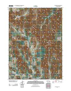
USGS Historical Quadrangle in GeoPDF.
Tags: 7.5 x 7.5 minute,
Downloadable Data,
GeoPDF,
GeoTIFF,
Greeley, All tags...
Historical Topographic Maps,
Historical Topographic Maps 7.5 x 7.5 Minute Map Series,
Map,
NE,
imageryBaseMapsEarthCover, Fewer tags
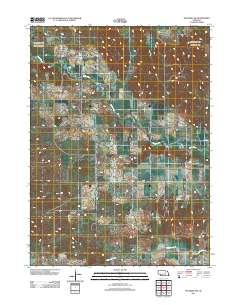
USGS Historical Quadrangle in GeoPDF.
Tags: 7.5 x 7.5 minute,
CO,
Downloadable Data,
GeoPDF,
GeoTIFF, All tags...
Greeley,
Historical Topographic Maps,
Historical Topographic Maps 7.5 x 7.5 Minute Map Series,
Map,
imageryBaseMapsEarthCover, Fewer tags

USGS Historical Quadrangle in GeoPDF.
Tags: 1 x 2 degree,
CO,
Downloadable Data,
GeoPDF,
GeoTIFF, All tags...
Greeley,
Historical Topographic Maps,
Historical Topographic Maps 1 x 2 Degree Map Series,
Map,
imageryBaseMapsEarthCover, Fewer tags
Layered GeoPDF 7.5 Minute Quadrangle Map. Layers of geospatial data include orthoimagery, roads, grids, geographic names, elevation contours, hydrography, and other selected map features.
Tags: 7.5 x 7.5 minute,
Colorado,
Downloadable Data,
EarthCover,
GeoPDF, All tags...
Greeley,
Imagery and Base Maps,
Kansas,
Kiowa,
Map,
Towner, CO-KS,
U.S. National Grid,
US,
US Topo,
US Topo Historical,
United States,
contour,
geographic names,
hydrography,
imageryBaseMapsEarthCover,
orthoimage,
topographic,
transportation, Fewer tags
Layered geospatial PDF Map. Layers of geospatial data include orthoimagery, roads, grids, geographic names, elevation contours, hydrography, and other selected map features.
Tags: 7.5 x 7.5 minute,
Colorado,
Downloadable Data,
EarthCover,
GeoPDF, All tags...
Greeley,
Hamilton,
Imagery and Base Maps,
Kansas,
Kiowa,
Map,
Prowers,
Public Land Survey System,
Towner SE, CO-KS,
U.S. National Grid,
US,
US Topo,
US Topo Historical,
United States,
boundary,
contour,
geographic names,
hydrography,
imageryBaseMapsEarthCover,
orthoimage,
structures,
topographic,
transportation,
woodland, Fewer tags
|
|

