Filters: Tags: Greenlee (X)
357 results (214ms)|
Filters
Date Range
Types Contacts
Categories Tag Types
|
A Phelps Dodge locamotive at the Morenci mine.
A water truck spraying water on a haul road at the Morenci mine on the right with a haul truck on the left.
A view of the Arizona Eastern Railway operating between Clifton and Miami, Arizona, mainly for transporting ore.
A view of the Morenci smelter with dumps on the right.
Categories: Data;
Tags: 1950s,
Arizona,
Arizona Copper Co. Smelter,
Clifton - 15 Min,
Clifton Smelter,
A drill rig and a power shovel on benches in the Morenci mine.
A view of the open pit at the Morenci mine.
EW starter sheet maker at the Morenci mine.
The Shamrock Shaft and headframe at the Ash Peak mine.
Categories: Data;
Tags: 1990s,
Arizona,
Arthur Murphy,
Ash Peak metallic mineral dist.,
Black Beauty,
Stringer mineralization underground at the Ash Peak mine.
Categories: Data;
Tags: 1990s,
Arizona,
Arthur Murphy,
Ash Peak metallic mineral dist.,
Black Beauty,
This location is part of the Arizona Mineral Industry Location System (AzMILS), an inventory of mineral occurences, prospects and mine locations in Arizona. Greenlee99 is located in T8S R31E Sec 12 C in the Duncan - 15 Min quad. This collection consists of various reports, maps, records and related materials acquired by the Arizona Department of Mines and Mineral Resources regarding mining properties in Arizona. Information was obtained by various means, including the property owners, exploration companies, consultants, verbal interviews, field visits, newspapers and publications. Some sections may be redacted for copyright. Please see the access statement.
This location is part of the Arizona Mineral Industry Location System (AzMILS), an inventory of mineral occurences, prospects and mine locations in Arizona. Greenlee25A is located in T3S R29E Sec 16 NE in the Clifton - 15 Min quad. This collection consists of various reports, maps, records and related materials acquired by the Arizona Department of Mines and Mineral Resources regarding mining properties in Arizona. Information was obtained by various means, including the property owners, exploration companies, consultants, verbal interviews, field visits, newspapers and publications. Some sections may be redacted for copyright. Please see the access statement.
This location is part of the Arizona Mineral Industry Location System (AzMILS), an inventory of mineral occurences, prospects and mine locations in Arizona. Greenlee19 is located in T2S R29E Sec 33 SE in the Clifton - 15 Min quad. This collection consists of various reports, maps, records and related materials acquired by the Arizona Department of Mines and Mineral Resources regarding mining properties in Arizona. Information was obtained by various means, including the property owners, exploration companies, consultants, verbal interviews, field visits, newspapers and publications. Some sections may be redacted for copyright. Please see the access statement.
Categories: Data;
Tags: 1940s,
Arizona,
Clifton - 15 Min,
Copper Mountain metallic mineral dist.,
Dataset,
This location is part of the Arizona Mineral Industry Location System (AzMILS), an inventory of mineral occurences, prospects and mine locations in Arizona. Greenlee92B is located in T7S R32E Sec 15 NE in the York Valley - 15 Min quad. This collection consists of various reports, maps, records and related materials acquired by the Arizona Department of Mines and Mineral Resources regarding mining properties in Arizona. Information was obtained by various means, including the property owners, exploration companies, consultants, verbal interviews, field visits, newspapers and publications. Some sections may be redacted for copyright. Please see the access statement.
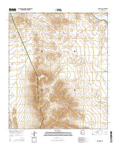
Layered GeoPDF 7.5 Minute Quadrangle Map. Layers of geospatial data include orthoimagery, roads, grids, geographic names, elevation contours, hydrography, and other selected map features.
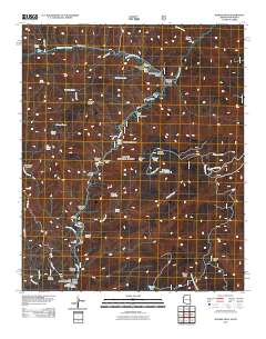
Layered GeoPDF 7.5 Minute Quadrangle Map. Layers of geospatial data include orthoimagery, roads, grids, geographic names, elevation contours, hydrography, and other selected map features.
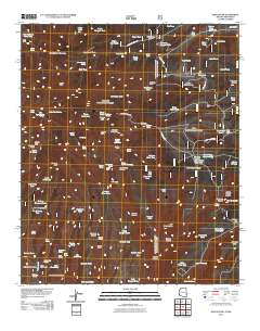
Layered GeoPDF 7.5 Minute Quadrangle Map. Layers of geospatial data include orthoimagery, roads, grids, geographic names, elevation contours, hydrography, and other selected map features.
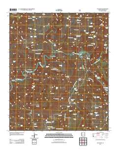
Layered GeoPDF 7.5 Minute Quadrangle Map. Layers of geospatial data include orthoimagery, roads, grids, geographic names, elevation contours, hydrography, and other selected map features.

Layered GeoPDF 7.5 Minute Quadrangle Map. Layers of geospatial data include orthoimagery, roads, grids, geographic names, elevation contours, hydrography, and other selected map features.
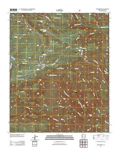
Layered GeoPDF 7.5 Minute Quadrangle Map. Layers of geospatial data include orthoimagery, roads, grids, geographic names, elevation contours, hydrography, and other selected map features.
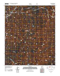
Layered GeoPDF 7.5 Minute Quadrangle Map. Layers of geospatial data include orthoimagery, roads, grids, geographic names, elevation contours, hydrography, and other selected map features.
|

|
