Filters
Date Range
Types
Contacts
Categories
Tag Types
Tag Schemes
|

A Phelps Dodge locamotive at the Morenci mine.
Categories: Data;
Tags: 1990s,
Arizona,
Arizona Central,
Bon Ton,
Caynga, All tags...
Clifton - 15 Min,
Copper King,Alice Winifred,
Copper Mountain,
Copper Mountain metallic mineral dist.,
Copper, Sulfide,
Dataset,
Delaware,
Detr,
East And West Yankie,
Garfield,
Greenlee,
Hormeyer,
Humboldt,
Ida,
Jameson, Joy, Raton,
King,
Las Terrazas,
Manganese Blue,
Metcalf,
Montezuma,
Morenci physiographic area,
Northwest Extension,
Ryerson,
Shannon,
T4S R29E Sec 16 N2,
Thompson,
United States,
geoscientificInformation,
image collections,
mining,
photographic prints,
railroads, Fewer tags

A water truck spraying water on a haul road at the Morenci mine on the right with a haul truck on the left.
Categories: Data;
Tags: 1990s,
Arizona,
Arizona Central,
Bon Ton,
Caynga, All tags...
Clifton - 15 Min,
Copper King,Alice Winifred,
Copper Mountain,
Copper Mountain metallic mineral dist.,
Copper, Sulfide,
Dataset,
Delaware,
Detr,
East And West Yankie,
Garfield,
Greenlee,
Hormeyer,
Humboldt,
Ida,
Jameson, Joy, Raton,
King,
Las Terrazas,
Manganese Blue,
Metcalf,
Montezuma,
Morenci physiographic area,
Northwest Extension,
Ryerson,
Shannon,
T4S R29E Sec 16 N2,
Thompson,
United States,
geoscientificInformation,
image collections,
mining,
photographic prints,
surface mining,
trucks,
water use, Fewer tags

A drill rig and a power shovel on benches in the Morenci mine.
Categories: Data;
Tags: 1990s,
Arizona,
Arizona Central,
Bon Ton,
Caynga, All tags...
Clifton - 15 Min,
Copper King,Alice Winifred,
Copper Mountain,
Copper Mountain metallic mineral dist.,
Copper, Sulfide,
Dataset,
Delaware,
Detr,
East And West Yankie,
Garfield,
Greenlee,
Hormeyer,
Humboldt,
Ida,
Jameson, Joy, Raton,
King,
Las Terrazas,
Manganese Blue,
Metcalf,
Montezuma,
Morenci physiographic area,
Northwest Extension,
Ryerson,
Shannon,
T4S R29E Sec 16 N2,
Thompson,
United States,
drilling and coring,
geoscientificInformation,
image collections,
mining,
photographic prints,
power shovels,
surface mining,
trucks, Fewer tags

A view of the open pit at the Morenci mine.
Categories: Data;
Tags: 1990s,
Arizona,
Arizona Central,
Bon Ton,
Caynga, All tags...
Clifton - 15 Min,
Copper King,Alice Winifred,
Copper Mountain,
Copper Mountain metallic mineral dist.,
Copper, Sulfide,
Dataset,
Delaware,
Detr,
East And West Yankie,
Garfield,
Greenlee,
Hormeyer,
Humboldt,
Ida,
Jameson, Joy, Raton,
King,
Las Terrazas,
Manganese Blue,
Metcalf,
Montezuma,
Morenci physiographic area,
Northwest Extension,
Ryerson,
Shannon,
T4S R29E Sec 16 N2,
Thompson,
United States,
geoscientificInformation,
image collections,
mining,
photographic prints,
surface mining, Fewer tags

ADMMR map collection: Morenci Mine Bit Shop; 1 in. to 10 feet; 23 x 20 in.
Categories: Data;
Tags: Abrasive, Garnet Andra,
Arizona,
Arizona Central,
Bon Ton,
Calcium, Limestone, All tags...
Caynga,
Clay,
Clifton - 15 Min,
Copper King,Alice Winifred,
Copper Mountain,
Copper, Native,
Copper, Oxide,
Copper, Sulfide,
Dataset,
Delaware,
Detr,
East And West Yankie,
Garfield,
Gemstone, Turquoise,
Gold,
Greenlee County,
Hormeyer,
Humboldt,
Ida,
Jameson, Joy, Raton,
King,
Las Terrazas,
Manganese Blue,
Metcalf,
Montezuma,
Morenci Mine,
Northwest Extension,
Ryerson,
Shannon,
Silicon,
Silver,
T4S R29E Sec 16 N2,
Thompson,
United States,
Vanadium,
diagrams,
geoscientificInformation,
maps and atlases,
mining and quarrying,
mining equipment,
plans, Fewer tags

ADMMR map collection: Morenci Inclined Top-Slice System; 24 x 14 in.
Categories: Data;
Tags: Abrasive, Garnet Andra,
Arizona,
Arizona Central,
Bon Ton,
Calcium, Limestone, All tags...
Caynga,
Clay,
Clifton - 15 Min,
Copper King,Alice Winifred,
Copper Mountain,
Copper, Native,
Copper, Oxide,
Copper, Sulfide,
Dataset,
Delaware,
Detr,
East And West Yankie,
Garfield,
Gemstone, Turquoise,
Gold,
Greenlee County,
Hormeyer,
Humboldt,
Ida,
Jameson, Joy, Raton,
King,
Las Terrazas,
Manganese Blue,
Metcalf,
Montezuma,
Morenci Mine,
Northwest Extension,
Ryerson,
Shannon,
Silicon,
Silver,
T4S R29E Sec 16 N2,
Thompson,
United States,
Vanadium,
geoscientificInformation,
maps and atlases,
mining and quarrying,
sections,
subsurface maps, Fewer tags
Layered GeoPDF 7.5 Minute Quadrangle Map. Layers of geospatial data include orthoimagery, roads, grids, geographic names, elevation contours, hydrography, and other selected map features.
Tags: 7.5 x 7.5 minute,
Cushing, IA,
Downloadable Data,
EarthCover,
GeoPDF, All tags...
Ida,
Imagery and Base Maps,
Iowa,
Map,
Public Land Survey System,
U.S. National Grid,
US,
US Topo,
US Topo Historical,
United States,
Woodbury,
boundary,
contour,
geographic names,
hydrography,
imageryBaseMapsEarthCover,
orthoimage,
structures,
topographic,
transportation,
woodland, Fewer tags
Layered GeoPDF 7.5 Minute Quadrangle Map. Layers of geospatial data include orthoimagery, roads, grids, geographic names, elevation contours, hydrography, and other selected map features.
Tags: 7.5 x 7.5 minute,
Crawford,
Downloadable Data,
EarthCover,
GeoPDF, All tags...
Ida,
Imagery and Base Maps,
Iowa,
Kiron, IA,
Map,
Public Land Survey System,
Sac,
U.S. National Grid,
US,
US Topo,
US Topo Historical,
United States,
boundary,
contour,
geographic names,
hydrography,
imageryBaseMapsEarthCover,
orthoimage,
structures,
topographic,
transportation,
woodland, Fewer tags

The Watershed Boundary Dataset (WBD) is a comprehensive aggregated collection of hydrologic unit data consistent with the national criteria for delineation and resolution. It defines the areal extent of surface water drainage to a point except in coastal or lake front areas where there could be multiple outlets as stated by the "Federal Standards and Procedures for the National Watershed Boundary Dataset (WBD)" "Standard" (https://pubs.usgs.gov/tm/11/a3/). Watershed boundaries are determined solely upon science-based hydrologic principles, not favoring any administrative boundaries or special projects, nor particular program or agency. This dataset represents the hydrologic unit boundaries to the 12-digit (6th level)...
Tags: 10-digit,
12-digit,
14-digit,
16-digit,
2-digit, All tags...
4-digit,
6-digit,
8-digit,
Adair,
Adams,
Albany,
Allen,
Anderson,
Andrew,
Antelope,
Appanoose,
Arapahoe,
Arthur,
Atchison,
Audrain,
Audubon,
Aurora,
Banner,
Barnes,
Barton,
Basin,
Bates,
Beadle,
Beaverhead,
Bennett,
Benton,
Big Horn,
Billings,
Blaine,
Bon Homme,
Boone,
Boulder,
Bourbon,
Bowman,
Box Butte,
Boyd,
Broadwater,
Brookings,
Broomfield,
Brown,
Brule,
Buchanan,
Buena Vista,
Buffalo,
Burke,
Burleigh,
Burt,
Butler,
Butte,
CO,
Caldwell,
Callaway,
Camden,
Campbell,
Carbon,
Carroll,
Carter,
Cascade,
Cass,
Cedar,
Chaffee,
Chariton,
Charles Mix,
Chase,
Cherokee,
Cherry,
Cheyenne,
Chouteau,
Christian,
Clark,
Clarke,
Clay,
Clear Creek,
Clinton,
Cloud,
Codington,
Coffey,
Cole,
Colfax,
Colorado,
Converse,
Cooper,
Corson,
Crawford,
Crook,
Cuming,
Custer,
Dade,
Dakota,
Dallas,
Daniels,
Daviess,
Davis,
Davison,
Dawes,
Dawson,
Day,
DeKalb,
Decatur,
Deer Lodge,
Dent,
Denver,
Deuel,
Dewey,
Dickey,
Dickinson,
Divide,
Dixon,
Dodge,
Doniphan,
Douglas,
Downloadable Data,
Dundy,
Dunn,
Eddy,
Edmunds,
El Paso,
Elbert,
Ellis,
Ellsworth,
Emmet,
Emmons,
Fall River,
Fallon,
Faulk,
Fergus,
Fillmore,
Flathead,
Foster,
Franklin,
Fremont,
Frontier,
Furnas,
Gage,
Gallatin,
Garden,
Garfield,
Gasconade,
Geary,
Gentry,
GeoPackage,
Gilpin,
Glacier,
Golden Valley,
Goshen,
Gosper,
Gove,
Graham,
Grand,
Granite,
Grant,
Greeley,
Greene,
Gregory,
Grundy,
Guthrie,
HU-2,
HU-2 Region,
HU2_10,
HUC,
Haakon,
Hall,
Hamilton,
Hamlin,
Hand,
Hanson,
Harding,
Harlan,
Harrison,
Hayes,
Henry,
Hettinger,
Hickory,
Hill,
Hitchcock,
Holt,
Hooker,
Hot Springs,
Howard,
Howell,
Hughes,
Hutchinson,
Hyde,
Hydrography,
Hydrologic Unit Code,
Hydrologic Units,
IA,
ID,
Ida,
Idaho,
Iowa,
Jackson,
Jefferson,
Jerauld,
Jewell,
Johnson,
Jones,
Judith Basin,
KS,
Kansas,
Kearney,
Keith,
Keya Paha,
Kidder,
Kimball,
Kingsbury,
Kit Carson,
Knox,
LaMoure,
Laclede,
Lafayette,
Lake,
Lancaster,
Lane,
Laramie,
Larimer,
Lawrence,
Leavenworth,
Lemhi,
Lewis and Clark,
Liberty,
Lincoln,
Linn,
Livingston,
Logan,
Loup,
Lucas,
Lyman,
Lyon,
MN,
MO,
MT,
Macon,
Madison,
Maries,
Marion,
Marshall,
McCone,
McCook,
McHenry,
McIntosh,
McKenzie,
McLean,
McPherson,
Meade,
Meagher,
Mellette,
Mercer,
Merrick,
Miami,
Miller,
Mills,
Miner,
Minnehaha,
Minnesota,
Missouri,
Mitchell,
Moniteau,
Monona,
Monroe,
Montana,
Montgomery,
Moody,
Morgan,
Morrill,
Morris,
Morton,
Mountrail,
Murray,
Musselshell,
ND,
NE,
Nance,
National Watershed Boundary Dataset (WBD),
National Watershed Boundary Dataset (WBD),
Natrona,
Nebraska,
Nemaha,
Ness,
Niobrara,
Nobles,
Nodaway,
North Dakota,
Norton,
Nuckolls,
O'Brien,
Oglala Lakota,
Oliver,
Open Geospatial Consortium GeoPackage 1.2,
Osage,
Osborne,
Osceola,
Otoe,
Ottawa,
Page,
Palo Alto,
Park,
Pawnee,
Pennington,
Perkins,
Petroleum,
Pettis,
Phelps,
Phillips,
Pierce,
Pipestone,
Platte,
Plymouth,
Polk,
Pondera,
Pottawatomie,
Pottawattamie,
Potter,
Powder River,
Powell,
Prairie,
Pulaski,
Putnam,
Randolph,
Ransom,
Ravalli,
Rawlins,
Ray,
Red Willow,
Region,
Republic,
Rice,
Richardson,
Richland,
Riley,
Ringgold,
Roberts,
Rock,
Rooks,
Roosevelt,
Rosebud,
Routt,
Rush,
Russell,
SD,
Sac,
Saline,
Sanborn,
Sargent,
Sarpy,
Saunders,
Schuyler,
Scott,
Scotts Bluff,
Sedgwick,
Seward,
Shawnee,
Shelby,
Sheridan,
Sherman,
Silver Bow,
Sioux,
Slope,
Smith,
South Dakota,
Spink,
St. Charles,
St. Clair,
St. Louis,
Stanley,
Stanton,
Stark,
Stillwater,
Stutsman,
Sub-basin,
Sub-region,
Sublette,
Subwatershed,
Sullivan,
Sully,
Summit,
Sweet Grass,
Sweetwater,
Taylor,
Teller,
Teton,
Texas,
Thayer,
Thomas,
Thurston,
Todd,
Toole,
Treasure,
Trego,
Tripp,
Turner,
US,
Union,
United States,
Valley,
Vernon,
WBD,
WY,
Wabaunsee,
Wallace,
Walworth,
Ward,
Warren,
Washakie,
Washington,
Watershed,
Watershed Boundary Dataset,
Wayne,
Webster,
Weld,
Wells,
Weston,
Wheatland,
Wheeler,
Wibaux,
Wichita,
Williams,
Woodbury,
Worth,
Wright,
Wyandotte,
Wyoming,
Yankton,
Yellowstone,
York,
Yuma,
Ziebach,
inlandWaters, Fewer tags
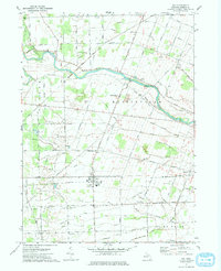
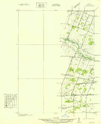
USGS Historical Quadrangle in GeoPDF.
Tags: 7.5 x 7.5 minute,
Downloadable Data,
GeoPDF,
GeoTIFF,
Historical Topographic Maps, All tags...
Historical Topographic Maps 7.5 x 7.5 Minute Map Series,
Ida,
MI,
Map,
imageryBaseMapsEarthCover, Fewer tags

Heinrichs Geoexploration Co. Maps: Inspiration Copper Cross Section, LLG 71-1; 1 in. to 200 feet; 64 x 23 in.
Categories: Data;
Tags: Abrasive, Garnet Andra,
Arizona,
Arizona Central,
Bon Ton,
Calcium, Limestone, All tags...
Caynga,
Clay,
Clifton - 15 Min,
Copper King,Alice Winifred,
Copper Mountain,
Copper Mountain metallic mineral dist.,
Copper, Native,
Copper, Oxide,
Copper, Sulfide,
Dataset,
Delaware,
Detr,
East And West Yankie,
Garfield,
Gemstone, Turquoise,
Gold,
Greenlee County,
Greenlee47,
Hormeyer,
Humboldt,
Ida,
Jameson, Joy, Raton,
King,
Las Terrazas,
Manganese Blue,
Metcalf,
Montezuma,
Morenci physiographic area,
Northwest Extension,
Ryerson,
Shannon,
Silicon,
Silver,
T4S R29E Sec 16 N2,
Thompson,
United States,
Vanadium,
drilling and coring,
geology,
geoscientificInformation,
maps and atlases,
mineral resources,
sections,
subsurface maps, Fewer tags

ADMMR map collection: Plan of Joy Shaft - Surface to 5th Level, Morenci Branch; 1 in. to 2 feet; 14 x 12 in.
Categories: Data;
Tags: Abrasive, Garnet Andra,
Arizona,
Arizona Central,
Bon Ton,
Calcium, Limestone, All tags...
Caynga,
Clay,
Clifton - 15 Min,
Copper King,Alice Winifred,
Copper Mountain,
Copper, Native,
Copper, Oxide,
Copper, Sulfide,
Dataset,
Delaware,
Detr,
East And West Yankie,
Garfield,
Gemstone, Turquoise,
Gold,
Greenlee County,
Hormeyer,
Humboldt,
Ida,
Jameson, Joy, Raton,
King,
Las Terrazas,
Manganese Blue,
Metcalf,
Montezuma,
Morenci Mine,
Northwest Extension,
Ryerson,
Shannon,
Silicon,
Silver,
T4S R29E Sec 16 N2,
Thompson,
United States,
Vanadium,
geoscientificInformation,
maps and atlases,
mining and quarrying,
plans,
subsurface maps, Fewer tags

SX Leach plant at Morenci in the foreground, the abandoned tailings leach plant in the background.
Categories: Data;
Tags: 1990s,
Arizona,
Arizona Central,
Bon Ton,
Caynga, All tags...
Clifton - 15 Min,
Copper King,Alice Winifred,
Copper Mountain,
Copper Mountain metallic mineral dist.,
Copper, Sulfide,
Dataset,
Delaware,
Detr,
East And West Yankie,
Garfield,
Greenlee,
Hormeyer,
Humboldt,
Ida,
Jameson, Joy, Raton,
King,
Las Terrazas,
Manganese Blue,
Metcalf,
Montezuma,
Morenci physiographic area,
Northwest Extension,
Ryerson,
Shannon,
T4S R29E Sec 16 N2,
Thompson,
United States,
buildings,
geoscientificInformation,
image collections,
milling and smelting,
mining,
photographic prints,
solution mining, Fewer tags

A view of mine roads at the Morenci mine.
Categories: Data;
Tags: 1990s,
Arizona,
Arizona Central,
Bon Ton,
Caynga, All tags...
Clifton - 15 Min,
Copper King,Alice Winifred,
Copper Mountain,
Copper Mountain metallic mineral dist.,
Copper, Sulfide,
Dataset,
Delaware,
Detr,
East And West Yankie,
Garfield,
Greenlee,
Hormeyer,
Humboldt,
Ida,
Jameson, Joy, Raton,
King,
Las Terrazas,
Manganese Blue,
Metcalf,
Montezuma,
Morenci physiographic area,
Northwest Extension,
Ryerson,
Shannon,
T4S R29E Sec 16 N2,
Thompson,
United States,
geoscientificInformation,
image collections,
mining,
photographic prints,
surface mining, Fewer tags

A view of the open pit at the Metcalf mine.
Categories: Data;
Tags: 1990s,
Arizona,
Arizona Central,
Bon Ton,
Caynga, All tags...
Clifton - 15 Min,
Copper King,Alice Winifred,
Copper Mountain,
Copper Mountain metallic mineral dist.,
Copper, Sulfide,
Dataset,
Delaware,
Detr,
East And West Yankie,
Garfield,
Greenlee,
Hormeyer,
Humboldt,
Ida,
Jameson, Joy, Raton,
King,
Las Terrazas,
Manganese Blue,
Metcalf,
Montezuma,
Morenci physiographic area,
Northwest Extension,
Ryerson,
Shannon,
T4S R29E Sec 16 N2,
Thompson,
United States,
geoscientificInformation,
image collections,
mining,
photographic prints,
surface mining, Fewer tags

Three men operating the cathode stripping machine at the Morenci Mine.
Categories: Data;
Tags: 1990s,
Arizona,
Arizona Central,
Bon Ton,
Caynga, All tags...
Clifton - 15 Min,
Copper King,Alice Winifred,
Copper Mountain,
Copper Mountain metallic mineral dist.,
Copper, Sulfide,
Dataset,
Delaware,
Detr,
East And West Yankie,
Garfield,
Greenlee,
Hormeyer,
Humboldt,
Ida,
Jameson, Joy, Raton,
King,
Las Terrazas,
Manganese Blue,
Metcalf,
Montezuma,
Morenci physiographic area,
Northwest Extension,
Ryerson,
Shannon,
T4S R29E Sec 16 N2,
Thompson,
United States,
adults,
geoscientificInformation,
image collections,
machinery,
mining,
photographic prints,
solution mining, Fewer tags

A Phelps Dodge locamotive at the Morence mine.
Categories: Data;
Tags: 1990s,
Arizona,
Arizona Central,
Bon Ton,
Caynga, All tags...
Clifton - 15 Min,
Copper King,Alice Winifred,
Copper Mountain,
Copper Mountain metallic mineral dist.,
Copper, Sulfide,
Dataset,
Delaware,
Detr,
East And West Yankie,
Garfield,
Greenlee,
Hormeyer,
Humboldt,
Ida,
Jameson, Joy, Raton,
King,
Las Terrazas,
Manganese Blue,
Metcalf,
Montezuma,
Morenci physiographic area,
Northwest Extension,
Ryerson,
Shannon,
T4S R29E Sec 16 N2,
Thompson,
United States,
geoscientificInformation,
image collections,
mining,
photographic prints,
railroads, Fewer tags
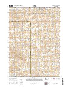
Layered GeoPDF 7.5 Minute Quadrangle Map. Layers of geospatial data include orthoimagery, roads, grids, geographic names, elevation contours, hydrography, and other selected map features.
Tags: 7.5 x 7.5 minute,
Crawford,
Downloadable Data,
EarthCover,
GeoPDF, All tags...
Ida,
Imagery and Base Maps,
Iowa,
Kiron, IA,
Map,
Public Land Survey System,
Sac,
U.S. National Grid,
US,
US Topo,
US Topo Historical,
United States,
boundary,
contour,
geographic names,
hydrography,
imageryBaseMapsEarthCover,
orthoimage,
structures,
topographic,
transportation,
woodland, Fewer tags
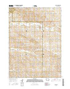
Layered GeoPDF 7.5 Minute Quadrangle Map. Layers of geospatial data include orthoimagery, roads, grids, geographic names, elevation contours, hydrography, and other selected map features.
Tags: 7.5 x 7.5 minute,
Downloadable Data,
EarthCover,
GeoPDF,
Ida, All tags...
Imagery and Base Maps,
Iowa,
Map,
Public Land Survey System,
Sac,
Schaller South, IA,
U.S. National Grid,
US,
US Topo,
US Topo Historical,
United States,
boundary,
contour,
geographic names,
hydrography,
imageryBaseMapsEarthCover,
orthoimage,
structures,
topographic,
transportation,
woodland, Fewer tags
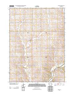
USGS Historical Quadrangle in GeoPDF.
Tags: 7.5 x 7.5 minute,
Advance,
Downloadable Data,
GeoPDF,
GeoTIFF, All tags...
Historical Topographic Maps,
Historical Topographic Maps 7.5 x 7.5 Minute Map Series,
Ida,
MI,
Map,
Planimetric,
imageryBaseMapsEarthCover, Fewer tags
|
|

