Filters: Tags: Klamath Falls (X)
20 results (79ms)|
Filters
Date Range
Extensions Types Contacts
Categories Tag Types
|

USGS Historical Quadrangle in GeoPDF.
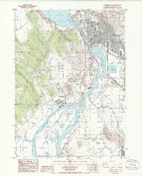
USGS Historical Quadrangle in GeoPDF.
The Klamath Basin mule deer herd contains an estimated 10,775 deer and features a mix of resident and migratory animals. Most winter ranges are adjacent to the California border near Bly and Lost River, California, in areas featuring western juniper, low shrublands, and early shrub-tree habitat. In spring, these mule deer either migrate northwest to regional national forest lands or northeast past South Fork Sprague River. Summer ranges contain ponderosa pine, mixed-conifer, and early shrub-tree habitat along with alfalfa and other agricultural crops. Notably, one mule deer migrated southeast into California near Goose Lake in May 2019 and spent a year near Deadhorse Reservoir before returning to Oregon in November...
Categories: Data;
Types: Downloadable,
Map Service,
OGC WFS Layer,
OGC WMS Layer,
Shapefile;
Tags: Klamath Falls,
Oregon,
United States,
animal behavior,
biota,
Research has suggested that biochar soil amendments have the ability to improve soil water retention, but results have not been consistent or predictable across soil types. The objective of this project was to evaluate the potential for biochar soil amendments to mitigate agricultural drought by characterizing their impacts on soil hydraulics and plant growth across a range of agricultural soil conditions. This data set contains soil moisture retention curves and unsaturated hydraulic conductivities for four Oregon agricultural soils amended with biochar. Gasified biochars made from wheat straw (AgEnergy, Spokane, WA) and conifer wood (BioLogical, Philomath, OR) were tilled into soils at experimental stations in...
Categories: Data;
Types: Downloadable;
Tags: Drought,
Drought, Fire and Extreme Weather,
Drought, Fire and Extreme Weather,
Klamath Falls,
Landscapes,
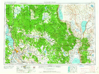
USGS Historical Quadrangle in GeoPDF.
USGS Historical Quadrangle in GeoPDF.
USGS Historical Quadrangle in GeoPDF.
USGS Historical Quadrangle in GeoPDF.
BLM Eastside Forest Management lands selected from General Land Use Allocations in the Western Oregon Plan Revision (WOPR) area. These lands lie within the East side of the Klamath Falls Resource Area. The Eastside Forest Management Areas are distinct from the rest of the Klamath Falls Resource Area for two reasons: The Eastside Forest Management Area lands are ecologically distinct from the Westside areas and must be managed differently. The Eastside Forest Management Area lands are in the Public Domain and are not included in the O&C Lands as is the West side of the Klamath Falls Resource Area and thus, fall under a different mandate for management.BLM (Bureau of Land Management) WOPR (Western Oregon Plan Revision)...
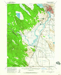
USGS Historical Quadrangle in GeoPDF.
USGS Historical Quadrangle in GeoPDF.
USGS Historical Quadrangle in GeoPDF.
USGS Historical Quadrangle in GeoPDF.
The Klamath Basin mule deer herd contains an estimated 10,775 deer and features a mix of resident and migratory animals. Most winter ranges are adjacent to the California border near Bly and Lost River, California, in areas featuring western juniper, low shrublands, and early shrub-tree habitat. In spring, these mule deer either migrate northwest to regional national forest lands or northeast past South Fork Sprague River. Summer ranges contain ponderosa pine, mixed-conifer, and early shrub-tree habitat along with alfalfa and other agricultural crops. Notably, one mule deer migrated southeast into California near Goose Lake in May 2019 and spent a year near Deadhorse Reservoir before returning to Oregon in November...
Categories: Data;
Types: Downloadable,
Map Service,
OGC WFS Layer,
OGC WMS Layer,
Shapefile;
Tags: Klamath Falls,
Oregon,
United States,
animal behavior,
biota,
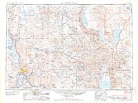
USGS Historical Quadrangle in GeoPDF.

USGS Historical Quadrangle in GeoPDF.
Research has suggested that biochar soil amendments have the ability to improve soil water retention, but results have not been consistent or predictable across soil types. The objective of this project was to evaluate the potential for biochar soil amendments to mitigate agricultural drought by characterizing their impacts on soil hydraulics and plant growth across a range of agricultural soil conditions. This data set contains soil moisture retention curves and unsaturated hydraulic conductivities for four Oregon agricultural soils amended with biochar. Gasified biochars made from wheat straw (AgEnergy, Spokane, WA) and conifer wood (BioLogical, Philomath, OR) were tilled into soils at experimental stations in...
Categories: Data;
Tags: Drought,
Drought, Fire and Extreme Weather,
Drought, Fire and Extreme Weather,
Klamath Falls,
Landscapes,
The objective of this project was to evaluate the potential for biochar soil amendments to mitigate agricultural drought by characterizing their impacts on soil hydraulics and plant growth across a range of agricultural soil conditions. This data set contains soil water infiltration measurements using Beerkan infiltration rings in four Oregon agricultural soils amended with biochar. Gasified biochars made from wheat straw (AgEnergy, Spokane, WA) and conifer wood (BioLogical, Philomath, OR) were tilled into soils at experimental stations in Madras (loam), Pendleton (silt loam), Aurora (sandy loam), and Klamath Falls (loamy sand). The biochars were incorporated by tillage in fall 2016 to a depth of 12 cm at rates...
Categories: Data;
Tags: Drought,
Drought, Fire and Extreme Weather,
Drought, Fire and Extreme Weather,
Klamath Falls,
Landscapes,
Water and gas chemistry data from: Benson, S.M., Janik, C.J., Long, D.C., Solbau, R.D. and Lienau, P.J., 1984. Data from pumping and injection tests and chemical sampling in the geothermal aquifer at Klamath Falls, Oregon: U.S. Geological Survey Open File Report 84-146, 114 p., https://doi.org/10.3133/ofr84146. Water chemistry data was digitized for 18 samples. Reported attributes include: Sample name, Type, Collection date, Reported location, State, County, Latitude, Longitude, Location resolution, Well depth, Temperature, pH (field), pH (lab), Aluminium (Al), Calcium (Ca), Chloride (Cl), Flouride (F), Bicarbonate (HCO3), Mercury (Hg), Potassium (K), Lithium (Li), Sodium (Na), Silica (SiO2), Sulfate (SO4),...
Categories: Data;
Types: Downloadable,
Map Service,
OGC WFS Layer,
OGC WMS Layer,
Shapefile;
Tags: Klamath Falls,
Oregon,
aquifer hydrology,
geologic energy storage,
geoscientificInformation,
|

|
