Filters
Date Range
Contacts
Categories
Tag Types
Tag Schemes
|
Core Research Center, core R591, from well operated by UNION PACIFIC RRRaw Properties from download, web scrape, MapServer, and Macrostrat API{"Lib Num": "R591", "API Num": "4903705421", "Operator": "UNION PACIFIC RR", "Well Name": "2-7 UNION PACIFIC", "Field": "MIDDLE BAXTER BASIN", "State": "WY", "County": "SWEETWATER", "Type": "FULL", "Photos": "F", "Thin Sec": "F", "Analysis": "F", "Latitude": "41.55801", "Longitude": "-109.06509", "coordinates_geohash": "9x6kqjmhznw9", "Source": "FROM STATE RECORDS", "Security Flag": "NO SPECIAL RESTRICTIONS", "crc_collection_name": "core", "sb_parent_id": "4f4e49dae4b07f02db5e0486", "intervals": [{"Formation": "LAKOTA", "Age": "CRET", "Min Depth": "2667", "Max Depth": "2703"},...
Core Research Center, core A799, from well operated by ALMINEX USARaw Properties from download, web scrape, MapServer, and Macrostrat API{"Lib Num": "A799", "API Num": "4901920355", "Operator": "ALMINEX USA", "Well Name": "25-1 HARRIS FEDERAL", "Field": "MEADOW CREEK", "State": "WY", "County": "JOHNSON", "Type": "SLABBED", "Photos": "T", "Thin Sec": "T", "Analysis": "T", "Latitude": "43.49892", "Longitude": "-106.17088", "coordinates_geohash": "9xsx2n8xx4mv", "Source": "FROM STATE RECORDS", "Security Flag": "NO SPECIAL RESTRICTIONS", "crc_collection_name": "core", "sb_parent_id": "4f4e49dae4b07f02db5e0486", "intervals": [{"Formation": "FRONTIER", "Age": "CRET", "Min Depth": "6293", "Max Depth": "6349"}, {"Formation":...
Core Research Center, core T964, from well operated by MARATHON OIL COMPANYRaw Properties from download, web scrape, MapServer, and Macrostrat API{"Lib Num": "T964", "API Num": "4902720279", "Operator": "MARATHON OIL COMPANY", "Well Name": "12 CONVERSE CREEK", "Field": "LANCE CREEK", "State": "WY", "County": "NIOBRARA", "Type": "SLABBED", "Photos": "T", "Thin Sec": "T", "Analysis": "T", "Latitude": "43.04624", "Longitude": "-104.68843", "coordinates_geohash": "9xtscu24wb8z", "Source": "FROM STATE RECORDS", "Security Flag": "NO SPECIAL RESTRICTIONS", "crc_collection_name": "core", "sb_parent_id": "4f4e49dae4b07f02db5e0486", "intervals": [{"Formation": "MUDDY", "Age": "CRET", "Min Depth": "2997", "Max Depth": "3050"},...
Categories: Physical Item;
Tags: CONVERSE,
CONVERSE,
CONVERSE,
CRET,
CRET, All tags...
CRET,
CRET,
CRET,
CRET,
DAKOTA,
DAKOTA,
LAKOTA,
LAKOTA,
LEO,
LEO,
LEO,
LEO,
LEO,
LEO,
MUDDY,
MUDDY,
Oligocene and Eocene,
PENN,
PENN,
PENN,
PENN,
PENN,
PENN,
PENN,
PENN,
PENN,
White River Group,
White River Group, Fewer tags
Core Research Center, core W160, from well operated by MARATHONRaw Properties from download, web scrape, MapServer, and Macrostrat API{"Lib Num": "W160", "API Num": "4901706464", "Operator": "MARATHON", "Well Name": "27 CURTIS UNIT", "Field": "GRASS CREEK", "State": "WY", "County": "HOT SPRINGS", "Type": "FULL", "Photos": "F", "Thin Sec": "F", "Analysis": "F", "Latitude": "43.95773", "Longitude": "-108.67209", "coordinates_geohash": "9xfdp472kfb9", "Source": "FROM STATE RECORDS", "Security Flag": "NO SPECIAL RESTRICTIONS", "crc_collection_name": "core", "sb_parent_id": "4f4e49dae4b07f02db5e0486", "intervals": [{"Formation": "FRONTIER", "Age": null, "Min Depth": "608", "Max Depth": "1699"}, {"Formation": "MUDDY",...
Categories: Physical Item;
Tags: Campanian,
Cody Shale,
Cody Shale,
DAKOTA,
FRONTIER, All tags...
LAKOTA,
MUDDY,
sandstone,
shale,
siltstone, Fewer tags
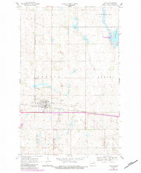
USGS Historical Quadrangle in GeoPDF.
Tags: 7.5 x 7.5 minute,
Downloadable Data,
GeoPDF,
GeoTIFF,
Historical Topographic Maps, All tags...
Historical Topographic Maps 7.5 x 7.5 Minute Map Series,
Lakota,
Map,
ND,
imageryBaseMapsEarthCover, Fewer tags
Core Research Center, core S642, from well operated by CHEVRON OILRaw Properties from download, web scrape, MapServer, and Macrostrat API{"Lib Num": "S642", "API Num": "4900105175", "Operator": "CHEVRON OIL", "Well Name": "1 GEORGE GOVERNMENT", "Field": "JAMES LAKE", "State": "WY", "County": "ALBANY", "Type": "FULL", "Photos": "F", "Thin Sec": "F", "Analysis": "F", "Latitude": "41.47685", "Longitude": "-105.83232", "coordinates_geohash": "9xkezwxk0jnx", "Source": "FROM STATE RECORDS", "Security Flag": "NO SPECIAL RESTRICTIONS", "crc_collection_name": "core", "sb_parent_id": "4f4e49dae4b07f02db5e0486", "intervals": [{"Formation": "LAKOTA", "Age": "CRET", "Min Depth": "4542", "Max Depth": "4594"}, {"Formation": "SUNDANCE",...
Categories: Physical Item;
Tags: CASPER,
CHUGWATER,
CRET,
CRET,
CRET, All tags...
CRET,
FRONTIER,
Holocene and Pleistocene,
JURA,
JURA,
LAKOTA,
MUDDY,
Mixed alluvium and colluvium,
PENN,
PENN,
SHANNON,
SUNDANCE,
SUNDANCE,
TENSLEEP,
TRIA,
alluvium,
clay,
gravel,
sand,
silt, Fewer tags
Core Research Center, core S490, from well operated by DAVIS OIL COMPANYRaw Properties from download, web scrape, MapServer, and Macrostrat API{"Lib Num": "S490", "API Num": "4902720573", "Operator": "DAVIS OIL COMPANY", "Well Name": "1 CANVASBACK FEDERAL", "Field": "WC", "State": "WY", "County": "NIOBRARA", "Type": "FULL", "Photos": "F", "Thin Sec": "F", "Analysis": "F", "Latitude": "43.24688", "Longitude": "-104.61395", "coordinates_geohash": "9xtw52y7q69p", "Source": "FROM STATE RECORDS", "Security Flag": "NO SPECIAL RESTRICTIONS", "crc_collection_name": "core", "sb_parent_id": "4f4e49dae4b07f02db5e0486", "intervals": [{"Formation": "LAKOTA", "Age": "CRET", "Min Depth": "7373", "Max Depth": "7434"}, {"Formation":...
Core Research Center, core T419, from well operated by ROCK WELL PETROLEUMRaw Properties from download, web scrape, MapServer, and Macrostrat API{"Lib Num": "T419", "API Num": "4902523466", "Operator": "ROCK WELL PETROLEUM", "Well Name": "FEDERAL WYC-037870 CORE 8", "Field": "POISON SPIDER", "State": "WY", "County": "NATRONA", "Type": "SLABBED & FULL", "Photos": "T", "Thin Sec": "F", "Analysis": "F", "Latitude": "42.4949", "Longitude": "-106.4346", "coordinates_geohash": "9xs3dpbwwpd0", "Source": "PROVIDED BY DONOR", "Security Flag": "NO SPECIAL RESTRICTIONS", "crc_collection_name": "core", "sb_parent_id": "4f4e49dae4b07f02db5e0486", "intervals": [{"Formation": "FRONTIER", "Age": "CRETACEOUS", "Min Depth": "48",...
Categories: Physical Item;
Tags: ALCOVA,
CANYON SPRINGS,
CRETACEOUS,
CRETACEOUS,
CRETACEOUS, All tags...
CRETACEOUS,
CRETACEOUS,
CRETACEOUS,
CROW MOUNTAIN,
CROW MOUNTAIN,
Campanian,
DAKOTA,
FRONTIER,
HULETT,
JURASSIC,
JURASSIC,
JURASSIC,
JURASSIC,
JURASSIC,
LAKOTA,
MORRISON,
MOWRY,
MUDDY,
POPO AGIE,
RED PEAK,
SKULL CREEK,
SUNDANCE,
SUNDANCE LOWER,
Steele Shale,
Steele Shale,
TRIASSIC,
TRIASSIC,
TRIASSIC,
TRIASSIC,
TRIASSIC,
sandstone,
shale, Fewer tags
Core Research Center, core C784, from well operated by FENIX & SCISSONRaw Properties from download, web scrape, MapServer, and Macrostrat API{"Lib Num": "C784", "API Num": "4902510710", "Operator": "FENIX & SCISSON", "Well Name": "56-LX-10 NPR 3", "Field": "TEAPOT DOME", "State": "WY", "County": "NATRONA", "Type": "SLABBED", "Photos": "F", "Thin Sec": "F", "Analysis": "F", "Latitude": "43.27379", "Longitude": "-106.19983", "coordinates_geohash": "9xsqpmg8he5h", "Source": "FROM STATE RECORDS", "Security Flag": "NO SPECIAL RESTRICTIONS", "crc_collection_name": "core", "sb_parent_id": "4f4e49dae4b07f02db5e0486", "intervals": [{"Formation": "MORRISON", "Age": "JURA", "Min Depth": "3900", "Max Depth": "3928"}, {"Formation":...
Core Research Center, core C733, from well operated by MERIT ENERGY COMPANYRaw Properties from download, web scrape, MapServer, and Macrostrat API{"Lib Num": "C733", "API Num": "4900527305", "Operator": "MERIT ENERGY COMPANY", "Well Name": "W-59601 22-20", "Field": "BUCK DRAW NORTH", "State": "WY", "County": "CAMPBELL", "Type": "SLABBED", "Photos": "T", "Thin Sec": "T", "Analysis": "T", "Latitude": "43.51417", "Longitude": "-105.65892", "coordinates_geohash": "9xsze9t82tny", "Source": "FROM STATE RECORDS", "Security Flag": "NO SPECIAL RESTRICTIONS", "crc_collection_name": "core", "sb_parent_id": "4f4e49dae4b07f02db5e0486", "intervals": [{"Formation": "DAKOTA", "Age": "CRET", "Min Depth": "12554", "Max Depth": "12581"},...
Core Research Center, core S024, from well operated by CALIFORNIA OILRaw Properties from download, web scrape, MapServer, and Macrostrat API{"Lib Num": "S024", "API Num": "4900105164", "Operator": "CALIFORNIA OIL", "Well Name": "3 SEVEN MILE", "Field": "SEVEN MILE", "State": "WY", "County": "ALBANY", "Type": "FULL", "Photos": "F", "Thin Sec": "F", "Analysis": "F", "Latitude": "41.45673", "Longitude": "-106.05423", "coordinates_geohash": "9xkefdvwvqd7", "Source": "FROM STATE RECORDS", "Security Flag": "NO SPECIAL RESTRICTIONS", "crc_collection_name": "core", "sb_parent_id": "4f4e49dae4b07f02db5e0486", "intervals": [{"Formation": "MORRISON", "Age": "JURA", "Min Depth": "6304", "Max Depth": "6335"}, {"Formation": "SUNDANCE",...
Categories: Physical Item;
Tags: CHUGWATER,
CRET,
CRET,
CRET,
CRET, All tags...
DAKOTA,
DAKOTA,
Gravel, pediment, and fan deposits,
JELM,
JURA,
JURA,
JURA,
JURA,
JURA,
LAKOTA,
MORRISON,
MORRISON,
PENN,
PENN,
Pleistocene - Holocene,
SHANNON,
SUNDANCE,
SUNDANCE,
SUNDANCE,
TENSLEEP,
TENSLEEP,
TRIA,
TRIA,
gravel, Fewer tags
Core Research Center, core R167, from well operated by CALIFORNIA OILRaw Properties from download, web scrape, MapServer, and Macrostrat API{"Lib Num": "R167", "API Num": "4900105165", "Operator": "CALIFORNIA OIL", "Well Name": "4 SEVEN MILE UNIT", "Field": "SEVEN MILE", "State": "WY", "County": "ALBANY", "Type": "FULL", "Photos": "F", "Thin Sec": "F", "Analysis": "T", "Latitude": "41.45477", "Longitude": "-106.05767", "coordinates_geohash": "9xkefde5t1jr", "Source": "FROM STATE RECORDS", "Security Flag": "NO SPECIAL RESTRICTIONS", "crc_collection_name": "core", "sb_parent_id": "4f4e49dae4b07f02db5e0486", "intervals": [{"Formation": "LAKOTA", "Age": "CRET", "Min Depth": "6167", "Max Depth": "6220"}, {"Formation":...
Categories: Physical Item;
Tags: CRET,
CRET,
CRET,
CRET,
DAKOTA, All tags...
LAKOTA,
Late Cretaceous,
Lewis Shale,
Lewis Shale,
MUDDY,
PENN,
PERM,
SATANKA,
TENSLEEP,
THERMOPOLIS,
sandstone,
shale, Fewer tags
Core Research Center, core F036, from well operated by MARATHON OIL CORaw Properties from download, web scrape, MapServer, and Macrostrat API{"Lib Num": "F036", "API Num": "4901720302", "Operator": "MARATHON OIL CO", "Well Name": "50 STATE LAND", "Field": "GRASS CREEK", "State": "WY", "County": "HOT SPRINGS", "Type": "SLABBED", "Photos": "T", "Thin Sec": "F", "Analysis": "F", "Latitude": "43.94283", "Longitude": "-108.6598", "coordinates_geohash": "9xf9zrs3e1hx", "Source": "FROM STATE RECORDS", "Security Flag": "NO SPECIAL RESTRICTIONS", "crc_collection_name": "core", "sb_parent_id": "4f4e49dae4b07f02db5e0486", "intervals": [{"Formation": "LAKOTA", "Age": "CRET", "Min Depth": "1991", "Max Depth": "2021"}, {"Formation":...
Categories: Physical Item;
Tags: CRET,
CRET,
Campanian,
Cody Shale,
Cody Shale, All tags...
LAKOTA,
MUDDY,
sandstone,
shale,
siltstone, Fewer tags
Core Research Center, core D972, from well operated by CHAMPLIN PETROLEUMRaw Properties from download, web scrape, MapServer, and Macrostrat API{"Lib Num": "D972", "API Num": "4900922401", "Operator": "CHAMPLIN PETROLEUM", "Well Name": "1 DORCHESTER-FEDERAL", "Field": "WILDCAT", "State": "WY", "County": "CONVERSE", "Type": "SLABBED", "Photos": "T", "Thin Sec": "T", "Analysis": "T", "Latitude": "43.14122", "Longitude": "-105.53585", "coordinates_geohash": "9xsvqmx5u6q9", "Source": "FROM STATE RECORDS", "Security Flag": "NO SPECIAL RESTRICTIONS", "crc_collection_name": "core", "sb_parent_id": "4f4e49dae4b07f02db5e0486", "intervals": [{"Formation": "DAKOTA", "Age": "CRET", "Min Depth": "13490", "Max Depth": "13550"},...
Core Research Center, core B866, from well operated by MOBIL OILRaw Properties from download, web scrape, MapServer, and Macrostrat API{"Lib Num": "B866", "API Num": "4901105045", "Operator": "MOBIL OIL", "Well Name": "F 43-33 GOVERNMENT", "Field": "COYOTE CREEK", "State": "WY", "County": "CROOK", "Type": "SLABBED", "Photos": "T", "Thin Sec": "F", "Analysis": "F", "Latitude": "44.18237", "Longitude": "-105.02386", "coordinates_geohash": "9xv7655uywwp", "Source": "FROM STATE RECORDS", "Security Flag": "NO SPECIAL RESTRICTIONS", "crc_collection_name": "core", "sb_parent_id": "4f4e49dae4b07f02db5e0486", "intervals": [{"Formation": "DAKOTA", "Age": "CRET", "Min Depth": "6432", "Max Depth": "6491"}, {"Formation": "LAKOTA",...
Core Research Center, core C459, from well operated by FENIX & SCISSONRaw Properties from download, web scrape, MapServer, and Macrostrat API{"Lib Num": "C459", "API Num": "4902510592", "Operator": "FENIX & SCISSON", "Well Name": "58-SX-14 NPR #3 58S-14", "Field": "TEAPOT DOME", "State": "WY", "County": "NATRONA", "Type": "SLABBED", "Photos": "F", "Thin Sec": "F", "Analysis": "F", "Latitude": "43.25837", "Longitude": "-106.17944", "coordinates_geohash": "9xsqpffqr8xh", "Source": "FROM STATE RECORDS", "Security Flag": "NO SPECIAL RESTRICTIONS", "crc_collection_name": "core", "sb_parent_id": "4f4e49dae4b07f02db5e0486", "intervals": [{"Formation": "LAKOTA", "Age": "CRET", "Min Depth": "4595", "Max Depth": "4614"},...
Core Research Center, core T867, from well operated by MARATHON OIL COMPANYRaw Properties from download, web scrape, MapServer, and Macrostrat API{"Lib Num": "T867", "API Num": "4900528857", "Operator": "MARATHON OIL COMPANY", "Well Name": "23-25 NORTH STAR", "Field": "WILDCAT", "State": "WY", "County": "CAMPBELL", "Type": null, "Photos": "F", "Thin Sec": "F", "Analysis": "T", "Latitude": "43.931", "Longitude": "-105.70152", "coordinates_geohash": "9xucftqs85fn", "Source": "FROM STATE RECORDS", "Security Flag": "NO SPECIAL RESTRICTIONS", "crc_collection_name": "core", "sb_parent_id": "4f4e49dae4b07f02db5e0486", "intervals": [{"Formation": "FUSON", "Age": "CRET", "Min Depth": "11201", "Max Depth": "11213"}, {"Formation":...
Core Research Center, core E341, from well operated by DIAMOND SHAMROCKRaw Properties from download, web scrape, MapServer, and Macrostrat API{"Lib Num": "E341", "API Num": "4900527615", "Operator": "DIAMOND SHAMROCK", "Well Name": "22-14 BELDA FEDERAL", "Field": "WILDCAT", "State": "WY", "County": "CAMPBELL", "Type": "SLABBED", "Photos": "T", "Thin Sec": "F", "Analysis": "T", "Latitude": "43.5284", "Longitude": "-105.59877", "coordinates_geohash": "9xszth1763fh", "Source": "FROM STATE RECORDS", "Security Flag": "NO SPECIAL RESTRICTIONS", "crc_collection_name": "core", "sb_parent_id": "4f4e49dae4b07f02db5e0486", "intervals": [{"Formation": "DAKOTA", "Age": "CRET", "Min Depth": "12090", "Max Depth": "12103"}, {"Formation":...
Core Research Center, core S238, from well operated by AMERADA HESS CORPRaw Properties from download, web scrape, MapServer, and Macrostrat API{"Lib Num": "S238", "API Num": "4900105183", "Operator": "AMERADA HESS CORP", "Well Name": "1 J M MILLER TRACT 1", "Field": "JAMES LAKE AREA", "State": "WY", "County": "ALBANY", "Type": "FULL", "Photos": "F", "Thin Sec": "F", "Analysis": "F", "Latitude": "41.51028", "Longitude": "-105.83158", "coordinates_geohash": "9xkspsxycmn3", "Source": "FROM STATE RECORDS", "Security Flag": "NO SPECIAL RESTRICTIONS", "crc_collection_name": "core", "sb_parent_id": "4f4e49dae4b07f02db5e0486", "intervals": [{"Formation": "SHANNON", "Age": "CRET", "Min Depth": "3530", "Max Depth": "3560"},...
Categories: Physical Item;
Tags: CRET,
CRET,
CRET,
CRET,
CRET, All tags...
DAKOTA,
LAKOTA,
Late Cretaceous,
Lewis Shale,
Lewis Shale,
MUDDY,
SHANNON,
SHANNON,
sandstone,
shale, Fewer tags
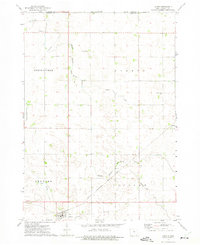
USGS Historical Quadrangle in GeoPDF.
Tags: 7.5 x 7.5 minute,
Downloadable Data,
GeoPDF,
GeoTIFF,
Historical Topographic Maps, All tags...
Historical Topographic Maps 7.5 x 7.5 Minute Map Series,
IA,
Lakota,
Map,
imageryBaseMapsEarthCover, Fewer tags
|
|

