Filters: Tags: Las Cruces (X)
71 results (14ms)|
Filters
Date Range
Types Contacts
Categories Tag Types Tag Schemes |
This part of the Data Release contains the raster representation of the water-level altitude and water-level change maps developed every 5 years from 1980-2015 for the upper Rio Grande Focus Area Study. The input point data used to generate the water-level altitude maps can be found in the "Groundwater level measurement data used to develop water-level altitude maps in the upper Rio Grande Alluvial Basins" child item of this data release. These digital data accompany Houston, N.A., Thomas, J.V., Foster, L.K., Pedraza, D.E., and Welborn, T.L., 2020, Hydrogeologic framework, groundwater-level altitudes, groundwater-level changes, and groundwater-storage changes in selected alluvial basins of the upper Rio Grande...
Types: Map Service,
OGC WFS Layer,
OGC WMS Layer,
OGC WMS Service;
Tags: Abiquiu Reservoir,
Ahumada,
Alamosa,
Alamosa County,
Alamosa Creek,
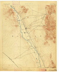
USGS Historical Quadrangle in GeoPDF.

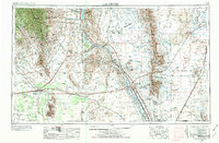
USGS Historical Quadrangle in GeoPDF.
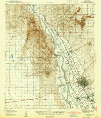
USGS Historical Quadrangle in GeoPDF.
This point vector dataset represents 10 climate stations used for analysis of annual and seasonal precipitation, analysis of monthly measured reference evapotranspiration, and comparison of simulated potential evapotranspiration with measured reference evapotranspiration within the Rio Grande transboundary integrated hydrologic model and water-availability analysis, New Mexico and Texas, United States, and Northern Chihuahua, Mexico.
This dataset contains monthly crop irrigation requirement (CIR) values from March 1940 through 2014 for the 20 virtual land-use units, including the seven canal service units, in the Rio Grande Transboundary Integrated Hydrologic Model (RGTIHM). CIR values are presented in units of feet per day.
Categories: Data;
Tags: Caballo Reservoir,
Chihuahua,
El Paso,
Elephant Butte Reservoir,
Las Cruces,
This dataset contains monthly pumping rates for municipal and industrial (MnI) wells in New Mexico within the Rio Grande Transboundary Integrated Hydrologic Model (RGTIHM). In RGTIHM, these wells are considered the Other New Mexico (ONM) group. Monthly pumping rates are presented in units of cubic feet per day for the period from March 1940 through December 2014.
Categories: Data;
Tags: Caballo Reservoir,
Chihuahua,
El Paso,
Elephant Butte Reservoir,
Las Cruces,
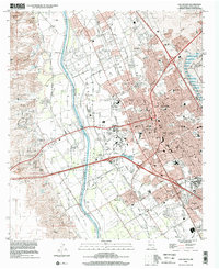
USGS Historical Quadrangle in GeoPDF.

USGS Historical Quadrangle in GeoPDF.
This dataset contains monthly crop irrigation requirement (CIR) values from 1938 through 2014 for six canal service units used in the Lower Rio Grande Basin groundwater flow model (SSPA, 2007). CIR values from 1938 through 2010 were extracted from the New Mexico Office of the State Engineer’s (NMOSE’s) Canal spreadsheet, version 11.2 (Barroll, P., NMOSE, written commun., 2011). CIR values from 2011 through 2014 were copied from a year within the 1938 through 2010 dataset with a similar total annual precipitation as recorded at the State University, NM US station, part of the National Oceanic and Atmospheric Administration (NOAA) National Climatic Data Center (NCDC) Global Historical Climatology Network (GHCND) (NCDC,...
Categories: Data;
Tags: Caballo Reservoir,
Chihuahua,
El Paso,
Elephant Butte Reservoir,
Las Cruces,
This dataset contains the source information for pumping rates for municipal and industrial (MnI) wells in Texas within the Rio Grande Transboundary Integrated Hydrologic Model (RGTIHM). In RGTIHM, these wells are considered the Other Texas (OTX) group.
Categories: Data;
Tags: Caballo Reservoir,
Chihuahua,
El Paso,
Elephant Butte Reservoir,
Las Cruces,
This line vector dataset represents the faults and dikes used as input data for the Rio Grande transboundary integrated hydrologic model and water-availability analysis, New Mexico and Texas, United States, and Northern Chihuahua, Mexico.
USGS Historical Quadrangle in GeoPDF.
USGS Historical Quadrangle in GeoPDF.
This dataset contains the source information for pumping rates for municipal and industrial (MnI) wells in New Mexico within the Rio Grande Transboundary Integrated Hydrologic Model (RGTIHM). In RGTIHM, these wells are considered the Other New Mexico (ONM) group.
Categories: Data;
Tags: Caballo Reservoir,
Chihuahua,
El Paso,
Elephant Butte Reservoir,
Las Cruces,
This dataset contains monthly pumping rates for municipal and industrial (MnI) wells in New Mexico within the Rio Grande Transboundary Integrated Hydrologic Model (RGTIHM) that were not included in other pumping rate datasets. In RGTIHM, these wells are considered the New Mexico Office of the State Engineer MnI (NMOSE_MnI) group. Monthly pumping rates are presented in units of cubic feet per day for the period from March 1940 through December 2014.
Categories: Data;
Tags: Caballo Reservoir,
Chihuahua,
El Paso,
Elephant Butte Reservoir,
Las Cruces,
This point vector dataset represents 8,877 domestic well locations and attributes used as input data for the Rio Grande Transboundary Integrated Hydrologic Model (RGTIHM). Attributes include well construction information, historic water use information, and flags indicating assumptions made for modeling purposes. Data were compiled from various sources; see Supplemental Information for details.
This point vector dataset represents tributary pour points used as model boundary inflow locations to the tributary Streamflow-Routing (SFR) Package network for recharge and runoff simulated by the Transboundary Rio Grande Watershed Model (TRGWM) for the Rio Grande transboundary integrated hydrologic model and water-availability analysis, New Mexico and Texas, United States, and Northern Chihuahua, Mexico (Hanson and others, 2018).
This dataset contains monthly pumping rates for municipal and industrial (MnI) wells in the Mexico portion of the Rio Grande Transboundary Integrated Hydrologic Model (RGTIHM). Monthly pumping rates are presented in units of cubic feet per day for the period from March 1940 through December 2014.
Categories: Data;
Tags: Caballo Reservoir,
Chihuahua,
El Paso,
Elephant Butte Reservoir,
Las Cruces,
This line vector dataset represents initial groundwater head contours used as input data for the Rio Grande transboundary integrated hydrologic model and water-availability analysis, New Mexico and Texas, United States, and Northern Chihuahua, Mexico.
|

|
