Filters: Tags: Matanzas Inlet (X)
12 results (51ms)|
Filters
Date Range
Extensions Types Contacts
Categories Tag Types Tag Schemes |
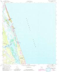
USGS Historical Quadrangle in GeoPDF.
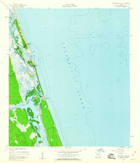
USGS Historical Quadrangle in GeoPDF.
Sandy ocean beaches in the United States are popular tourist and recreational destinations and constitute some of the most valuable real estate in the country. The boundary between land and water along the coastline is often the location of concentrated residential and commercial development and is frequently exposed to a range of natural hazards, which include flooding, storm effects, and coastal erosion. In response, the U.S. Geological Survey (USGS) is conducting a national assessment of coastal change hazards. One component of this research effort, the National Assessment of Shoreline Change Project (http://coastal.er.usgs.gov/shoreline-change/), documents changes in shoreline position as a proxy for coastal...
Categories: Data;
Types: Citation,
Downloadable,
Map Service,
OGC WFS Layer,
OGC WMS Layer,
Shapefile;
Tags: Atlantic Coast,
CMGP,
Cape Canaveral,
Coastal and Marine Geology Program,
DSAS,
Sandy ocean beaches in the United States are popular tourist and recreational destinations and constitute some of the most valuable real estate in the country. The boundary between land and water along the coastline is often the location of concentrated residential and commercial development and is frequently exposed to a range of natural hazards, which include flooding, storm effects, and coastal erosion. In response, the U.S. Geological Survey (USGS) is conducting a national assessment of coastal change hazards. One component of this research effort, the National Assessment of Shoreline Change Project (http://coastal.er.usgs.gov/shoreline-change/), documents changes in shoreline position as a proxy for coastal...
Categories: Data;
Types: Citation,
Downloadable,
Map Service,
OGC WFS Layer,
OGC WMS Layer,
Shapefile;
Tags: Accretion,
Atlantic Coast,
CMGP,
Cape Canaveral,
Coastal and Marine Geology Program,
This data release supersedes version 1.0, published in May 2021 at https://doi.org/10.5066/P9FKARIZ. Versioning details are documented in the accompanying Matanzas_revision_history.txt file. The interactions of waves and currents near an inlet influence sediment and alter sea-floor bedforms, especially during winter storms. As part of the Cross-Shore and Inlets Processes project to improve our understanding of cross-shore processes that control sediment budgets, the U.S. Geological Survey deployed instrumented platforms at two sites near Matanzas Inlet between January 24 and April 13, 2018. Matanzas Inlet is a natural, unmaintained inlet on the Florida Atlantic coast that is well suited for study of inlet and cross-shore...
Categories: Data;
Types: Downloadable,
Map Service,
OGC WFS Layer,
OGC WMS Layer,
Shapefile;
Tags: Atlantic Ocean,
Florida,
Fort Matanzas National Monument,
Marine Geology,
Matanzas,
Note: this data release has been deprecated. Find the updated version here: https://doi.org/10.5066/P9X7VIN2 The interactions of waves and currents near an inlet influence sediment and alter sea-floor bedforms, especially during winter storms. As part of the Cross-Shore and Inlets Processes project to improve our understanding of cross-shore processes that control sediment budgets, the U.S. Geological Survey deployed instrumented platforms at two sites near Matanzas Inlet between January 24 and April 13, 2018. Matanzas Inlet is a natural, unmaintained inlet on the Florida Atlantic coast that is well suited for study of inlet and cross-shore processes. The study sites were offshore of the surf zone in a line perpendicular...
Sandy ocean beaches in the United States are popular tourist and recreational destinations and constitute some of the most valuable real estate in the country. The boundary between land and water along the coastline is often the location of concentrated residential and commercial development and is frequently exposed to a range of natural hazards, which include flooding, storm effects, and coastal erosion. In response, the U.S. Geological Survey (USGS) is conducting a national assessment of coastal change hazards. One component of this research effort, the National Assessment of Shoreline Change Project (http://coastal.er.usgs.gov/shoreline-change/), documents changes in shoreline position as a proxy for coastal...
Categories: Data;
Types: Citation,
Downloadable,
Map Service,
OGC WFS Layer,
OGC WMS Layer,
Shapefile;
Tags: Accretion,
Atlantic Coast,
CMGP,
Cape Canaveral,
Coastal and Marine Geology Program,
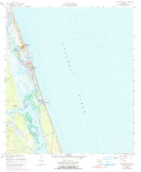
USGS Historical Quadrangle in GeoPDF.
Sandy ocean beaches in the United States are popular tourist and recreational destinations and constitute some of the most valuable real estate in the country. The boundary between land and water along the coastline is often the location of concentrated residential and commercial development and is frequently exposed to a range of natural hazards, which include flooding, storm effects, and coastal erosion. In response, the U.S. Geological Survey (USGS) is conducting a national assessment of coastal change hazards. One component of this research effort, the National Assessment of Shoreline Change Project (http://coastal.er.usgs.gov/shoreline-change/), documents changes in shoreline position as a proxy for coastal...
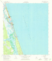
Categories: Data;
Types: Citation,
Downloadable,
Map Service,
OGC WFS Layer,
OGC WMS Layer,
Shapefile;
Tags: Atlantic Coast,
Baseline,
CMGP,
Cape Canaveral,
Coastal and Marine Geology Program,
Sandy ocean beaches in the United States are popular tourist and recreational destinations and constitute some of the most valuable real estate in the country. The boundary between land and water along the coastline is often the location of concentrated residential and commercial development and is frequently exposed to a range of natural hazards, which include flooding, storm effects, and coastal erosion. In response, the U.S. Geological Survey (USGS) is conducting a national assessment of coastal change hazards. One component of this research effort, the National Assessment of Shoreline Change Project (http://coastal.er.usgs.gov/shoreline-change/), documents changes in shoreline position as a proxy for coastal...
Categories: Data;
Types: Citation,
Downloadable,
Map Service,
OGC WFS Layer,
OGC WMS Layer,
Shapefile;
Tags: Accretion,
Atlantic Coast,
CMGP,
Cape Canaveral,
Coastal and Marine Geology Program,
|

|
