Filters: Tags: Mexico (X)
296 results (70ms)|
Filters
Date Range
Extensions Types
Contacts
Categories Tag Types
|
The Critical Minerals in Archived Mine Samples Database (CMDB) contains chemistry and geologic information for historic ore and ore-related rock samples from mineral deposits in the United States. In addition, the database contains samples from archetypal deposits from 27 other countries in North America, South America, Asia, Africa and Europe. Samples were obtained from archived ore collections under the U.S. Geological Survey's project titled "Quick Assessment of Rare and Critical Metals in Ore Deposits: A National Assessment" (2008 to 2013) in an effort to begin an assessment of the Nations' previously mined ore deposits for critical minerals. Mineralized and altered rock samples were provided by the Colorado...
Categories: Data;
Types: ArcGIS REST Map Service,
ArcGIS Service Definition,
Downloadable,
Map Service,
OGC WFS Layer,
OGC WMS Layer,
Shapefile;
Tags: Alaska,
Argentina,
Arizona,
Arkansas,
Australia,
Polygon locations of fire perimeters in the Sky Island mountain ranges in the Madrean Archipelago Ecoregion of the southwestern United States and northern Mexico. These fires occurred from 1985 to 2017 and were mapped using Landsat satellite imagery.
Natural cave passages penetrating a coastal aquifer in the Yucatan Peninsula (Mexico) were accessed to test the hypothesis that chemoclines associated with salinity gradients (haloclines) within the flooded cave networks of the karst subterranean estuary are sites of methane oxidation. Two field trips were carried out to the fully-submerged cave system located 6.6 km inland from the coastline in January 2015 and January 2016. Vertical chemical profiles across the water column haloclines were obtained using the OctoPiPi (OPP), a high-resolution water sampler built by the U.S. Geological Survey (USGS). The sampling efforts resulted in cm-scale profiles of major ions (e.g., chloride and sulfate), as well as concentrations...
WHISPers stands for Wildlife Health Information Sharing Partnership - event reporting system. It is a web-based repository for sharing basic information about historic and ongoing wildlife mortality (death) and morbidity (illness) events. The system possesses a searchable archive of wildlife mortality and morbidity event data that is available to the public. The information is opportunistically collected and does not reflect all the mortality events that occur in North America.
This dataset includes all North American Breeding Bird Survey data collected in Mexico between 2008-2018. These data were used as the basis for all analyses discussed in an associated publication: The North American Breeding Bird Survey in Mexico, 2008-2018 — A Status Report; https:doi.org/10.3133/cir1479. The records include avian point count data for all reported taxa (species, races, and unidentified species groupings). In addition to avian count data, this dataset also contains survey date, survey start and end times, start and end weather conditions, a unique observer identification number, route identification information, and route location information including country, state, and BCR, as well as geographic...
Categories: Data;
Tags: Birds,
Mexico,
North America,
USGS Science Data Catalog (SDC),
Wildlife Biology,
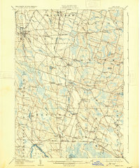
USGS Historical Quadrangle in GeoPDF.
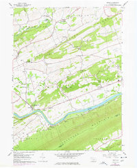
USGS Historical Quadrangle in GeoPDF.
These data were compiled to understand the effects of riparian vegetation health on local abundance and species diversity of land birds. The primary objective of our study was to to determine the effects of riparian restoration on birds in the Colorado River delta. These tabular data represent vegetation indices and evapotranspiration (ET) data at varying spatial scales that correspond to avian use circles of 100 to 2000 meters. Three vegetation reflectance indices (VIs): NDVI, EVI, and EVI2 were obtained from Landsat imagery with a biweekly temporal frequency, and covering the entire period of bird surveys (2002-2020). The Normalized Difference Vegetation Index (NDVI) and Enhanced Vegetation Index (EVI) and two-band...
Album Caption: Monterey ten miles below Purisima. Baja California, Mexico.
There are few resources that provide managers cross-scale information for planning climate adaptation strategies for species and taxa at risk. Appropriate allocation of resources requires an understanding of mechanisms influencing a species’ risk to global change. Dr. Griffis-Kyle will produce a manuscript for peer-reviewed publication and create content for web pages that can be included on the Desert LCC website that provide modules on amphibian climate adaptation strategies. This work is associated with addressing Desert LCC Critical Management Question 4: Physiological Stress of Climate Change and follows a webinar that Dr. Griffis-Kyle presented for the Desert LCC’s CMQ 4 team, titled “Climate and Desert Amphibian...
Categories: Data,
Web Site;
Types: Map Service,
OGC WFS Layer,
OGC WMS Layer,
OGC WMS Service;
Tags: 2014,
AZ-01,
AZ-02,
AZ-03,
AZ-04,
The Desert Landscape Conservation Cooperative (LCC) is a partnership formed and directed by resource management entities as well as interested public and private entities in the Mojave, Sonoran, and Chihuahuan Desert and montane sky island regions of the southwestern United States and northern Mexico. Desert LCC science depends on access to transboundary base datasets. Given the importance of vegetation such as grasslands and riparian vegetation in conservation science, a bi-national, landscape-scale vegetation data layer with classes relevant to Desert LCC research is crucial. One objective of this project is to investigate appropriate methodologies and landscape scales to create a Desert LCC binational land cover...
Categories: Data;
Tags: Academics & scientific researchers,
Aquascalientes,
Arizona,
Baja California,
California,
The National Hydrography Dataset (NHD) is a feature-based database that interconnects and uniquely identifies the stream segments or reaches that make up the nation's surface water drainage system. NHD data was originally developed at 1:100,000-scale and exists at that scale for the whole country. This high-resolution NHD, generally developed at 1:24,000/1:12,000 scale, adds detail to the original 1:100,000-scale NHD. (Data for Alaska, Puerto Rico and the Virgin Islands was developed at high-resolution, not 1:100,000 scale.) Local resolution NHD is being developed where partners and data exist. The NHD contains reach codes for networked features, flow direction, names, and centerline representations for areal water...

Multi Order Hydrologic Position (MOHP) raster datasets: Distance from Stream to Divide (DSD) and Lateral Position (LP) have been produced nationally for the 48 contiguous United States at a 30-meter resolution for stream orders 1 through 9. These data are available for testing as predictor variables for various regional and national groundwater-flow and groundwater-quality statistical models. The concept behind MOHP is that for any given point on the earth’s surface there is the potential for longer and longer groundwater flow paths as one goes deeper and deeper beneath the land surface. These increasing depths correspond to increasing stream orders. Or in other words, with increasing depth these paths of groundwater...
Geoinformación es un portal de información geográfica donde se puede consultar, visualizar y descargar cartografía temática de diferentes escalas generada y recopilada por CONABIO. Para desarrollar este portal se utilizó software de código abierto (open source). Las características principales del portal, son, desarrollar mecanismos de acceso a los acervos de datos geográficos de la CONABIO a través de servicios de información especializados, como: Vista gráfica de la información por temas generales. Información detallada sobre la cartografía disponible a través de búsquedas en los metadatos. Descarga de información en un formato compatible (shapefile) La información cartográfica es administrada por la Subdirección...
Types: Map Service,
OGC WFS Layer,
OGC WMS Layer,
OGC WMS Service;
Tags: GIS,
Mexico,
Spanish,
agriculture,
amphibian,
Esta Biblioteca se creó para los ciudadanos, para que puedas acceder a información ambiental de tu interés, en el momento y lugar que lo requieras. Actualmente está integrada por documentos y publicaciones del Centro de Conocimiento del Agua (CENCA) del IMTA, Centro de Información para la Gestión Ambiental (CIGA) de la Subsecretaría de Gestión para la Protección Ambiental y el Centro de Información de CECADESU (Centro de Educación y Capacitación para el Desarrollo Sustentable).
Types: Map Service,
OGC WFS Layer,
OGC WMS Layer,
OGC WMS Service;
Tags: Mexico,
Spanish,
climate,
education,
management,
Esta sección le ofrece seis sistemas de consulta geográfica y un módulo de solicitud de imágenes satelitales: Mosaico nacional de imágenes Muestra un continuo nacional de imágenes de satélite, formado por alrededor de 811 imágenes de 60 por 60 kilómetros, con resolución espacial de 2.5 metros. Mapas dinámicos Le permite explotar la base de datos agropecuaria y pesquera SIACON para generar sus propios mapas tematizados, seleccionando áreas específicas y manipulando capas de datos para ellas. Zonas áridas Sistema que ofrece información sobre las zonas climáticas en México, poniendo énfasis en los productos no maderables característicos de las zonas áridas. Infraestructura del sector agroalimentario Le presenta información...
Types: Map Service,
OGC WFS Layer,
OGC WMS Layer,
OGC WMS Service;
Tags: GIS,
Mexico,
Spanish,
agriculture,
climate,
This sampling frame is a set of grid-based finite-area frames spanning Canada, the United States, and Mexico. The grid for the United States is broken into individual grids for the continental United States, Hawaii, and Puerto Rico. Alaska is combined with Canada into a single grid. Each country/state/territory extent consists of four nested sampling grids at 50x50km, 10x10km, 5x5km, and 1x1km resolutions. The original 10x10km continental United States grid was developed by the Forest Service, U.S. Department of Agriculture for use in the interagency “Bat Grid” monitoring program in the Pacific Northwest and was expanded across Canada, the United States, and Mexico for the North American Bat Monitoring Program (NABat)....
Categories: Data;
Types: Downloadable,
Map Service,
OGC WFS Layer,
OGC WMS Layer,
Shapefile;
Tags: Alaska,
Canada,
Hawaii,
Mexico,
Puerto Rico,
This sampling frame is a set of grid-based finite-area frames spanning Canada, the United States, and Mexico. The grid for the United States is broken into individual grids for the continental United States, Hawaii, and Puerto Rico. Alaska is combined with Canada into a single grid. Each country/state/territory extent consists of four nested sampling grids at 50x50km, 10x10km, 5x5km, and 1x1km resolutions. The original 10x10km continental United States grid was developed by the Forest Service, U.S. Department of Agriculture for use in the interagency “Bat Grid” monitoring program in the Pacific Northwest and was expanded across Canada, the United States, and Mexico for the North American Bat Monitoring Program (NABat)....
This sampling frame is a set of grid-based finite-area frames spanning Canada, the United States, and Mexico. The grid for the United States is broken into individual grids for the continental United States, Hawaii, and Puerto Rico. Alaska is combined with Canada into a single grid. Each country/state/territory extent consists of four nested sampling grids at 50x50km, 10x10km, 5x5km, and 1x1km resolutions. The original 10x10km continental United States grid was developed by the Forest Service, U.S. Department of Agriculture for use in the interagency “Bat Grid” monitoring program in the Pacific Northwest and was expanded across Canada, the United States, and Mexico for the North American Bat Monitoring Program (NABat)....
Categories: Data;
Types: Downloadable,
Map Service,
OGC WFS Layer,
OGC WMS Layer,
Shapefile;
Tags: Alaska,
Canada,
Hawaii,
Mexico,
Puerto Rico,
|

|
