Filters: Tags: Miami-Dade County (X)
154 results (291ms)|
Filters
Date Range
Extensions Types
Contacts
Categories Tag Types Tag Schemes |
Several canals in southern Florida run from Lake Okeechobee through the Everglades Agricultural Area (EAA) and feed water to the northern Everglades. Agricultural and water-management practices affect the water quality of these canals. Fertilizers added in the EAA flow into the canals and are transported to treatment areas which remove much of the phosphorous in the water, but are not as effective in removing dissolved sulfate. Elevated sulfate concentrations, found downstream in the Water Conservation Areas in the northern Everglades, can stimulate sulfur-reducing bacteria which can also convert inorganic mercury to methyl mercury, a bioaccumulative neurotoxin. Chemistry data at 25 canal sites in southern Florida...
Categories: Data;
Tags: Broward County,
Energy Resources,
Geochemistry,
Miami-Dade County,
Palm Beach County,
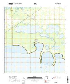
Layered geospatial PDF 7.5 Minute Quadrangle Map. Layers of geospatial data include orthoimagery, roads, grids, geographic names, elevation contours, hydrography, and other selected map features. This map is derived from GIS (geospatial information system) data. It represents a repackaging of GIS data in traditional map form, not creation of new information. The geospatial data in this map are from selected National Map data holdings and other government sources.
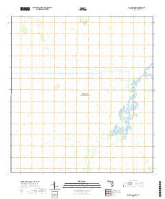
Layered geospatial PDF 7.5 Minute Quadrangle Map. Layers of geospatial data include orthoimagery, roads, grids, geographic names, elevation contours, hydrography, and other selected map features. This map is derived from GIS (geospatial information system) data. It represents a repackaging of GIS data in traditional map form, not creation of new information. The geospatial data in this map are from selected National Map data holdings and other government sources.
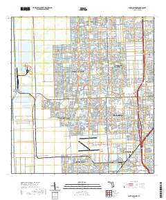
Layered geospatial PDF 7.5 Minute Quadrangle Map. Layers of geospatial data include orthoimagery, roads, grids, geographic names, elevation contours, hydrography, and other selected map features. This map is derived from GIS (geospatial information system) data. It represents a repackaging of GIS data in traditional map form, not creation of new information. The geospatial data in this map are from selected National Map data holdings and other government sources.
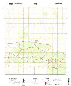
Layered geospatial PDF 7.5 Minute Quadrangle Map. Layers of geospatial data include orthoimagery, roads, grids, geographic names, elevation contours, hydrography, and other selected map features. This map is derived from GIS (geospatial information system) data. It represents a repackaging of GIS data in traditional map form, not creation of new information. The geospatial data in this map are from selected National Map data holdings and other government sources.
Statistical analyses and maps representing mean, high, and low water-level conditions in the surface water and groundwater of Miami-Dade County were made by the U.S. Geological Survey, in cooperation with the Miami-Dade County Department of Regulatory and Economic Resources, to help inform decisions necessary for urban planning and development. Sixteen maps were created that show contours of (1) the mean of daily water levels at each site during October and May for the 2000-2009 water years; (2) the 25th, 50th, and 75th percentiles of the daily water levels at each site during October and May and for all months during 2000-2009; and (3) the differences between mean October and May water levels, as well as the differences...
Categories: Data;
Types: Downloadable,
Map Service,
OGC WFS Layer,
OGC WMS Layer,
Shapefile;
Tags: Biscayne Bay,
Biscayne aquifer,
Florida,
Florida Bay,
Miami-Dade County,
Layered geospatial PDF 7.5 Minute Quadrangle Map. Layers of geospatial data include orthoimagery, roads, grids, geographic names, elevation contours, hydrography, and other selected map features. This map is derived from GIS (geospatial information system) data. It represents a repackaging of GIS data in traditional map form, not creation of new information. The geospatial data in this map are from selected National Map data holdings and other government sources.
Layered geospatial PDF 7.5 Minute Quadrangle Map. Layers of geospatial data include orthoimagery, roads, grids, geographic names, elevation contours, hydrography, and other selected map features. This map is derived from GIS (geospatial information system) data. It represents a repackaging of GIS data in traditional map form, not creation of new information. The geospatial data in this map are from selected National Map data holdings and other government sources.
Layered geospatial PDF 7.5 Minute Quadrangle Map. Layers of geospatial data include orthoimagery, roads, grids, geographic names, elevation contours, hydrography, and other selected map features. This map is derived from GIS (geospatial information system) data. It represents a repackaging of GIS data in traditional map form, not creation of new information. The geospatial data in this map are from selected National Map data holdings and other government sources.
The data set consists of time, depth, reflection coefficient synthetic, sonic velocity, density, and amplitude used to create synthetic seismogram - City of Hollywood Utility, G-2961, (HOL-IW1), Broward County, Florida.
Categories: Data;
Types: Citation;
Tags: Broward County,
Miami-Dade County,
USA,
United States,
data preservation,
The data set consists of text files used to create the synthetic seismogram - City of Miramar, G-2946, (IW-2), Broward County, Florida.
Categories: Data;
Types: Citation;
Tags: Broward County,
Miami-Dade County,
USA,
United States,
data preservation,
Data pertaining to mapping the approximate inland extent of saltwater at the base of the Biscayne Aquifer in the Model Land Area of Miami-Dade County, Florida in 2016. The inland extent of saltwater at the base of the Biscayne aquifer in the Model Land area of Miami-Dade County, Florida, was last mapped in 2011. Since that time, the saltwater interface has continued to move inland. The interface is near several active well fields; therefore, an updated approximation of the inland extent of saltwater and an improved understanding of the rate of movement of the saltwater interface are necessary. A geographic information system was used to create a map using the data collected by the organizations that monitor water...
Categories: Data;
Tags: Biscayne aquifer,
Florida,
Miami-Dade County,
Model Land area,
USGS Science Data Catalog (SDC),
The 2008 - Present Ecosystem History of South Florida's Estuaries Database contains listings of all sites (modern and core) and modern monitoring site survey information (water chemistry, floral and faunal data, etc.). Three general types of data are contained within this database: 1) Modern Field Data (2008-present), 2) Master list of location information on all modern sites, and 3) Core data - location information. Data are available for modern sites (from 2008 to present) and cores in the general areas of Florida Bay, Biscayne Bay, and the southwest (Florida) coastal mangrove estuaries. Specific sites in the Florida Bay area include Taylor Creek, Bob Allen Key, Russell Bank, Pass Key, Whipray Basin, Rankin Bight,...
Layered geospatial PDF 7.5 Minute Quadrangle Map. Layers of geospatial data include orthoimagery, roads, grids, geographic names, elevation contours, hydrography, and other selected map features. This map is derived from GIS (geospatial information system) data. It represents a repackaging of GIS data in traditional map form, not creation of new information. The geospatial data in this map are from selected National Map data holdings and other government sources.
Layered geospatial PDF 7.5 Minute Quadrangle Map. Layers of geospatial data include orthoimagery, roads, grids, geographic names, elevation contours, hydrography, and other selected map features. This map is derived from GIS (geospatial information system) data. It represents a repackaging of GIS data in traditional map form, not creation of new information. The geospatial data in this map are from selected National Map data holdings and other government sources.
Layered geospatial PDF 7.5 Minute Quadrangle Map. Layers of geospatial data include orthoimagery, roads, grids, geographic names, elevation contours, hydrography, and other selected map features. This map is derived from GIS (geospatial information system) data. It represents a repackaging of GIS data in traditional map form, not creation of new information. The geospatial data in this map are from selected National Map data holdings and other government sources.
The maximum, and 80th, 90th, and 96th percentiles of the annual maximums of daily water levels recorded at monitoring sites in and near Miami-Dade County, Florida, during the 1974-2009 water years. [≥, greater than or equal to; %, percent; GW, groundwater; NPS, National Park Service; SFWMD, South Florida Water Management District; USGS, U.S. Geological Survey. All data adjusted to the North American Vertical Datum of 1988. Latitude and longitude are in decimal degrees]
Categories: Data;
Types: Citation;
Tags: Biscayne Bay,
Biscayne aquifer,
Contours,
Florida,
Inland Waters,
Statistical analyses and maps representing mean, high, and low water-level conditions in the surface water and groundwater of Miami-Dade County were made by the U.S. Geological Survey, in cooperation with the Miami-Dade County Department of Regulatory and Economic Resources, to help inform decisions necessary for urban planning and development. Sixteen maps were created that show contours of (1) the mean of daily water levels at each site during October and May for the 2000-2009 water years; (2) the 25th, 50th, and 75th percentiles of the daily water levels at each site during October and May and for all months during 2000-2009; and (3) the differences between mean October and May water levels, as well as the differences...
Categories: Data;
Types: Downloadable,
Map Service,
OGC WFS Layer,
OGC WMS Layer,
Shapefile;
Tags: Biscayne Bay,
Biscayne aquifer,
Florida,
Florida Bay,
Miami-Dade County,
Time series electromagnetic induction-log (TSEMIL) datasets are collected from polyvinyl chloride (PVC) cased or uncased monitoring wells to evaluate changes in water conductivity over time. TSEMIL datasets consist of a series of individual electromagnetic induction logs collected at a frequency of months or years that have been compiled into a dataset by eliminating small uniform offsets in bulk conductivity between logs likely caused by minor variations in calibration. At depths where water conductivity is not changing through time, each log is typically within about ±15 mS/m of the median of the dataset at any given depth, which is within the stated repeatability specifications of the probe (Mount Sopris Instrument...
|