Filters: Tags: Montana (X) > Date Range: {"choice":"year"} (X)
944 results (63ms)|
Filters
Date Types (for Date Range)
Types
Contacts
Categories Tag Types
|
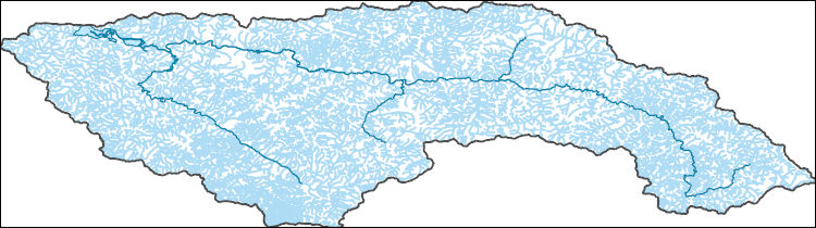
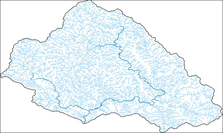
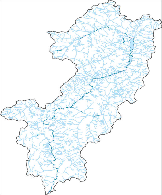
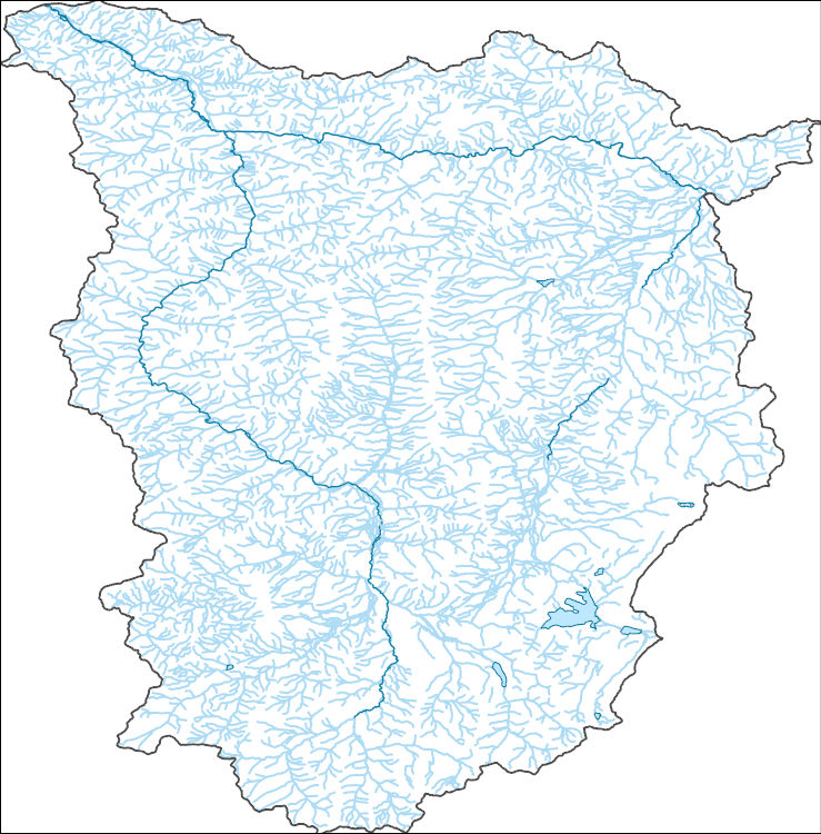
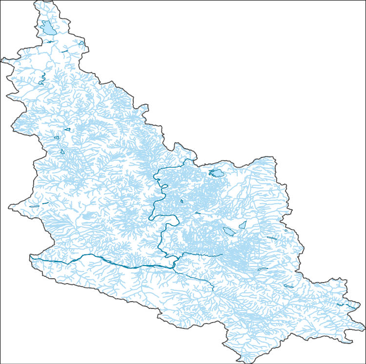
The National Hydrography Dataset (NHD) is a feature-based database that interconnects and uniquely identifies the stream segments or reaches that make up the nation's surface water drainage system. NHD data was originally developed at 1:100,000-scale and exists at that scale for the whole country. This high-resolution NHD, generally developed at 1:24,000/1:12,000 scale, adds detail to the original 1:100,000-scale NHD. (Data for Alaska, Puerto Rico and the Virgin Islands was developed at high-resolution, not 1:100,000 scale.) Local resolution NHD is being developed where partners and data exist. The NHD contains reach codes for networked features, flow direction, names, and centerline representations for areal water...
The National Hydrography Dataset (NHD) is a feature-based database that interconnects and uniquely identifies the stream segments or reaches that make up the nation's surface water drainage system. NHD data was originally developed at 1:100,000-scale and exists at that scale for the whole country. This high-resolution NHD, generally developed at 1:24,000/1:12,000 scale, adds detail to the original 1:100,000-scale NHD. (Data for Alaska, Puerto Rico and the Virgin Islands was developed at high-resolution, not 1:100,000 scale.) Local resolution NHD is being developed where partners and data exist. The NHD contains reach codes for networked features, flow direction, names, and centerline representations for areal water...
The National Hydrography Dataset (NHD) is a feature-based database that interconnects and uniquely identifies the stream segments or reaches that make up the nation's surface water drainage system. NHD data was originally developed at 1:100,000-scale and exists at that scale for the whole country. This high-resolution NHD, generally developed at 1:24,000/1:12,000 scale, adds detail to the original 1:100,000-scale NHD. (Data for Alaska, Puerto Rico and the Virgin Islands was developed at high-resolution, not 1:100,000 scale.) Local resolution NHD is being developed where partners and data exist. The NHD contains reach codes for networked features, flow direction, names, and centerline representations for areal water...
The National Hydrography Dataset (NHD) is a feature-based database that interconnects and uniquely identifies the stream segments or reaches that make up the nation's surface water drainage system. NHD data was originally developed at 1:100,000-scale and exists at that scale for the whole country. This high-resolution NHD, generally developed at 1:24,000/1:12,000 scale, adds detail to the original 1:100,000-scale NHD. (Data for Alaska, Puerto Rico and the Virgin Islands was developed at high-resolution, not 1:100,000 scale.) Local resolution NHD is being developed where partners and data exist. The NHD contains reach codes for networked features, flow direction, names, and centerline representations for areal water...
The National Hydrography Dataset (NHD) is a feature-based database that interconnects and uniquely identifies the stream segments or reaches that make up the nation's surface water drainage system. NHD data was originally developed at 1:100,000-scale and exists at that scale for the whole country. This high-resolution NHD, generally developed at 1:24,000/1:12,000 scale, adds detail to the original 1:100,000-scale NHD. (Data for Alaska, Puerto Rico and the Virgin Islands was developed at high-resolution, not 1:100,000 scale.) Local resolution NHD is being developed where partners and data exist. The NHD contains reach codes for networked features, flow direction, names, and centerline representations for areal water...
Layers of geospatial data include contours, boundaries, land cover, hydrography, roads, transportation, geographic names, structures, and other selected map features.
Layers of geospatial data include contours, boundaries, land cover, hydrography, roads, transportation, geographic names, structures, and other selected map features.
Types: Citation;
Tags: 7.5 x 7.5 minute,
7_5_Min,
Combined Vector,
Combined Vector,
Combined Vector,
For the past six years, the Bureau of Reclamation (BOR) has funded the USGS to study fish responses to restoration efforts and to construct a model relating stream habitat with fish population dynamics in the Methow River Basin, a tributary of the Columbia River. In the proposed study, we will use fish growth, distribution and movement (USGS data), foodweb data (Idaho State University), river flow (BOR data that we will expand) and water temperature data (from numerous agencies) to develop spatially-explicit bioenergetics models to assess effects of climate change on the viability of resident salmonid populations based on models being developed by USGS. The bioenergetics models will integrate such things as climate-change...
Categories: Data,
Project;
Types: Map Service,
OGC WFS Layer,
OGC WMS Layer,
OGC WMS Service;
Tags: Alberta,
British Columbia,
Bull Trout,
Climate Change,
Climate Change,
The GNLCC Multi-dimensional Synthesis is a synthesis of existing information in four categories to promote a common understanding of situation, existing information and information gaps, as well as providing an index of programmatic, resource and other climate and landscape related information for GNLCC. The synthesis includes: the GNLCC Resource Directory (organizations and initiatives); climate and ecological response (what does existing and projected climate information say and what are expected ecological effects); and monitoring (who is monitoring what).FY2011Objectives:Provide a Framework from which to organize the various monitoring and evaluation efforts. Included are key monitoring and evaluation questions...
Categories: Data,
Project;
Types: Map Service,
OGC WFS Layer,
OGC WMS Layer,
OGC WMS Service;
Tags: Alberta,
British Columbia,
CO-2,
CO-3,
CO-3,
We propose a collaborative project with the USGS, Wyoming State Climate Office, USFWS, USFS, and the NPS whereby we will assemble and maintain long-term records of climate from key stations in and around the Great Northern LCC and subject these records to a rigorous series of QA/QC procedures. Where appropriate we will use best available practices to infill missing data, and we will develop station histories (e.g., details of station moves, instrumentation changes, etc.) as a context for interpreting these records. We will then rigorously analyze patterns of long-term (50-100 years) variability and trends in these datasets, and provide summaries designed to meet the needs of non-climate specialists working in the...
Categories: Data,
Project;
Types: Map Service,
OGC WFS Layer,
OGC WMS Layer,
OGC WMS Service;
Tags: Alberta,
British Columbia,
CO-2,
CO-3,
CO-3,
The Canadian portion of the Crown of the Continent (CCoC) ecosystem has been identified as crucial for wolverines north of the US border to rescue or supply individuals and genes through dispersal to the highly fragmented population in the northern US Rocky Mountains. Highway 3, motorized recreation, and a growing resource extraction industry, however, increasingly fragment this critical landscape. This project will capitalize on multi-year wolverine occupancy and genetic data collected noninvasively in a >40,000 km2 area encompassing the core protected areas of the central Canadian Rocky Mountains to the north; and Glacier-Waterton Lakes National Park complex in the south. Our goal is to obtain spatially-explicit...
Categories: Data,
Project;
Types: Map Service,
OGC WFS Layer,
OGC WMS Layer,
OGC WMS Service;
Tags: Alberta,
Alpine,
Applications and Tools,
British Columbia,
Climate Change,
WGFD has a quantity of GPS-based animal movement data available for processing. In order to fully integrate this data into existing statewide migration route data layers and/or to use it to develop modeled migration corridor data layers, it must be reviewed, organized appropriately, analyzed, modeled and finally structured to allow seamless integration. The objective of this proposal is to review and examine the data, organize it meaningfully, and present it initially in combination with existing migration routes in order to represent generalized big game migration corridors across the landscapes of Wyoming. This is anticipated as a “first look” product, and serve as a basis for future work to more fully analyze...
Categories: Data,
Project;
Types: Map Service,
OGC WFS Layer,
OGC WMS Layer,
OGC WMS Service;
Tags: 2010,
2012,
CO-2,
CO-3,
CO-3,
(NWI) protocols to provide complete NWI coverage for the state of Idaho. Where hard copy maps are unavailable, habitat will be interpreted and digital data will be completed by contractors/cooperators.Main goal is to develop digital data compliant with NWI protocol for wetlands and riparian habitats in Montana and Idaho. Existing hard copy maps will be digitized according to standard NWI protocols to provide complete NWI coverage for the state of Idaho. Where hard copy maps are unavailable, habitat will be interpreted and digital data will be completed by contractors/cooperators.
Across the country, public land managers make hundreds of decisions each year that influence landscapes and ecosystems within the lands they manage. Many of these decisions involve vegetation manipulations known as land treatments. Land treatments include activities such as removal or alteration of plant biomass, seeding burned areas, and herbicide applications. Data on these land treatments historically have been stored at local offices and gathering information across large spatial areas was difficult. These valuable data needed to be centralized and stored for Federal agencies involved in land treatments because these data are useful to land managers for policy and management and to scientists for developing...
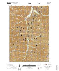
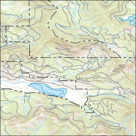
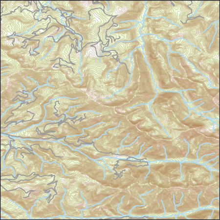
Layered geospatial PDF 7.5 Minute Quadrangle Map. Layers of geospatial data include orthoimagery, roads, grids, geographic names, elevation contours, hydrography, and other selected map features. This map is derived from GIS (geospatial information system) data. It represents a repackaging of GIS data in traditional map form, not creation of new information. The geospatial data in this map are from selected National Map data holdings and other government sources.
Probability map of Cheatgrass occurrence in relation to vegetation, abiotic, and anthropogenic features. These data were released prior to the October 1, 2016 effective date for the USGS’s policy dictating the review, approval, and release of scientific data as referenced in USGS Survey Manual Chapter 502.8 Fundamental Science Practices: Review and Approval of Scientific Data for Release.
Probability map of green-tailed towhee occurrence in relation to vegetation, abiotic, and anthropogenic features. These data were released prior to the October 1, 2016 effective date for the USGS’s policy dictating the review, approval, and release of scientific data as referenced in USGS Survey Manual Chapter 502.8 Fundamental Science Practices: Review and Approval of Scientific Data for Release.
Probability map of Halogeton occurrence in relation to vegetation, abiotic, and anthropogenic features. These data were released prior to the October 1, 2016 effective date for the USGS’s policy dictating the review, approval, and release of scientific data as referenced in USGS Survey Manual Chapter 502.8 Fundamental Science Practices: Review and Approval of Scientific Data for Release.
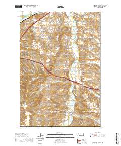
Layered geospatial PDF 7.5 Minute Quadrangle Map. Layers of geospatial data include orthoimagery, roads, grids, geographic names, elevation contours, hydrography, and other selected map features. This map is derived from GIS (geospatial information system) data. It represents a repackaging of GIS data in traditional map form, not creation of new information. The geospatial data in this map are from selected National Map data holdings and other government sources.
Layered geospatial PDF 7.5 Minute Quadrangle Map. Layers of geospatial data include orthoimagery, roads, grids, geographic names, elevation contours, hydrography, and other selected map features. This map is derived from GIS (geospatial information system) data. It represents a repackaging of GIS data in traditional map form, not creation of new information. The geospatial data in this map are from selected National Map data holdings and other government sources.
|

|
