Filters: Tags: Nabesna (X)
39 results (68ms)|
Filters
Date Range
Extensions Types Contacts Categories Tag Types Tag Schemes |
During 2009, the Alaska Division of Geological & Geophysical Surveys continued a program, begun in 2006, of reconnaissance mapping of surficial geology in the proposed natural-gas pipeline corridor through the upper Tanana River valley. The study area is a 12-mi-wide (19.3-km-wide) area that straddles the Alaska Highway from the western boundaries of the Tanacross B-3 and A-3 quadrangles near Tetlin Junction eastward to the eastern boundaries of the Nabesna D-1 and C-1 quadrangles along the Canada border. Mapping during 2008-2009 in the Tanacross and Nabesna quadrangles linked with the mapping completed in the Tanacross, Big Delta and Mt. Hayes quadrangles in 2006-2008. Surficial geology was initially mapped in...
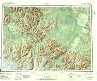
USGS Historical Quadrangle in GeoPDF.
Corescan© Hyperspectral Core Imager Mark III (HCI-III) system data were acquired for hand samples, and subsequent billets made from the hand samples, collected during the U.S. Geological Survey (USGS) 2014, 2015, and 2016 field seasons in the Nabesna area of the eastern Alaska Range. This area contains exposed porphyry deposits and hand samples were collected throughout the region in support of the HyMap imaging spectrometer survey (https://doi.org/10.5066/F7DN435W) (Kokaly and others, 2017a). The HCI-III system consists of three different components. The first is an imaging spectrometer which collects reflectance data with a spatial resolution of approximately 500 nanometers (nm) for 514 spectral channels covering...
Reflectance data from HyMap™ were processed using the Material Identification and Characterization Algorithm (MICA), a module of the USGS PRISM (Processing Routines in IDL for Spectroscopic Measurements) software (Kokaly, 2011), programmed in Interactive Data Language (IDL; Harris Geospatial Solutions, Broomfield, Colorado). The HyMap reflectance data are provided and described in this data release. MICA identifies the spectrally predominant mineral(s) in each pixel of imaging spectrometer data by comparing continuum-removed spectral features in the pixel’s reflectance spectrum to continuum-removed absorption features in reference spectra of minerals, vegetation, water, and other materials. Linear continuum removal...
Categories: Data;
Types: Downloadable,
GeoTIFF,
Map Service,
Raster;
Tags: Alaska,
Alaska,
Alaska Range,
Bond Creek,
Canada,
Approximately 1,900 line square kilometers of imagery were collected using a HyMap™ sensor (Cocks and others, 1998) mounted on a modified Piper Navajo aircraft. The aircraft was flown at an altitude of approximately 5,050 m (3,480 m above the mean ground surface elevation of 1570 m) resulting in average ground spatial resolution of 6.7 m. Solar elevation and azimuth angles ranged from 42.0-48.3° (average 46.2°) and 134.2-182.4° (average 155°), respectively. HyMap measured reflected sunlight in 126 narrow channels that cover the wavelength region of 455 to 2,483 nm. Data were delivered by the operators of the sensor (HyVista Corp., Australia) in units of radiance (data are available in Kokaly and others, 2017)....

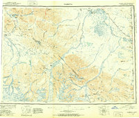
USGS Historical Quadrangle in GeoPDF.
Mineral predominance data were a derivative product from the Corescan© reflectance data. Corescan Hyperspectral Core Imager Mark III (HCI-III) system data were acquired for hand samples, and subsequent billets made from the hand samples, collected during the U.S. Geological Survey (USGS) 2014, 2015, and 2016 field seasons in the Nabesna area of the eastern Alaska Range. This area contains exposed porphyry deposits and hand samples were collected throughout the region in support of the HyMap imaging spectrometer survey (https://doi.org/10.5066/F7DN435W) (Kokaly and others, 2017a). The HCI-III system consists of three different components. The first is an imaging spectrometer which collects reflectance data with a...
This data release includes geochemical, x-ray diffraction mineralogical, and electron probe microanalysis (EPMA) data on rocks, soils, and sediments collected near the Orange Hill and Bond Creek porphyry copper deposits, Nabesna quadrangle, Alaska. Geochemical analyses were completed by a laboratory under contract with the U.S. Geological Survey (USGS). Electron microprobe and x-ray diffraction mineralogical analyses were completed by personnel of the Central Region Minerals Program in Denver, Colorado. The samples were collected and analyzed during 2014 to 2016, selected to help characterize the distribution and composition of mineralized and unmineralized geologic materials in this remote part of the eastern Alaska...
Categories: Data;
Types: Citation,
Downloadable,
Map Service,
OGC WFS Layer,
OGC WMS Layer,
Shapefile;
Tags: Alaska,
Alaska Range,
Alder Gulch,
Bond Creek,
Chathenda Creek,

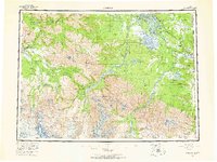
USGS Historical Quadrangle in GeoPDF.
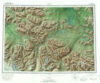
USGS Historical Quadrangle in GeoPDF.
Imaging spectrometer (hyperspectral) data were collected using the HyMap™ sensor over the Nabesna Area of Interest (AOI) in the eastern Alaska Range, July 14 and July 21, 2014. The primary study area was a remote part of the eastern Alaska Range where porphyry deposits are exposed. The HyMap imaging spectrometer measured reflected sunlight in 126 narrow channels spanning the 0.4 to 2.5 micron wavelength region of the electromagnetic spectrum. The data were collected at a nominal 6-m ground-instantaneous field of view (GIFOV). A total 1,900 square kilometers were collected. This data release provides flight line data for the survey and a report describing the dataset and procedures.
USGS Historical Quadrangle in GeoPDF.
A map of the wavelength position of the white mica 2,200 nanometer (nm) Al-OH absorption feature was compiled for a region of Nabesna, Alaska, using HyMap™ reflectance data provided and described in this data release. White mica wavelength position was computed for each pixel with spectrally predominant muscovite or illite. The computation was made using a function of the USGS PRISM (Processing Routines in IDL for Spectroscopic Measurements) software (Kokaly, 2011), programmed in Interactive Data Language (IDL; Harris Geospatial Solutions, Broomfield, Colorado). The PRISM function applies linear continuum-removal (Clark and Roush, 1984) to the 2,200 nm feature and fits a parabola to three channels: the channel...
Categories: Data;
Types: Downloadable,
GeoTIFF,
Map Service,
Raster;
Tags: Alaska,
Alaska,
Alaska Range,
Bond Creek,
Canada,
Imaging spectrometer (hyperspectral) data were collected using the HyMap™ sensor over the Nabesna Area of Interest (AOI) in the eastern Alaska Range, July 14 and July 21, 2014. The primary study area was a remote part of the eastern Alaska Range where porphyry deposits are exposed. The HyMap imaging spectrometer measured reflected sunlight in 126 narrow channels spanning the 0.4 to 2.5 micron wavelength region of the electromagnetic spectrum. The data were collected at a nominal 6-m ground-instantaneous field of view (GIFOV). A total 1,900 square kilometers were collected. This data release provides flight line data for the survey and a report describing the dataset and procedures.
Imaging spectrometer (hyperspectral) data were collected using the HyMap™ sensor over the Nabesna Area of Interest (AOI) in the eastern Alaska Range, July 14 and July 21, 2014. The primary study area was a remote part of the eastern Alaska Range where porphyry deposits are exposed. The HyMap imaging spectrometer measured reflected sunlight in 126 narrow channels spanning the 0.4 to 2.5 micron wavelength region of the electromagnetic spectrum. The data were collected at a nominal 6-m ground-instantaneous field of view (GIFOV). A total 1,900 square kilometers were collected. This data release provides flight line data for the survey and a report describing the dataset and procedures.
During 2009 the Alaska Division of Geological & Geophysical Surveys (DGGS) conducted reconnaissance interpretive mapping of permafrost in Alaska Highway Corridor Segment 3, a 12-mi-wide (19.3-km-wide) corridor that straddles the Alaska Highway through the Northway-Tanacross Lowland and the southern Yukon-Tanana Upland from Tetlin Junction to the Canada border. This work was an extension of permafrost mapping done in Alaska Highway Corridor Segment 1 from Delta Junction to Dot Lake in the Big Delta and Mt. Hayes Quadrangles during 2006-2007 and Alaska Highway Corridor Segment 2 from the Robertson River to Tetlin Junction in the Tanacross Quadrangles during 2008. Primarily, we inferred the extent of permafrost and...
Approximately 1,900 square kilometers of imagery were collected from July 14 to July 21, 2014 using a HyMap™ sensor (Cocks and others, 1998) mounted on a modified Piper Navajo aircraft. The survey area covered parts of the Wrangell and Nutzotin Mountains in the eastern Alaska Range near Nabesna, Alaska. The aircraft was flown at an altitude of approximately 5,050 meters (m) (3,480 m above the mean ground surface elevation of 1570 m) resulting in average ground spatial resolution of 6.7 m. HyMap measured reflected sunlight in 126 narrow channels that cover the wavelength region of 455 to 2,483 nanometers (nm). Data were delivered by the operators of the sensor (HyVista Corp., Australia) in units of radiance (Kokaly...
Categories: Data Release - Revised;
Types: Map Service,
OGC WFS Layer,
OGC WMS Layer,
OGC WMS Service;
Tags: Alaska,
Alaska,
Alaska Range,
Bond Creek,
Canada,
Corescan© Hyperspectral Core Imager Mark III (HCI-III) system data were acquired for hand samples, and subsequent billets made from the hand samples, collected during the U.S. Geological Survey (USGS) 2014, 2015, and 2016 field seasons in the Nabesna area of the eastern Alaska Range. This area contains exposed porphyry deposits and hand samples were collected throughout the region in support of the HyMap imaging spectrometer survey (https://doi.org/10.5066/F7DN435W) (Kokaly and others, 2017a). The HCI-III system consists of three different components. The first is an imaging spectrometer which collects reflectance data with a spatial resolution of approximately 500 nanometers (nm) for 514 spectral channels covering...
Categories: Data;
Types: Downloadable,
Map Service,
OGC WFS Layer,
OGC WMS Layer,
OGC WMS Service,
Shapefile;
Tags: Alaska,
Alaska,
Alaska Range,
Bond Creek,
Canada,
USGS Historical Quadrangle in GeoPDF.
Imaging spectrometer (hyperspectral) data were collected using the HyMap™ sensor over the Nabesna Area of Interest (AOI) in the eastern Alaska Range, July 14 and July 21, 2014. The primary study area was a remote part of the eastern Alaska Range where porphyry deposits are exposed. The HyMap imaging spectrometer measured reflected sunlight in 126 narrow channels spanning the 0.4 to 2.5 micron wavelength region of the electromagnetic spectrum. The data were collected at a nominal 6-m ground-instantaneous field of view (GIFOV). A total 1,900 square kilometers were collected. This data release provides flight line data for the survey and a report describing the dataset and procedures.
|

|
