Filters: Tags: New Mexico (X)
18,156 results (61ms)|
Filters
Date Range
Extensions Types
Contacts
Categories Tag Types
|
Future climates are simulated by general circulation models (GCM) using climate change scenarios (IPCC 2014). To project climate change for the sagebrush biome, we used 11 GCMs and two climate change scenarios from the IPCC Fifth Assessment, representative concentration pathways (RCPs) 4.5 and 8.5 (Moss et al. 2010, Van Vuuren et al. 2011). RCP4.5 scenario represents a future where climate policies limit and achieve stabilization of greenhouse gas concentrations to 4.5 W m-2 by 2100. RCP8.5 scenario might be called a business-as-usual scenario, where high emissions of greenhouse gases continue in the absence of climate change policies. The two selected time frames allow comparison of near-term (2020-2050) and longer-term...
Categories: Data;
Types: Citation,
Downloadable,
GeoTIFF,
Map Service,
Raster;
Tags: Arizona,
CRS,
California,
Climate,
Colorado,
Five principal components are used to represent the climate variation in an original set of 12 composite climate variables reflecting complex precipitation and temperature gradients. The dataset provides coverage for future climate (defined as the 2040-2070 normal period) under the RCP4.5 emission scenarios. Climate variables were chosen based on their known influence on local adaptation in plants, and include: mean annual temperature, summer maximum temperature, winter minimum temperature, annual temperature range, temperature seasonality (coefficient of variation in monthly average temperatures), mean annual precipitation, winter precipitation, summer precipitation, proportion of summer precipitation, precipitation...
Categories: Data;
Types: Downloadable,
GeoTIFF,
Map Service,
Raster;
Tags: Arizona,
California,
Colorado,
Colorado Plateau,
Great Basin,
This dataset provides timeseries data on water quality and quantity, as collected or computed from outside sources. The format is many tables with one row per time series observation (1 tab-delimited file per site-variable combination, 1 zip file per site). This compilation of data is intended for use in estimating or interpreting metabolism. Sites were included if they met the initial criteria of having at least 100 dissolved oxygen observations and one of the accepted NWIS site types ('ST','ST-CA','ST-DCH','ST-TS', or 'SP'). This dataset is part of a larger data release of metabolism model inputs and outputs for 356 streams and rivers across the United States (https://doi.org/10.5066/F70864KX). The complete release...
The 'Map - San Miguel County, Central' file is part of the Grover Heinrichs mining collection. Grover was the Vice President of Heinrichs GEOEXploration, located in Tucson, Arizona. The collection contains over 1,400 folders including economic geology reports, maps, photos, correspondence, drill logs and other related materials. The focus of much of the information is on the western United States, particularly Arizona, but the collection also includes files on mining activity throughout the United States, foreign countries, and 82 mineral commodities.
Categories: Data;
Tags: Dataset,
New Mexico,
San Miguel County,
United States,
geoscientificInformation,
The 'Central Mining District' file is part of the Grover Heinrichs mining collection. Grover was the Vice President of Heinrichs GEOEXploration, located in Tucson, Arizona. The collection contains over 1,400 folders including economic geology reports, maps, photos, correspondence, drill logs and other related materials. The focus of much of the information is on the western United States, particularly Arizona, but the collection also includes files on mining activity throughout the United States, foreign countries, and 82 mineral commodities.
The 'Apollo Project, Copper Mountain Co.' file is part of the Grover Heinrichs mining collection. Grover was the Vice President of Heinrichs GEOEXploration, located in Tucson, Arizona. The collection contains over 1,400 folders including economic geology reports, maps, photos, correspondence, drill logs and other related materials. The focus of much of the information is on the western United States, particularly Arizona, but the collection also includes files on mining activity throughout the United States, foreign countries, and 82 mineral commodities.
Categories: Data;
Tags: Dataset,
Hidalgo County,
New Mexico,
United States,
geoscientificInformation,
The 'J.E. Fuller Resources Co. 7 Claim Groups: J. N., Old Timer, Los Jarillas, S.O.B., Monarch, Lucky Strike, and Queens Crown' file is part of the Grover Heinrichs mining collection. Grover was the Vice President of Heinrichs GEOEXploration, located in Tucson, Arizona. The collection contains over 1,400 folders including economic geology reports, maps, photos, correspondence, drill logs and other related materials. The focus of much of the information is on the western United States, particularly Arizona, but the collection also includes files on mining activity throughout the United States, foreign countries, and 82 mineral commodities.
Locations of railroad lines for 11 western states. The Bureau of Transportation Statistics 1:100k Railroads line network was clipped to the boundary of the 11 Western States.
Future climates are simulated by general circulation models (GCM) using climate change scenarios (IPCC 2014). To project climate change for the sagebrush biome, we used 11 GCMs and two climate change scenarios from the IPCC Fifth Assessment, representative concentration pathways (RCPs) 4.5 and 8.5 (Moss et al. 2010, Van Vuuren et al. 2011). RCP4.5 scenario represents a future where climate policies limit and achieve stabilization of greenhouse gas concentrations to 4.5 W m-2 by 2100. RCP8.5 scenario might be called a business-as-usual scenario, where high emissions of greenhouse gases continue in the absence of climate change policies. The two selected time frames allow comparison of near-term (2020-2050) and longer-term...
Categories: Data;
Types: Citation,
Downloadable,
GeoTIFF,
Map Service,
Raster;
Tags: Arizona,
CRS,
California,
Climate,
Colorado,
These data were compiled for a manuscript in which 1) we develop a water temperature model for the major river segments and tributaries of the Colorado River basin, including the Colorado, Green, Yampa, White, and San Juan rivers; 2) we link modeled water temperature to fish population data to predict the probability native and nonnative species will be common in the future in a warming climate; and 3) assess the degree to which dams create thermal discontinuity in summer in river segments across the western US. Per goal #1, we developed a water temperature model using data spanning 1985-2015 that predicts water temperature every 1 mile (1.6-km) in rivers both now and in the future due to the potential influence...
This shapefile is the official boundary of the Western Native Trout Initiative. The boundary was originally developed by the United States Fish and Wildlife Service and was updated in 2013 to reflect revisions from the Western Native Trout Initiative, a recognized Fish Habitat Partnership (FHP) of the National Fish Habitat Partnership.
Categories: Data;
Types: ArcGIS REST Map Service,
ArcGIS Service Definition,
Downloadable,
Map Service;
Tags: Alaska,
Analytical boundary,
Aquatic habitats,
Arizona,
Boundaries,
Climate Distance Mapper is an interactive web mapping application designed to facilitate informed seed sourcing decisions and to aid in directing regional seed collections. Implemented as a shiny web application (Chang et al. 2017), Climate Distance Mapper is hosted on the web at: https://usgs-werc-shinytools.shinyapps.io/Climate_Distance_Mapper/. The application is designed to guide restoration seed sourcing in the desert southwest by allowing users to interactively match seed sources with restoration sites climatic differences – in the form of multivariate climate distance values – between restoration sites and the surrounding landscape. Climatic distances are based on a combination of variables likely to influence...
Five principal components are used to represent the climate variation in an original set of 12 composite climate variables reflecting complex precipitation and temperature gradients. The dataset provides coverage for future climate (defined as the 2040-2070 normal period) under the RCP8.5 emission scenarios. Climate variables were chosen based on their known influence on local adaptation in plants, and include: mean annual temperature, summer maximum temperature, winter minimum temperature, annual temperature range, temperature seasonality (coefficient of variation in monthly average temperatures), mean annual precipitation, winter precipitation, summer precipitation, proportion of summer precipitation, precipitation...
Categories: Data;
Types: Downloadable,
GeoTIFF,
Map Service,
Raster;
Tags: Arizona,
California,
Colorado,
Colorado Plateau,
Great Basin,
These data represent simulated soil temperature and moisture conditions for current climate, and for future climate represented by all available climate models at two time periods during the 21st century. These data were used to: 1) quantify the direction and magnitude of expected changes in several measures of soil temperature and soil moisture, including the key variables used to distinguish the regimes used in the R and R categories; 2) assess how these changes will impact the geographic distribution of soil temperature and moisture regimes; and 3) explore the implications for using R and R categories for estimating future ecosystem resilience and resistance.

This map layer shows Indian lands of the United States. For the most part, only areas of 320 acres or more are included; some smaller areas deemed to be important or significant are also included. Federally-administered lands within a reservation are included for continuity; these may or may not be considered part of the reservation and are simply described with their feature type and the administrating Federal agency. Some established Indian lands which are larger than 320 acres are not included in this map layer because their boundaries were not available from the owning or administering agency.
Map containing historical census data from 1900 - 2000 throughout the western United States at the county level. Data includes total population, population density, and percent population change by decade for each county. Population data was obtained from the US Census Bureau and joined to 1:2,000,000 scale National Atlas counties shapefile.
Categories: Data;
Types: Downloadable,
Map Service,
OGC WFS Layer,
OGC WMS Layer,
Shapefile;
Tags: Arizona,
California,
Colorado,
Idaho,
Montana,
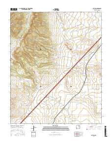
Layered geospatial PDF Map. Layers of geospatial data include orthoimagery, roads, grids, geographic names, elevation contours, hydrography, and other selected map features.
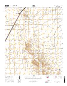
Layered geospatial PDF Map. Layers of geospatial data include orthoimagery, roads, grids, geographic names, elevation contours, hydrography, and other selected map features.
|

|
