Filters: Tags: North Dakota (X) > Categories: pre-SM502.8 (X)
16 results (13ms)|
Filters
Date Range
Extensions Types Contacts
Categories Tag Types Tag Schemes |
Agricultural land cover in the study area for the conservation assessment of Greater Sage-grouse conducted by the Western Association of Fish and Wildlife Agencies. This dataset was developed from Sagestitch, an Eastern Washington Shrubsteppe Mapping Project, several state-level Gap Analysis Program (GAP) land cover products (AZ, CA, NM, OR, and WA), National Land Cover Data (NLCD) (ND,SD,NE), and the Prairie Farm Rehabilitation Administration (PFRA) Generalized Landcover (Alberta, Saskatchewan).
This dataset contains information regarding the acreages of land currently (as of 2004) enrolled in the Conservation Reserve Program (CRP) distributed by county and the year the CRP contract was initiated (1987-2004, excluding 1994 and 1995). Additionally, it contains total acreages of land enrolled in the CRP distributed by county and the contract year (1987-2003). USDA Farm Service Agency's (FSA) Conservation Reserve Program (CRP) is a voluntary program available to agricultural producers to help them safeguard environmentally sensitive land. Producers enrolled in CRP plant long-term, resource-conserving covers to improve the quality of water, control soil erosion, and enhance wildlife habitat. In return, FSA...
Categories: Data,
pre-SM502.8;
Types: Downloadable,
Map Service,
OGC WFS Layer,
OGC WMS Layer,
Shapefile;
Tags: Arizona,
CRP,
California,
Colorado,
Colorado Plateau,
These data were released prior to the October 1, 2016 effective date for the USGS’s policy dictating the review, approval, and release of scientific data as referenced in USGS Survey Manual Chapter 502.8 Fundamental Science Practices: Review and Approval of Scientific Data for Release. As part of the U.S. Geological Survey's National Water-Quality Assessment Program, an investigation of the Yellowstone River Basin study unit is being conducted to document status and trends in surface- and ground-water quality. Surface-water samples are collected from streams or lakes at specific sampling stations. Water-quality characteristics at each station are influenced by the natural and cultural characteristics of the drainage...
Categories: pre-SM502.8;
Tags: Montana,
NSDI,
North Dakota,
USGS Science Data Catalog (SDC),
Wyoming,

These data were released prior to the October 1, 2016 effective date for the USGS’s policy dictating the review, approval, and release of scientific data as referenced in USGS Survey Manual Chapter 502.8 Fundamental Science Practices: Review and Approval of Scientific Data for Release. The USGS compiles online access to water-resources data collected at approximately 1.5 million sites in all 50 States, the District of Columbia, Puerto Rico, the Virgin Islands, Guam, American Samoa and the Commonwealth of the Northern Mariana Islands.
Powerlines in the western United States and Canada as identified by the 22 source data layers used to compile this shapefile. Source data were collected by personal contact or through the internet in the winter and spring of 2004 and assimilated using ArcGIS. This file is a complete record of overhead powerline data that was available as of 5/15/2004 but IS NOT INTENDED TO BE A COMPLETE REPRESENTATION OF THE SUM TOTAL OF ALL POWERLINES ON THE GROUND. These data primarily depict the higher voltage, long distance transmission lines but some arcs likely represent lower voltage distribution lines.
Categories: Data,
pre-SM502.8;
Types: Downloadable,
Map Service,
OGC WFS Layer,
OGC WMS Layer,
Shapefile;
Tags: Alberta,
Arizona,
British Columbia,
California,
Canada,

These data were released prior to the October 1, 2016 effective date for the USGS’s policy dictating the review, approval, and release of scientific data as referenced in USGS Survey Manual Chapter 502.8 Fundamental Science Practices: Review and Approval of Scientific Data for Release. This data set represents the extent of the Lower Tertiary aquifers in the states of North Dakota, South Dakota, Wyoming, and Montana.
Categories: pre-SM502.8;
Tags: Montana,
NSDI,
North Dakota,
South Dakota,
USGS Science Data Catalog (SDC),

These data were released prior to the October 1, 2016 effective date for the USGS’s policy dictating the review, approval, and release of scientific data as referenced in USGS Survey Manual Chapter 502.8 Fundamental Science Practices: Review and Approval of Scientific Data for Release. This dataset provides a U.S. national 60-m, 19-class mapping of anthropogenic land uses for five time periods: 1974-1982-1992-2002-2012. The 2012 dataset is based on a slightly modified version of the National Land Cover Database 2011 (NLCD 2011) that was recoded to a schema of land uses, and mapped back in time to develop datasets for the four earlier eras. The time periods coincide with years in which U.S. Department of Agriculture...
Categories: pre-SM502.8;
Tags: Alabama,
Anthropogenic Land Use Trends,
Arizona,
Arkansas,
California,

These data were released prior to the October 1, 2016 effective date for the USGS’s policy dictating the review, approval, and release of scientific data as referenced in USGS Survey Manual Chapter 502.8 Fundamental Science Practices: Review and Approval of Scientific Data for Release. The USGS compiles online access to water-resources data collected at approximately 1.5 million sites in all 50 States, the District of Columbia, Puerto Rico, the Virgin Islands, Guam, American Samoa and the Commonwealth of the Northern Mariana Islands.

These data were released prior to the October 1, 2016 effective date for the USGS’s policy dictating the review, approval, and release of scientific data as referenced in USGS Survey Manual Chapter 502.8 Fundamental Science Practices: Review and Approval of Scientific Data for Release. The U.S. Geological Survey's National Water-Use Information Program is responsible for compiling and disseminating the nation's water-use data. The USGS works in cooperation with local, State, and Federal environmental agencies to collect water-use information. USGS compiles these data to produce water-use information aggregated at the county, state, and national levels. Every five years, data at the county level are compiled into...
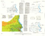
These data were released prior to the October 1, 2016 effective date for the USGS’s policy dictating the review, approval, and release of scientific data as referenced in USGS Survey Manual Chapter 502.8 Fundamental Science Practices: Review and Approval of Scientific Data for Release. This coverage contains information about the buried valleys within the Standing Rock Indian Reservation, Sioux County, North Dakota, and Corson County, South Dakota. The delineation of the buried valleys was included as part of the surficial geology map (figure 5) created by Howells (1982). The digital data were produced by the U.S. Geological Survey (USGS) in cooperation with the U.S. Environmental Protection Agency. Figure 5 in...
Categories: pre-SM502.8;
Tags: Corson County, South Dakota,
NSDI,
North Dakota,
Sioux County, North Dakota,
South Dakota,
These data were released prior to the October 1, 2016 effective date for the USGS’s policy dictating the review, approval, and release of scientific data as referenced in USGS Survey Manual Chapter 502.8 Fundamental Science Practices: Review and Approval of Scientific Data for Release. The locations of approximately 23,000 current and historical U.S. Geological Survey (USGS) streamgages in the United States and Puerto Rico (with the exception of Alaska) have been snapped to the medium resolution National Hydrography Dataset (NHD). The NHD contains geospatial information about mapped surface-water features, such as streams, lakes, and reservoirs, etc., creating a hydrologic network that can be used to determine...
This dataset portrays the boundary of the Regions as defined for the National Coal Resource Assessment Project.
Categories: Data,
pre-SM502.8;
Types: Downloadable,
Map Service,
OGC WFS Layer,
OGC WMS Layer,
Shapefile;
Tags: Colorado,
Great Plains,
Montana,
North Dakota,
Northern Rocky Mountain and Great Plains Fort Union Coal Resources Assessment,
These data were released prior to the October 1, 2016 effective date for the USGS’s policy dictating the review, approval, and release of scientific data as referenced in USGS Survey Manual Chapter 502.8 Fundamental Science Practices: Review and Approval of Scientific Data for Release. This map layer contains the shallowest principal aquifers of the conterminous United States, Hawaii, Puerto Rico, and the U.S. Virgin Islands, portrayed as polygons. The map layer was developed as part of the effort to produce the maps published at 1:2,500,000 in the printed series "Ground Water Atlas of the United States". The published maps contain base and cultural features not included in these data. This is a replacement for...
These data were released prior to the October 1, 2016 effective date for the USGS’s policy dictating the review, approval, and release of scientific data as referenced in USGS Survey Manual Chapter 502.8 Fundamental Science Practices: Review and Approval of Scientific Data for Release. As part of the U.S. Geological Survey's National Water-Quality Assessment Program, an investigation of the Yellowstone River Basin study unit is being conducted to document status and trends in surface- and ground-water quality. Surface-water samples are collected from streams or lakes at specific sampling stations. Efficient quantification of the site-specific geographic and environmental characteristics at sampling stations requires...
Categories: pre-SM502.8;
Tags: Montana,
NSDI,
North Dakota,
USGS Science Data Catalog (SDC),
Wyoming,
These data were released prior to the October 1, 2016 effective date for the USGS’s policy dictating the review, approval, and release of scientific data as referenced in USGS Survey Manual Chapter 502.8 Fundamental Science Practices: Review and Approval of Scientific Data for Release. As part of the U.S. Geological Survey's National Water-Quality Assessment Program, an investigation of the Yellowstone River Basin study unit is being conducted to document status and trends in surface- and ground-water quality. Efficient quantification of a variety of environmental and geographic characteristics of the study unit requires a digital map of the study-unit boundary that may be processed, together with other digital...
Categories: pre-SM502.8;
Tags: Montana,
NSDI,
North Dakota,
USGS Science Data Catalog (SDC),
Wyoming,
These data were released prior to the October 1, 2016 effective date for the USGS’s policy dictating the review, approval, and release of scientific data as referenced in USGS Survey Manual Chapter 502.8 Fundamental Science Practices: Review and Approval of Scientific Data for Release. As part of the U.S. Geological Survey's (USGS) National Water-Quality Assessment Program (NAWQA), an investigation of the Missouri River Basin is being conducted to document trends in surface-water quality, specifically for trends in nutrients and suspended sediment. Surface-water samples were collected from streams at specific sampling stations. Water-quality characteristics at each station are influenced by the natural and cultural...
|

|
