Filters
Date Range
Types
Contacts
Categories
Tag Types
Tag Schemes
|

A view of the #2 shaft at the Gold Bar mine showing a headframe and buildings.
Categories: Data;
Tags: 1980s,
Arizona,
Black Bear, Patented,
Black Rock metallic mineral dist.,
Crown, Patented, All tags...
Dataset,
Gold,
Homestake, Patented,
Interior Mining And Trust Co.,
Jenny Lynn Patented,
Little Jim, Patented,
Morgan Butte - 7.5 Min,
O'Brien,
T9N R3W Sec 33 NE,
United States,
Wickenburg Mts. physiographic area,
Yavapai,
buildings,
geoscientificInformation,
headframes,
image collections,
mining,
photographic prints,
shafts and adits, Fewer tags

ADMMR map collection: O'Brien Detail and Assay Map; 1 in. to 200 feet; 16 x 11 in.
Categories: Data;
Tags: 1920s,
Arizona,
Cerbat - 7.5 Min,
Charcoal Canyon Group,
Cowboy Mine, All tags...
Dataset,
Gold, Lode,
Lead, Sulfide,
Mohave County,
O'Brien,
Silver,
T22N R17W Sec 18 NE,
United States,
Zinc,
chemical analysis,
geochemistry,
geoscientificInformation,
maps and atlases,
mineral resources,
mining and quarrying,
natural resource assessment,
natural resource exploration,
plans, Fewer tags

This location is part of the Arizona Mineral Industry Location System (AzMILS), an inventory of mineral occurences, prospects and mine locations in Arizona. Yavapai852 is located in T9N R1W Sec 9 W2 in the Minnehaha - 7.5 Min quad. This collection consists of various reports, maps, records and related materials acquired by the Arizona Department of Mines and Mineral Resources regarding mining properties in Arizona. Information was obtained by various means, including the property owners, exploration companies, consultants, verbal interviews, field visits, newspapers and publications. Some sections may be redacted for copyright. Please see the access statement.
Categories: Data;
Tags: 1970s,
1980s,
Arizona,
Bradshaw Mts. physiographic area,
Copper, Sulfide, All tags...
Dataset,
Gold,
Minnehaha - 7.5 Min,
O'Brien,
Patented Claims Ms 2803,
Silver,
Silver Mountain,
Silver Mountain metallic mineral dist.,
Sunnside, Ms 2803, Pat.,
T9N R1W Sec 9 W2,
United States,
Yavapai,
chemical analysis,
economic geology,
geology,
geophysics,
geoscientificInformation,
gold ores,
image collections,
maps and atlases,
metallic ores,
mineral resources,
mining and quarrying,
natural resource exploration,
reports,
stratigraphy, Fewer tags

ADMMR map collection: O'Brien Proposed Development Cross Section; 1 in. to 50 feet; 27 x 28 in.
Categories: Data;
Tags: 1920s,
Arizona,
Cerbat - 7.5 Min,
Charcoal Canyon Group,
Cowboy Mine, All tags...
Dataset,
Gold, Lode,
Lead, Sulfide,
Mohave County,
O'Brien,
Silver,
T22N R17W Sec 18 NE,
United States,
Zinc,
geoscientificInformation,
maps and atlases,
mineral resources,
mining and quarrying,
natural resource exploration,
plans,
sections,
subsurface maps, Fewer tags
Layered GeoPDF 7.5 Minute Quadrangle Map. Layers of geospatial data include orthoimagery, roads, grids, geographic names, elevation contours, hydrography, and other selected map features.
Tags: 7.5 x 7.5 minute,
Cherokee,
Downloadable Data,
EarthCover,
GeoPDF, All tags...
Imagery and Base Maps,
Iowa,
Map,
O'Brien,
Sutherland East, IA,
U.S. National Grid,
US,
US Topo,
US Topo Historical,
United States,
contour,
geographic names,
hydrography,
orthoimage,
topographic,
transportation, Fewer tags
Layered GeoPDF 7.5 Minute Quadrangle Map. Layers of geospatial data include orthoimagery, roads, grids, geographic names, elevation contours, hydrography, and other selected map features.
Tags: 7.5 x 7.5 minute,
Downloadable Data,
EarthCover,
GeoPDF,
Imagery and Base Maps, All tags...
Iowa,
Map,
Melvin, IA,
O'Brien,
Osceola,
U.S. National Grid,
US,
US Topo,
US Topo Historical,
United States,
contour,
geographic names,
hydrography,
orthoimage,
topographic,
transportation, Fewer tags

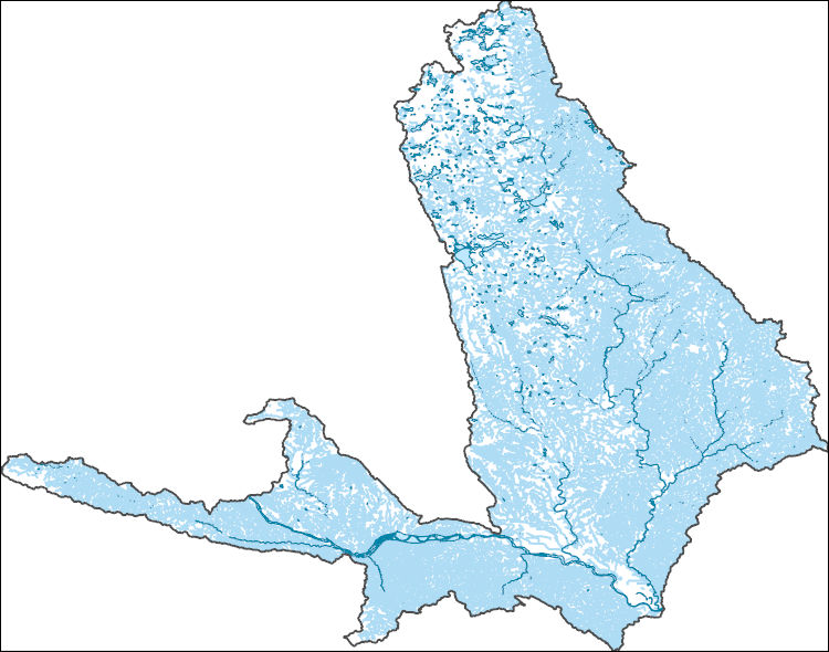
The Watershed Boundary Dataset (WBD) is a comprehensive aggregated collection of hydrologic unit data consistent with the national criteria for delineation and resolution. It defines the areal extent of surface water drainage to a point except in coastal or lake front areas where there could be multiple outlets as stated by the "Federal Standards and Procedures for the National Watershed Boundary Dataset (WBD)" "Standard" (https://pubs.usgs.gov/tm/11/a3/). Watershed boundaries are determined solely upon science-based hydrologic principles, not favoring any administrative boundaries or special projects, nor particular program or agency. This dataset represents the hydrologic unit boundaries to the 12-digit (6th level)...
Tags: 10-digit,
12-digit,
14-digit,
16-digit,
2-digit, All tags...
4-digit,
6-digit,
8-digit,
Adair,
Adams,
Albany,
Allen,
Anderson,
Andrew,
Antelope,
Appanoose,
Arapahoe,
Arthur,
Atchison,
Audrain,
Audubon,
Aurora,
Banner,
Barnes,
Barton,
Basin,
Bates,
Beadle,
Beaverhead,
Bennett,
Benton,
Big Horn,
Billings,
Blaine,
Bon Homme,
Boone,
Boulder,
Bourbon,
Bowman,
Box Butte,
Boyd,
Broadwater,
Brookings,
Broomfield,
Brown,
Brule,
Buchanan,
Buena Vista,
Buffalo,
Burke,
Burleigh,
Burt,
Butler,
Butte,
CO,
Caldwell,
Callaway,
Camden,
Campbell,
Carbon,
Carroll,
Carter,
Cascade,
Cass,
Cedar,
Chaffee,
Chariton,
Charles Mix,
Chase,
Cherokee,
Cherry,
Cheyenne,
Chouteau,
Christian,
Clark,
Clarke,
Clay,
Clear Creek,
Clinton,
Cloud,
Codington,
Coffey,
Cole,
Colfax,
Colorado,
Converse,
Cooper,
Corson,
Crawford,
Crook,
Cuming,
Custer,
Dade,
Dakota,
Dallas,
Daniels,
Daviess,
Davis,
Davison,
Dawes,
Dawson,
Day,
DeKalb,
Decatur,
Deer Lodge,
Dent,
Denver,
Deuel,
Dewey,
Dickey,
Dickinson,
Divide,
Dixon,
Dodge,
Doniphan,
Douglas,
Downloadable Data,
Dundy,
Dunn,
Eddy,
Edmunds,
El Paso,
Elbert,
Ellis,
Ellsworth,
Emmet,
Emmons,
Fall River,
Fallon,
Faulk,
Fergus,
Fillmore,
Flathead,
Foster,
Franklin,
Fremont,
Frontier,
Furnas,
Gage,
Gallatin,
Garden,
Garfield,
Gasconade,
Geary,
Gentry,
GeoPackage,
Gilpin,
Glacier,
Golden Valley,
Goshen,
Gosper,
Gove,
Graham,
Grand,
Granite,
Grant,
Greeley,
Greene,
Gregory,
Grundy,
Guthrie,
HU-2,
HU-2 Region,
HU2_10,
HUC,
Haakon,
Hall,
Hamilton,
Hamlin,
Hand,
Hanson,
Harding,
Harlan,
Harrison,
Hayes,
Henry,
Hettinger,
Hickory,
Hill,
Hitchcock,
Holt,
Hooker,
Hot Springs,
Howard,
Howell,
Hughes,
Hutchinson,
Hyde,
Hydrography,
Hydrologic Unit Code,
Hydrologic Units,
IA,
ID,
Ida,
Idaho,
Iowa,
Jackson,
Jefferson,
Jerauld,
Jewell,
Johnson,
Jones,
Judith Basin,
KS,
Kansas,
Kearney,
Keith,
Keya Paha,
Kidder,
Kimball,
Kingsbury,
Kit Carson,
Knox,
LaMoure,
Laclede,
Lafayette,
Lake,
Lancaster,
Lane,
Laramie,
Larimer,
Lawrence,
Leavenworth,
Lemhi,
Lewis and Clark,
Liberty,
Lincoln,
Linn,
Livingston,
Logan,
Loup,
Lucas,
Lyman,
Lyon,
MN,
MO,
MT,
Macon,
Madison,
Maries,
Marion,
Marshall,
McCone,
McCook,
McHenry,
McIntosh,
McKenzie,
McLean,
McPherson,
Meade,
Meagher,
Mellette,
Mercer,
Merrick,
Miami,
Miller,
Mills,
Miner,
Minnehaha,
Minnesota,
Missouri,
Mitchell,
Moniteau,
Monona,
Monroe,
Montana,
Montgomery,
Moody,
Morgan,
Morrill,
Morris,
Morton,
Mountrail,
Murray,
Musselshell,
ND,
NE,
Nance,
National Watershed Boundary Dataset (WBD),
National Watershed Boundary Dataset (WBD),
Natrona,
Nebraska,
Nemaha,
Ness,
Niobrara,
Nobles,
Nodaway,
North Dakota,
Norton,
Nuckolls,
O'Brien,
Oglala Lakota,
Oliver,
Open Geospatial Consortium GeoPackage 1.2,
Osage,
Osborne,
Osceola,
Otoe,
Ottawa,
Page,
Palo Alto,
Park,
Pawnee,
Pennington,
Perkins,
Petroleum,
Pettis,
Phelps,
Phillips,
Pierce,
Pipestone,
Platte,
Plymouth,
Polk,
Pondera,
Pottawatomie,
Pottawattamie,
Potter,
Powder River,
Powell,
Prairie,
Pulaski,
Putnam,
Randolph,
Ransom,
Ravalli,
Rawlins,
Ray,
Red Willow,
Region,
Republic,
Rice,
Richardson,
Richland,
Riley,
Ringgold,
Roberts,
Rock,
Rooks,
Roosevelt,
Rosebud,
Routt,
Rush,
Russell,
SD,
Sac,
Saline,
Sanborn,
Sargent,
Sarpy,
Saunders,
Schuyler,
Scott,
Scotts Bluff,
Sedgwick,
Seward,
Shawnee,
Shelby,
Sheridan,
Sherman,
Silver Bow,
Sioux,
Slope,
Smith,
South Dakota,
Spink,
St. Charles,
St. Clair,
St. Louis,
Stanley,
Stanton,
Stark,
Stillwater,
Stutsman,
Sub-basin,
Sub-region,
Sublette,
Subwatershed,
Sullivan,
Sully,
Summit,
Sweet Grass,
Sweetwater,
Taylor,
Teller,
Teton,
Texas,
Thayer,
Thomas,
Thurston,
Todd,
Toole,
Treasure,
Trego,
Tripp,
Turner,
US,
Union,
United States,
Valley,
Vernon,
WBD,
WY,
Wabaunsee,
Wallace,
Walworth,
Ward,
Warren,
Washakie,
Washington,
Watershed,
Watershed Boundary Dataset,
Wayne,
Webster,
Weld,
Wells,
Weston,
Wheatland,
Wheeler,
Wibaux,
Wichita,
Williams,
Woodbury,
Worth,
Wright,
Wyandotte,
Wyoming,
Yankton,
Yellowstone,
York,
Yuma,
Ziebach,
inlandWaters, Fewer tags
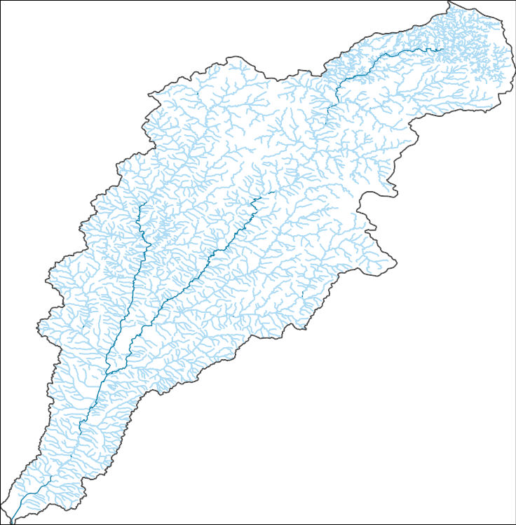
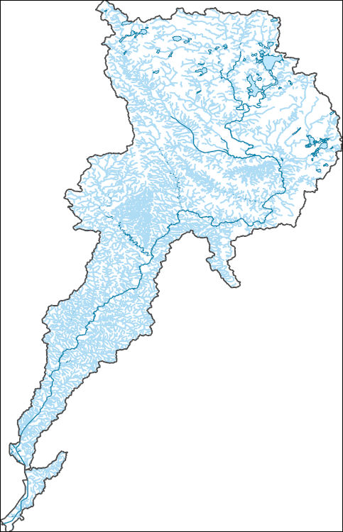
The National Hydrography Dataset (NHD) is a feature-based database that interconnects and uniquely identifies the stream segments or reaches that make up the nation's surface water drainage system. NHD data was originally developed at 1:100,000-scale and exists at that scale for the whole country. This high-resolution NHD, generally developed at 1:24,000/1:12,000 scale, adds detail to the original 1:100,000-scale NHD. (Data for Alaska, Puerto Rico and the Virgin Islands was developed at high-resolution, not 1:100,000 scale.) Local resolution NHD is being developed where partners and data exist. The NHD contains reach codes for networked features, flow direction, names, and centerline representations for areal water...
Tags: Administrative watershed units,
Administrative watershed units,
Area of Complex Channels,
Area to be submerged,
Basin, All tags...
Basin,
Bay/Inlet,
Boundaries,
Boundary,
Bridge,
Canal/Ditch,
Cherokee,
Coastline,
Connector,
Dam/Weir,
Downloadable Data,
Drainage areas for surface water,
Drainageway,
Estuary,
Flow direction network,
Flume,
ForeShore,
Gaging Station,
Gate,
GeoPackage,
HU-8,
HU-8 Subbasin,
HU10,
HU12,
HU14,
HU16,
HU2,
HU4,
HU6,
HU8,
HU8_10230002,
HUC,
Hazard Zone,
Hydrographic,
Hydrography,
Hydrography,
Hydrography,
Hydrologic Unit Code,
Hydrologic Units,
IA,
Ice mass,
Inundation Area,
Iowa,
Levee,
Line,
Lock Chamber,
Marsh,
National Hydrography Dataset (NHD),
National Hydrography Dataset (NHD) Best Resolution,
National Hydrography Dataset (NHD) Best Resolution,
Nonearthen Shore,
O'Brien,
Open Geospatial Consortium GeoPackage 1.2,
Orthoimage,
Osceola,
Playa,
Plymouth,
Point,
PointEvent,
Pond,
Rapids,
Rapids,
Reach,
Reach code,
Reef,
Region,
Reservoir,
Rock,
Sea/Ocean,
Sink/Rise,
Sioux,
Sounding Datum Line,
Special Use Zone,
Special Use Zone Limit,
Spillway,
Stream,
Stream/River,
Sub-basin,
Sub-region,
Subbasin,
Submerged Stream,
Subregion,
Subwatershed,
Surface water systems,
Swamp,
Topographic,
Tunnel,
US,
Underground Conduit,
United States,
WBD,
WBD,
Wall,
Wash,
Water Intake Outflow,
Waterfall,
Watershed,
Watershed Boundaries,
Watershed Boundary Dataset,
Watershed Boundary Dataset,
Well,
Woodbury,
artificial path,
boundaries,
dams,
drainage systems and characteristics,
inlandWaters,
lakes,
ngda,
rivers, Fewer tags
The National Hydrography Dataset (NHD) is a feature-based database that interconnects and uniquely identifies the stream segments or reaches that make up the nation's surface water drainage system. NHD data was originally developed at 1:100,000-scale and exists at that scale for the whole country. This high-resolution NHD, generally developed at 1:24,000/1:12,000 scale, adds detail to the original 1:100,000-scale NHD. (Data for Alaska, Puerto Rico and the Virgin Islands was developed at high-resolution, not 1:100,000 scale.) Local resolution NHD is being developed where partners and data exist. The NHD contains reach codes for networked features, flow direction, names, and centerline representations for areal water...
Tags: Administrative watershed units,
Administrative watershed units,
Antelope,
Area of Complex Channels,
Area to be submerged, All tags...
Aurora,
Basin,
Basin,
Bay/Inlet,
Bon Homme,
Boundaries,
Boundary,
Boyd,
Bridge,
Brookings,
Canal/Ditch,
Cedar,
Charles Mix,
Clark,
Clay,
Coastline,
Codington,
Connector,
Dakota,
Dam/Weir,
Davison,
Day,
Deuel,
Dixon,
Douglas,
Downloadable Data,
Drainage areas for surface water,
Drainageway,
Esri File GeoDatabase 10,
Estuary,
FileGDB,
Flow direction network,
Flume,
ForeShore,
Gaging Station,
Gate,
Grant,
Gregory,
HU-4,
HU-4 Subregion,
HU10,
HU12,
HU14,
HU16,
HU2,
HU4,
HU4_1017,
HU6,
HU8,
HUC,
Hamlin,
Hazard Zone,
Hutchinson,
Hydrographic,
Hydrography,
Hydrography,
Hydrography,
Hydrologic Unit Code,
Hydrologic Units,
IA,
Ice mass,
Inundation Area,
Iowa,
Keya Paha,
Kingsbury,
Knox,
Lake,
Levee,
Lincoln,
Line,
Lock Chamber,
Lyon,
MN,
Marsh,
Marshall,
McCook,
Miner,
Minnehaha,
Minnesota,
Moody,
Murray,
NE,
National Hydrography Dataset (NHD),
National Hydrography Dataset (NHD) Best Resolution,
National Hydrography Dataset (NHD) Best Resolution,
Nebraska,
Nobles,
Nonearthen Shore,
O'Brien,
Orthoimage,
Osceola,
Pierce,
Pipestone,
Playa,
Plymouth,
Point,
PointEvent,
Pond,
Rapids,
Rapids,
Reach,
Reach code,
Reef,
Region,
Reservoir,
Roberts,
Rock,
Rock,
SD,
Sea/Ocean,
Sink/Rise,
Sioux,
Sounding Datum Line,
South Dakota,
Special Use Zone,
Special Use Zone Limit,
Spillway,
Stream,
Stream/River,
Sub-basin,
Sub-region,
Subbasin,
Submerged Stream,
Subregion,
Subwatershed,
Surface water systems,
Swamp,
Thurston,
Topographic,
Tripp,
Tunnel,
Turner,
US,
Underground Conduit,
Union,
United States,
WBD,
WBD,
Wall,
Wash,
Water Intake Outflow,
Waterfall,
Watershed,
Watershed Boundaries,
Watershed Boundary Dataset,
Watershed Boundary Dataset,
Well,
Woodbury,
Yankton,
artificial path,
boundaries,
dams,
drainage systems and characteristics,
inlandWaters,
lakes,
ngda,
rivers, Fewer tags
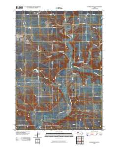
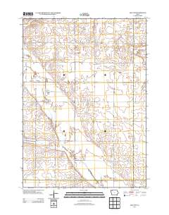
Layered GeoPDF 7.5 Minute Quadrangle Map. Layers of geospatial data include orthoimagery, roads, grids, geographic names, elevation contours, hydrography, and other selected map features.
Tags: 7.5 x 7.5 minute,
Downloadable Data,
EarthCover,
GeoPDF,
Imagery and Base Maps, All tags...
Iowa,
Map,
O'Brien,
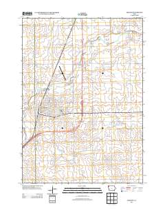
Primghar, IA,
Public Land Survey System,
U.S. National Grid,
US,
US Topo,
US Topo Historical,
United States,
boundary,
contour,
geographic names,
hydrography,
imageryBaseMapsEarthCover,
orthoimage,
structures,
topographic,
transportation,
woodland, Fewer tags
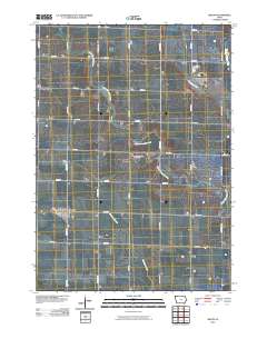
Layered GeoPDF 7.5 Minute Quadrangle Map. Layers of geospatial data include orthoimagery, roads, grids, geographic names, elevation contours, hydrography, and other selected map features.
Tags: 7.5 x 7.5 minute,
Downloadable Data,
EarthCover,
GeoPDF,
Imagery and Base Maps, All tags...
Iowa,
Map,
O'Brien,
Sanborn, IA,
U.S. National Grid,
US,
US Topo,
US Topo Historical,
United States,
contour,
geographic names,
hydrography,
orthoimage,
topographic,
transportation, Fewer tags
USGS Historical Quadrangle in GeoPDF.
Tags: 7.5 x 7.5 minute,
Downloadable Data,
FL,
GeoPDF,
GeoTIFF, All tags...
Historical Topographic Maps,
Historical Topographic Maps 7.5 x 7.5 Minute Map Series,
Map,
O'Brien,
imageryBaseMapsEarthCover, Fewer tags

Geospatial data includes structures and other selected map features.
Tags: Adair,
Adams,
Allamakee,
Appanoose,
Audubon, All tags...
Benton,
Black Hawk,
Boone,
Bremer,
Buchanan,
Buena Vista,
Butler,
Calhoun,
Campground,
Carroll,
Cass,
Cedar,
Cerro Gordo,
Cherokee,
Chickasaw,
Clarke,
Clay,
Clayton,
Clinton,
College / University,
Courthouse,
Crawford,
Dallas,
Davis,
Decatur,
Delaware,
Des Moines,
Dickinson,
Downloadable Data,
Dubuque,
Emmet,
Esri Shapefile nan,
Fayette,
Fire Station/ EMS Station,
Floyd,
Franklin,
Fremont,
Greene,
Grundy,
Guthrie,
Hamilton,
Hancock,
Hardin,
Harrison,
Henry,
Hospital/Medical Center,
Howard,
Humboldt,
IA,
Ida,
Information Center,
Iowa,
Iowa,
Jackson,
Jasper,
Jefferson,
Johnson,
Jones,
Keokuk,
Kossuth,
Law Enforcement,
Lee,
Linn,
Louisa,
Lucas,
Lyon,
Madison,
Mahaska,
Marion,
Marshall,
Mills,
Mitchell,
Monona,
Monroe,
Montgomery,
Muscatine,
National Structures Dataset (NSD),
National Structures Dataset (NSD),
O'Brien,
Osceola,
Page,
Palo Alto,
Plymouth,
Pocahontas,
Polk,
Post Office,
Pottawattamie,
Poweshiek,
Prison/ Correctional Facility,
Ringgold,
Sac,
School,
School:Elementary,
School:High School,
School:Middle School,
Scott,
Shapefile,
Shelby,
Sioux,
State,
State,
State Capitol,
Story,
Structures,
Tama,
Taylor,
Technical School,
Town Hall,
Trade School,
Trailhead,
US,
Union,
United States,
Van Buren,
Visitor Center,
Wapello,
Warren,
Washington,
Wayne,
Webster,
Winnebago,
Winneshiek,
Woodbury,
Worth,
Wright,
structure, Fewer tags
Layered GeoPDF 7.5 Minute Quadrangle Map. Layers of geospatial data include orthoimagery, roads, grids, geographic names, elevation contours, hydrography, and other selected map features.
Tags: 7.5 x 7.5 minute,
Downloadable Data,
EarthCover,
GeoPDF,
Imagery and Base Maps, All tags...
Iowa,
Map,
O'Brien,
Public Land Survey System,
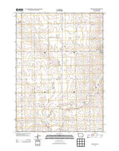
Sheldon, IA,
Sioux,
U.S. National Grid,
US,
US Topo,
US Topo Historical,
United States,
boundary,
contour,
geographic names,
hydrography,
imageryBaseMapsEarthCover,
orthoimage,
structures,
topographic,
transportation,
woodland, Fewer tags
Layered GeoPDF 7.5 Minute Quadrangle Map. Layers of geospatial data include orthoimagery, roads, grids, geographic names, elevation contours, hydrography, and other selected map features.
Tags: 7.5 x 7.5 minute,
Clay,
Dickinson,
Downloadable Data,
EarthCover, All tags...
GeoPDF,
Imagery and Base Maps,
Iowa,
Map,
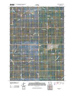
May City, IA,
O'Brien,
Osceola,
Public Land Survey System,
U.S. National Grid,
US,
US Topo,
US Topo Historical,
United States,
boundary,
contour,
geographic names,
hydrography,
imageryBaseMapsEarthCover,
orthoimage,
structures,
topographic,
transportation,
woodland, Fewer tags

USGS Historical Quadrangle in GeoPDF.
Tags: 7.5 x 7.5 minute,
CA,
Downloadable Data,
GeoPDF,
GeoTIFF, All tags...
Historical Topographic Maps,
Historical Topographic Maps 7.5 x 7.5 Minute Map Series,
Map,
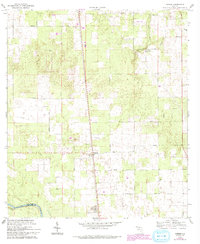
O'Brien,
Provisional,
imageryBaseMapsEarthCover, Fewer tags
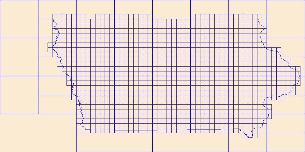
This data represents the map extent for current and historical USGS topographic maps for the United States and Territories, including 1 X 2 Degree, 1 X 1 Degree, 30 X 60 Minute, 15 X 15 Minute, 7.5 X 7.5 Minute, and 3.75 X 3.75 Minute. The grid was generated using ESRI ArcInfo GIS software.
Tags: Adair,
Adams,
Allamakee,
Appanoose,
Audubon, All tags...
Benton,
Black Hawk,
Boone,
Boundaries,
Bremer,
Buchanan,
Buena Vista,
Butler,
Calhoun,
Carroll,
Cass,
Cedar,
Cerro Gordo,
Cherokee,
Chickasaw,
Clarke,
Clay,
Clayton,
Clinton,
Crawford,
Dallas,
Davis,
Decatur,
Delaware,
Des Moines,
Dickinson,
Downloadable Data,
Dubuque,
Emmet,
Esri File GeoDatabase 10,
Fayette,
FileGDB,
Floyd,
Franklin,
Fremont,
Greene,
Grundy,
Guthrie,
Hamilton,
Hancock,
Hardin,
Harrison,
Henry,
Howard,
Humboldt,
IA,
Ida,
Iowa,
Iowa,
Jackson,
Jasper,
Jefferson,
Johnson,
Jones,
Keokuk,
Kossuth,
Lee,
Linn,
Louisa,
Lucas,
Lyon,
Madison,
Mahaska,
Map Indices,
Map Indices,
Map Indices,
Marion,
Marshall,
Mills,
Mitchell,
Monona,
Monroe,
Montgomery,
Muscatine,
O'Brien,
Osceola,
Page,
Palo Alto,
Plymouth,
Pocahontas,
Polk,
Pottawattamie,
Poweshiek,
Ringgold,
Sac,
Scott,
Shelby,
Sioux,
State,
State,
Story,
Tama,
Taylor,
US,
Union,
United States,
United States of America,
Van Buren,
Wapello,
Warren,
Washington,
Wayne,
Webster,
Winnebago,
Winneshiek,
Woodbury,
Worth,
Wright,
cells,
map indices,
polygon grid, Fewer tags
Geospatial data includes structures and other selected map features.
Tags: Adair,
Adams,
Allamakee,
Appanoose,
Audubon, All tags...
Benton,
Black Hawk,
Boone,
Bremer,
Buchanan,
Buena Vista,
Butler,
Calhoun,
Campground,
Carroll,
Cass,
Cedar,
Cerro Gordo,
Cherokee,
Chickasaw,
Clarke,
Clay,
Clayton,
Clinton,
College / University,
Courthouse,
Crawford,
Dallas,
Davis,
Decatur,
Delaware,
Des Moines,
Dickinson,
Downloadable Data,
Dubuque,
Emmet,
Esri File GeoDatabase 10,
Fayette,
FileGDB,
Fire Station/ EMS Station,
Floyd,
Franklin,
Fremont,
Greene,
Grundy,
Guthrie,
Hamilton,
Hancock,
Hardin,
Harrison,
Henry,
Hospital/Medical Center,
Howard,
Humboldt,
IA,
Ida,
Information Center,
Iowa,
Iowa,
Jackson,
Jasper,
Jefferson,
Johnson,
Jones,
Keokuk,
Kossuth,
Law Enforcement,
Lee,
Linn,
Louisa,
Lucas,
Lyon,
Madison,
Mahaska,
Marion,
Marshall,
Mills,
Mitchell,
Monona,
Monroe,
Montgomery,
Muscatine,
National Structures Dataset (NSD),
National Structures Dataset (NSD),
O'Brien,
Osceola,
Page,
Palo Alto,
Plymouth,
Pocahontas,
Polk,
Post Office,
Pottawattamie,
Poweshiek,
Prison/ Correctional Facility,
Ringgold,
Sac,
School,
School:Elementary,
School:High School,
School:Middle School,
Scott,
Shelby,
Sioux,
State,
State,
State Capitol,
Story,
Structures,
Tama,
Taylor,
Technical School,
Town Hall,
Trade School,
Trailhead,
US,
Union,
United States,
Van Buren,
Visitor Center,
Wapello,
Warren,
Washington,
Wayne,
Webster,
Winnebago,
Winneshiek,
Woodbury,
Worth,
Wright,
structure, Fewer tags
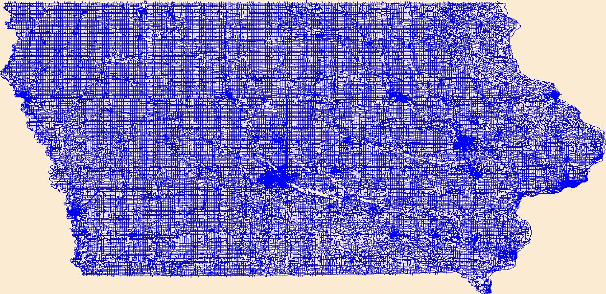
Layers of geospatial data include roads, airports, trails, and railroads.
Tags: Adair,
Adams,
Airport Complex,
Airport Point,
Airport Runway, All tags...
Airports,
Airstrips,
Allamakee,
Appanoose,
Audubon,
Benton,
Black Hawk,
Boone,
Bremer,
Buchanan,
Buena Vista,
Butler,
Calhoun,
Carroll,
Cass,
Cedar,
Cerro Gordo,
Cherokee,
Chickasaw,
Clarke,
Clay,
Clayton,
Clinton,
Crawford,
Dallas,
Davis,
Decatur,
Delaware,
Des Moines,
Dickinson,
Downloadable Data,
Dubuque,
Emmet,
Esri File GeoDatabase 10,
Fayette,
FileGDB,
Floyd,
Franklin,
Fremont,
Geographic names,
Greene,
Grundy,
Guthrie,
Hamilton,
Hancock,
Hardin,
Harrison,
Henry,
Howard,
Humboldt,
IA,
Ida,
Iowa,
Iowa,
Jackson,
Jasper,
Jefferson,
Johnson,
Jones,
Keokuk,
Kossuth,
Lee,
Linn,
Louisa,
Lucas,
Lyon,
Madison,
Mahaska,
Marion,
Marshall,
Mills,
Mitchell,
Monona,
Monroe,
Montgomery,
Muscatine,
National Transportation Dataset (NTD),
National Transportation Dataset (NTD),
O'Brien,
Osceola,
Page,
Palo Alto,
Plymouth,
Pocahontas,
Polk,
Pottawattamie,
Poweshiek,
Railways,
Ringgold,
Roads,
Sac,
Scott,
Shelby,
Sioux,
State,
State,
Story,
Tama,
Taylor,
Trail,
Trails,
Transportation,
Transportation,
US,
Union,
United States,
Van Buren,
Wapello,
Warren,
Washington,
Waterway,
Wayne,
Webster,
Winnebago,
Winneshiek,
Woodbury,
Worth,
Wright,
transportation, Fewer tags
The National Hydrography Dataset (NHD) is a feature-based database that interconnects and uniquely identifies the stream segments or reaches that make up the nation's surface water drainage system. NHD data was originally developed at 1:100,000-scale and exists at that scale for the whole country. This high-resolution NHD, generally developed at 1:24,000/1:12,000 scale, adds detail to the original 1:100,000-scale NHD. (Data for Alaska, Puerto Rico and the Virgin Islands was developed at high-resolution, not 1:100,000 scale.) Local resolution NHD is being developed where partners and data exist. The NHD contains reach codes for networked features, flow direction, names, and centerline representations for areal water...
Tags: Administrative watershed units,
Administrative watershed units,
Area of Complex Channels,
Area to be submerged,
Basin, All tags...
Basin,
Bay/Inlet,
Boundaries,
Boundary,
Bridge,
Buena Vista,
Canal/Ditch,
Cherokee,
Clay,
Coastline,
Connector,
Dam/Weir,
Dickinson,
Downloadable Data,
Drainage areas for surface water,
Drainageway,
Emmet,
Esri File GeoDatabase 10,
Estuary,
FileGDB,
Flow direction network,
Flume,
ForeShore,
Gaging Station,
Gate,
HU-8,
HU-8 Subbasin,
HU10,
HU12,
HU14,
HU16,
HU2,
HU4,
HU6,
HU8,
HU8_10230003,
HUC,
Harrison,
Hazard Zone,
Hydrographic,
Hydrography,
Hydrography,
Hydrography,
Hydrologic Unit Code,
Hydrologic Units,
IA,
Ice mass,
Ida,
Inundation Area,
Iowa,
Jackson,
Levee,
Line,
Lock Chamber,
MN,
Marsh,
Minnesota,
Monona,
National Hydrography Dataset (NHD),
National Hydrography Dataset (NHD) Best Resolution,
National Hydrography Dataset (NHD) Best Resolution,
Nobles,
Nonearthen Shore,
O'Brien,
Orthoimage,
Osceola,
Palo Alto,
Playa,
Plymouth,
Point,
PointEvent,
Pond,
Rapids,
Rapids,
Reach,
Reach code,
Reef,
Region,
Reservoir,
Rock,
Sea/Ocean,
Sink/Rise,
Sounding Datum Line,
Special Use Zone,
Special Use Zone Limit,
Spillway,
Stream,
Stream/River,
Sub-basin,
Sub-region,
Subbasin,
Submerged Stream,
Subregion,
Subwatershed,
Surface water systems,
Swamp,
Topographic,
Tunnel,
US,
Underground Conduit,
United States,
WBD,
WBD,
Wall,
Wash,
Water Intake Outflow,
Waterfall,
Watershed,
Watershed Boundaries,
Watershed Boundary Dataset,
Watershed Boundary Dataset,
Well,
Woodbury,
artificial path,
boundaries,
dams,
drainage systems and characteristics,
inlandWaters,
lakes,
ngda,
rivers, Fewer tags
|
|

