Filters
Date Range
Types
Contacts
Categories
Tag Types
Tag Schemes
|
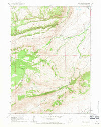
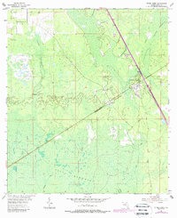
USGS Historical Quadrangle in GeoPDF.
Tags: 7.5 x 7.5 minute,
Downloadable Data,
GeoPDF,
GeoTIFF,
Historical Topographic Maps, All tags...
Historical Topographic Maps 7.5 x 7.5 Minute Map Series,
Map,
Otter Creek,
WY,
imageryBaseMapsEarthCover, Fewer tags

The 2008 - Present Ecosystem History of South Florida's Estuaries Database contains listings of all sites (modern and core) and modern monitoring site survey information (water chemistry, floral and faunal data, etc.). Three general types of data are contained within this database: 1) Modern Field Data (2008-present), 2) Master list of location information on all modern sites, and 3) Core data - location information. Data are available for modern sites (from 2008 to present) and cores in the general areas of Florida Bay, Biscayne Bay, and the southwest (Florida) coastal mangrove estuaries. Specific sites in the Florida Bay area include Taylor Creek, Bob Allen Key, Russell Bank, Pass Key, Whipray Basin, Rankin Bight,...
Categories: Data Release - Revised;
Tags: 002,
004,
007,
008,
012, All tags...
014,
Alinas Reef,
Alligator Bay,
Arsenicker Bank,
Arsenicker Key,
Arsenicker Shoal,
Barnes Key,
Big Cypress National Preserve,
Big Lostmans Bay,
Biscayne Bay,
Black Creek Canal,
Black Point,
Black Point Creek Canal,
Bob Allen Key,
Bottle Key,
Broad River,
Broad River Bay,
Broward County,
Buchanan Bank,
Butternut Key,
Buttonwood Keys,
C-111 Canal,
Caesars Cut,
Cape Sable,
Card Bank,
Central Everglades,
Chicken Key,
Chokoloskee Bay,
Clive Key,
Collier County,
Convoy Point,
Crab Keys,
Crocodile Point,
Dead Terrapin Basin,
Dragover Bank,
Duck Key,
Everglades National Park,
FL,
Featherbed Bank,
Florida,
Florida Bay,
Florida City Canal,
Florida Keys,
Gopher Pass,
Goulds Canal,
Gun Rock Point,
Harney River,
Huston River,
Ironwood Channel,
Jim Foot Key,
Johnson Key,
Lake Key,
Lignumvitae Basin,
Little Blackwater Sound,
Little Madeira Bay,
Long Sound,
Lostmans River,
Manatee Bay,
McCormick Creek,
Miami-Dade County,
Middle Key Basin,
Military Canal,
Monroe County,
Monroe Lake,
Mowry Canal,
Nest Key,
North Canal,
North Prong Otter Creek,
North River,
Old Dan Bank,
Old Sweat Bank,
Otter Creek,
Oyster Bay,
Park Key,
Pass Key,
Pavillion Key,
Pelican Bank,
Peterson Keys,
Ponce de Leon Bay,
Porjoe Key,
Princeton Canal,
Prong Creek,
Rabbit Key,
Rabbit Key Basin,
Rankin Basin,
Rankin Lake,
Roberts River,
Rodgers River Bay,
Russell Key,
SW Big Cypress,
Samphire Keys,
Schooner Bank,
Shark River,
Shell Creek,
Sid Key,
South East Coast,
Sprigger Bank,
Spy Key,
Storter Bay,
Tarpon Bay,
Taylor Creek,
Trout Creek,
US,
USGS Science Data Catalog (SDC),
United States,
Whipray Basin,
White Water Bay,
biology,
biota,
climatologyMeteorologyAtmosphere,
conservation paleobiology,
diatoms,
ecology,
ecology,
ecosystem history,
environment,
estuary,
foraminifera,
gastropods,
geography,
geologic core,
geology,
geoscientificInformation,
inlandWaters,
molluscs,
mollusks,
oceans,
ostracodes,
paleoecology,
paleontology,
pelecypods,
pollen,
salinity,
sedimentology,
vegetation, Fewer tags

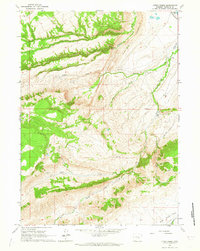
The US Geological Survey, in cooperation with the National Park Service, mapped 35 7.5-minute quadrangles, within a 2-mile-wide+ corridor centered on the Parkway, from BLRI (Blue Ridge Parkway) Mile Post (MP) 0 near Afton, Virginia southward to MP 218 at Cumberland Knob, approximately 1.3 km south of the Virginia – North Carolina State Line. Detailed bedrock geologic mapping for this project was conducted at 1:24,000-scale by systematically traversing roads, trails, creeks, and ridges within and adjacent to the 2-mile-wide+ corridor along the 216.9-mile length of the BLRI in Virginia. Geologic data at more than 23,000 station points were collected during this project (September 2009 – February 2014), with approximately...
Types: Citation,
Map Service,
OGC WFS Layer,
OGC WMS Layer,
OGC WMS Service;
Tags: Adney Gap,
Air Bellows Gap,
Alligator Back Formation,
Antietam Formation,
Ashe Formation, All tags...
Ashville,
Bald Mountain,
Balsam Gap,
Beacon Heights,
Bear Den,
Bear Mountain Gap,
Bearwallow Gap,
Bedrock,
Beech Gap,
Beetree Gap,
Benge Gap,
Big Island,
Big Witch Gap,
Biltmore Estate,
Blackhorse Gap,
Blowing Rock,
Blue Ridge Music Center Visitor Center,
Blue Ridge Park Visitor Center and Park Headquarters,
Blue Ridge Parkway,
Bluff Mountain,
Bottom Creek Metagranitoid Suite,
Buck Creek Gap,
Buena Vista,
Bull Gap,
Carbonate,
Cherokee,
Cherokee Indian Reservation,
Chestoa View,
Chilhowee Group,
Cold Mountain,
Conococheague Formation,
Crabtree Falls,
Crabtree Faults,
Craggy Gardens Visitor Center,
Craven Gap,
Crossnore,
Crossnore Plutonic Suite,
Cumberland Knob,
Daniel Boone's Trace,
Deep Gap,
Devils Backbone Overlook,
Devils Courthouse,
Diabase,
Doughton Park,
E.B. Jeffress Park,
Elbrook Formation,
Elk Pasture Gap,
Ervin,
Ervin,
Fallingwater Cascades,
Fancy Gap,
Flat Rock,
Folds,
Formation,
Fox Hunters Paradise,
Geology,
George Washington National Forest,
Gillespie Gap,
Glendale Springs,
Gneiss,
Graggy Dome,
Grandfather Mountain,
Grandfather Mountain State Park,
Granite,
Graveyard Fields,
Great Valley Overlook,
Green Knob,
Greenstone Trail,
Groundhog Mountain,
Hampton Formation,
Harpers Formation,
Hawksbill Mountain,
Hominy Creek,
Humpback Mountain,
Humpback Rocks Visitor Center,
Indian Gap,
Irish Gap,
James River,
James River Visitor Center and Canal,
Jefferson National Forest,
Julian Price Memorial Park,
Jumpinoff Rock,
Lake Powhaten,
Laurel Springs,
Lineville River,
Linville,
Linville Falls,
Linville Falls Visitor Center,
Little Switzerland,
Looking Glass Rock Overlook,
Lynchburg Group,
Mabry Hill,
Martinsburg Formation,
McKinney Gap,
Meadows of Dan,
Mesoproterozoic gneisses of the Fries Thrust Sheet,
Metabasalt,
Metagranitoid,
Moses H. Cone Memorial Park and Visitor Center,
Mount Jefferson State Park,
Mount Mitchell,
Mount Mitchell State Park,
Mount Pisgah,
Museum of North Carolina Minerals Visitor Center,
N&W Railroad Overlook,
Nantahala National Forest,
Normal Fault,
North Carolina,
North Carolina Arboretum,
Northwest Trading Post,
Oconalufte Visitor Center,
Onion Mountain Overlook,
Orchard Gap,
Oteen,
Otter Creek,
Overmountain Victory Nation Historic Trail,
Peach Bottom Mountain,
Peaks of Otter Metagranitoid,
Peaks of Otter Visitor Center,
Petites Gap,
Pilot Gneiss,
Pineola,
Pipers Gap,
Pisgah National Forest,
Poor Mountain,
Powell Gap,
Price Lake,
Puckett Cabin,
Purgatory Overlook,
Rakes Millpond,
Ravens Roost,
Reverse Fault,
Richland Balsam,
Roanoke Mountain,
Roanoke River,
Roanoke River Gorge,
Roanoke Valley Overlook,
Rocky Knob,
Rocky Knob Visitor Center,
Sandy Creek Gneiss,
Shady Dolomite,
Sharp Top,
Sherando Lake,
Skyland,
Southern End,
Staunton River,
Stone Mountain State Park,
Structure,
Sugarloaf Mountain,
Swannanoa River,
Swift Run Formation,
Table Rock Mountain,
Terrapin Mountain,
The Lump,
The Saddle,
Thrust Fault,
Tunnel Gap,
Twenty Minute Cliff,
Tye River,
Tye River Gap,
USGS Science Data Catalog (SDC),
Unicoi Formation,
Virginia,
Virginia Explore Park and Visitor Center,
Volunteer Gap,
Wagon Road Gap,
Watauga River,
Waterrock Knob Visitor Center,
Wayneboro Formation,
Waynesboro,
Wayneville,
Weverton Formation,
Whites Gap Overlook,
Wigwarm Falls,
Woodlaw,
Wrights Creek,
Yankee Horse Ridge,
Z.B. Vance Birthplace, Fewer tags
USGS Historical Quadrangle in GeoPDF.
Tags: 7.5 x 7.5 minute,
Downloadable Data,
GeoPDF,
GeoTIFF,
Historical Topographic Maps, All tags...
Historical Topographic Maps 7.5 x 7.5 Minute Map Series,
Map,
ND,
Otter Creek,
imageryBaseMapsEarthCover, Fewer tags

The US Geological Survey, in cooperation with the National Park Service, mapped 35 7.5-minute quadrangles, within a 2-mile-wide+ corridor centered on the Parkway, from BLRI (Blue Ridge Parkway) Mile Post (MP) 0 near Afton, Virginia southward to MP 218 at Cumberland Knob, approximately 1.3 km south of the Virginia – North Carolina State Line. Detailed bedrock geologic mapping for this project was conducted at 1:24,000-scale by systematically traversing roads, trails, creeks, and ridges within and adjacent to the 2-mile-wide+ corridor along the 216.9-mile length of the BLRI in Virginia. Geologic data at more than 23,000 station points were collected during this project (September 2009 – February 2014), with approximately...
Types: Citation;
Tags: Adney Gap,
Air Bellows Gap,
Alligator Back Formation,
Antietam Formation,
Ashe Formation, All tags...
Ashville,
Bald Mountain,
Balsam Gap,
Beacon Heights,
Bear Den,
Bear Mountain Gap,
Bearwallow Gap,
Bedrock,
Beech Gap,
Beetree Gap,
Benge Gap,
Big Island,
Big Witch Gap,
Biltmore Estate,
Blackhorse Gap,
Blowing Rock,
Blue Ridge Music Center Visitor Center,
Blue Ridge Park Visitor Center and Park Headquarters,
Blue Ridge Parkway,
Bluff Mountain,
Bottom Creek Metagranitoid Suite,
Buck Creek Gap,
Buena Vista,
Bull Gap,
Carbonate,
Cherokee,
Cherokee Indian Reservation,
Chestoa View,
Chilhowee Group,
Cold Mountain,
Conococheague Formation,
Crabtree Falls,
Crabtree Faults,
Craggy Gardens Visitor Center,
Craven Gap,
Crossnore,
Crossnore Plutonic Suite,
Cumberland Knob,
Daniel Boone's Trace,
Deep Gap,
Devils Backbone Overlook,
Devils Courthouse,
Diabase,
Doughton Park,
E.B. Jeffress Park,
Elbrook Formation,
Elk Pasture Gap,
Ervin,
Ervin,
Fallingwater Cascades,
Fancy Gap,
Flat Rock,
Folds,
Formation,
Fox Hunters Paradise,
Geology,
George Washington National Forest,
Gillespie Gap,
Glendale Springs,
Gneiss,
Graggy Dome,
Grandfather Mountain,
Grandfather Mountain State Park,
Granite,
Graveyard Fields,
Great Valley Overlook,
Green Knob,
Greenstone Trail,
Groundhog Mountain,
Hampton Formation,
Harpers Formation,
Hawksbill Mountain,
Hominy Creek,
Humpback Mountain,
Humpback Rocks Visitor Center,
Indian Gap,
Irish Gap,
James River,
James River Visitor Center and Canal,
Jefferson National Forest,
Julian Price Memorial Park,
Jumpinoff Rock,
Lake Powhaten,
Laurel Springs,
Lineville River,
Linville,
Linville Falls,
Linville Falls Visitor Center,
Little Switzerland,
Looking Glass Rock Overlook,
Lynchburg Group,
Mabry Hill,
Martinsburg Formation,
McKinney Gap,
Meadows of Dan,
Mesoproterozoic gneisses of the Fries Thrust Sheet,
Metabasalt,
Metagranitoid,
Moses H. Cone Memorial Park and Visitor Center,
Mount Jefferson State Park,
Mount Mitchell,
Mount Mitchell State Park,
Mount Pisgah,
Museum of North Carolina Minerals Visitor Center,
N&W Railroad Overlook,
Nantahala National Forest,
Normal Fault,
North Carolina,
North Carolina Arboretum,
Northwest Trading Post,
Oconalufte Visitor Center,
Onion Mountain Overlook,
Orchard Gap,
Oteen,
Otter Creek,
Overmountain Victory Nation Historic Trail,
Peach Bottom Mountain,
Peaks of Otter Metagranitoid,
Peaks of Otter Visitor Center,
Petites Gap,
Pilot Gneiss,
Pineola,
Pipers Gap,
Pisgah National Forest,
Poor Mountain,
Powell Gap,
Price Lake,
Puckett Cabin,
Purgatory Overlook,
Rakes Millpond,
Ravens Roost,
Reverse Fault,
Richland Balsam,
Roanoke Mountain,
Roanoke River,
Roanoke River Gorge,
Roanoke Valley Overlook,
Rocky Knob,
Rocky Knob Visitor Center,
Sandy Creek Gneiss,
Shady Dolomite,
Sharp Top,
Sherando Lake,
Skyland,
Southern End,
Staunton River,
Stone Mountain State Park,
Structure,
Sugarloaf Mountain,
Swannanoa River,
Swift Run Formation,
Table Rock Mountain,
Terrapin Mountain,
The Lump,
The Saddle,
Thrust Fault,
Tunnel Gap,
Twenty Minute Cliff,
Tye River,
Tye River Gap,
Unicoi Formation,
Virginia,
Virginia Explore Park and Visitor Center,
Volunteer Gap,
Wagon Road Gap,
Watauga River,
Waterrock Knob Visitor Center,
Wayneboro Formation,
Waynesboro,
Wayneville,
Weverton Formation,
Whites Gap Overlook,
Wigwarm Falls,
Woodlaw,
Wrights Creek,
Yankee Horse Ridge,
Z.B. Vance Birthplace, Fewer tags
USGS Historical Quadrangle in GeoPDF.
Tags: 7.5 x 7.5 minute,
Downloadable Data,
FL,
GeoPDF,
GeoTIFF, All tags...
Historical Topographic Maps,
Historical Topographic Maps 7.5 x 7.5 Minute Map Series,
Map,
Otter Creek,
imageryBaseMapsEarthCover, Fewer tags
USGS Historical Quadrangle in GeoPDF.
Tags: 7.5 x 7.5 minute,
Downloadable Data,
GeoPDF,
GeoTIFF,
Historical Topographic Maps, All tags...
Historical Topographic Maps 7.5 x 7.5 Minute Map Series,
Map,
Otter Creek,
WY,
imageryBaseMapsEarthCover, Fewer tags
USGS Historical Quadrangle in GeoPDF.
Tags: 7.5 x 7.5 minute,
Downloadable Data,
FL,
GeoPDF,
GeoTIFF, All tags...
Historical Topographic Maps,
Historical Topographic Maps 7.5 x 7.5 Minute Map Series,
Map,
Otter Creek,
imageryBaseMapsEarthCover, Fewer tags

The 1995 - 2007 Ecosystem History of South Florida's Estuaries Database contains listings of all sites (modern and core), modern monitoring site survey information (water chemistry, floral and faunal data, bottom type, etc.), and published core data. Three general types of data are contained within this database: 1) Modern Field Data (1995-2007), 2) Master list of location information on all modern sites, and 3) Core data - faunal assemblages and location information. Data are available for modern sites and cores in the general areas of Florida Bay, Biscayne Bay, and the southwest (Florida) coastal mangrove estuaries. Specific sites in the Florida Bay area include Taylor Creek, Bob Allen Key, Russell Bank, Pass...
Categories: Data Release - Revised;
Tags: 002,
004,
007,
008,
012, All tags...
014,
Alinas Reef,
Alligator Bay,
Arsenicker Bank,
Arsenicker Key,
Arsenicker Shoal,
Barnes Key,
Big Cypress National Preserve,
Big Lostmans Bay,
Biscayne Bay,
Black Creek Canal,
Black Point,
Black Point Creek Canal,
Bob Allen Key,
Bottle Key,
Broad River,
Broad River Bay,
Broward County,
Buchanan Bank,
Butternut Key,
Buttonwood Keys,
C-111 Canal,
Caesars Cut,
Cape Sable,
Card Bank,
Central Everglades,
Chicken Key,
Chokoloskee Bay,
Clive Key,
Collier County,
Convoy Point,
Crab Keys,
Crocodile Point,
Dead Terrapin Basin,
Dragover Bank,
Duck Key,
Everglades National Park,
FL,
Featherbed Bank,
Florida,
Florida Bay,
Florida City Canal,
Florida Keys,
Gopher Pass,
Goulds Canal,
Gun Rock Point,
Harney River,
Huston River,
Ironwood Channel,
Jim Foot Key,
Johnson Key,
Lake Key,
Lignumvitae Basin,
Little Blackwater Sound,
Little Madeira Bay,
Long Sound,
Lostmans River,
Manatee Bay,
McCormick Creek,
Miami-Dade County,
Middle Key Basin,
Military Canal,
Monroe County,
Monroe Lake,
Mowry Canal,
Nest Key,
North Canal,
North Prong Otter Creek,
North River,
Old Dan Bank,
Old Sweat Bank,
Otter Creek,
Oyster Bay,
Park Key,
Pass Key,
Pavillion Key,
Pelican Bank,
Peterson Keys,
Ponce de Leon Bay,
Porjoe Key,
Princeton Canal,
Prong Creek,
Rabbit Key,
Rabbit Key Basin,
Rankin Basin,
Rankin Lake,
Roberts River,
Rodgers River Bay,
Russell Key,
SW Big Cypress,
Samphire Keys,
Schooner Bank,
Shark River,
Shell Creek,
Sid Key,
South East Coast,
Sprigger Bank,
Spy Key,
Storter Bay,
Tarpon Bay,
Taylor Creek,
Trout Creek,
US,
USGS Science Data Catalog (SDC),
United States,
Whipray Basin,
White Water Bay,
biology,
biota,
climatologyMeteorologyAtmosphere,
conservation paleobiology,
diatoms,
ecology,
ecology,
ecosystem history,
environment,
estuary,
foraminifera,
gastropods,
geography,
geologic core,
geology,
geoscientificInformation,
inlandWaters,
mollusks,
mollusks,
oceans,
ostracodes,
paleoecology,
paleontology,
pelecypods,
pollen,
salinity,
sedimentology,
vegetation, Fewer tags

The 1:100,000-scale geologic map database of the South Boston 30' × 60' quadrangle, Virginia and North Carolina, provides geologic information for the Piedmont along the I-85 and U.S. Route 58 corridors and in the Roanoke River watershed, which includes the John H. Kerr Reservoir and Lake Gaston. The Raleigh terrane (located on the eastern side of the map) contains Neoproterozoic to early Paleozoic(?) polydeformed, amphibolite-facies gneisses and schists. The Carolina slate belt of the Carolina terrane (located in the central part of the map) contains Neoproterozoic metavolcanic and metasedimentary rocks at greenschist facies. Although locally complicated, the slate-belt structure mapped across the South Boston...
Tags: 30 x 60 minute,
Aaron Formation,
Aarons Creek,
Alkaline basalt,
Allen Creek, All tags...
Alluvium,
Amphibolite,
Argillite,
Armistead Branch,
Ashcake Creek,
Augen gneiss,
Averett,
Bagleys Mills,
Banister Lake,
Banister River,
Barnes Junction,
Basalt,
Baskerville,
Bears Element Creek,
Beaver Pond,
Beaver Pond Creek,
Beech Creek,
Bethel Hill,
Big Hounds Creek,
Big Juniper Creek,
Biotite gneiss,
Birch Creek,
Bishops Corner,
Black Walnut Creek,
Blackridge,
Blackstone Creek,
Blanes Millpond,
Bluestone Creek,
Bluestone Otter Creek,
Bluewing Creek,
Bowes Branch,
Boydton,
Bracey,
Brodnax,
Brunswick County,
Buckham Creek,
Buckhorn Creek,
Buckskin Creek,
Buffalo Creek,
Buffalo Junction,
Buffalo Springs,
Buggs Island,
Burton Branch,
Butcher Creek,
Cambrian,
Cargills Creek,
Carolina slate belt,
Carolina terrane,
Castle Creek,
Castle Heights,
Cataclasite,
Catawba Creek,
Cedar Creek,
Cenozoic,
Charlotte County,
Chase City,
Christie,
Clarksville,
Clarkton,
Clays Mill,
Clover,
Clover Creek,
Cluster Springs,
Coleman Creek,
Colluvium,
Conglomerate,
Connor Lake,
Cotton Creek,
Couches Creek,
Country Line complex,
Cox Creek,
Crooked Creek,
Crupper Run,
Crystal Hill,
Cub Creek,
Cunningham complex,
Dacite,
Dan River,
Devils Branch,
Devonian,
Diabase,
Difficult Creek,
Diorite,
Dixon Millpond,
Dockery Creek,
Drakes Branch,
Dryburg,
Dudley,
Dundas,
Ellis Creek,
Esnon,
Evans Creek,
Farmers Branch,
Felsic gneiss,
Finchley,
Finnewood Creek,
Finneywood,
Flat Creek,
Flat Rock Creek,
Forksville,
Formosa,
Fort Mitchell,
Gabbro,
Gibson Creek,
Gilliams Branch,
Gneiss,
Goodell Creek,
Granite,
Granitic gneiss,
Granodiorite,
Granville County,
Grassy Creek,
Great Creek,
Greenschist,
Gregory Corner,
Hagood Creek,
Halifax,
Halifax County,
Harmony,
Hawtree Creek,
Hitesburg,
Holocene,
Horsepen Creek,
Horseshoe Lake,
Hughs Lake,
Hunting Creek,
Hyco Formation,
Hyco River,
Island Creek,
Island Creek Reservoir,
Jeffress,
Johnson Creek,
Jurassic,
Kenbridge,
Kerr Reservoir,
Kettle Creek,
Kettlesticks Creek,
Kits Creek,
La Crosse,
Lake Gaston,
Lake Gordon,
Langford Pond,
Lawsons Creek,
Layton Creek,
Lennig,
Little Genito Creek,
Little Horsepen Creek,
Little Johnson Creek,
Little Juniper Creek,
Little Temble Creek,
Long Branch,
Lunenburg,
Lunenburg County,
Lyle Creek,
Marengo,
Mason Creek,
Mayo,
Mayo Creek,
Mayo Reservoir,
Mecklenburg County,
Mesozoic,
Metabasalt,
Metamorphic rock,
Metamorphic suite of South Hill,
Metasedimentary rock,
Metavolcanic rock,
Middle Meherrin River,
Mikes Creek,
Miles Creek,
Mill Branch,
Milton terrane,
Mines Creek,
Miocene,
Miry Creek,
Mississippian,
Mitchell Creek,
Monzodiorite,
Monzonite,
Moody Creek,
Mossingford,
Mount Laurel,
Mountain Creek,
Mylonite,
Nathalie,
Nelson,
Neogene,
Neoproterozoic,
North Carolina,
North Meherrin River,
North View,
Nutbush Creek,
Nutbush Creek mylonite zone,
Omega,
Ontario,
Ordovician,
Orthogneiss,
Otter Creek,
Paleozoic,
Palmer Crossroads,
Palmer Springs,
Panhandle Creek,
Parham Creek,
Pennsylvanian,
Permian,
Person County,
Peter Creek,
Philbeck Crossroads,
Phyllonite,
Piney Creek,
Piney Grove,
Plantersville,
Pleistocene,
Pliocene,
Poplar Creek,
Public Fork,
Quartz diorite,
Quartz monzonite,
Quartzite,
Quaternary,
Rabat,
Raleigh terrane,
Randolph,
Ready Creek,
Red Bank,
Red Oak,
Redlawn,
Reedy Creek,
Reeses Creek,
Rehoboth,
Reynolds Creek,
Rhyolite,
Riverdale,
Roanoke Creek,
Roanoke River,
Rocky Branch,
Sand,
Sandy Creek,
Saxe,
Schist,
Scotts Crossroad,
Scottsburg,
Seay Creek,
Shiny Rock,
Siddon,
Siltstone,
Silurian,
Sinai,
Skipwith,
Smith Creek,
South Boston,
South Hill,
South Meherrin River,
Spanish Grove,
Stokes Creek,
Stony Creek,
Taylors Creek,
Temble Creek,
Terrace,
The Ridge,
Tonalite,
Triassic,
Tungsten,
Twittys Creek,
USGS Science Data Catalog (SDC),
Union Level,
Vance County,
Vance pluton,
Victoria,
Virgilina,
Virgilina Formation,
Virginia,
Wallace Branch,
Warren County,
Wightman,
Winn Creek,
Wolf Trap Creek,
Wylliesburg,
abandoned mines and quarries,
bedrock geologic units,
copper,
earth sciences,
folding (geologic),
foliation (geologic),
fracture (geologic),
geologic contacts,
geologic maps,
geologic processes,
geologic structure,
geologic time periods,
geologic time scales,
geology,
geoscientificInformation,
geospatial datasets,
information product types,
inlandWaters,
lithology,
maps and atlases,
metamorphic rocks,
metamorphism (geological),
mining and quarrying,
place,
sedimentary rocks,
sedimentation,
society,
stratum,
structural geology,
structure,
surficial geologic units,
unconsolidated deposits,
utilitiesCommunication, Fewer tags
USGS Historical Quadrangle in GeoPDF.
Tags: 7.5 x 7.5 minute,
Downloadable Data,
FL,
GeoPDF,
GeoTIFF, All tags...
Historical Topographic Maps,
Historical Topographic Maps 7.5 x 7.5 Minute Map Series,
Map,
Otter Creek,
imageryBaseMapsEarthCover, Fewer tags
|
|

