Filters: Tags: POTLATCH (X)
19 results (57ms)|
Filters
Date Range
Contacts
Categories Tag Types Tag Schemes |
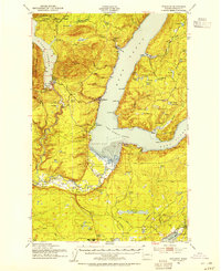
USGS Historical Quadrangle in GeoPDF.
USGS Historical Quadrangle in GeoPDF.
Core Research Center, core T130, from well operated by NEWFIELD PRODUCTIONRaw Properties from download, web scrape, MapServer, and Macrostrat API{"Lib Num": "T130", "API Num": "2503522144", "Operator": "NEWFIELD PRODUCTION", "Well Name": "OLD WEST 1-9-16H", "Field": "WILDCAT", "State": "MT", "County": "GLACIER", "Type": "SLABBED", "Photos": "T", "Thin Sec": "F", "Analysis": "T", "Latitude": "48.62713", "Longitude": "-112.5306", "coordinates_geohash": "c2xuxk39wfnc", "Source": "PROVIDED BY DONOR", "Security Flag": "NO SPECIAL RESTRICTIONS", "crc_collection_name": "core", "sb_parent_id": "4f4e49dae4b07f02db5e0486", "intervals": [{"Formation": "BAKKEN", "Age": null, "Min Depth": "5319", "Max Depth": "5427"}, {"Formation":...
Core Research Center, core T151, from well operated by NEWFIELD PRODUCTIONRaw Properties from download, web scrape, MapServer, and Macrostrat API{"Lib Num": "T151", "API Num": "2503522163", "Operator": "NEWFIELD PRODUCTION", "Well Name": "TRIBAL BUFFALO JUMP 1-28H", "Field": "WILDCAT", "State": "MT", "County": "GLACIER", "Type": "SLABBED", "Photos": "T", "Thin Sec": "F", "Analysis": "T", "Latitude": "48.76849", "Longitude": "-113.0405", "coordinates_geohash": "c2xt7wn3j3my", "Source": "PROVIDED BY DONOR", "Security Flag": "NO SPECIAL RESTRICTIONS", "crc_collection_name": "core", "sb_parent_id": "4f4e49dae4b07f02db5e0486", "intervals": [{"Formation": "LODGEPOLE", "Age": null, "Min Depth": "9642", "Max Depth": "9720"},...
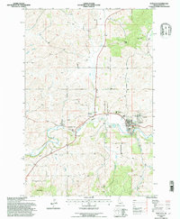
USGS Historical Quadrangle in GeoPDF.

USGS Historical Quadrangle in GeoPDF.
Core Research Center, core T193, from well operated by NEWFIELD PRODUCTIONRaw Properties from download, web scrape, MapServer, and Macrostrat API{"Lib Num": "T193", "API Num": "2503522159", "Operator": "NEWFIELD PRODUCTION", "Well Name": "TRIBAL SACRED PIPE 1-21H", "Field": "WILDCAT", "State": "MT", "County": "GLACIER", "Type": "SLABBED", "Photos": "T", "Thin Sec": "F", "Analysis": "T", "Latitude": "48.78217", "Longitude": "-112.78563", "coordinates_geohash": "c2xv98808rdf", "Source": "PROVIDED BY DONOR", "Security Flag": "NO SPECIAL RESTRICTIONS", "crc_collection_name": "core", "sb_parent_id": "4f4e49dae4b07f02db5e0486", "intervals": [{"Formation": "POTLATCH", "Age": null, "Min Depth": "7137", "Max Depth": "7205"},...
Categories: Physical Item;
Tags: Horsethief Formation,
Horsethief Formation,
Maastrichtian,
NISKU,
POTLATCH,
Core Research Center, core C902, from well operated by QUINTANA PETROLEUMRaw Properties from download, web scrape, MapServer, and Macrostrat API{"Lib Num": "C902", "API Num": "2510122740", "Operator": "QUINTANA PETROLEUM", "Well Name": "1-28 SKESLIEN", "Field": "WILDCAT", "State": "MT", "County": "TOOLE", "Type": "SLABBED", "Photos": "F", "Thin Sec": "T", "Analysis": "T", "Latitude": "48.506922", "Longitude": "-111.603868", "coordinates_geohash": "c88euqkt33sk", "Source": "FROM STATE RECORDS", "Security Flag": "NO SPECIAL RESTRICTIONS", "crc_collection_name": "core", "sb_parent_id": "4f4e49dae4b07f02db5e0486", "intervals": [{"Formation": "POTLATCH", "Age": "DEVO", "Min Depth": "2855", "Max Depth": "2882"}], "crcwc_url":...
Categories: Physical Item;
Tags: Coniacian - Santonian,
DEVO,
Kevin Member,
Kevin Member of Marias River Formation,
POTLATCH,
Core Research Center, core B644, from well operated by RAINBOW RESOURCESRaw Properties from download, web scrape, MapServer, and Macrostrat API{"Lib Num": "B644", "API Num": "2509921042", "Operator": "RAINBOW RESOURCES", "Well Name": "1-32 PEARSON BROTHERS", "Field": "WILDCAT", "State": "MT", "County": "TETON", "Type": "SLABBED", "Photos": "F", "Thin Sec": "T", "Analysis": "F", "Latitude": "47.612615", "Longitude": "-112.272039", "coordinates_geohash": "c82nv5tgxfsp", "Source": "FROM STATE RECORDS", "Security Flag": "NO SPECIAL RESTRICTIONS", "crc_collection_name": "core", "sb_parent_id": "4f4e49dae4b07f02db5e0486", "intervals": [{"Formation": "POTLATCH", "Age": "CRET", "Min Depth": "5410", "Max Depth": "5428"}],...
Categories: Physical Item;
Tags: Alluvial gravel, terrace,
CRET,
POTLATCH,
Quaternary-Tertiary,
gravel,
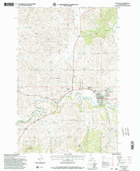
USGS Historical Quadrangle in GeoPDF.
Core Research Center, core T128, from well operated by NEWFIELD PRODUCTIONRaw Properties from download, web scrape, MapServer, and Macrostrat API{"Lib Num": "T128", "API Num": "2503522129", "Operator": "NEWFIELD PRODUCTION", "Well Name": "PEACEMAKER 1-5H", "Field": "WILDCAT", "State": "MT", "County": "GLACIER", "Type": "SLABBED", "Photos": "T", "Thin Sec": "F", "Analysis": "T", "Latitude": "48.6528", "Longitude": "-112.42537", "coordinates_geohash": "c88hc8yr5520", "Source": "PROVIDED BY DONOR", "Security Flag": "NO SPECIAL RESTRICTIONS", "crc_collection_name": "core", "sb_parent_id": "4f4e49dae4b07f02db5e0486", "intervals": [{"Formation": "LODGEPOLE", "Age": null, "Min Depth": "4652", "Max Depth": "4797"}, {"Formation":...
Categories: Physical Item;
Tags: Campanian - Maastrichtian,
LODGEPOLE,
NISKU,
POTLATCH,
Two Medicine Formation,
Core Research Center, core T194, from well operated by NEWFIELD PRODUCTIONRaw Properties from download, web scrape, MapServer, and Macrostrat API{"Lib Num": "T194", "API Num": "2503522167", "Operator": "NEWFIELD PRODUCTION", "Well Name": "TRIBAL RUMNEY 1-21H", "Field": "WILDCAT", "State": "MT", "County": "GLACIER", "Type": "SLABBED", "Photos": "T", "Thin Sec": "F", "Analysis": "T", "Latitude": "48.94419", "Longitude": "-113.05221", "coordinates_geohash": "c2xw7qjbsd63", "Source": "PROVIDED BY DONOR", "Security Flag": "NO SPECIAL RESTRICTIONS", "crc_collection_name": "core", "sb_parent_id": "4f4e49dae4b07f02db5e0486", "intervals": [{"Formation": "BAKKEN", "Age": null, "Min Depth": "8845", "Max Depth": "8848"}, {"Formation":...
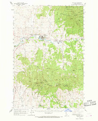
USGS Historical Quadrangle in GeoPDF.

USGS Historical Quadrangle in GeoPDF.
USGS Historical Quadrangle in GeoPDF.
Core Research Center, core T150, from well operated by NEWFIELD PRODUCTIONRaw Properties from download, web scrape, MapServer, and Macrostrat API{"Lib Num": "T150", "API Num": "2503522158", "Operator": "NEWFIELD PRODUCTION", "Well Name": "TRIBAL LULU PARR 1-8H", "Field": "WILDCAT", "State": "MT", "County": "GLACIER", "Type": "SLABBED", "Photos": "F", "Thin Sec": "F", "Analysis": "F", "Latitude": "48.62614", "Longitude": "-112.68326", "coordinates_geohash": "c2xueu4ec9rr", "Source": "PROVIDED BY DONOR", "Security Flag": "NO SPECIAL RESTRICTIONS", "crc_collection_name": "core", "sb_parent_id": "4f4e49dae4b07f02db5e0486", "intervals": [{"Formation": "POTLATCH", "Age": null, "Min Depth": "6315", "Max Depth": "6459"},...
USGS Historical Quadrangle in GeoPDF.
USGS Historical Quadrangle in GeoPDF.
USGS Historical Quadrangle in GeoPDF.
|

|
