Filters: Tags: Placer (X)
187 results (13ms)|
Filters
Date Range
Extensions Types Contacts
Categories Tag Types Tag Schemes |
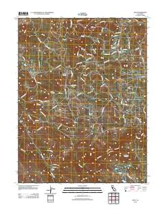
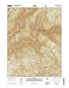
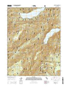
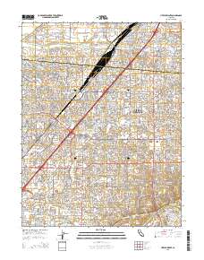
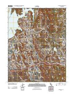
Layered GeoPDF 7.5 Minute Quadrangle Map. Layers of geospatial data include orthoimagery, roads, grids, geographic names, elevation contours, hydrography, and other selected map features.
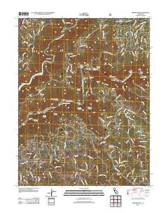
Layered GeoPDF 7.5 Minute Quadrangle Map. Layers of geospatial data include orthoimagery, roads, grids, geographic names, elevation contours, hydrography, and other selected map features.
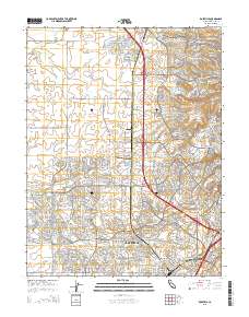
Layered GeoPDF 7.5 Minute Quadrangle Map. Layers of geospatial data include orthoimagery, roads, grids, geographic names, elevation contours, hydrography, and other selected map features.
To estimate the potential of mineral resources in the Bureau of Land Management Central Yukon Planning Area using geographic information systems (GIS) analysis of muliple statewide datasets. The six mineral deposit models are: 1) REE-Th-Y-Nb deposits associated with peralkaline to carbonatitic intrusive rocks, 2) placer and paleoplacer Au, 3) PGE (-Co-Cr-Ni-Ti-V) deposits associated with mafic-to-ultramafic intrusive rocks, 4) carbonate-hosted Cu (-Co-Ag-Ge-Ga) deposits, 5) sandstone U (-V-Cu) deposits, and 6) Sn-W-Mo (-Ta-In-fluorspar) deposits in specialized granites. GIS data layers available for analysis include sediment and rock geochemistry, pan concentrate mineralogy and geochemistry, Alaska Resource Data...
To estimate the potential of mineral resources in the Bureau of Land Management Central Yukon Planning Area using geographic information systems (GIS) analysis of muliple statewide datasets. The six mineral deposit models are: 1) REE-Th-Y-Nb deposits associated with peralkaline to carbonatitic intrusive rocks, 2) placer and paleoplacer Au, 3) PGE (-Co-Cr-Ni-Ti-V) deposits associated with mafic-to-ultramafic intrusive rocks, 4) carbonate-hosted Cu (-Co-Ag-Ge-Ga) deposits, 5) sandstone U (-V-Cu) deposits, and 6) Sn-W-Mo (-Ta-In-fluorspar) deposits in specialized granites. GIS data layers available for analysis include sediment and rock geochemistry, pan concentrate mineralogy and geochemistry, Alaska Resource Data...
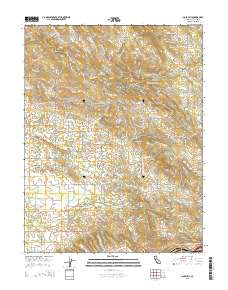
Layered GeoPDF 7.5 Minute Quadrangle Map. Layers of geospatial data include orthoimagery, roads, grids, geographic names, elevation contours, hydrography, and other selected map features.
Layered GeoPDF 7.5 Minute Quadrangle Map. Layers of geospatial data include orthoimagery, roads, grids, geographic names, elevation contours, hydrography, and other selected map features.

Layered GeoPDF 7.5 Minute Quadrangle Map. Layers of geospatial data include orthoimagery, roads, grids, geographic names, elevation contours, hydrography, and other selected map features.
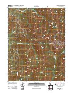
Layered GeoPDF 7.5 Minute Quadrangle Map. Layers of geospatial data include orthoimagery, roads, grids, geographic names, elevation contours, hydrography, and other selected map features.

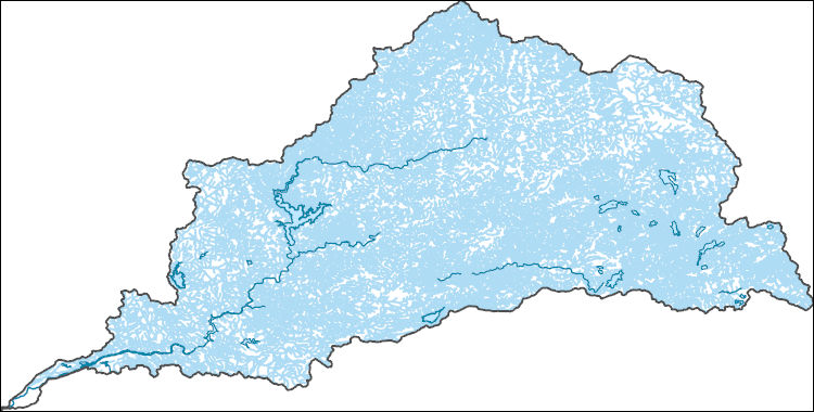
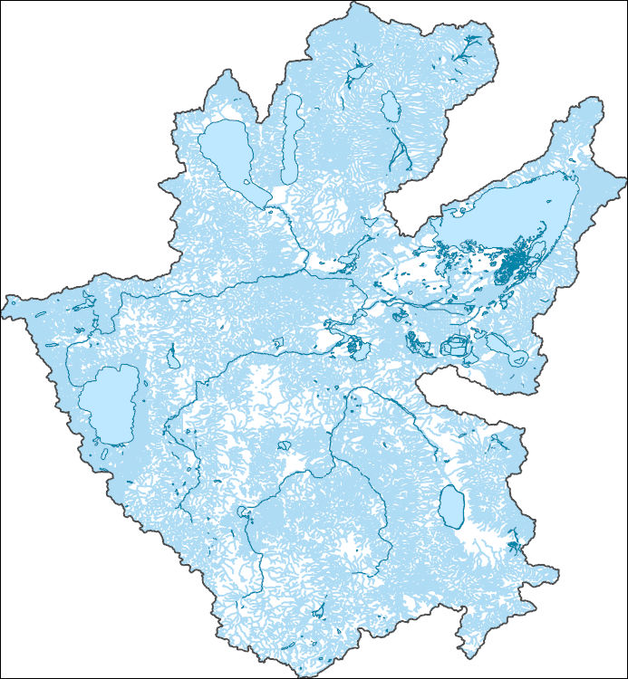
The National Hydrography Dataset (NHD) is a feature-based database that interconnects and uniquely identifies the stream segments or reaches that make up the nation's surface water drainage system. NHD data was originally developed at 1:100,000-scale and exists at that scale for the whole country. This high-resolution NHD, generally developed at 1:24,000/1:12,000 scale, adds detail to the original 1:100,000-scale NHD. (Data for Alaska, Puerto Rico and the Virgin Islands was developed at high-resolution, not 1:100,000 scale.) Local resolution NHD is being developed where partners and data exist. The NHD contains reach codes for networked features, flow direction, names, and centerline representations for areal water...
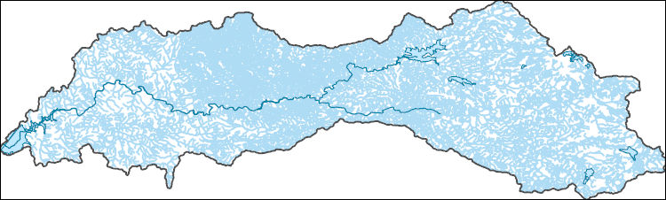
The National Hydrography Dataset (NHD) is a feature-based database that interconnects and uniquely identifies the stream segments or reaches that make up the nation's surface water drainage system. NHD data was originally developed at 1:100,000-scale and exists at that scale for the whole country. This high-resolution NHD, generally developed at 1:24,000/1:12,000 scale, adds detail to the original 1:100,000-scale NHD. (Data for Alaska, Puerto Rico and the Virgin Islands was developed at high-resolution, not 1:100,000 scale.) Local resolution NHD is being developed where partners and data exist. The NHD contains reach codes for networked features, flow direction, names, and centerline representations for areal water...
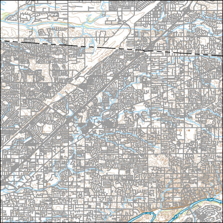
Layers of geospatial data include contours, boundaries, land cover, hydrography, roads, transportation, geographic names, structures, and other selected map features.

Layers of geospatial data include roads, airports, trails, and railroads.
The National Hydrography Dataset (NHD) is a feature-based database that interconnects and uniquely identifies the stream segments or reaches that make up the nation's surface water drainage system. NHD data was originally developed at 1:100,000-scale and exists at that scale for the whole country. This high-resolution NHD, generally developed at 1:24,000/1:12,000 scale, adds detail to the original 1:100,000-scale NHD. (Data for Alaska, Puerto Rico and the Virgin Islands was developed at high-resolution, not 1:100,000 scale.) Local resolution NHD is being developed where partners and data exist. The NHD contains reach codes for networked features, flow direction, names, and centerline representations for areal water...
The National Hydrography Dataset (NHD) is a feature-based database that interconnects and uniquely identifies the stream segments or reaches that make up the nation's surface water drainage system. NHD data was originally developed at 1:100,000-scale and exists at that scale for the whole country. This high-resolution NHD, generally developed at 1:24,000/1:12,000 scale, adds detail to the original 1:100,000-scale NHD. (Data for Alaska, Puerto Rico and the Virgin Islands was developed at high-resolution, not 1:100,000 scale.) Local resolution NHD is being developed where partners and data exist. The NHD contains reach codes for networked features, flow direction, names, and centerline representations for areal water...
Coalbed methane is one of the most important and valuable natural resources in the Western United States. The natural gas that results from CBM development is the cleanest burning fossil fuel, and the extensive domestic supply makes it a central element of the national goal of a secure supply of energy. Demand for natural gas will continue to grow and CBM will play an increasingly larger role in meeting that demand. CBM production has expanded tremendously over the past decade, and the rapidity with which development has expanded has resulted in stresses and tension in affected communities. Development of this important energy resource must be balanced with a number of other important goals of protecting water,...
Categories: Publication;
Types: Citation;
Tags: Canada,
Commentary,
Information,
considerations,
diamond,
This report provides detailed (1:63,360-scale) mapping of the Tanana A-1 and A-2 quadrangles (500 square miles; equivalent to eight 7.5-minute quadrangles). The area is part of the Manley Hot Springs-Tofty mining districts and adjacent to the Rampart mining district to the south of the Tanana B-1 Quadrangle. This report includes detailed bedrock, surficial, structural, and stratigraphic data. Based on the resulting geologic maps, field investigations, and laboratory materials analyses, the report also includes derivative maps of geologic construction materials and geologic hazards. The Tanana A-1 and A-2 Quadrangles and surrounding area comprise several isolated mountainous ridges in the western Yukon-Tanana Upland...
Layered GeoPDF 7.5 Minute Quadrangle Map. Layers of geospatial data include orthoimagery, roads, grids, geographic names, elevation contours, hydrography, and other selected map features.
Layered GeoPDF 7.5 Minute Quadrangle Map. Layers of geospatial data include orthoimagery, roads, grids, geographic names, elevation contours, hydrography, and other selected map features.
Layered GeoPDF 7.5 Minute Quadrangle Map. Layers of geospatial data include orthoimagery, roads, grids, geographic names, elevation contours, hydrography, and other selected map features.
|

|
