Filters: Tags: Shellmound (X)
27 results (12ms)|
Filters
Date Range
Extensions Types Contacts
Categories Tag Types Tag Schemes |
Airborne electromagnetic (AEM), magnetic, and radiometric data were acquired in late February to early March 2018 along 2,364 line-kilometers in the Shellmound, Mississippi study area. Data were acquired by CGG Canada Services, Ltd. with three different helicopter-borne sensors: the CGG Canada Services, Ltd. RESOLVE frequency-domain AEM instrument that is used to map subsurface geologic structure at depths up to 100 meters, depending on the subsurface resistivity; a Scintrex CS-3 cesium vapor magnetometer that detects changes in deep (hundreds of meters to kilometers) geologic structure based on variations in the magnetic properties of different formations; and a Radiation Solutions RS-500 spectrometer that detects...
Categories: Data;
Tags: GGGSC,
Geology, Geophysics, and Geochemistry Science Center,
Greenwood,
Leflore County,
MRVA,
Shallow soil characteristics were mapped near Shellmound, Mississippi, using the DualEM 421 electromagnetic sensor in October 2018. Data were acquired by towing the DualEM sensor on a wheeled cart behind an ATV, with the sensor at a height of 0.432 meters (m) above the ground surface. Approximately 175 line-kilometers of data were acquired over an area of nearly four square kilometers, with 25 m separation between survey lines. Data were manually edited for noise sources such as powerlines or other buried structures, and averaged to regular output soundings every 5 m along survey lines. This data release contains the processed data that have been averaged and culled to produce final resistivity models. Digital data...
Categories: Data;
Tags: GGGSC,
Geology, Geophysics, and Geochemistry Science Center,
Leflore County,
MRVA,
Mississippi,
Shallow soil characteristics were mapped near Shellmound, Mississippi, using the DualEM 421 electromagnetic sensor in October 2018. Data were acquired by towing the DualEM sensor on a wheeled cart behind an ATV, with the sensor at a height of 0.432 meters (m) above the ground surface. Approximately 175 line-kilometers of data were acquired over an area of nearly four square kilometers, with 25 m separation between survey lines. Raw data are provided here.
Categories: Data;
Tags: GGGSC,
Geology, Geophysics, and Geochemistry Science Center,
Leflore County,
MRVA,
Mississippi,
Airborne electromagnetic (AEM), magnetic, and radiometric data were acquired November 2019 to March 2020 along 24,030 line-kilometers (line-km) over the Mississippi Alluvial Plain (MAP). Data were acquired by CGG Canada Services, Ltd. with three different airborne sensors: the CGG Canada Services, Ltd. TEMPEST time-domain AEM instrument that is used to map subsurface geologic structure at depths up to 300 meters (m), depending on the subsurface resistivity; a Scintrex CS-3 cesium vapor magnetometer that detects changes in deep (hundreds of meters to kilometers) geologic structure based on variations in the magnetic properties of different formations; and a Radiation Solutions RS-500 spectrometer that detects the...
Categories: Data;
Types: Downloadable,
Map Service,
OGC WFS Layer,
OGC WMS Layer,
Shapefile;
Tags: Arkansas,
Arkansas River,
GGGSC,
Geology, Geophysics, and Geochemistry Science Center,
Geophysics,
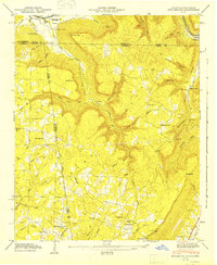
USGS Historical Quadrangle in GeoPDF.
Airborne electromagnetic (AEM), magnetic, and radiometric data were acquired in late February to early March 2018 along 2,364 line-kilometers in the Shellmound, Mississippi study area. Data were acquired by CGG Canada Services, Ltd. with three different helicopter-borne sensors: the CGG Canada Services, Ltd. RESOLVE frequency-domain AEM instrument that is used to map subsurface geologic structure at depths up to 100 meters, depending on the subsurface resistivity; a Scintrex CS-3 cesium vapor magnetometer that detects changes in deep (hundreds of meters to kilometers) geologic structure based on variations in the magnetic properties of different formations; and a Radiation Solutions RS-500 spectrometer that detects...
Categories: Data;
Tags: GGGSC,
Geology, Geophysics, and Geochemistry Science Center,
Greenwood,
Leflore County,
MRVA,
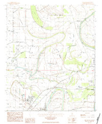
USGS Historical Quadrangle in GeoPDF.
Airborne frequency domain electromagnetic (AEM) data were acquired in a grid pattern consisting of many west-east oriented survey lines over the Tallahatchie River during November 2018. Data were collected by members of the U.S. Geological Survey, Crustal Geophysics and Geochemistry Science Center Group, and CGG. AEM data acquired in Leflore County, Mississippi, were collected to characterize the subsurface resistivity structure in support of a U.S. Geological Survey groundwater investigation of the Mississippi Alluvial Plain. Airborne EM data were acquired with the Resolve (CGG Airborne) frequency-domain instrument over the same reach 18 line-kilometers that follow the Tallahatchie River in Leflore County in Mississippi...
Surface and water-borne geophysical methods can provide information for the characterization of the subsurface structure of the earth for aquifer investigations. Floating and towed transient electromagnetic (FloaTEM and tTEM) surveys provide resistivity soundings of the subsurface, which can be related to lithology and hydrogeology. In the TEM method, a primary electrical current is cycled through a wire in a transmitter loop (Tx), which in turn produces a static primary magnetic field. When the current in the TX loop is abruptly terminated, secondary electrical currents are induced in the earth that move downward and outward decaying with time. The decay of the secondary electrical field is controlled by the subsurface...
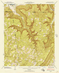
USGS Historical Quadrangle in GeoPDF.
Airborne electromagnetic (AEM), magnetic, and radiometric data were acquired in late February to early March 2018 along 2,364 line-kilometers in the Shellmound, Mississippi study area. Data were acquired by CGG Canada Services, Ltd. with three different helicopter-borne sensors: the CGG Canada Services, Ltd. RESOLVE frequency-domain AEM instrument that is used to map subsurface geologic structure at depths up to 100 meters, depending on the subsurface resistivity; a Scintrex CS-3 cesium vapor magnetometer that detects changes in deep (hundreds of meters to kilometers) geologic structure based on variations in the magnetic properties of different formations; and a Radiation Solutions RS-500 spectrometer that detects...
Categories: Data;
Tags: GGGSC,
Geology, Geophysics, and Geochemistry Science Center,
Greenwood,
Leflore County,
MRVA,
Airborne electromagnetic (AEM), magnetic, and radiometric data were acquired in late February to early March 2018 along 2,364 line-kilometers in the Shellmound, Mississippi study area. Data were acquired by CGG Canada Services, Ltd. with three different helicopter-borne sensors: the CGG Canada Services, Ltd. RESOLVE frequency-domain AEM instrument that is used to map subsurface geologic structure at depths up to 100 meters, depending on the subsurface resistivity; a Scintrex CS-3 cesium vapor magnetometer that detects changes in deep (hundreds of meters to kilometers) geologic structure based on variations in the magnetic properties of different formations; and a Radiation Solutions RS-500 spectrometer that detects...
Airborne electromagnetic (AEM), magnetic, and radiometric data were acquired November 2019 to March 2020 along 24,030 line-kilometers (line-km) over the Mississippi Alluvial Plain (MAP). Data were acquired by CGG Canada Services, Ltd. with three different airborne sensors: the CGG Canada Services, Ltd. TEMPEST time-domain AEM instrument that is used to map subsurface geologic structure at depths up to 300 meters (m), depending on the subsurface resistivity; a Scintrex CS-3 cesium vapor magnetometer that detects changes in deep (hundreds of meters to kilometers) geologic structure based on variations in the magnetic properties of different formations; and a Radiation Solutions RS-500 spectrometer that detects the...
Airborne electromagnetic (AEM), magnetic, and radiometric data were acquired September 2021 to January 2022 along 27,204 line-kilometers (line-km) over the Mississippi Alluvial Plain (MAP), Mississippi Embayment, and Gulf Coastal Plain. Data were acquired by Xcalibur Multiphysics (Canada), Ltd. with three different airborne sensors: the 30Hz TEMPEST time-domain AEM instrument that is used to map subsurface geologic structure at depths up to 300 meters (m) depending on the subsurface resistivity; a Scintrex CS-3 cesium vapor magnetometer that detects changes in deep (hundreds of meters to kilometers) geologic structure based on variations in the magnetic properties of different formations; and a Radiation Solutions...
Categories: Data;
Types: Downloadable,
Map Service,
OGC WFS Layer,
OGC WMS Layer,
Shapefile;
Tags: Arkansas,
Arkansas River,
GGGSC,
Geology, Geophysics, and Geochemistry Science Center,
Illinois,
Towed transient electromagnetic (tTEM) data were acquired at two field locations near Shellmound, Mississippi during March 2018. During the survey, approximately 34.7 line-kilometers were collected in the study area. Data were collected by members of the U.S. Geological Survey, Hydrogeophysics Branch, and the Aarhus University Hydrogeophysics Group. tTEM data acquired along the approximately 35-line kilometers in two agricultural fields near the banks of the Tallahatchie River in Leflore County, Mississippi. Data were collected to characterize the subsurface resistivity structure in support of a U.S. Geological Survey groundwater investigation of the Mississippi Alluvial Plain. tTEM data were collected using an...
Towed transient electromagnetic (tTEM) data were acquired adjacent to the Tallahatchie River during March 2018. During the survey, approximately 35 line-kilometers were collected in the Shellmound, Mississippi study area. Data were collected by members of the U.S. Geological Survey, Hydrogeophysics Branch, and the Aarhus University HydroGeophysics Group. FloaTEM data acquired near the Tallahatchie River in Leflore County, in Mississippi, were collected to characterize the subsurface resistivity structure in support of a U.S. Geological Survey groundwater investigation of the Mississippi Alluvial Plain. tTEM data were collected using an Aarhus University HydroGeophysics Group tTEM unit using a transmitter loop (Tx)...
Airborne electromagnetic (AEM), magnetic, and radiometric data were acquired in late February to early March 2018 along 2,364 line-kilometers in the Shellmound, Mississippi study area. Data were acquired by CGG Canada Services, Ltd. with three different helicopter-borne sensors: the CGG Canada Services, Ltd. RESOLVE frequency-domain AEM instrument that is used to map subsurface geologic structure at depths up to 100 meters, depending on the subsurface resistivity; a Scintrex CS-3 cesium vapor magnetometer that detects changes in deep (hundreds of meters to kilometers) geologic structure based on variations in the magnetic properties of different formations; and a Radiation Solutions RS-500 spectrometer that detects...
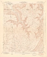
USGS Historical Quadrangle in GeoPDF.

USGS Historical Quadrangle in GeoPDF.
USGS Historical Quadrangle in GeoPDF.
|

|
