Filters: Tags: Spring Creek (X)
41 results (41ms)|
Filters
Date Range
Extensions Types
Contacts
Categories Tag Types Tag Schemes |
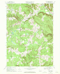
USGS Historical Quadrangle in GeoPDF.

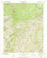
USGS Historical Quadrangle in GeoPDF.
This dataset includes the magnetotelluric (MT) sounding data collected in 2003 along a north-south profile west of Wendover, Nevada. It is important to know whether major mining districts in the Northern Nevada Gold Province are underlain by rocks of the Archean Wyoming craton, which are known to contain orogenic gold deposits, or by accreted rocks of the Paleoproterozoic Mojave province. It is also important to know the location and orientation of the Archean/Proterozoic suture zone between these provinces as well as major basement structures within these terranes because they may influence subsequent patterns of sedimentation, deformation, magmatism, and hydrothermal activity. This study was funded by the U.S....
The Apalachicola-Chattahoochee-Flint River Basin (ACFB) was modeled to produce fourteen simulations of streamflow for demonstration of enhancements to the Precipitation Runoff Modeling System (PRMS); seven simulations without water use effects and seven simulations with water use effects. The seven simulations without water use were for 1) the whole ACFB basin (1982-2012), 2) the Chestatee River sub-basin (1982-2012), 3) the Chipola River sub-basin (1982-2012), 4) the Ichawaynochaway Creek sub-basin (1982-2012), 5) the Potato Creek sub-basin (1942-2012), 6) the Spring Creek sub-basin (1952-2012), and 7) the upper Chattahoochee River sub-basin (1982-2012). The seven simulations with water use effects were for the...
Types: Citation;
Tags: Apalachicola River,
Chattahoochee River,
Chestatee River,
Chipola River,
Flint River,
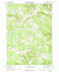
USGS Historical Quadrangle in GeoPDF.

USGS Historical Quadrangle in GeoPDF.

USGS Historical Quadrangle in GeoPDF.
USGS Historical Quadrangle in GeoPDF.
USGS Historical Quadrangle in GeoPDF.
This dataset includes the magnetotelluric (MT) sounding data collected in 2003 along a north-south profile west of Wendover, Nevada. It is important to know whether major mining districts in the Northern Nevada Gold Province are underlain by rocks of the Archean Wyoming craton, which are known to contain orogenic gold deposits, or by accreted rocks of the Paleoproterozoic Mojave province. It is also important to know the location and orientation of the Archean/Proterozoic suture zone between these provinces as well as major basement structures within these terranes because they may influence subsequent patterns of sedimentation, deformation, magmatism, and hydrothermal activity. This study was funded by the U.S....
USGS Historical Quadrangle in GeoPDF.

USGS Historical Quadrangle in GeoPDF.
This dataset includes the magnetotelluric (MT) sounding data collected in 2003 along a north-south profile west of Wendover, Nevada. It is important to know whether major mining districts in the Northern Nevada Gold Province are underlain by rocks of the Archean Wyoming craton, which are known to contain orogenic gold deposits, or by accreted rocks of the Paleoproterozoic Mojave province. It is also important to know the location and orientation of the Archean/Proterozoic suture zone between these provinces as well as major basement structures within these terranes because they may influence subsequent patterns of sedimentation, deformation, magmatism, and hydrothermal activity. This study was funded by the U.S....
This dataset includes the magnetotelluric (MT) sounding data collected in 2003 along a north-south profile west of Wendover, Nevada. It is important to know whether major mining districts in the Northern Nevada Gold Province are underlain by rocks of the Archean Wyoming craton, which are known to contain orogenic gold deposits, or by accreted rocks of the Paleoproterozoic Mojave province. It is also important to know the location and orientation of the Archean/Proterozoic suture zone between these provinces as well as major basement structures within these terranes because they may influence subsequent patterns of sedimentation, deformation, magmatism, and hydrothermal activity. This study was funded by the U.S....
The consequence of the 1996 Buffalo Creek wildfire disturbance and a subsequent high-intensity summer convective rain storm (~100 mm h-1) was the deposition of a sediment superslug in the Spring Creek basin (26.8 km2) of the Front Range Mountains in Colorado. Changes in the superslug near the confluence of Spring Creek with the South Platte River were monitored by cross-section surveys at 18 nearly equally-spaced cross sections along a 1500 m study reach for 18 years (1996-2014) to understand the evolution and internal stratigraphy of this type of disturbance in response to different geomorphic processes. These data consist of 18 Excel files (one for each cross section) containing worksheets corresponding to each...
Categories: Data;
Types: Map Service,
OGC WFS Layer,
OGC WMS Layer,
OGC WMS Service;
Tags: Colorado,
Front Range,
Geomorphology,
Jefferson County,
Spring Creek,
USGS Historical Quadrangle in GeoPDF.
USGS Historical Quadrangle in GeoPDF.
This data release is a geochemical data set from the reanalysis of 23 rock and 85 sediment samples collected between 1966 and 1970 by the U.S. Geological Survey (USGS) for a series of studies investigating the mineral resources of the Idaho Primitive Area (Cater et al., 1973). The samples are from the upper Middle Fork Salmon River and the South Fork Salmon River, including the tributaries of East Fork of the South Fork and Porphyry Creek. The overall objective of this study is to characterize the regional impact of legacy mining for the Frank Church - River of No Return Wilderness Area. In 1980 the U. S. Congress passed the Central Idaho Wilderness Act which combined the Idaho Primitive Area, the Salmon Rivers...
Categories: Data;
Types: Downloadable,
Map Service,
OGC WFS Layer,
OGC WMS Layer,
Shapefile;
Tags: Automatic Creek,
Beansnapper Creek,
Bear Creek,
Big Chief Creek,
Big Cottonwood Creek,

USGS Historical Quadrangle in GeoPDF.
The Apalachicola-Chattahoochee-Flint River Basin (ACFB) was modeled to produce fourteen simulations of streamflow with the Precipitation Runoff Modeling System (PRMS); seven simulations without water use effects and seven simulations with water use effects. The simulations were for 1) the whole ACFB basin (1982-2012), 2) the Chestatee River sub-basin (1982-2012), 3) the Chipola River sub-basin (1982-2012), 4) the Ichawaynochaway Creek sub-basin (1982-2012), 5) the Potato Creek sub-basin (1942-2012), 6) the Spring Creek sub-basin (1952-2012), and 7) the upper Chattahoochee River sub-basin (1982-2012). These data document the PRMS parameter files and input data files used in each of these simulations. Input files...
Types: Citation;
Tags: Apalachicola River,
Chattahoochee River,
Chestatee River,
Chipola River,
Flint River,
|

|
