Filters
Date Range
Extensions
Types
Contacts
Categories
Tag Types
Tag Schemes
|

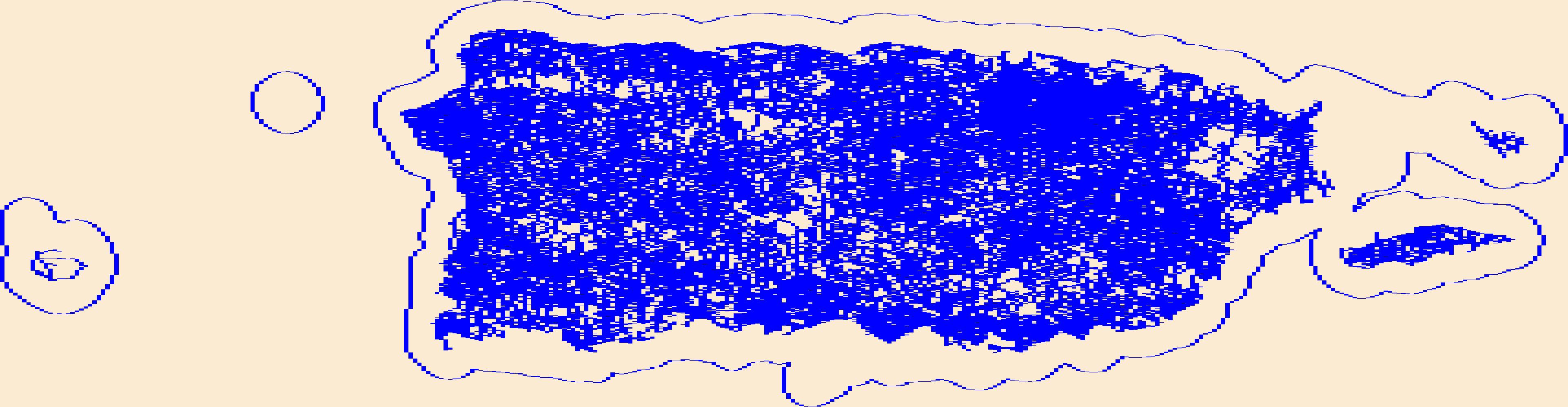
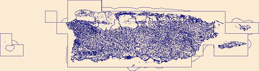
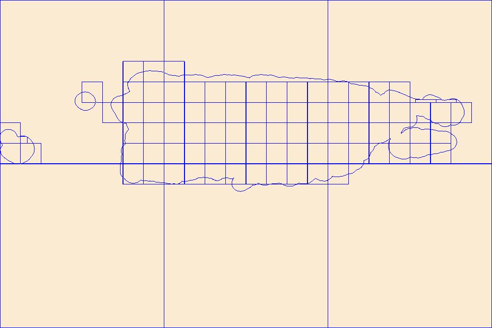
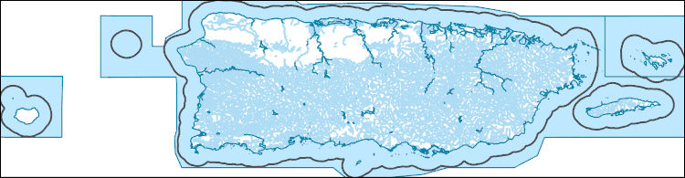
This data represents the map extent for current and historical USGS topographic maps for the United States and Territories, including 1 X 2 Degree, 1 X 1 Degree, 30 X 60 Minute, 15 X 15 Minute, 7.5 X 7.5 Minute, and 3.75 X 3.75 Minute. The grid was generated using ESRI ArcInfo GIS software.
Tags: Adjuntas,
Aguada,
Aguadilla,
Aguas Buenas,
Aibonito, All tags...
Arecibo,
Arroyo,
Añasco,
Barceloneta,
Barranquitas,
Bayamón,
Boundaries,
Cabo Rojo,
Caguas,
Camuy,
Canóvanas,
Carolina,
Cataño,
Cayey,
Ceiba,
Ciales,
Cidra,
Coamo,
Comerío,
Corozal,
Culebra,
Dorado,
Downloadable Data,
Esri File GeoDatabase 10,
Fajardo,
FileGDB,
Florida,
Guayama,
Guayanilla,
Guaynabo,
Gurabo,
Guánica,
Hatillo,
Hormigueros,
Humacao,
Isabela,
Jayuya,
Juana Díaz,
Juncos,
Lajas,
Lares,
Las Marías,
Las Piedras,
Loíza,
Luquillo,
Manatí,
Map Indices,
Map Indices,
Map Indices,
Maricao,
Maunabo,
Mayagüez,
Moca,
Morovis,
Naguabo,
Naranjito,
Orocovis,
PR,
Patillas,
Peñuelas,
Ponce,
Puerto Rico,
Quebradillas,
Rincón,
Río Grande,
Sabana Grande,
Salinas,
San Germán,
San Juan,
San Lorenzo,
San Sebastián,
Santa Isabel,
State,
State,
Toa Alta,
Toa Baja,
Trujillo Alto,
US,
United States,
United States of America,
Utuado,
Vega Alta,
Vega Baja,
Vieques,
Villalba,
Yabucoa,
Yauco,
cells,
map indices,
polygon grid, Fewer tags

This child item contains the spatial data associated with the bathymetric survey of the Levittown lake, conducted on January 11, 2011. The child item consist of two datasets: 1) contours of the lake bottom and 2) data points colleced along each established navigation line, to calculate the water volume of the lake at mean sea level. A bathymetric/land survey system (BLASS) interfaced to a depth sounder was used to conduct the survey. The system consists of a Global Positioning System (GPS) and a digital depth sounder. Geographic location and water depth data were simultaneously collected and stored in a portable computer. The data were then transferred into the USGS geographic information system (GIS) for processing...
Categories: Data;
Types: Downloadable,
Map Service,
OGC WFS Layer,
OGC WMS Layer,
Shapefile;
Tags: Levittown,
Levittown Lake,
Puerto Rico,
Toa Baja,
bathymetry, All tags...
coastal waters,
storage volume, Fewer tags

This data release contains data for the hydrologic and water-quality characterization of Levittown Lake, from April 2010 to June 2021. Three child items were included in the data release to summarize the results of the (1) community productivity through the light and dark bottle method (2) two diel data collection efforts, and (3) spatial data associated with the bathymetric survey conducted at Levittown Lake to contour the lake bottom. Diel studies were conducted at the lake to estimate the community net primary productivity, the respiration rate, and the gross productivity rate. Two diel studies were conducted on November 18, 2010, and May 18, 2011, near the respective annual periods of highest and lowest tides...
Tags: Lago de Levittown,
Levittown,
Levittown Lake,
Puerto Rico,
Toa Baja, All tags...
USGS Science Data Catalog (SDC),
Water Quality,
Water Resources,
biological production,
biota,
coastal ecosystems,
diel study,
ecology,
productivity (ecosystems),
storage volume,
topographic maps,
water-quality, Fewer tags

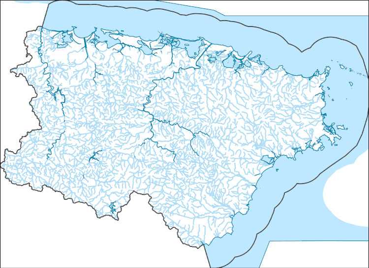
The National Hydrography Dataset (NHD) is a feature-based database that interconnects and uniquely identifies the stream segments or reaches that make up the nation's surface water drainage system. NHD data was originally developed at 1:100,000-scale and exists at that scale for the whole country. This high-resolution NHD, generally developed at 1:24,000/1:12,000 scale, adds detail to the original 1:100,000-scale NHD. (Data for Alaska, Puerto Rico and the Virgin Islands was developed at high-resolution, not 1:100,000 scale.) Local resolution NHD is being developed where partners and data exist. The NHD contains reach codes for networked features, flow direction, names, and centerline representations for areal water...
Tags: Adjuntas,
Administrative watershed units,
Administrative watershed units,
Aguada,
Aguadilla, All tags...
Aguas Buenas,
Aibonito,
Area of Complex Channels,
Area to be submerged,
Arecibo,
Arroyo,
Añasco,
Barceloneta,
Barranquitas,
Basin,
Basin,
Bay/Inlet,
Bayamón,
Boundaries,
Boundary,
Bridge,
Cabo Rojo,
Caguas,
Camuy,
Canal/Ditch,
Canóvanas,
Carolina,
Cataño,
Cayey,
Ceiba,
Ciales,
Cidra,
Coamo,
Coastline,
Comerío,
Connector,
Corozal,
Culebra,
Dam/Weir,
Dorado,
Downloadable Data,
Drainage areas for surface water,
Drainageway,
Esri Shapefile nan,
Estuary,
Fajardo,
Florida,
Flow direction network,
Flume,
ForeShore,
Gaging Station,
Gate,
Guayama,
Guayanilla,
Guaynabo,
Gurabo,
Guánica,
HU-4,
HU-4 Subregion,
HU10,
HU12,
HU14,
HU16,
HU2,
HU4,
HU4_2101,
HU6,
HU8,
HUC,
Hatillo,
Hazard Zone,
Hormigueros,
Humacao,
Hydrographic,
Hydrography,
Hydrography,
Hydrography,
Hydrologic Unit Code,
Hydrologic Units,
Ice mass,
Inundation Area,
Isabela,
Jayuya,
Juana Díaz,
Juncos,
Lajas,
Lares,
Las Marías,
Las Piedras,
Levee,
Line,
Lock Chamber,
Loíza,
Luquillo,
Manatí,
Maricao,
Marsh,
Maunabo,
Mayagüez,
Moca,
Morovis,
Naguabo,
Naranjito,
National Hydrography Dataset (NHD),
National Hydrography Dataset (NHD) Best Resolution,
National Hydrography Dataset (NHD) Best Resolution,
Nonearthen Shore,
Orocovis,
Orthoimage,
PR,
Patillas,
Peñuelas,
Playa,
Point,
PointEvent,
Ponce,
Pond,
Puerto Rico,
Quebradillas,
Rapids,
Rapids,
Reach,
Reach code,
Reef,
Region,
Reservoir,
Rincón,
Rock,
Río Grande,
Sabana Grande,
Salinas,
San Germán,
San Juan,
San Lorenzo,
San Sebastián,
Santa Isabel,
Sea/Ocean,
Shapefile,
Sink/Rise,
Sounding Datum Line,
Special Use Zone,
Special Use Zone Limit,
Spillway,
Stream,
Stream/River,
Sub-basin,
Sub-region,
Subbasin,
Submerged Stream,
Subregion,
Subwatershed,
Surface water systems,
Swamp,
Toa Alta,
Toa Baja,
Topographic,
Trujillo Alto,
Tunnel,
US,
Underground Conduit,
United States,
Utuado,
Vega Alta,
Vega Baja,
Vieques,
Villalba,
WBD,
WBD,
Wall,
Wash,
Water Intake Outflow,
Waterfall,
Watershed,
Watershed Boundaries,
Watershed Boundary Dataset,
Watershed Boundary Dataset,
Well,
Yabucoa,
Yauco,
artificial path,
boundaries,
dams,
drainage systems and characteristics,
inlandWaters,
lakes,
ngda,
rivers, Fewer tags

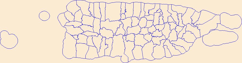
Geospatial data is comprised of government boundaries.
Tags: Adjuntas,
Aguada,
Aguadilla,
Aguas Buenas,
Aibonito, All tags...
Arecibo,
Arroyo,
Añasco,
Barceloneta,
Barranquitas,
Bayamón,
Boundaries,
Cabo Rojo,
Caguas,
Camuy,
Canóvanas,
Carolina,
Cataño,
Cayey,
Ceiba,
Ciales,
Cidra,
Coamo,
Comerío,
Corozal,
County or Equivalent,
Culebra,
Dorado,
Downloadable Data,
Fajardo,
Florida,
GeoPackage,
Guayama,
Guayanilla,
Guaynabo,
Gurabo,
Guánica,
Hatillo,
Hormigueros,
Humacao,
Incorporated Place,
Isabela,
Jayuya,
Juana Díaz,
Juncos,
Jurisdictional,
Lajas,
Lares,
Las Marías,
Las Piedras,
Loíza,
Luquillo,
Manatí,
Maricao,
Maunabo,
Mayagüez,
Minor Civil Division,
Moca,
Morovis,
Naguabo,
Naranjito,
National Boundary Dataset (NBD),
National Boundary Dataset (NBD),
Native American Area,
Open Geospatial Consortium GeoPackage 1.2,
Orocovis,
PLSS First Division,
PLSS Special Survey,
PLSS Township,
PR,
Patillas,
Peñuelas,
Ponce,
Public Land Survey System,
Puerto Rico,
Quebradillas,
Reserve,
Rincón,
Río Grande,
Sabana Grande,
Salinas,
San Germán,
San Juan,
San Lorenzo,
San Sebastián,
Santa Isabel,
State,
State,
State or Territory,
Toa Alta,
Toa Baja,
Trujillo Alto,
U.S. National Grid,
US,
Unincorporated Place,
United States,
Utuado,
Vega Alta,
Vega Baja,
Vieques,
Villalba,
Yabucoa,
Yauco,
boundaries,
boundary,
cadastral surveys,
geographic names,
land ownership,
land use maps,
legal land descriptions,
political and administrative boundaries,
zoning maps, Fewer tags
Layers of geospatial data include roads, airports, trails, and railroads.
Tags: Adjuntas,
Aguada,
Aguadilla,
Aguas Buenas,
Aibonito, All tags...
Airport Complex,
Airport Point,
Airport Runway,
Airports,
Airstrips,
Arecibo,
Arroyo,
Añasco,
Barceloneta,
Barranquitas,
Bayamón,
Cabo Rojo,
Caguas,
Camuy,
Canóvanas,
Carolina,
Cataño,
Cayey,
Ceiba,
Ciales,
Cidra,
Coamo,
Comerío,
Corozal,
Culebra,
Dorado,
Downloadable Data,
Fajardo,
Florida,
GeoPackage,
Geographic names,
Guayama,
Guayanilla,
Guaynabo,
Gurabo,
Guánica,
Hatillo,
Hormigueros,
Humacao,
Isabela,
Jayuya,
Juana Díaz,
Juncos,
Lajas,
Lares,
Las Marías,
Las Piedras,
Loíza,
Luquillo,
Manatí,
Maricao,
Maunabo,
Mayagüez,
Moca,
Morovis,
Naguabo,
Naranjito,
National Transportation Dataset (NTD),
National Transportation Dataset (NTD),
Open Geospatial Consortium GeoPackage 1.2,
Orocovis,
PR,
Patillas,
Peñuelas,
Ponce,
Puerto Rico,
Quebradillas,
Railways,
Rincón,
Roads,
Río Grande,
Sabana Grande,
Salinas,
San Germán,
San Juan,
San Lorenzo,
San Sebastián,
Santa Isabel,
State,
State,
Toa Alta,
Toa Baja,
Trail,
Trails,
Transportation,
Transportation,
Trujillo Alto,
US,
United States,
Utuado,
Vega Alta,
Vega Baja,
Vieques,
Villalba,
Waterway,
Yabucoa,
Yauco,
transportation, Fewer tags
Geospatial data includes structures and other selected map features.
Tags: Adjuntas,
Aguada,
Aguadilla,
Aguas Buenas,
Aibonito, All tags...
Arecibo,
Arroyo,
Añasco,
Barceloneta,
Barranquitas,
Bayamón,
Cabo Rojo,
Caguas,
Campground,
Camuy,
Canóvanas,
Carolina,
Cataño,
Cayey,
Ceiba,
Ciales,
Cidra,
Coamo,
College / University,
Comerío,
Corozal,
Courthouse,
Culebra,
Dorado,
Downloadable Data,
Esri File GeoDatabase 10,
Fajardo,
FileGDB,
Fire Station/ EMS Station,
Florida,
Guayama,
Guayanilla,
Guaynabo,
Gurabo,
Guánica,
Hatillo,
Hormigueros,
Hospital/Medical Center,
Humacao,
Information Center,
Isabela,
Jayuya,
Juana Díaz,
Juncos,
Lajas,
Lares,
Las Marías,
Las Piedras,
Law Enforcement,
Loíza,
Luquillo,
Manatí,
Maricao,
Maunabo,
Mayagüez,
Moca,
Morovis,
Naguabo,
Naranjito,
National Structures Dataset (NSD),
National Structures Dataset (NSD),
Orocovis,
PR,
Patillas,
Peñuelas,
Ponce,
Post Office,
Prison/ Correctional Facility,
Puerto Rico,
Quebradillas,
Rincón,
Río Grande,
Sabana Grande,
Salinas,
San Germán,
San Juan,
San Lorenzo,
San Sebastián,
Santa Isabel,
School,
School:Elementary,
School:High School,
School:Middle School,
State,
State,
State Capitol,
Structures,
Technical School,
Toa Alta,
Toa Baja,
Town Hall,
Trade School,
Trailhead,
Trujillo Alto,
US,
United States,
Utuado,
Vega Alta,
Vega Baja,
Vieques,
Villalba,
Visitor Center,
Yabucoa,
Yauco,
structure, Fewer tags
The National Hydrography Dataset (NHD) is a feature-based database that interconnects and uniquely identifies the stream segments or reaches that make up the nation's surface water drainage system. NHD data was originally developed at 1:100,000-scale and exists at that scale for the whole country. This high-resolution NHD, generally developed at 1:24,000/1:12,000 scale, adds detail to the original 1:100,000-scale NHD. (Data for Alaska, Puerto Rico and the Virgin Islands was developed at high-resolution, not 1:100,000 scale.) Local resolution NHD is being developed where partners and data exist. The NHD contains reach codes for networked features, flow direction, names, and centerline representations for areal water...
Tags: Administrative watershed units,
Administrative watershed units,
Aguas Buenas,
Aibonito,
Area of Complex Channels, All tags...
Area to be submerged,
Barranquitas,
Basin,
Basin,
Bay/Inlet,
Bayamón,
Boundaries,
Boundary,
Bridge,
Caguas,
Canal/Ditch,
Canóvanas,
Carolina,
Cataño,
Cayey,
Ceiba,
Cidra,
Coamo,
Coastline,
Comerío,
Connector,
Corozal,
Dam/Weir,
Dorado,
Downloadable Data,
Drainage areas for surface water,
Drainageway,
Estuary,
Fajardo,
Flow direction network,
Flume,
ForeShore,
Gaging Station,
Gate,
GeoPackage,
Guayama,
Guaynabo,
Gurabo,
HU-8,
HU-8 Subbasin,
HU10,
HU12,
HU14,
HU16,
HU2,
HU4,
HU6,
HU8,
HU8_21010005,
HUC,
Hazard Zone,
Humacao,
Hydrographic,
Hydrography,
Hydrography,
Hydrography,
Hydrologic Unit Code,
Hydrologic Units,
Ice mass,
Inundation Area,
Juncos,
Las Piedras,
Levee,
Line,
Lock Chamber,
Loíza,
Luquillo,
Marsh,
Maunabo,
Naguabo,
Naranjito,
National Hydrography Dataset (NHD),
National Hydrography Dataset (NHD) Best Resolution,
National Hydrography Dataset (NHD) Best Resolution,
Nonearthen Shore,
Open Geospatial Consortium GeoPackage 1.2,
Orthoimage,
PR,
Patillas,
Playa,
Point,
PointEvent,
Pond,
Puerto Rico,
Rapids,
Rapids,
Reach,
Reach code,
Reef,
Region,
Reservoir,
Rock,
Río Grande,
San Juan,
San Lorenzo,
Sea/Ocean,
Sink/Rise,
Sounding Datum Line,
Special Use Zone,
Special Use Zone Limit,
Spillway,
Stream,
Stream/River,
Sub-basin,
Sub-region,
Subbasin,
Submerged Stream,
Subregion,
Subwatershed,
Surface water systems,
Swamp,
Toa Alta,
Toa Baja,
Topographic,
Trujillo Alto,
Tunnel,
US,
Underground Conduit,
United States,
Vega Alta,
WBD,
WBD,
Wall,
Wash,
Water Intake Outflow,
Waterfall,
Watershed,
Watershed Boundaries,
Watershed Boundary Dataset,
Watershed Boundary Dataset,
Well,
Yabucoa,
artificial path,
boundaries,
dams,
drainage systems and characteristics,
inlandWaters,
lakes,
ngda,
rivers, Fewer tags
The National Hydrography Dataset (NHD) is a feature-based database that interconnects and uniquely identifies the stream segments or reaches that make up the nation's surface water drainage system. NHD data was originally developed at 1:100,000-scale and exists at that scale for the whole country. This high-resolution NHD, generally developed at 1:24,000/1:12,000 scale, adds detail to the original 1:100,000-scale NHD. (Data for Alaska, Puerto Rico and the Virgin Islands was developed at high-resolution, not 1:100,000 scale.) Local resolution NHD is being developed where partners and data exist. The NHD contains reach codes for networked features, flow direction, names, and centerline representations for areal water...
Tags: Adjuntas,
Administrative watershed units,
Administrative watershed units,
Aguada,
Aguadilla, All tags...
Aguas Buenas,
Aibonito,
Area of Complex Channels,
Area to be submerged,
Arecibo,
Arroyo,
Añasco,
Barceloneta,
Barranquitas,
Basin,
Basin,
Bay/Inlet,
Bayamón,
Boundaries,
Boundary,
Bridge,
Cabo Rojo,
Caguas,
Camuy,
Canal/Ditch,
Canóvanas,
Carolina,
Cataño,
Cayey,
Ceiba,
Ciales,
Cidra,
Coamo,
Coastline,
Comerío,
Connector,
Corozal,
Culebra,
Dam/Weir,
Dorado,
Downloadable Data,
Drainage areas for surface water,
Drainageway,
Esri Shapefile nan,
Estuary,
Fajardo,
Florida,
Flow direction network,
Flume,
ForeShore,
Gaging Station,
Gate,
Guayama,
Guayanilla,
Guaynabo,
Gurabo,
Guánica,
HU10,
HU12,
HU14,
HU16,
HU2,
HU4,
HU6,
HU8,
HUC,
Hatillo,
Hazard Zone,
Hormigueros,
Humacao,
Hydrographic,
Hydrography,
Hydrography,
Hydrography,
Hydrologic Unit Code,
Hydrologic Units,
Ice mass,
Inundation Area,
Isabela,
Jayuya,
Juana Díaz,
Juncos,
Lajas,
Lares,
Las Marías,
Las Piedras,
Levee,
Line,
Lock Chamber,
Loíza,
Luquillo,
Manatí,
Maricao,
Marsh,
Maunabo,
Mayagüez,
Moca,
Morovis,
Naguabo,
Naranjito,
National Hydrography Dataset (NHD),
National Hydrography Dataset (NHD) Best Resolution,
National Hydrography Dataset (NHD) Best Resolution,
Nonearthen Shore,
Orocovis,
Orthoimage,
PR,
Patillas,
Peñuelas,
Playa,
Point,
PointEvent,
Ponce,
Pond,
Puerto Rico,
Quebradillas,
Rapids,
Rapids,
Reach,
Reach code,
Reef,
Region,
Reservoir,
Rincón,
Rock,
Río Grande,
Sabana Grande,
Salinas,
San Germán,
San Juan,
San Lorenzo,
San Sebastián,
Santa Isabel,
Sea/Ocean,
Shapefile,
Sink/Rise,
Sounding Datum Line,
Special Use Zone,
Special Use Zone Limit,
Spillway,
State,
State,
State_Puerto Rico,
Stream,
Stream/River,
Sub-basin,
Sub-region,
Subbasin,
Submerged Stream,
Subregion,
Subwatershed,
Surface water systems,
Swamp,
Toa Alta,
Toa Baja,
Topographic,
Trujillo Alto,
Tunnel,
US,
Underground Conduit,
United States,
Utuado,
Vega Alta,
Vega Baja,
Vieques,
Villalba,
WBD,
WBD,
Wall,
Wash,
Water Intake Outflow,
Waterfall,
Watershed,
Watershed Boundaries,
Watershed Boundary Dataset,
Watershed Boundary Dataset,
Well,
Yabucoa,
Yauco,
artificial path,
boundaries,
dams,
drainage systems and characteristics,
inlandWaters,
lakes,
ngda,
rivers, Fewer tags

The National Hydrography Dataset (NHD) is a feature-based database that interconnects and uniquely identifies the stream segments or reaches that make up the nation's surface water drainage system. NHD data was originally developed at 1:100,000-scale and exists at that scale for the whole country. This high-resolution NHD, generally developed at 1:24,000/1:12,000 scale, adds detail to the original 1:100,000-scale NHD. (Data for Alaska, Puerto Rico and the Virgin Islands was developed at high-resolution, not 1:100,000 scale.) Local resolution NHD is being developed where partners and data exist. The NHD contains reach codes for networked features, flow direction, names, and centerline representations for areal water...
Tags: Adjuntas,
Administrative watershed units,
Administrative watershed units,
Aguada,
Aguadilla, All tags...
Aguas Buenas,
Aibonito,
Area of Complex Channels,
Area to be submerged,
Arecibo,
Arroyo,
Añasco,
Barceloneta,
Barranquitas,
Basin,
Basin,
Bay/Inlet,
Bayamón,
Boundaries,
Boundary,
Bridge,
Cabo Rojo,
Caguas,
Camuy,
Canal/Ditch,
Canóvanas,
Carolina,
Cataño,
Cayey,
Ceiba,
Ciales,
Cidra,
Coamo,
Coastline,
Comerío,
Connector,
Corozal,
Culebra,
Dam/Weir,
Dorado,
Downloadable Data,
Drainage areas for surface water,
Drainageway,
Estuary,
Fajardo,
Florida,
Flow direction network,
Flume,
ForeShore,
Gaging Station,
Gate,
GeoPackage,
Guayama,
Guayanilla,
Guaynabo,
Gurabo,
Guánica,
HU10,
HU12,
HU14,
HU16,
HU2,
HU4,
HU6,
HU8,
HUC,
Hatillo,
Hazard Zone,
Hormigueros,
Humacao,
Hydrographic,
Hydrography,
Hydrography,
Hydrography,
Hydrologic Unit Code,
Hydrologic Units,
Ice mass,
Inundation Area,
Isabela,
Jayuya,
Juana Díaz,
Juncos,
Lajas,
Lares,
Las Marías,
Las Piedras,
Levee,
Line,
Lock Chamber,
Loíza,
Luquillo,
Manatí,
Maricao,
Marsh,
Maunabo,
Mayagüez,
Moca,
Morovis,
Naguabo,
Naranjito,
National Hydrography Dataset (NHD),
National Hydrography Dataset (NHD) Best Resolution,
National Hydrography Dataset (NHD) Best Resolution,
Nonearthen Shore,
Open Geospatial Consortium GeoPackage 1.2,
Orocovis,
Orthoimage,
PR,
Patillas,
Peñuelas,
Playa,
Point,
PointEvent,
Ponce,
Pond,
Puerto Rico,
Quebradillas,
Rapids,
Rapids,
Reach,
Reach code,
Reef,
Region,
Reservoir,
Rincón,
Rock,
Río Grande,
Sabana Grande,
Salinas,
San Germán,
San Juan,
San Lorenzo,
San Sebastián,
Santa Isabel,
Sea/Ocean,
Sink/Rise,
Sounding Datum Line,
Special Use Zone,
Special Use Zone Limit,
Spillway,
State,
State,
State_Puerto Rico,
Stream,
Stream/River,
Sub-basin,
Sub-region,
Subbasin,
Submerged Stream,
Subregion,
Subwatershed,
Surface water systems,
Swamp,
Toa Alta,
Toa Baja,
Topographic,
Trujillo Alto,
Tunnel,
US,
Underground Conduit,
United States,
Utuado,
Vega Alta,
Vega Baja,
Vieques,
Villalba,
WBD,
WBD,
Wall,
Wash,
Water Intake Outflow,
Waterfall,
Watershed,
Watershed Boundaries,
Watershed Boundary Dataset,
Watershed Boundary Dataset,
Well,
Yabucoa,
Yauco,
artificial path,
boundaries,
dams,
drainage systems and characteristics,
inlandWaters,
lakes,
ngda,
rivers, Fewer tags
The Geographic Names Information System (GNIS) is the Federal standard for geographic nomenclature. The U.S. Geological Survey developed the GNIS for the U.S. Board on Geographic Names, a Federal inter-agency body chartered by public law to maintain uniform feature name usage throughout the Government and to promulgate standard names to the public. The GNIS is the official repository of domestic geographic names data; the official vehicle for geographic names use by all departments of the Federal Government; and the source for applying geographic names to Federal electronic and printed products of all types.
Tags: Adjuntas,
Aguada,
Aguadilla,
Aguas Buenas,
Aibonito, All tags...
Antarctica,
Antarctica,
Arecibo,
Arroyo,
Añasco,
BGN,
Barceloneta,
Barranquitas,
Bayamón,
Board on Geographic Names,
Borough,
Cabo Rojo,
Caguas,
Camuy,
Canóvanas,
Carolina,
Cataño,
Cayey,
Ceiba,
Census Area,
Ciales,
Cidra,
Coamo,
Comerío,
Commonwealth,
Corozal,
County,
Culebra,
District,
Dorado,
Downloadable Data,
Fajardo,
Feature class,
Feature coordinates,
Feature county,
Feature description,
Feature designation,
Feature history,
Feature indentification,
Feature name,
Feature state,
Florida,
GNIS,
GeoPackage,
Geographic Names,
Geographic Names Full Model,
Geographic Names Information System,
Geographic feature,
Geographic name,
Geographical feature,
Geographical name,
Guayama,
Guayanilla,
Guaynabo,
Gurabo,
Guánica,
Hatillo,
Hormigueros,
Humacao,
Isabela,
Jayuya,
Juana Díaz,
Juncos,
Lajas,
Lares,
Las Marías,
Las Piedras,
Loíza,
Luquillo,
Manatí,
Maricao,
Maunabo,
Mayagüez,
Moca,
Morovis,
Municipio,
Naguabo,
Naranjito,
National Geographic Names Information System (GNIS),
National Geographic Names Information System (GNIS),
Official feature name,
Open Geospatial Consortium GeoPackage 1.2,
Orocovis,
Outlying Area,
PR,
Parish,
Patillas,
Peñuelas,
Place name,
Ponce,
Populated Place,
Puerto Rico,
Quebradillas,
Rincón,
Río Grande,
Sabana Grande,
Salinas,
San Germán,
San Juan,
San Lorenzo,
San Sebastián,
Santa Isabel,
State,
Territories,
Territory,
Toa Alta,
Toa Baja,
Topographic Map,
Trujillo Alto,
U.S. Board on Geographic Names,
U.S. Geological Survey,
US,
USA,
USBGN,
USGS,
United States,
United States,
United States,
Utuado,
Variant name,
Vega Alta,
Vega Baja,
Vieques,
Villalba,
Yabucoa,
Yauco,
antarctic,
database,
economy,
environment,
feature,
gazetteer,
geographic,
geographic names,
geographical,
geography,
geospatial,
imageryBaseMapsEarthCover,
inlandWaters,
location,
map,
name,
place,
placename,
society,
structure,
topographic map,
toponymy, Fewer tags

Layers of geospatial data include roads, airports, trails, and railroads.
Tags: Adjuntas,
Aguada,
Aguadilla,
Aguas Buenas,
Aibonito, All tags...
Airport Complex,
Airport Point,
Airport Runway,
Airports,
Airstrips,
Arecibo,
Arroyo,
Añasco,
Barceloneta,
Barranquitas,
Bayamón,
Cabo Rojo,
Caguas,
Camuy,
Canóvanas,
Carolina,
Cataño,
Cayey,
Ceiba,
Ciales,
Cidra,
Coamo,
Comerío,
Corozal,
Culebra,
Dorado,
Downloadable Data,
Esri File GeoDatabase 10,
Fajardo,
FileGDB,
Florida,
Geographic names,
Guayama,
Guayanilla,
Guaynabo,
Gurabo,
Guánica,
Hatillo,
Hormigueros,
Humacao,
Isabela,
Jayuya,
Juana Díaz,
Juncos,
Lajas,
Lares,
Las Marías,
Las Piedras,
Loíza,
Luquillo,
Manatí,
Maricao,
Maunabo,
Mayagüez,
Moca,
Morovis,
Naguabo,
Naranjito,
National Transportation Dataset (NTD),
National Transportation Dataset (NTD),
Orocovis,
PR,
Patillas,
Peñuelas,
Ponce,
Puerto Rico,
Quebradillas,
Railways,
Rincón,
Roads,
Río Grande,
Sabana Grande,
Salinas,
San Germán,
San Juan,
San Lorenzo,
San Sebastián,
Santa Isabel,
State,
State,
Toa Alta,
Toa Baja,
Trail,
Trails,
Transportation,
Transportation,
Trujillo Alto,
US,
United States,
Utuado,
Vega Alta,
Vega Baja,
Vieques,
Villalba,
Waterway,
Yabucoa,
Yauco,
transportation, Fewer tags
Layered GeoPDF Quadrangle Map. Layers of geospatial data include orthoimagery, roads, grids, geographic names, elevation contours, hydrography, and other selected map features.
Tags: 7.5 x 7.5 minute,
Bayamón,
Bayamón, PR,
Cataño,
Dorado, All tags...
Downloadable Data,
EarthCover,
GeoPDF,
Guaynabo,
Imagery and Base Maps,
Map,
Public Land Survey System,
Puerto Rico,
San Juan,
Toa Alta,
Toa Baja,
U.S. National Grid,
US,
US Topo,
US Topo Historical,
United States,
boundary,
contour,
geographic names,
hydrography,
imageryBaseMapsEarthCover,
orthoimage,
structures,
topographic,
transportation,
woodland, Fewer tags

This dataset contains tabulated-data of dissolved oxygen concentrations collected at Levittown Lake, Toa Baja, Puerto Rico. The standard light-dark method was used to determine the primary productivity in phytoplankton. The method consists in the in-situ incubation of two light-and-dark bottles for approximately four hours. Dissolved oxygen concentrations were estimated using the Winkler method. A total of twelve in-situ incubations were conducted on a monthly basis from April 2010 to June 2011. For each bottle incubated, two or three titrations were conducted and an average of the dissolved concentrations is calculated.
Categories: Data;
Tags: Levittown,
Puerto Rico,
Salt Pond,
Toa Baja,
aquatic ecosystems, All tags...
biological production,
ecology,
phytoplankton,
planktonic ecosystems,
pond,
productivity (ecosystems),
water-quality data, Fewer tags

Layers of geospatial data include roads, airports, trails, and railroads.
Tags: Adjuntas,
Aguada,
Aguadilla,
Aguas Buenas,
Aibonito, All tags...
Airport Complex,
Airport Point,
Airport Runway,
Airports,
Airstrips,
Arecibo,
Arroyo,
Añasco,
Barceloneta,
Barranquitas,
Bayamón,
Cabo Rojo,
Caguas,
Camuy,
Canóvanas,
Carolina,
Cataño,
Cayey,
Ceiba,
Ciales,
Cidra,
Coamo,
Comerío,
Corozal,
Culebra,
Dorado,
Downloadable Data,
Esri Shapefile nan,
Fajardo,
Florida,
Geographic names,
Guayama,
Guayanilla,
Guaynabo,
Gurabo,
Guánica,
Hatillo,
Hormigueros,
Humacao,
Isabela,
Jayuya,
Juana Díaz,
Juncos,
Lajas,
Lares,
Las Marías,
Las Piedras,
Loíza,
Luquillo,
Manatí,
Maricao,
Maunabo,
Mayagüez,
Moca,
Morovis,
Naguabo,
Naranjito,
National Transportation Dataset (NTD),
National Transportation Dataset (NTD),
Orocovis,
PR,
Patillas,
Peñuelas,
Ponce,
Puerto Rico,
Quebradillas,
Railways,
Rincón,
Roads,
Río Grande,
Sabana Grande,
Salinas,
San Germán,
San Juan,
San Lorenzo,
San Sebastián,
Santa Isabel,
Shapefile,
State,
State,
Toa Alta,
Toa Baja,
Trail,
Trails,
Transportation,
Transportation,
Trujillo Alto,
US,
United States,
Utuado,
Vega Alta,
Vega Baja,
Vieques,
Villalba,
Waterway,
Yabucoa,
Yauco,
transportation, Fewer tags
This data represents the map extent for current and historical USGS topographic maps for the United States and Territories, including 1 X 2 Degree, 1 X 1 Degree, 30 X 60 Minute, 15 X 15 Minute, 7.5 X 7.5 Minute, and 3.75 X 3.75 Minute. The grid was generated using ESRI ArcInfo GIS software.
Tags: Adjuntas,
Aguada,
Aguadilla,
Aguas Buenas,
Aibonito, All tags...
Arecibo,
Arroyo,
Añasco,
Barceloneta,
Barranquitas,
Bayamón,
Boundaries,
Cabo Rojo,
Caguas,
Camuy,
Canóvanas,
Carolina,
Cataño,
Cayey,
Ceiba,
Ciales,
Cidra,
Coamo,
Comerío,
Corozal,
Culebra,
Dorado,
Downloadable Data,
Esri Shapefile nan,
Fajardo,
Florida,
Guayama,
Guayanilla,
Guaynabo,
Gurabo,
Guánica,
Hatillo,
Hormigueros,
Humacao,
Isabela,
Jayuya,
Juana Díaz,
Juncos,
Lajas,
Lares,
Las Marías,
Las Piedras,
Loíza,
Luquillo,
Manatí,
Map Indices,
Map Indices,
Map Indices,
Maricao,
Maunabo,
Mayagüez,
Moca,
Morovis,
Naguabo,
Naranjito,
Orocovis,
PR,
Patillas,
Peñuelas,
Ponce,
Puerto Rico,
Quebradillas,
Rincón,
Río Grande,
Sabana Grande,
Salinas,
San Germán,
San Juan,
San Lorenzo,
San Sebastián,
Santa Isabel,
Shapefile,
State,
State,
Toa Alta,
Toa Baja,
Trujillo Alto,
US,
United States,
United States of America,
Utuado,
Vega Alta,
Vega Baja,
Vieques,
Villalba,
Yabucoa,
Yauco,
cells,
map indices,
polygon grid, Fewer tags
Geospatial data is comprised of government boundaries.
Types: Citation;
Tags: Adjuntas,
Aguada,
Aguadilla,
Aguas Buenas,
Aibonito, All tags...
Arecibo,
Arroyo,
Añasco,
Barceloneta,
Barranquitas,
Bayamón,
Boundaries,
Cabo Rojo,
Caguas,
Camuy,
Canóvanas,
Carolina,
Cataño,
Cayey,
Ceiba,
Ciales,
Cidra,
Coamo,
Comerío,
Corozal,
County or Equivalent,
Culebra,
Dorado,
Downloadable Data,
Esri File GeoDatabase 10,
Fajardo,
FileGDB,
Florida,
Guayama,
Guayanilla,
Guaynabo,
Gurabo,
Guánica,
Hatillo,
Hormigueros,
Humacao,
Incorporated Place,
Isabela,
Jayuya,
Juana Díaz,
Juncos,
Jurisdictional,
Lajas,
Lares,
Las Marías,
Las Piedras,
Loíza,
Luquillo,
Manatí,
Maricao,
Maunabo,
Mayagüez,
Minor Civil Division,
Moca,
Morovis,
Naguabo,
Naranjito,
National Boundary Dataset (NBD),
National Boundary Dataset (NBD),
Native American Area,
Orocovis,
PLSS First Division,
PLSS Special Survey,
PLSS Township,
PR,
Patillas,
Peñuelas,
Ponce,
Public Land Survey System,
Puerto Rico,
Quebradillas,
Reserve,
Rincón,
Río Grande,
Sabana Grande,
Salinas,
San Germán,
San Juan,
San Lorenzo,
San Sebastián,
Santa Isabel,
State,
State,
State or Territory,
Toa Alta,
Toa Baja,
Trujillo Alto,
U.S. National Grid,
US,
Unincorporated Place,
United States,
Utuado,
Vega Alta,
Vega Baja,
Vieques,
Villalba,
Yabucoa,
Yauco,
boundaries,
boundary,
cadastral surveys,
geographic names,
land ownership,
land use maps,
legal land descriptions,
political and administrative boundaries,
zoning maps, Fewer tags
The National Hydrography Dataset (NHD) is a feature-based database that interconnects and uniquely identifies the stream segments or reaches that make up the nation's surface water drainage system. NHD data was originally developed at 1:100,000-scale and exists at that scale for the whole country. This high-resolution NHD, generally developed at 1:24,000/1:12,000 scale, adds detail to the original 1:100,000-scale NHD. (Data for Alaska, Puerto Rico and the Virgin Islands was developed at high-resolution, not 1:100,000 scale.) Local resolution NHD is being developed where partners and data exist. The NHD contains reach codes for networked features, flow direction, names, and centerline representations for areal water...
Tags: Adjuntas,
Administrative watershed units,
Administrative watershed units,
Aguada,
Aguadilla, All tags...
Aguas Buenas,
Aibonito,
Area of Complex Channels,
Area to be submerged,
Arecibo,
Arroyo,
Añasco,
Barceloneta,
Barranquitas,
Basin,
Basin,
Bay/Inlet,
Bayamón,
Boundaries,
Boundary,
Bridge,
Cabo Rojo,
Caguas,
Camuy,
Canal/Ditch,
Canóvanas,
Carolina,
Cataño,
Cayey,
Ceiba,
Ciales,
Cidra,
Coamo,
Coastline,
Comerío,
Connector,
Corozal,
Culebra,
Dam/Weir,
Dorado,
Downloadable Data,
Drainage areas for surface water,
Drainageway,
Estuary,
Fajardo,
Florida,
Flow direction network,
Flume,
ForeShore,
Gaging Station,
Gate,
GeoPackage,
Guayama,
Guayanilla,
Guaynabo,
Gurabo,
Guánica,
HU-4,
HU-4 Subregion,
HU10,
HU12,
HU14,
HU16,
HU2,
HU4,
HU4_2101,
HU6,
HU8,
HUC,
Hatillo,
Hazard Zone,
Hormigueros,
Humacao,
Hydrographic,
Hydrography,
Hydrography,
Hydrography,
Hydrologic Unit Code,
Hydrologic Units,
Ice mass,
Inundation Area,
Isabela,
Jayuya,
Juana Díaz,
Juncos,
Lajas,
Lares,
Las Marías,
Las Piedras,
Levee,
Line,
Lock Chamber,
Loíza,
Luquillo,
Manatí,
Maricao,
Marsh,
Maunabo,
Mayagüez,
Moca,
Morovis,
Naguabo,
Naranjito,
National Hydrography Dataset (NHD),
National Hydrography Dataset (NHD) Best Resolution,
National Hydrography Dataset (NHD) Best Resolution,
Nonearthen Shore,
Open Geospatial Consortium GeoPackage 1.2,
Orocovis,
Orthoimage,
PR,
Patillas,
Peñuelas,
Playa,
Point,
PointEvent,
Ponce,
Pond,
Puerto Rico,
Quebradillas,
Rapids,
Rapids,
Reach,
Reach code,
Reef,
Region,
Reservoir,
Rincón,
Rock,
Río Grande,
Sabana Grande,
Salinas,
San Germán,
San Juan,
San Lorenzo,
San Sebastián,
Santa Isabel,
Sea/Ocean,
Sink/Rise,
Sounding Datum Line,
Special Use Zone,
Special Use Zone Limit,
Spillway,
Stream,
Stream/River,
Sub-basin,
Sub-region,
Subbasin,
Submerged Stream,
Subregion,
Subwatershed,
Surface water systems,
Swamp,
Toa Alta,
Toa Baja,
Topographic,
Trujillo Alto,
Tunnel,
US,
Underground Conduit,
United States,
Utuado,
Vega Alta,
Vega Baja,
Vieques,
Villalba,
WBD,
WBD,
Wall,
Wash,
Water Intake Outflow,
Waterfall,
Watershed,
Watershed Boundaries,
Watershed Boundary Dataset,
Watershed Boundary Dataset,
Well,
Yabucoa,
Yauco,
artificial path,
boundaries,
dams,
drainage systems and characteristics,
inlandWaters,
lakes,
ngda,
rivers, Fewer tags

The National Hydrography Dataset (NHD) is a feature-based database that interconnects and uniquely identifies the stream segments or reaches that make up the nation's surface water drainage system. NHD data was originally developed at 1:100,000-scale and exists at that scale for the whole country. This high-resolution NHD, generally developed at 1:24,000/1:12,000 scale, adds detail to the original 1:100,000-scale NHD. (Data for Alaska, Puerto Rico and the Virgin Islands was developed at high-resolution, not 1:100,000 scale.) Local resolution NHD is being developed where partners and data exist. The NHD contains reach codes for networked features, flow direction, names, and centerline representations for areal water...
Tags: Administrative watershed units,
Administrative watershed units,
Aguas Buenas,
Aibonito,
Area of Complex Channels, All tags...
Area to be submerged,
Barranquitas,
Basin,
Basin,
Bay/Inlet,
Bayamón,
Boundaries,
Boundary,
Bridge,
Caguas,
Canal/Ditch,
Canóvanas,
Carolina,
Cataño,
Cayey,
Ceiba,
Cidra,
Coamo,
Coastline,
Comerío,
Connector,
Corozal,
Dam/Weir,
Dorado,
Downloadable Data,
Drainage areas for surface water,
Drainageway,
Esri Shapefile nan,
Estuary,
Fajardo,
Flow direction network,
Flume,
ForeShore,
Gaging Station,
Gate,
Guayama,
Guaynabo,
Gurabo,
HU-8,
HU-8 Subbasin,
HU10,
HU12,
HU14,
HU16,
HU2,
HU4,
HU6,
HU8,
HU8_21010005,
HUC,
Hazard Zone,
Humacao,
Hydrographic,
Hydrography,
Hydrography,
Hydrography,
Hydrologic Unit Code,
Hydrologic Units,
Ice mass,
Inundation Area,
Juncos,
Las Piedras,
Levee,
Line,
Lock Chamber,
Loíza,
Luquillo,
Marsh,
Maunabo,
Naguabo,
Naranjito,
National Hydrography Dataset (NHD),
National Hydrography Dataset (NHD) Best Resolution,
National Hydrography Dataset (NHD) Best Resolution,
Nonearthen Shore,
Orthoimage,
PR,
Patillas,
Playa,
Point,
PointEvent,
Pond,
Puerto Rico,
Rapids,
Rapids,
Reach,
Reach code,
Reef,
Region,
Reservoir,
Rock,
Río Grande,
San Juan,
San Lorenzo,
Sea/Ocean,
Shapefile,
Sink/Rise,
Sounding Datum Line,
Special Use Zone,
Special Use Zone Limit,
Spillway,
Stream,
Stream/River,
Sub-basin,
Sub-region,
Subbasin,
Submerged Stream,
Subregion,
Subwatershed,
Surface water systems,
Swamp,
Toa Alta,
Toa Baja,
Topographic,
Trujillo Alto,
Tunnel,
US,
Underground Conduit,
United States,
Vega Alta,
WBD,
WBD,
Wall,
Wash,
Water Intake Outflow,
Waterfall,
Watershed,
Watershed Boundaries,
Watershed Boundary Dataset,
Watershed Boundary Dataset,
Well,
Yabucoa,
artificial path,
boundaries,
dams,
drainage systems and characteristics,
inlandWaters,
lakes,
ngda,
rivers, Fewer tags

The Geographic Names Information System (GNIS) is the Federal standard for geographic nomenclature. The U.S. Geological Survey developed the GNIS for the U.S. Board on Geographic Names, a Federal inter-agency body chartered by public law to maintain uniform feature name usage throughout the Government and to promulgate standard names to the public. The GNIS is the official repository of domestic geographic names data; the official vehicle for geographic names use by all departments of the Federal Government; and the source for applying geographic names to Federal electronic and printed products of all types.
Tags: Adjuntas,
Aguada,
Aguadilla,
Aguas Buenas,
Aibonito, All tags...
Antarctica,
Antarctica,
Arecibo,
Arroyo,
Añasco,
BGN,
Barceloneta,
Barranquitas,
Bayamón,
Board on Geographic Names,
Borough,
Cabo Rojo,
Caguas,
Camuy,
Canóvanas,
Carolina,
Cataño,
Cayey,
Ceiba,
Census Area,
Ciales,
Cidra,
Coamo,
Comerío,
Commonwealth,
Corozal,
County,
Culebra,
District,
Dorado,
Downloadable Data,
Fajardo,
Feature class,
Feature coordinates,
Feature county,
Feature description,
Feature designation,
Feature history,
Feature indentification,
Feature name,
Feature state,
Florida,
GNIS,
Geographic Names,
Geographic Names Federal Codes,
Geographic Names Information System,
Geographic feature,
Geographic name,
Geographical feature,
Geographical name,
Guayama,
Guayanilla,
Guaynabo,
Gurabo,
Guánica,
Hatillo,
Hormigueros,
Humacao,
Isabela,
Jayuya,
Juana Díaz,
Juncos,
Lajas,
Lares,
Las Marías,
Las Piedras,
Loíza,
Luquillo,
Manatí,
Maricao,
Maunabo,
Mayagüez,
Moca,
Morovis,
Municipio,
Naguabo,
Naranjito,
National Geographic Names Information System (GNIS),
National Geographic Names Information System (GNIS),
Official feature name,
Orocovis,
Outlying Area,
PR,
Parish,
Patillas,
Peñuelas,
Place name,
Ponce,
Populated Place,
Puerto Rico,
Quebradillas,
Rincón,
Río Grande,
Sabana Grande,
Salinas,
San Germán,
San Juan,
San Lorenzo,
San Sebastián,
Santa Isabel,
State,
TXT (pipes),
Territories,
Territory,
Toa Alta,
Toa Baja,
Topographic Map,
Trujillo Alto,
U.S. Board on Geographic Names,
U.S. Geological Survey,
US,
USA,
USBGN,
USGS,
UTF-8 Pipe Delimited Text File nan,
United States,
United States,
United States,
Utuado,
Variant name,
Vega Alta,
Vega Baja,
Vieques,
Villalba,
Yabucoa,
Yauco,
antarctic,
database,
economy,
environment,
feature,
gazetteer,
geographic,
geographic names,
geographical,
geography,
geospatial,
imageryBaseMapsEarthCover,
inlandWaters,
location,
map,
name,
place,
placename,
society,
structure,
topographic map,
toponymy, Fewer tags
|
|

